
Where Flight Simulation Enthusiasts Gather from Around the World!
AVSIM Library - Search Results

| Category: Flight Simulator 2004 - Scenery | |
| Southeast Farallon Islands Version 3 |

|
File Description:
Complete download: Surf height fix. Also new island texture map. These islands were mysteriously absent from the FS2004 default scenery, probably owing to their small size. When I went to look for them I found a small mountain of water instead of the islands. Most people don't seem to be aware of the Farallon Islands. Located off the coast of California, near San Francisco, they are home to thousands of birds, seals, and some of the largest Great White sharks known to man. All of this is within a very short distance of the city. Today, it is a wildlife refuge and is off limits to visitation by the general public. Those of you interested in more info might check out "The Devil's Teeth" by Susan Casey. This island is actually a scenery object. As such it doesn't have a landable surface. Future versions will have a helicopter pad, a lighthouse, and the 100 year old houses used by researchers.
| Filename: | Southeast_Farallon_Islands_Version_3.zip |
| License: | Freeware, limited distribution |
| Added: | 22nd November 2005, 19:05:56 |
| Downloads: | 1,098 |
| Author: | Glen Gordon (Prof K.) |
| Size: | 1.38 MB |
| Category: Flight Simulator 2004 - Scenery | |
| Southeast Farallon Islands Version 2 |
|
File Description:
SIGNIFICANTLY ENHANCED UPGRADE OF PRIOR VERSION. These islands were mysteriously absent from the FS2004 default scenery, probably owing to their small size. When I went to look for them I found a small mountain of water instead of the islands. Most people don't seem to be aware of the Farallon Islands. Located off the coast of California, near San Francisco, they are home to thousands of birds, seals, and some of the largest Great White sharks known to man. All of this is within a very short distance of the city. Today, it is a wildlife refuge and is off limits to visitation by the general public. Those of you interested in more info might check out "The Devil's Teeth" by Susan Casey. This island is actually a scenery object. As such it doesn't have a landable surface. Future versions will have a helicopter pad, a lighthouse, and the 100 year old houses used by researchers.
| Filename: | Southeast_Farallon_Islands_Version_2.zip |
| License: | Freeware, limited distribution |
| Added: | 19th November 2005, 23:35:28 |
| Downloads: | 794 |
| Author: | Glen Gordon (Prof K.) |
| Size: | 1.62 MB |
| Category: Flight Simulator 2004 - AFCAD Files | |
| Heydar Aliyev International Airport Baku Azerbaijan (UBBB) |
|
File Description:
UBBB - Heydar Aliyev International Airport, Baku, Azerbaijan for FS9 default scenery. Formerly named 'Bina'. Featuring:- "Crosswind active runways" (simultaneous approaches on 16/34 and 18/36) to reduce AI go-arounds. Rw16/34 is closed to takeoffs due to poor taxiway access at the 16 end. The missing ILS/DME is fitted to runway 18/36. Special, additional bgl (compiled XML) to activate the AFCAD-added ILS so that ATC offers the ILS approach and vectoring to the user and AI aircraft, instead of just the visual approach. New cargo ramp added. Parking positions and gate numbers revised in accordance with a recent chart. A third bgl to move the Airport beacon off the ramp it was sat on and remove an object blocking the taxiway to the new cargo spaces. Nearby airbases "Baku Kala" (UB18) and Nasosnaya (UB0C) thrown in as optional extras. XML source files are included but not required for functionality. The AFCAD2 files are unsuitable for use in FSX.
| Filename: | Heydar_Aliyev_International_Airport__Baku_Azerbaij.zip |
| License: | Freeware, limited distribution |
| Added: | 21st November 2006, 11:07:20 |
| Downloads: | 1,017 |
| Author: | Mark S. Cherry |
| Size: | 25.18 KB |
| Category: Flight Simulator 2004 - Scenery | |
| Montana Unleashed! - Part Two |
|
File Description:
Montana Unleashed! Part Two is a continuation of the original Montana Unleashed! scenery which was released just over a year ago. The original scenery package currently has over 3,500 downloads on AVSIM alone and I'm hoping you all will enjoy this new collection as much as the first set. Part Two adds 14 more Montana airports bringing the combined total of the two packages to 28 highly detailed airports. Please do a Zip Dive for an in depth look at the included airports in picture form. Also in the Read Me file is a link to Joe Degregorio's FlightLevel390 website where you can download all the necessary Object Libraries (192MB). Thanks Joe! Included airports are 3U7, 1S3, 4U6, S64, M75, KHWQ, KRPX, KJDN, KMLS, KOLF, KGDV, KPWD, KSDY, and KBHK as well as the Wind Generator Farm in the St, Jude Pass. This scenery runs pretty well on older PC's and smooth as silk on newer PC's! Happy flying to all!! (Designed for FS9)
| Filename: | Montana_Unleashed__Part_Two.zip |
| License: | Freeware, limited distribution |
| Added: | 25th April 2008, 08:13:55 |
| Downloads: | 3,269 |
| Author: | Lauren Robison with Sidney Schwartz |
| Size: | 2.78 MB |
| Category: Flight Simulator X - Scenery | |
| MMTJ - Gen Abelardo L Rodriguez Intl - Tijuana, Mexico ----- KSDM - Brown Mun - San Diego, California - USA |
|
Images related to this file:
File Description:
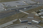
This scenery adds the new Cross Border Xpress (CBX) terminal to MMTJ, which opened on December 9, 2015, making it the first airport in the world to have connecting terminals in two different countries. All of MMTJ is also updated to reflect the most current airport layout. The neighboring KSDM is also completely updated and included in this scenery package. This scenery is optimized to fit seamlessly with FTX Global/Vector and also includes an optional CVX file which adds roads for default FSX users. All elements of both airports were traced directly from current satellite imagery and updated to reflect current satellite positioning. Scenery was created using Airport Design Editor X v1.61.5298, SBuilderX 3.13, and the FSX Object Placement Tool. Scenery objects were added and modified from stock FSX scenery to resemble as closely as possible the actual airports. The FSX apron lights included are from the set created by Jim Dhaenens.
| Filename: | MMTJ__Gen_Abelardo_L_Rodriguez_Intl__Tijuana_Mexic.zip |
| License: | Freeware |
| Added: | 3rd January 2016, 12:58:36 |
| Downloads: | 2,679 |
| Author: | Carlyle Sharpe |
| Size: | 3.58 MB |
| Category: Flight Simulator X - Scenery | |
| SCIP - Isla de Pascua & Mataveri Intl - Easter Island |
|
Images related to this file:
File Description:
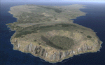
This project rebuilds Easter Island / Isla de Pascua. Mataveri Intl (SCIP) is completely overhauled, and all airport objects are aligned from satellite imagery. Landclass polygons and coastlines were meticulously hand-drawn directly from satellite imagery to provide the most detailed and accurate scenery available for this region. AI road and boat traffic is activated for the region. Accurate coastlines and road data, as well as corrected land and waterclass are provided based on the latest available satellite imagery. GA flights use default aircraft and include an option to add Chilean Air Force planes around the island. Numerous Moai (Easter Island heads) have been placed around the island according to satellite imagery. Scenery was created using Airport Design Editor X v1.61.5298, SBuilderX 3.13, and the FSX Object Placement Tool. Scenery objects were added and modified from stock FSX scenery to resemble as closely as possible the actual airports. The FSX apron lights included are from the terrific set created by Jim Dhaenens.
| Filename: | SCIP__Isla_de_Pascua__Mataveri_Intl___Easter_Islan.zip |
| License: | Freeware |
| Added: | 12th July 2014, 08:17:55 |
| Downloads: | 5,731 |
| Author: | Carlyle Sharpe |
| Size: | 5.33 MB |
| Category: Flight Simulator 2004 - Scenery | |
| Milan Malpensa Airport (LIMC - MXP) |
|
Images related to this file:
File Description:
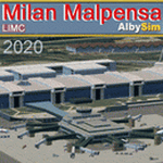
This FS2004 scenery reproduce the second-busiest italian airport "Milan Malpensa" (Iata: MXP, Icao: LIMC) located in the northwest area of Italy. The airport is used by over 100 airlines (passenger and cargo) that fly to Milan from all over the world, so this scenery is a “must have†for every simmer!
In the scenery you'll find almost all airport buldings exsisting at the real airport, hundred of custom made detailed objects, static and animated vehicles and a photoreal airport background with night lighting and hard winter textures. Each scenery part and object (frame-rate friendly thanks to the hi-performance design) has day and night photoreal textures and everything is placed in the right position which has been seen on autumn 2020 at the real airport.English extendet handbook is included and AES support is working too. Watch the screenshot inside this zip package or on the Albysim Website and enjoy all scenery features (in this free/demo edition some features are limited).
| Filename: | Milan_Malpensa_Airport_LIMC__MXP.zip |
| License: | Shareware, limited functionality |
| Added: | 15th January 2021, 20:25:12 |
| Downloads: | 2,042 |
| Author: | Alberto Di Bolzano (Albysim Scenery Design) |
| Size: | 48.72 MB |
| Category: Flight Simulator X - Scenery | |
| Los Roques Archipelago and Airports |
|
Images related to this file:
File Description:
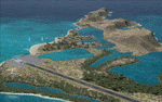
This project rebuilds Venezuela's Los Roques archipelago, adds the Gran Roque (SVRS) and Dos Mosquises (SVDM) airports, and includes AI flight plans, boat traffic, and a custom terrain mesh for Gran Roque. Accurate coastlines and lakes, as well as corrected landclass and waterclass are provided based on the latest available satellite imagery. Although current satellite imagery for this region only exists in relatively low resolution, an abundance of aerial photography was used to add custom features to Gran Roque and Dos Mosquises. Updates were created or rebuilt in a manner which carefully aligned airport data with current satellite imagery, when available. Scenery was created using Airport Design Editor X v1.50.4402, SBuilderX 3.13, and the FSX Object Placement Tool. Scenery objects were added and modified from stock FSX scenery to resemble as closely as possible the actual airports. Thank you to John Hinson and Tiago Besciak for granting permission to adapt their AI flight plans to realistically populate (SVRS) Gran Roque.
| Filename: | Los_Roques_Archipelago_and_Airports.zip |
| License: | Freeware |
| Added: | 27th July 2013, 02:34:10 |
| Downloads: | 1,401 |
| Author: | Carlyle Sharpe |
| Size: | 7.66 MB |
| Category: Flight Simulator 2004 - Scenery | |
| HKMO - Moi Intl. Airport - Mombasa, Kenya |
|
Images related to this file:
File Description:

This FS2004 project reproduce the african "Mombasa Moi International Airport" (IATA: MBO, ICAO: HKMO) located on the coast of Kenya. If you are a tourist long-haul pilot, an air-safari bush pilot or a night-freight pilot this airport is a "must have" ! In the scenery you'll find all buildings (airport and close surroundings buildings with full night lighting), hundred of custom made detailed objects, static and animated vehicles, animated scenery parts and a photoreal airport background. Each scenery part and object (frame-rate friendly thanks to the low poly design) has photoreal textures and everything is placed in the right position (which has been seen on summer 2015 at the real airport). English extended handbook is included. Watch the screenshot and the demo video on the Albysim youtube channel and enjoy all scenery features (in this free/demo edition some features are limited).
This is the free/demo version of the complete package, for more details please refer to the manual.
| Filename: | HKMO__Moi_Intl_Airport__Mombasa_Kenya.zip |
| License: | Check within download |
| Added: | 21st November 2015, 20:19:24 |
| Downloads: | 3,092 |
| Author: | Albysim Scenery Design (Alberto Di Bolzano) |
| Size: | 32.39 MB |
| Category: Flight Simulator 2004 - Scenery | |
| KGFL - Glens Falls, Floyd Bennett Memorial (v2.2) |
|
Images related to this file:
File Description:
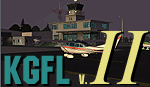
KGFL - Glens Falls, Floyd Bennett Memorial v2.2, located in the foothills of the Adirondack Mountains in upstate NY USA, this facility is owned by Warren County and run by RichAir. Although it has a 5000 ft main rwy, KGFL is a Non-controlled airfield catering to small engine a/c up to a few private jet daily traffic serving 'The Northcountry' New York. KGFL recently received several upgrades including 4 new GA hangars large enough to accommodate the needs of business jets.
All Objects fully designed and completely redone in GMAX using high resolution custom photo-real 32bit textures. Optional DXT textures included. Also includes new AFCAD file, more accurate airport grounds perimeter, satellite photo-real grounds, custom taxiways, taxi-signs and taxi lights, area roads, animated hangar doors, and near area landclass. No AI traffic tracks included with this release, but afcad designed to support several AI. Rwy12 objects required for a few static a/c and parking lot cars. v2.2 Includes mipmapped textures, reduced trees for better performance, and increased, more accurate taxiway light density. This v2.2 package is a full-install.
| Filename: | KGFL__Glens_Falls_Floyd_Bennett_Memorial_v22.zip |
| License: | Freeware, limited distribution |
| Added: | 5th February 2010, 16:52:44 |
| Downloads: | 2,350 |
| Author: | Ed 'Geneer' Cox |
| Size: | 74.81 MB |


© 2001-2026 AVSIM Online
All Rights Reserved
Privacy Policy |