
Where Flight Simulation Enthusiasts Gather from Around the World!
AVSIM Library - Search Results

| Category: Civil Flight Simulators - Looking Glass Flight Unlimited 3 | |
| Duxford, Fowlmere |

|
File Description:
After a long time of sleep there was a wakeup for this package since UKS is not crashing any more.
For users without UKS there will be a Duxford version for the Sanfran region near area 52.
There are 2 airports in this package: Duxford gsu and Fowlmere gma
This package was designed for 2 independent regions UKS and SanFran
There are a lot of planes in this package, most of it is a converted AI plane to static model using
The new version of models.res refined by Ansgar Avermeyer and the Catalina model is from Capt.Bazza's AI
from 1999. He demonstrate as first the feasibility of AI model modifications :-).
Duxford UKS is at the geographic correct position very near to Fowlmere also included in this package.
A Tigermoth as moving object (not AI) is flying from Fowlmere to Duxford 06L.
Enjoy Duxford exhibition
| Filename: | Duxford_Fowlmere.zip |
| License: | Freeware, limited distribution |
| Added: | 9th November 2004, 19:11:47 |
| Downloads: | 252 |
| Author: | André Meystre |
| Size: | 1.87 MB |
| Category: Flight Simulator X - Scenery | |
| RAF Folkingham |
|
File Description:
Royal Air Force Station Folkingham or RAF Folkingham is a former Royal Air Force station located south west of Folkingham, Lincolnshire and about 29 miles (47 km) due south of county town Lincoln and 112 miles (180 km) north of London, England.
Opened in 1940, it was used by both the Royal Air Force and United States Army Air Forces. During the war it was used primarily as a troop carrier airfield for airborne units and as a subsidiary training depot of the newly formed Royal Air Force Regiment. After the war it was placed on care and maintenance during 1947 when the RAF Regiment relocated to RAF Catterick.
You will need some additional scenery files by Ted Andrews and Ian Pearson which can be found at http://www.ianpsdarkcorner.co.uk, otherwise on the runway and peri track show. Ted Andrew - small buildings and Ians FSX Object Libraries.
| Filename: | RAF_Folkingham.zip |
| License: | Freeware |
| Added: | 8th October 2015, 17:55:15 |
| Downloads: | 298 |
| Author: | Terry Boissel |
| Size: | 9.59 KB |
| Category: Flight Simulator X - Scenery | |
| FIMP - Sir Seewoosagur Ramgoolam Intl - Mauritius *New Terminal & Airport Layout* |
|
Images related to this file:
File Description:

This scenery adds the new terminal and taxiways, and rebuilds the aprons and runway to provide a fully functioning AI traffic extension for runway 14. The airport is assigned a mean elevation, allowing it to blend naturally with the surrounding terrain, and landclass is provided for the entire island. This scenery is most effective when used in combination with "mauritius_fsx.zip" by Max Kraus. This scenery is optimized to fit seamlessly with FTX Global/Vector and should also be fully functional in all FSX configurations. The airport is updated to reflect current satellite imagery and positioning. Scenery was created using Airport Design Editor X v1.61.5298, SBuilderX 3.13, and the FSX Object Placement Tool. Scenery objects were added and modified from stock FSX scenery to resemble as closely as possible the actual airport. The FSX apron lights included are from the set created by Jim Dhaenens.
| Filename: | FIMP__Sir_Seewoosagur_Ramgoolam_Intl__Mauritius_Ne.zip |
| License: | Freeware |
| Added: | 10th July 2015, 16:16:40 |
| Downloads: | 8,808 |
| Author: | Carlyle Sharpe |
| Size: | 5.06 MB |
| Category: Flight Simulator 2004 - Scenery | |
| Pemberton CYPS in British Columbia Canada |
|
Images related to this file:
File Description:
Pemberton is a small village in the Coast Mountains of British Columbia, with a permanent population of under 3,000 and reliant on logging and increasing tourism. It is around 40 miles north of Squamish and 15 miles north of Whistler and the flight north is best described as scenic. The Nairn Falls, a scenic attraction for tourists, are close by. The runway is 3,920 feet of asphalt aligned 06-24, between and close to the join of the Lillooet River and the Green River. The airfield buildings are to the north of the runway, and at the eastern end is a Fire Base for the expected summer forest fires. To the south and west is the Pemberton Golf Course. All the buildings are replicated, and once again this is not an airport, it is an airfield without any lighting and typical of my future posts which are updated versions of airfield scenery made some time ago and not posted. This one is probably more intricate than most that will follow. The lack of lighting is actually very sensible as landing in the mountains in the dark..... Gun Lake is included here, but not for regular use as it is a deserted dirt strip 40 miles to the north that was once used for fire fighting and there is nothing to see. Just a part of the scenery in this area of BC. If you want to follow this trip on Google Earth the next stop is Cache Creek. If you find a defect, email me. Do not email me about the strange doors to the front of the Blackcomb hangar. I was surprised when I saw it and then discovered that the "doors" are actually flexible curtains that are rolled up and down and if rolled down too far...
I have the ok to use the Bell 212 CCG helicopter as a scenery object, but not to post the entire object library of the Red Deer CYQF scenery; if you have the scenery it should show up here.
| Filename: | Pemberton_CYPS_in_British_Columbia_Canada.zip |
| License: | Freeware, limited distribution |
| Added: | 17th November 2020, 17:29:13 |
| Downloads: | 113 |
| Author: | Roger Wensley |
| Size: | 16.18 MB |
| Category: Flight Simulator 2004 - Scenery | |
| Tillamook, Oregon (S47) Airport - a comprehensive enhancement |
|
Images related to this file:
File Description:
Tillamook, Oregon (S47) Airport - a comprehensive enhancement - designed to work in the default FS2004 setup. Featured is the Hangar B Air Museum which houses a fine privately owned collection of restored Warbirds. Hangar B is considered to be the largest, all wooden structure in the world - built in the early 1940's to house and service Navy Blimps. Also featured is the Tillamook Air Tours charter service complete with an AI Bi-Wing Waco aircraft. There is even an option to have an AI Goodyear Blimp visit Tillamook and make sightseeing flights. Driving or slewing around the airport will reveal many other surprises! The airport, which was virtually ignored by MS, has been redone using RWY12, EZ and many custom objects. A listing of all required libraries is included and a list of those who have contributed their time and talents to this project will be found in the documentation. Please unzip to a temporary folder and follow the installation instructions very carefully. Compiled for your flying enjoyment by David "Opa" Marshall.
| Filename: | Tillamook_Oregon_S47_Airport__a_comprehensive_enha.zip |
| License: | Freeware |
| Added: | 11th December 2009, 09:54:01 |
| Downloads: | 2,681 |
| Author: | John McKeon, David "Opa" Marshall and friends |
| Size: | 12.41 MB |
| Category: Flight Simulator X - Scenery | |
| Chatham Islands for Vector Land Class New Zealand |
|
Images related to this file:
File Description:
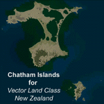
This project is a modified version of the Chatham_Islands.zip project which allows my landclass and airports to work seamlessly with the free Chatham Islands scenery available from Vector Land Class New Zealand. This package allows the user to switch back and forth easily between the different scenery combinations and also provides standalone Chatham and Pitt Island airports which can be used with the Vector Land Class (VLC) scenery on its own. It also allows the user to take advantage of the 15m terrain mesh and added water detail that comes with the VLC scenery. A modified Pitt Island AI runway is also included that is compatible with the 15m mesh. Chatham Islands/Tuuta Airport (NZCI), Napier (NZNR), and the Pitt Island Airstrip (NZPI) are included here. Scenery was created using Airport Design Editor X v1.47.07, SBuilderX 3.13, and the FSX Object Placement Tool. Scenery objects were added and modified from stock FSX scenery to resemble as closely as possible the actual airports.
| Filename: | Chatham_Islands_for_Vector_Land_Class_New_Zealand.zip |
| License: | Freeware |
| Added: | 15th July 2011, 21:54:43 |
| Downloads: | 931 |
| Author: | Carlyle Sharpe |
| Size: | 3.78 MB |
| Category: Flight Simulator X - Missions | |
| Biggles In The Desert v1.0.3 |
|
File Description:
This is a fix to the original mission. In the original one I used a scenery object (tent) that is a non "stock" FSX tent. Since most end users don't have that tent, the mission will fail entirely. This fixed version has been tested in a clean FSX install, and works as intended...now with a stock FSX tent. Please uninstall the original mission (if you installed it) and use this one. Sorry for the inconvenience. If this is the first time you are downloading this, it should work just fine. So here's the description again:
Finally! Biggles and Co. (Algy, Bertie, and Ginger) fly the skies of FSX. Their boss, Col. Raymond, has disappeared while visiting the Interpol Air Operations hangar in Aden. They fear he has been kidnapped. They must find him! Their French counterpart, Marcel Brissac is there to assist them. Perils await, including ruthless tent-dwellers, and frightful haboobs.
| Filename: | Biggles_In_The_Desert_v103.zip |
| License: | Freeware |
| Added: | 13th August 2013, 20:56:24 |
| Downloads: | 875 |
| Author: | Dan Cowan |
| Size: | 28.02 MB |
| Category: Miscellaneous Files - Demos from Commercial Vendors | |
| FenceBuilder PRO (Demo version) |
|
Images related to this file:
File Description:

FenceBuilder PRO is a graphical, multi-purpose object placement tool. While designed initially for creating and placing ground-hugging fences and other segmented structures such as walls and hedges, FenceBuilder PRO now places models from Flight Simulator library files and effects including, for FSX, sound effects. It will also place models you have created with Gmax or other tools - without you having to create a XML file. You can even customize library models developed by others. But, what really separates FenceBuilder PRO from the competition is its ability to place one or more rows of objects/effects in a single operation, thus making it easy to add power-lines, ski-lifts, orchards, tree-farms, etc. to your scenery with only a few mouse clicks. To add realism, all row placement parameters can be randomized under user control. This demo version is identical to the "production" version save for the number of segments/objects it will permit you to place.
| Filename: | FenceBuilder_PRO_Demo_version.zip |
| License: | Commercial demo |
| Added: | 26th March 2010, 22:27:44 |
| Downloads: | 418 |
| Author: | Don Grovestine |
| Size: | 13.52 MB |
| Category: Flight Simulator 2004 - Scenery | |
| Turangi Airfield, New Zealand. NZTN. Version-2 UPDATE and FIX. |
|
File Description:
Welcome to Turangi Airfield, 1nm North of the township of Turangi, at the southern end of the
beautiful Lake Taupo, in the central North Island of New Zealand.
The airfield is home to the Turangi Aero Club, and is served by Mountain Air, undertaking tourist flights
around the National Park and central North Island volcanoes, and flights to the Chateau and skifields
at Mount Ruapehu.
This scenery is built to fit into the freeware "Turangi" photoreal area scenery by Robin Corn, freely available
from avsim.com, filename...... godzoneturangi.zip .
This version corrects an error i made in the first scenery, when i accidentally mixed some pictures of another airfield
in with the Turangi pictures i was using for building. It corrects the type of buildings, and their locations on the airfield.
Update also adds a few other detail changes and additions.
This is a TOTAL replacement for my previous scenery. Requires some EZ Scenery Object Sets (see INSTALL instructions for details).
| Filename: | Turangi_Airfield_New_Zealand__NZTN__Version2_UPDAT.zip |
| License: | Freeware, limited distribution |
| Added: | 13th November 2008, 12:52:09 |
| Downloads: | 733 |
| Author: | Lawrie Roache |
| Size: | 549.77 KB |
| Category: Flight Simulator 2004 - Scenery | |
| Denali Park Research Base |
|
Images related to this file:
File Description:
A fictitious research base located 16 nautical miles west of Denali airport (AK06). It is owned and operated by NWS and used by several agencies including park service, various concessionaires, Fish and Game, Law enforcement and Medical/search and rescue agencies.
It has a runway only marked by barrels emitting heavy smoke along with crew barracks, main base building w/comm center, covered parking for snowcats and cargo/supplies. there are other buildings and a very large communications tower on the south side of the runway which parallels the river. It has an NDB of 351.2 (ADF).
Get hired to bring in cargo from Denali and other nearby airports. Made with Instant Scenery and various object libraries.
Best approach is from the north and the smoking barrels only mark a short section of the available landing area. Read the txt file for more info and have a great fly to the research base. By savageagle.
| Filename: | Denali_Park_Research_Base.zip |
| License: | Freeware |
| Added: | 1st February 2010, 09:35:25 |
| Downloads: | 279 |
| Author: | Tim Durham |
| Size: | 3.46 MB |


© 2001-2026 AVSIM Online
All Rights Reserved
Privacy Policy |