
Where Flight Simulation Enthusiasts Gather from Around the World!
AVSIM Library - Search Results

| Category: Flight Simulator 2004 - Panels | |
| 737 757 767 777 VRIF GG PANEL v13 |

|
File Description:
This is Greetmir Goodeguard's modification of Ken Mitchell's great Boeing 757 panel. He has made these modifications to comply with his "VRIF" criteria. (Visibility Readablility Information & Functionality) This panel has been thoroughly tested and is believed it to be totally funtional as well as VERY FSNAV friendly.
Although this panel modification is designed to be an ideal panel for the Boeing 767 series, it surely can be used in any two engine jet especially Boeing 737's, 757's and 777's. Features of this panel include Ken Mitchell's super PFD and MFD gauges, Eric Mariciano's excellent sweep-hand TCAS Radar Gauge. Bob Guy's very informative Fuel Statistics Gauge and the MSFS 2004 GPS System.
This is a stand-alone panel with all files, gauges, bitmaps and installation as well as PFD and MFD use instructions included. This panel is intended for FS2004 (FS9) and has NOT been tested on FS2002 or FS2000.
| Filename: | 737_757_767_777_VRIF_GG_PANEL_v13.zip |
| License: | Freeware |
| Added: | 4th January 2006, 14:45:40 |
| Downloads: | 74,700 |
| Author: | Greetmir Goodeguard |
| Size: | 22.76 MB |
| Category: Navigation and ATC - Navigation | |
| Los Angeles ARTCC charts from AIRAC 0505 - Volume 3 of 5 |
|
File Description:
This collection of US Terminal Procedures has been assembled to provide a complete set of charts for flight simulation use within the Los Angeles ARTCC region, on behalf of VATSIM's Los Angeles ARTCC (ZLA), whose website can be found at http://www.laartcc.org
**THIS IS VOLUME 3 OF 5** Charts are in Adobe PDF format.
Volume 3 = ZLA_AIRAC0505_CA_OUTLYING.ZIP
Features procedure charts for all appropriate California airports outside the combined Southern California Terminal Radar Approach Control facility "SoCAL", but under the limited ATC responsibility of the Los Angeles Center facility, and includes amongst others:
KSBA - Santa Barbara Airport (Class C)
KPSP - Palm Springs Airport (TRSA)
KBFL - Bakersfield Meadows Field (Class D)
KCMA - Camarillo Airport (Class D)
KOXR - Oxnard Airport (Class D)
KSMX - Santa Maria Public / Hancock Field (Class D)
KSBP - San Luis County Regional (Class D)
KMHV - Mohave Airport (Class D)
KVCV - Victorville Airport (Class D)
KTRM - Jacqueline Cochran Regional Airport
L35 - Big Bear Airport
16 other California outlying fields in LA Center airspace.
| Filename: | Los_Angeles_ARTCC_charts_from_AIRAC_0505____Volume.zip |
| License: | Freeware |
| Added: | 15th May 2005, 18:05:53 |
| Downloads: | 499 |
| Author: | Mark Coldwell |
| Size: | 27.18 MB |
| Category: Flight Simulator X - Original Aircraft | |
| Boeing E-3D AWACS |
|
Images related to this file:
File Description:

JUST IN TIME FOR HURRICANE SEASON ... The E-3D Sentry, known to the RAF as the AEW1, is a fully modified and re-engined Boeing 707-320B aircraft. Mission endurance is approximately 11 to 15 hours (over 5,000 nm), although this can be extended by air-to-air refuelling when necessary. The normal crew complement of 18 comprises four flight-deck crew, three technicians and an 11-man mission crew. The aircraft cruises between FL300 and FL430, and its Northrop Grumman AN/APY-2 high-performance, multimode lookdown radar (rotodome), housed in the black radome, is able to separate airborne and maritime targets from ground and sea clutter. The aircraft is also used for weather recon detail dispatched world-wide, and can survive extreme weather conditions including hurricane force winds at low altitude.
Offered for Free Educational Use Only!
Original Model by Roc Dolenec
CFM Sound by Aaron R. Swindle
Modified by Douglas E. Trapp, [email protected], with Real World Charcteristics, August 2017
| Filename: | Boeing_E3D_AWACS.zip |
| License: | Freeware |
| Added: | 26th August 2017, 18:59:35 |
| Downloads: | 860 |
| Author: | Douglas E. Trapp |
| Size: | 5.09 MB |
| Category: Flight Simulator 2004 - Scenery | |
| "Himalayan Peaks" LOD10 Mesh, Volume 3 - Namcha Barwa |
|
File Description:
Highly detailed terrain mesh of the Namcha Barwa area, N29°-31° E94°-96°. The files in this package are based on Shuttle Radar (SRTM) Version 2 data but with many of the void areas, especially the most significant sections, filled with elevation data generated from topographic maps by Jonathan de Ferranti. While Jonathan's work is unrelated to flight simulation he kindly gave me permission to compile his data for use in FS. The result is a wonderful improvement in detail and accuracy over any existing mesh file, freeware or commercial, based on SRTM or DTED data alone. Due to the large area of the Himalayas I've compiled the source data as two separate series: the "Himalayan Peaks" series covers prominent mountains and ranges in higher detail and locally overrides any existing LOD9 terrain mesh. In addition, a LOD9 "base mesh" series covering the entire Himalayas will be available for those who do not yet have an add-on terrain mesh of these beautiful mountains.
| Filename: | Himalayan_Peaks_LOD10_Mesh_Volume_3__Namcha_Barwa.zip |
| License: | Freeware, limited distribution |
| Added: | 18th February 2006, 23:15:17 |
| Downloads: | 12,188 |
| Author: | Holger Sandmann and Jonathan de Ferranti |
| Size: | 15.09 MB |
| Category: Flight Simulator 2004 - Scenery | |
| "Himalayan Peaks" LOD10 Mesh, Volume 6 - Jammu and Kashmir |
|
Images related to this file:
File Description:
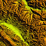
Highly detailed terrain mesh of the Jammu and Kashmir areas, N31-36 E76-78. The files in this package are based on Shuttle Radar (SRTM) Version 2 data but with many of the void areas, especially the most significant sections, filled with elevation data generated from topographic maps by Jonathan de Ferranti. While Jonathan's work is unrelated to flight simulation he kindly gave me permission to compile his data for use in FS. The result is a wonderful improvement in detail and accuracy over any existing mesh file, freeware or commercial, based on SRTM or DTED data alone.
Due to the large area of the Himalayas I've compiled the source data as two separate series: the "Himalayan Peaks" series covers prominent mountains and ranges in higher detail and locally overrides any existing LOD9 terrain mesh. In addition, a LOD9 "base mesh" series covering the entire Himalayas will be available for those who do not yet have an add-on terrain mesh of these beautiful mountains.
| Filename: | Himalayan_Peaks_LOD10_Mesh_Volume_6__Jammu_and_Kas.zip |
| License: | Freeware, limited distribution |
| Added: | 29th May 2010, 08:55:43 |
| Downloads: | 9,666 |
| Author: | Holger Sandmann, Jonathan de Ferranti |
| Size: | 52.19 MB |
| Category: Flight Simulator 2004 - Scenery | |
| "Himalayan Peaks" LOD10 Mesh, Volume 5 - Garhwal |
|
File Description:
Highly detailed terrain mesh of the Garhwal area, N30°-32° E78°-81°. The files in this package are based on Shuttle Radar (SRTM) Version 2 data but with many of the void areas, especially the most significant sections, filled with elevation data generated from topographic maps by Jonathan de Ferranti. While Jonathan's work is unrelated to flight simulation he kindly gave me permission to compile his data for use in FS. The result is a wonderful improvement in detail and accuracy over any existing mesh file, freeware or commercial, based on SRTM or DTED data alone. Due to the large area of the Himalayas I've compiled the source data as two separate series: the "Himalayan Peaks" series covers prominent mountains and ranges in higher detail and locally overrides any existing LOD9 terrain mesh. In addition, a LOD9 "base mesh" series covering the entire Himalayas will be available for those who do not yet have an add-on terrain mesh of these beautiful mountains.
| Filename: | Himalayan_Peaks_LOD10_Mesh_Volume_5__Garhwal.zip |
| License: | Freeware, limited distribution |
| Added: | 18th February 2006, 23:16:47 |
| Downloads: | 10,134 |
| Author: | Holger Sandmann and Jonathan de Ferranti |
| Size: | 27.72 MB |
| Category: Flight Simulator 2004 - Scenery | |
| "Himalayan Peaks" LOD10 Mesh, Volume 7 - K2 and Karakoram |
|
Images related to this file:
File Description:

Highly detailed terrain mesh of the Karakoram area, N35-37 E73-77. The files in this package are based on Shuttle Radar (SRTM) Version 2 data but with many of the void areas, especially the most significant sections, filled with elevation data generated from topographic maps by Jonathan de Ferranti. While Jonathan's work is unrelated to flight simulation he kindly gave me permission to compile his data for use in FS. The result is a wonderful improvement in detail and accuracy over any existing mesh file, freeware or commercial, based on SRTM or DTED data alone.
Due to the large area of the Himalayas I've compiled the source data as two separate series: the "Himalayan Peaks" series covers prominent mountains and ranges in higher detail and locally overrides any existing LOD9 terrain mesh. In addition, a LOD9 "base mesh" series covering the entire Himalayas will be available for those who do not yet have an add-on terrain mesh of these beautiful mountains.
| Filename: | Himalayan_Peaks_LOD10_Mesh_Volume_7__K2_and_Karako.zip |
| License: | Freeware, limited distribution |
| Added: | 30th May 2010, 09:56:27 |
| Downloads: | 9,480 |
| Author: | Holger Sandmann, Jonathan de Ferranti |
| Size: | 38.58 MB |
| Category: Flight Simulator 2004 - Scenery | |
| High-resolution 76-m (LOD9) Terrain Mesh and Scenery Enhancements for the Southern Canadian Rockies |
|
File Description:
Not simply an add-on mesh, these files include many scenery enhancements for the southern Rockies of British Columbia and Alberta. Coverage extends from Cranbrook to Calgary, and Hinton to Edmonton (N48.9-53.4 W112.3-116.3). The mesh source data are 3-arcsec (~90-m) Shuttle Radar (SRTM) files, compiled at LOD9 (76-m) resolution. All lake elevations (!) have been adjusted to eliminate the problems with the default lake data and to better fit the new terrain mesh. In addition, the Transcanada Highway/Icefields Parkway corridor in Banff National Park, from Canmore to the Hwy 11 junction, has been completely re-made, with dozens of alpine lakes (including Lake Louise, Moraine Lake, and Lake O'Hara), accurate transportation network, and landclass/waterclass updates based on satellite imagery. Due to significant changes in FS2004 to vector layering and autogen features, the special scenery enhancements cannot be used with FS2002. However, terrain mesh, lake corrections and landclass replacements will work well in FS2002.
| Filename: | Highresolution_76m_LOD9_Terrain_Mesh_and_Scenery_E.zip |
| License: | Freeware, limited distribution |
| Added: | 29th October 2003, 03:01:22 |
| Downloads: | 15,467 |
| Author: | Holger Sandmann |
| Size: | 21.81 MB |
| Category: Flight Simulator 2004 - Scenery | |
| Himalayan Peaks LOD10 Mesh, Volume 1 - Mt. Everest and Kula Kangri |
|
File Description:
Highly detailed terrain mesh of the Mt. Everest and Kula Kangri areas, N26°-29° E85°-92°. The files in this package are based on Shuttle Radar (SRTM) Version 2 data but with many of the void areas, especially the most significant sections, filled with elevation data generated from topographic maps by Jonathan de Ferranti. While Jonathan's work is unrelated to flight simulation he kindly gave me permission to compile his data for use in FS. The result is a wonderful improvement in detail and accuracy over any existing mesh file, freeware or commercial, based on SRTM or DTED data alone. Due to the large area of the Himalayas I've compiled the source data as two separate series: the "Himalayan Peaks" series covers prominent mountains and ranges in higher detail and locally overrides any existing LOD9 terrain mesh. In addition, a LOD9 "base mesh" series covering the entire Himalayas will be available for those who do not yet have an add-on terrain mesh of these beautiful mountains.
| Filename: | Himalayan_Peaks_LOD10_Mesh_Volume_1__Mt_Everest_an.zip |
| License: | Freeware, limited distribution |
| Added: | 9th February 2006, 22:13:00 |
| Downloads: | 37,047 |
| Author: | Holger Sandmann and Jonathan de Ferranti |
| Size: | 52.01 MB |
| Category: Prepar3D V1-4 - Scenery | |
| KSRQ - Sarasota-Bradenton Florida USA International Airport |
|
Images related to this file:
File Description:
Sarasota-Bradenton Florida USA International Airport for Prepar3D. Originally created for FSX, this airport has been converted to work in Prepar3D. Several improvements have been made to the default airport. The default terminal buildings have been replaced with buildings created in FSDS; aircraft gates have been correctly coded using Airport Design Editor 1.76.6715; a new airport vehicle network has been built; extra fuel trucks have been added throughout the airport; the tower view has been changed to display from the roof of the control tower; all taxiway designators are correct and all taxiway signs are correctly placed and named; there is the option to open both runways to AI traffic; and Jim Dhaenen's excellent ramp lights are also included. Please refer to the README FIRST.txt file to insure proper installation of all files.
| Filename: | KSRQ__SarasotaBradenton_Florida_USA_International_.zip |
| License: | Freeware, limited distribution |
| Added: | 2nd June 2018, 00:20:00 |
| Downloads: | 827 |
| Author: | Patrick Finch |
| Size: | 2.73 MB |


© 2001-2026 AVSIM Online
All Rights Reserved
Privacy Policy |