
Where Flight Simulation Enthusiasts Gather from Around the World!
AVSIM Library - Search Results

| Category: Flight Simulator 2004 - Aircraft Repaints, Textures and Modifications | |
| Thai AirAsia - Updated 9M-AAN "Carabow" |

|
File Description:
Airasia's Thai service aircraft with "Carabao" livery (9M-AAN)
Air Asia is a low-cost no frills Malaysian airline which operates
flights from Kuala Lumpur International Airport to various destinations
throughout Malaysia. It operates exclusively on Boeing 737-300 aircraft.
Thai Airasia is a jointventure company between Shin corp. Thailand
and Airasia Malaysia. Two aircraft are initialy used for thai domestic
flights using Bangkok Intl. as a hub with a plan to increase the number
upto 10 at the end of the year2004. Carabao(meaned buffalo) is a folk
star of Thailand and Thai Airasia presenter.
-----
In this updated package, the Malay flag at the nose was moved to the side of the
frontal door,funny appearance of grey painted over area can be seen at the nose.
Main wheel red button was also added.
-----The folder contains all you need for flying the "CARABAO" ,just unzip and paste.
This aircraft has a ving view function and is as easy to fly as the default 737-400 and also very suitable for AI too!
| Filename: | Thai_AirAsia__Updated_9MAAN__Carabow.zip |
| License: | Freeware |
| Added: | 7th August 2004, 21:58:42 |
| Downloads: | 1,342 |
| Author: | Anuraka Siriwatra |
| Size: | 2.91 MB |
| Category: Flight Simulator 2004 - Miscellaneous Files | |
| Active ILS - KIAH v2.0 |
|
File Description:
UPDATED KIAH see the readme file -- By design KIAH is now another Airport that features advanced ATC control. As most know initiating the ILS at certain airports for AI Traffic is not a function at this time when using AFCAD2. If you add a new ILS runway to an airport such as KIAH (8L/26R) only the user aircraft can use this runway when visibility falls below 3 miles. ATC will no longer use this runway for AI Traffic because FS9 sees it as a visual runway. This will cause ATC to vector your AI Traffic back to 8/26 (old numbers) 8R/26L (new numbers) which is also a Terminal Departure Runway. All 5 runways for KIAH are now simultaneously active for departure and arrival. There are many additional options added to version 2.0 so follow the instructions in the README and just sit back (or fly) and plane spot either VMC or IMC for a very active airport. *** SimFlyers Scenery AFCAD2 and special ILS bgl also included ***
| Filename: | Active_ILS__KIAH_v20.zip |
| License: | Freeware, limited distribution |
| Added: | 26th August 2004, 02:23:19 |
| Downloads: | 2,720 |
| Author: | Jim Vile |
| Size: | 81.21 KB |
| Category: Flight Simulator X - Scenery | |
| Wynoochee Lake WA - (Bob's Fly-in Cabin) |
|
File Description:
Wynoochee Lake WA (Bob's Fishing Cabin) - Airport ID: BOB (FSX). - -
This is a fictitious fly-in lodge that I created for a quiet spot to fly into for weekend trips from the Seattle area. My cabin is located about 40 miles due south of Port Angeles, WA and about 50 miles due west of Seattle. - -
Wynoochee Lake is a real location, but my scenery around the lake is fictitious. - -
You will find my dirt airstrip to be quite challenging, although completely fly-able. My location is even more challenging at dawn or dusk with Weather. There are no approach lights, its just a rugged bush strip. - -
It is extra challenging with crash detection turned on - watch out for those birds, they're everywhere and that old tree just of the side of the dirt strip - don't get too close! - -
This is freeware. I hope you enjoy it. - -
Designed with the FS X Sdk Scenery function of the Mission builder,Abacus Scenery shortcut tool and Lee Swordy's AFCAD. - -
This scenery is frame rate friendly. - - Please read the "readme" - -
by Bob Caparoula
www.flydeervalley.com
| Filename: | Wynoochee_Lake_WA___Bobs_Flyin_Cabin.zip |
| License: | Freeware |
| Added: | 2nd February 2007, 21:10:37 |
| Downloads: | 1,456 |
| Author: | Bob Caparoula |
| Size: | 4.64 KB |
| Category: Flight Simulator X - Utilities | |
| TweakFS Utility Collection for FSX |
|
Images related to this file:
File Description:

The TweakFS Utility Collection for FSX includes the following: TweakFlight for FSX (Flight File Editor), TweakFPS for FSX (Scenery Mode Editor), TweakLoad for FSX (Aircraft Loading Editor), TweakAircraft for FSX (Aircraft Config File Editor) and the TweakFS Explorer (File Manager for FSX). As a group these five unique applications each have a different scope and purpose, but come with a consistent look and feel. Between them they can handle well over 1000 settings and variables in FSX. They make fine-tuning your fsx.CFG, Aircraft.CFG and FLT (saved flight) files a breeze, providing functionality, speed and ease of use that goes well beyond what can be done by manually editing the files. All the tools are designed with one important principle in mind - a one-click "restore from backup" function. This means an adjustment can be applied with complete impunity and there is always the "bailout" option if there are any "funnies", the one justifiable concern that holds many back from making changes to their FS setup. All come as free 30-Day demos.
| Filename: | TweakFS_Utility_Collection_for_FSX.zip |
| License: | Shareware, time limited |
| Added: | 5th March 2010, 10:51:29 |
| Downloads: | 2,105 |
| Author: | TweakFS (Fermin Fernandez) |
| Size: | 44.1 MB |
| Category: Flight Simulator 2004 - Scenery | |
| Wake Island (PWAK) |
|
Images related to this file:
File Description:

FS2004 photo scenery and AI package for Wake Island (PWAK) in the Pacific. Seemingly drifting in a strategic yet isolated position Wake Island-an atoll really-was one of the loneliest outposts of the United States. Originally a gas station for Pan Am's 'Clipper' flying boats, Wake was also a strategic air base during the Second World War. This continued with the Cold War as Wake became a centerpiece of the Pacific Radar Net against the Soviets.
With the thawing of Eastern Europe and the advent of more efficient jet aircraft Wake slowly drifted back to the quiet backwater it is again today, home to a handful of civilian caretakers and local wildlife. This scenery attempt to recapture Wake in the early 1980's when it still performed a semi-regular duty as gas station and pit stop. (This is a reload of the scenery due to the Hack attack - no changes to previous package)
| Filename: | Wake_Island_PWAK.zip |
| License: | Freeware, limited distribution |
| Added: | 15th May 2010, 08:57:58 |
| Downloads: | 4,934 |
| Author: | John Stinstrom |
| Size: | 4.75 MB |
| Category: Flight Simulator 2004 - Scenery | |
| "Himalayan Peaks" LOD10 Mesh, Volume 4 - Annapurna |
|
Images related to this file:
File Description:

Highly detailed terrain mesh of the Annapurna area, N28-30 E83-85. The files in this package are based on Shuttle Radar (SRTM) Version 2 data but with many of the void areas, especially the most significant sections, filled with elevation data generated from topographic maps by Jonathan de Ferranti. While Jonathan's work is unrelated to flight simulation he kindly gave me permission to compile his data for use in FS. The result is a wonderful improvement in detail and accuracy over any existing mesh file, freeware or commercial, based on SRTM or DTED data alone.
Due to the large area of the Himalayas I've compiled the source data as two separate series: the "Himalayan Peaks" series covers prominent mountains and ranges in higher detail and locally overrides any existing LOD9 terrain mesh. In addition, a LOD9 "base mesh" series covering the entire Himalayas will be available for those who do not yet have an add-on terrain mesh of these beautiful mountains.
| Filename: | Himalayan_Peaks_LOD10_Mesh_Volume_4__Annapurna.zip |
| License: | Freeware, limited distribution |
| Added: | 29th May 2010, 08:59:29 |
| Downloads: | 10,462 |
| Author: | Holger Sandmann, Jonathan de Ferranti |
| Size: | 15.07 MB |
| Category: Flight Simulator X - Aircraft Repaints, Textures and Modifications | |
| F/A-18 Combat Version |
|
Images related to this file:
File Description:
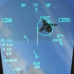
FSX F/A-18 Combat Version. This is the Acceleration F/A-18 Hornet equipped with 20mm M61 cannon and a fully functional air-to-air gun mode found in the real F/A-18. With the two radar modes, the two gun sights and the flying tracers, the virtual dogfight will be very similar to a real one. You will not be able to shoot down other aircraft, but you will receive an immediate indication on your HUD if a bullet hit the bandit. The flight model is unchanged from the Acceleration F/A-18 except for allowing manually controlled flaps and reducing the arresting wire tension for smoother carrier landings. The HUD is an upgrade of the Realistic F/A-18 HUD by Jivko Rusev and Scott Printz, which allows ILS and TACAN navigation for aircraft carriers. You will also get a couple of additional gauges - an In-Flight Refueling Gauge, PLAT Camera and a Carrier Landing Gauge. By Jivko Rusev.
| Filename: | FA18_Combat_Version.zip |
| License: | Freeware, limited distribution |
| Added: | 30th October 2010, 08:42:20 |
| Downloads: | 1,594 |
| Author: | Jivko Rusev |
| Size: | 13.09 MB |
| Category: Flight Simulator 2004 - Aircraft Repaints, Textures and Modifications | |
| Caicos International Limited Douglas DC-4 |
|
Images related to this file:
File Description:

Textures for Jens B. Kristensen's excellent Douglas DC-4/C-54, repainted by Manfred Meyer.
This are textures only, You need to download and install DC4_V30.ZIP by J. B. Kristensen, use the cargo model with no radar nose!
These textures depict N529D (c/n 10748) of Caicos International Limited.
The aircraft was delivered in june 1945 as 42-72643 to the USAAF. After conversion to DC-4 in 1946 she went to China and flew for CNAC and CAT as XT-T-07 and XT-102. 1949 the plane came into US register as N4890V and served with several companies like Trans Ocean, Southwest, Riddle and Flying Tiger. 1960 she goes to Paraguayan Air Service as ZP-CBP and later in 1968 to SAM Colombia as HK-529. Bought by Florida Aircraft Leasing in 1970 and leased 1973 to 1975 to Caicos International Limited.
After then flew for Anglers Club and Southern Aero Trades, after all it believed destroyed in Colombia 1979.
| Filename: | Caicos_International_Limited_Douglas_DC4.zip |
| License: | Freeware |
| Added: | 16th November 2014, 21:00:43 |
| Downloads: | 120 |
| Author: | Manfred Meyer |
| Size: | 2.6 MB |
| Category: Flight Simulator X - Scenery | |
| RNAS Inskip |
|
File Description:
RNAS Inskip is located a few miles north of a place called Kirkham near Blackpool which is in the county of Lancashire (U.K.). During WWII the Lancashire plain was used extensively for airfields. Most famously, USAAF's BAD2, which General Doolittle labelled
'the world's greatest air depot' was located at Warton, only a few miles south of Inskip. What with RNAS Burscough and RAF Woodvale close by the other side of the river, the skies above the Ribble must have been a dense mass of most of the u.k./u.s.a. aircraft types ever flown during WW2.
Otherwise known as HMS Nightjar (X4IP), it was only open as an active airfield for a few years 1943 - 1946. It was used by the Fleet Air Arm
mainly for Radar Training and bombing practice, but many operational units would disembark from their carriers for upgrades or maintenance during carrier refits. Flying out of Inskip were many FAA types - Fireflies, Swordfish, Ansons, Barracudas, Fulmars, Tarpons (Avengers)
and Martlets (Wildcats).
| Filename: | RNAS_Inskip.zip |
| License: | Freeware |
| Added: | 18th September 2015, 06:01:18 |
| Downloads: | 383 |
| Author: | Ian Robinson |
| Size: | 27.89 MB |
| Category: Flight Simulator 2004 - Panels | |
| Bristol Britannia |
|
File Description:
A highly detailed and comprehensive panel designed for Mike Stone's Bristol
Britannia aircraft. In addition to the standard instrumentation, includes cabin
announcements, traffic radar, fuel management etc.
Also requires a) FSUIPC (the latest version is always available at http://www.schiratti.com/dowson.html and is essential for the operation of some of the gauges in this panel), b) (optional) Flight Deck Sound Effects available here at AVSIM - fdsfxpnl.zip, and c) (optional) GPWS Altitude Call-Out Sounds available here at AVSIM - fpda_a330_callout.zip.
The manual is available in plain text format in this main download, or you can download an illustrated manual separately from the same download site in PDF format (britpanm.zip).
This is the result of over eighteen months of development and has been produced
specifically as a thankyou to all the people that have produced free add-ons that I have benefitted from.
I hope this enhances the pleasure of flying the only British-built long long-range turboprop airliner.
| Filename: | Bristol_Britannia.zip |
| License: | Freeware |
| Added: | 30th November 2004, 01:15:55 |
| Downloads: | 2,434 |
| Author: | John Hinson |
| Size: | 9.41 MB |


© 2001-2026 AVSIM Online
All Rights Reserved
Privacy Policy |