
Where Flight Simulation Enthusiasts Gather from Around the World!
AVSIM Library - Search Results

| Category: Flight Simulator 2004 - AFCAD Files | |
| Metro Oakland with Active Crosswind Runways |

|
File Description:
A high spec AFCAD2 for the FS2004 Metro Oakland Int'l Airport (KOAK) scenery by the Mach-1 Design Group. This afcad has been built using FAA Charts, various aerial photographs and information from the Airport Website. All taxiways are named and all aprons are reworked to be as real as possible according to photos. All gates are named and have airlines assigned to them. As per real life, only Southwest Airlines will use Terminal 2, all other airlines being allocated to Terminal 1. The Fedex and UPS aprons are represented and can accomodate many cargo aircraft. The final parking area is random GA parking to the north of the airport. Overflow parking is also available for rush hour periods. This airport features a tower view and also night and approach lighting. Finally, by using the crosswind runway technique, runways 9L/27R, 9R/27L and 11/29 can all be used simultaniously for take-off and landing. Runway 15/33 is closed as it is not used in real life. An extra taxiway "Zulu" has been added (not real life) to avoid AI conflicts when using runway 29 for Takeoffs and landings. Enjoy!! Requires that you install m1dg_oak2007.zip from this site.
| Filename: | Metro_Oakland_with_Active_Crosswind_Runways.zip |
| License: | Freeware |
| Added: | 1st June 2007, 17:44:02 |
| Downloads: | 1,461 |
| Author: | Lee Brompton |
| Size: | 203.67 KB |
| Category: Flight Simulator 2004 - Aircraft Repaints, Textures and Modifications | |
| British United Airways Douglas C-54A |
|
Images related to this file:
File Description:
This package contains two repaints for Jens B. Kristensen's FS2004 Douglas DC-4 & C-54 V3.0. Featured are the C-54A's (modified to DC-4 standard) G-AOFW and G-AREK in the colours of British United Airways in 1961.
In December 1955 Freddie Laker's Air Charter acquired the C-54A G-AOFW 'Jason' for transport work in Germany and trooping flights from Stansted to Cyprus. In 1959 the aircraft was moved from trooping flights to service on the route Southend to Calais flying passengers on one-day trips without a passport till 1 July 1960 when Air Charter was merged into British United. In April 1963 Aviation Traders (Engineering) Ltd started converting G-AOFW to ATL.98 Carvair car-ferry aircraft. The first flight as a Carvair took place from Stansted on 11 February 1964. C-54A G-AREK was purchased by British United Airways in August 1960. The aircraft was earmarked to become a Carvair. Conversion started in December 1961. The first flight as a Carvair (all-cargo version) took place from Stansted on 2 November 1962.
These are textures only. You will need the Jens B. Kristensen FS2004 Douglas DC-4 & C-54 (DC4_V30.ZIP). Repaints by Maarten Brouwer.
| Filename: | British_United_Airways_Douglas_C54A.zip |
| License: | Freeware, limited distribution |
| Added: | 6th November 2012, 19:56:26 |
| Downloads: | 181 |
| Author: | Maarten Brouwer |
| Size: | 4.21 MB |
| Category: Flight Simulator 2004 - Scenery | |
| Peawanuck CYPO / Winisk CYWN - Northern Ontario, Canada |
|
Images related to this file:
File Description:
Peawanuck is on the bank of the Winisk River, 23 miles upstream from where the river empties into the Hudson Bay just west of James Bay. It has a population of around 240, and was established in 1986 when the original settlement (Winisk) at the mouth of the river was destroyed by a flood. The airport is on a bluff in a corner of the river at 171 feet ASL, with a gravel runway just over 3,500 feet long and aligned 11-29. There is only basic runway lighting, with no ILS, VASI, or PAPI; there is also no apron lighting, or fuel. Service is provided by Air Creebec with connector flights to Moosonee and Timmins, and on to Montreal. A search of their timetable did not provide any information regarding timings but I made the AI flight from Timmins a daily one; it is probably only once or twice a week. There is also a daily private Cessna from Moosonee. Winisk, at the mouth of the river, has another gravel runway which is over 6,000 feet long. There is also a large hangar and to the north the remaining buildings and fuel tanks etc of a Radar Control site which was closed in 1965 after only 7 years of use.
| Filename: | Peawanuck_CYPO__Winisk_CYWN__Northern_Ontario_Cana.zip |
| License: | Freeware, limited distribution |
| Added: | 29th December 2012, 09:14:03 |
| Downloads: | 282 |
| Author: | Roger Wensley |
| Size: | 2.61 MB |
| Category: Flight Simulator 2004 - Scenery | |
| CYHD - Dryden Regional - Ontario, Canada * Updated v2 * |
|
Images related to this file:
File Description:
This greatly modifies my previous (2009) post of Dryden; this version has bespoke buildings and is stand-alone and does not require you to have the previous post. There will also be follow-up posts of Sioux Lookout and Geraldton. Dryden is in northern Ontario, 110 miles east of the Manitoba border, 40 miles west of Sioux Lookout, and with the US border 90 miles to the south. The town is on the northern shore of Wabigoon Lake and has a population of around 7,800. The main business is pulp and paper, along with agriculture, tourism, and mining. The airport is 5 miles northeast of the town.
Dryden Regional has 6,000' of asphalt which in FS9 is aligned 11-29. The second runway is compacted sand 2,000' long and aligned 05-23. There are two aprons, the western being for the terminal building and some ga parking, and the eastern larger and used in the summer for parking fire fighting planes, along with maintenance hangarage and accomodation etc. The Ontario Fire Service planes were included with my original Geraldton post and are included here again; they fly back and forth and keep Dryden busy along with several Bearskin Airlines and Perimeter Aviation flights.
| Filename: | CYHD__Dryden_Regional__Ontario_Canada___Updated_v2.zip |
| License: | Freeware, limited distribution |
| Added: | 16th March 2013, 09:59:52 |
| Downloads: | 595 |
| Author: | Roger Wensley |
| Size: | 26.99 MB |
| Category: Flight Simulator 2004 - Scenery | |
| Port McNeill CAT5 in British Columbia, Canada |
|
Images related to this file:
File Description:
Port McNeill is at the northern end of Vancouver Island, on the coast and around 20 miles east of Port Hardy. The town population is just over 2,000 and the main industry is logging, followed by sand and gravel quarrying and exporting for the construction industry. Tourism rates third.
The airport, a mile or so east of the town, provides a swift connection for nearby islands and the surrounding area to the rest of the west coast, and serves as the HQ main base for West Coast Helicopters. Their newly built large hangar and office accommodation is next to their older hangar to one side of the central public parking area, opposite the club house cum terminal and hangars. There are two runways: 06-24 which is asphalt, 2,400 feet long, and lit; and 11-29 of gravel, 3,650 feet long and also lit. There is some taxiway lighting, but not, for instance, for the connection between runways, which is in real life a ramp up to the gravel runway which is 15 feet higher. There are no regularly scheduled flights and traffic consists mainly of the West Coast helicopters, plus GA and irregular charters, the latter being mostly from Port Hardy.
| Filename: | Port_McNeill_CAT5_in_British_Columbia_Canada.zip |
| License: | Freeware, limited distribution |
| Added: | 18th November 2018, 05:49:13 |
| Downloads: | 138 |
| Author: | Roger Wensley |
| Size: | 13.29 MB |
| Category: Flight Simulator 2004 - AI Aircraft | |
| 26 Needed AI Repaints |
|
File Description:
Twenty six repaints that are missing from the AI skies for flight simulator 2004. Or 2002, whatever one you use! The list of repaints is as follows:
AAS Lifeflight Beechcraft 200 -- Mike Hill
Ada Air Embraer 110 (Operated for DHL) -- Dee Waldron
Ada Air Yakovlev Yak-40 -- Project AI
Ada Air Yakovlev Yak-42D -- Samdim
Aerosvit Boeing 767-300 -- AI Aardvark
Albanian Airlines BAe 146-200 (2 Variations) -- Project AI
Albanian Airlines BAe 146-300 -- OSS AI
Arberia Airways Tupolev Tu-134 -- George Sukhyev
Balkh Airlines BAC 1-11-200 -- Dee Waldron
Balkh Airlines Boeing 727-100 -- AI Aardvark
Carib Aviation DHC-6-300 (2 Variations including a VistaLiner) -- Henry Tomkiewicz
Ecoair International Beechcraft 1900D -- Charles Dayhuff
Ecoair International Boeing 737-200 (2 Variations) -- AI Aardvark
Ecoair International Boeing 737-300 -- AI Aardvark
Ecoair International Boeing 737-400 -- AI Aardvark
Icaro Airlines Fokker F-28 -- Fernando Martinez
Icaro Express Beechcraft 1900D -- Charles Dayhuff
Kam Air Antonov An-24 -- Samdim
Libyan Arab Airbus A320-200 -- FSPainter
Phillipines Airbus A320-200 -- FSPainter
Sahara Airlines Boeing 737-400 -- AI Aardvark
Sahara Airlines Boeing 737-700 -- Tsutomu Urukawa
Sahara Airlines Boeing 737-800 -- Tsutomu Urukawa
I hope this can fill a small gap in at least a few people's AI skies.
| Filename: | 26_Needed_AI_Repaints.zip |
| License: | Freeware |
| Added: | 17th July 2004, 01:09:32 |
| Downloads: | 13,821 |
| Author: | Andrew Jarvis |
| Size: | 9.14 MB |
| Category: Flight Simulator X - Aircraft Repaints, Textures and Modifications | |
| British United Airways Douglas C-54A |
|
Images related to this file:
File Description:
This package contains two repaints for Jens B. Kristensen's FSX Douglas DC-4 & C-54 V3.0. Featured are the C-54A's (modified to DC-4 standard) G-AOFW and G-AREK in the colours of British United Airways in 1961.
In December 1955 Freddie Laker's Air Charter acquired the C-54A G-AOFW 'Jason' for transport work in Germany and trooping flights from Stansted to Cyprus. In 1959 the aircraft was moved from trooping flights to service on the route Southend to Calais flying passengers on one-day trips without a passport till 1 July 1960 when Air Charter was merged into British United. In April 1963 Aviation Traders (Engineering) Ltd started converting G-AOFW to ATL.98 Carvair car-ferry aircraft. The first flight as a Carvair took place from Stansted on 11 February 1964. C-54A G-AREK was purchased by British United Airways in August 1960. The aircraft was earmarked to become a Carvair. Conversion started in December 1961. The first flight as a Carvair (all-cargo version) took place from Stansted on 2 November 1962.
These are textures only. You will need the Jens B. Kristensen FSX Douglas DC-4 & C-54 (DC4_V30X.ZIP). Repaints by Maarten Brouwer.
| Filename: | British_United_Airways_Douglas_C54A.zip |
| License: | Freeware, limited distribution |
| Added: | 6th November 2012, 19:57:34 |
| Downloads: | 136 |
| Author: | Maarten Brouwer |
| Size: | 1.47 MB |
| Category: Flight Simulator X - Scenery | |
| Ireland VFR Small Airports Part 2 |
|
Images related to this file:
File Description:
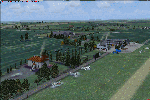
Ireland VFR Small Airports Part 2.
This scenery consists of EIME Casement Aerodrome, EIWT Weston Executive Airport and EIKH Kilrush Airfield. Casement and Weston are within 8nm of Dublin International whilst Kilrush lies approximately 30miles to the south west.
EIME's main runway 11/29 is 1,829m (6,001feet) in length and has handled the largest of heavies. Weston caters for small executive jets, GA and helicopters. Kilrush is a small private airstrip with grass and paved runways.
The scenery has been created almost entirely from real photographs and features many open hangers with internal textures. Each airport features a full panoramic view from inside the tower, sound, lighting, and smoke effects, together with animations, high definition people and military personnel. Full night lighting with wash lighting of the aprons is included. The scenery can be used as a standalone, however it also uses many objects from my Ireland VFR Small Airports Part 1. It has been tested with FSXA only and is designed to complement vfr photographic scenery. It will also work with the default terrain and I have included a set of photoreal textures with night masks. Full installation instructions are included in the Readme file. I hope you enjoy using the airports as much as I enjoyed making them.
| Filename: | Ireland_VFR_Small_Airports_Part_2.zip |
| License: | Freeware, limited distribution |
| Added: | 15th February 2012, 04:35:57 |
| Downloads: | 4,354 |
| Author: | George Keogh |
| Size: | 86.1 MB |
| Category: Flight Simulator X - Scenery | |
| LATI - Tirana Intlnational Airport Nene Tereza - Tirana, Albania |
|
File Description:
Tirana International Airport Nene Tereza (IATA: TIA, ICAO: LATI) is Albania's only international airport. It is commonly known as Rinas International Airport, as it is located 6 NM (11 km; 6.9 mi) northwest of Tirana, in the village of
Rinas. In 2001, the airport was named after Mother Teresa. Tirana International Airport Nene Tereza was constructed in a period of two years, from 1955 to 1957.
After the fall of communism political and social changes caused an increase in the number of airlines operating in the airport. Notably its reconstruction, started in 2005 and terminated in 2008, made possible a relevant increase in
the processing capacity of the airport, which saw its number of passengers per year doubling from 2005 to 2010, when it reached 1.5M. The airport currently has a capacity to process 1.8M passengers per year and it is thought that such
capacity will suffice to handle the expected increase given the visa liberalization for the citizens of Albania in the Schengen Area, which started at the end of 2010.
This file has the right coordenates, with the apron and characteristics of the airport and buildings, also it is set to the correct altitud of 126 feet or 38 meters.
| Filename: | LATI__Tirana_Intlnational_Airport_Nene_Tereza__Tir.zip |
| License: | Freeware |
| Added: | 24th October 2012, 22:31:54 |
| Downloads: | 6,446 |
| Author: | Anwar Gonzalez |
| Size: | 5.62 MB |
| Category: Flight Simulator 2004 - Scenery | |
| CYQU - Grande Prairie, Alberta, Canada |
|
Images related to this file:
File Description:
Grande Prairie is at 2,195 feet asl, 65 miles southeast of Dawsons Creek, 90 miles southwest of Peace River and around 60 miles east of the Rockies. The town has a population of 55,000 and growing. The airport is just to the west of the town and was originally a military base, built during WW2. The two runways are 07-25 and 11-29 and when one is the active runway then the other is used as a taxiway. AI in FS9 doesn't like this, and just stops at the first hold short without ever reaching the active runway. I have found a way to overcome this and AI will now use taxiway A and whichever runway is inactive to feed to and from both ends of the active runway. The vertical red tanks are for de-icing fluid; de-icing is carried out before take-off in the winter. The industrial area to the southeast is now larger than I have made it, but I kept it to this minimum size to keep frame rates down. All the buildings are modeled specifically for CYQU. The AI includes Westjet, Air Canada Jazz, and others as listed. The GA AI uses only FS9 standard aircraft.
| Filename: | CYQU__Grande_Prairie_Alberta_Canada.zip |
| License: | Freeware, limited distribution |
| Added: | 9th May 2014, 10:05:40 |
| Downloads: | 674 |
| Author: | Roger Wensley |
| Size: | 18.33 MB |


© 2001-2026 AVSIM Online
All Rights Reserved
Privacy Policy |