
Where Flight Simulation Enthusiasts Gather from Around the World!
AVSIM Library - Search Results

| Category: Flight Simulator X - Scenery | |
| CYCD - Nanaimo |

|
File Description:
Nanaimo is one of the greatest city situated on the east side of Vancouver Island, only 20mn Hop from/to YVR - Vancouver Intl and less than 10mn from Victoria,The capital.
Enjoy your stop in Nanaimo while soaring this beautifull island!
Nanaimo has as well a harbour to welcome all seaplane that I will develop in a near future so stay tuned!! :)
I have placed a larger terminal as it is today, all maintenance hangar located north and south, Both closed taxiway,the large oval parking lot and of course, the tower control that FSX completely forgot! :0
The push back truck is on auto for the two left side parking spot.(the nearest to the tower)
Nanaimo only offers an NDB for the Rwy 16.
Hope this will make your stop-over more Fun!
Airport already available:
-CZBB Boundary Bay
| Filename: | CYCD__Nanaimo.zip |
| License: | Freeware |
| Added: | 7th March 2009, 12:46:30 |
| Downloads: | 2,537 |
| Author: | Daniel Louvet |
| Size: | 1.29 MB |
| Category: Flight Simulator X - Scenery | |
| LFMA - Aix les Milles |
|
File Description:
Welcome to Aix Les Milles Airport.
Situated in the south coast of France, only few miles North East of Marignane (Marseille Provence - LFML). This is a great option for all G.A aircrafts to visit as well as Helicopters/Medical with their own base and it's even large enough to welcome the famous Alphajets from the "Patrouille de France".:)
The airport is used by those who wants to spend a great week end in the very well known city called Aix En provence and discover the beauty of Provence.
I have enhanced the entire airport with all buildings, proper taxi marking of aprons, taxisigns, Glider area/parking lot, Heli area including the medical one, replaced the tower at its own place, a military parking for the Alpha jets (Novembre West apron) and added...the LFMA VFR chart!!!
Enjoy!
| Filename: | LFMA__Aix_les_Milles.zip |
| License: | Freeware |
| Added: | 1st May 2009, 00:14:01 |
| Downloads: | 1,974 |
| Author: | Daniel Louvet |
| Size: | 1.29 MB |
| Category: Flight Simulator 2004 - Scenery | |
| Comb Ridge, Rock Point (49AZ), Utah/Arizona, Photo-Scenery |
|
Images related to this file:
File Description:

Comb Ridge, Rock Point (49AZ), Utah/Arizona, Photo-Scenery (FS9 & FSX)
This scenery extends my Monument Valley scenery to the east. It covers the area between the San Juan River in the north down to Rock Point, AZ (49AZ). Most of the scenery lies on the Navajo Nation Reservation. It completes the southeastern corner of Utah and paves our way into Colorado.
High resolution versions of this scenery for FS9 and FSX (much sharper, but larger and multiple downloads) are available at www.blueskyscenery.com/CNY_South3West6.html . The screenies are taken from the high-res versions, so expect this version to be slightly more blurry. Thanks to Joop Mak for providing custom AFCADs that correct airport layouts so that they align with the photo-textures! They are available at www.blueskyscenery.com/AFCADs.html . YourDonation@Work: Dedicated to Olivier, Kevin and Ruben.
| Filename: | Comb_Ridge_Rock_Point_49AZ_UtahArizona_PhotoScener.zip |
| License: | Freeware, limited distribution |
| Added: | 9th April 2010, 21:57:41 |
| Downloads: | 1,356 |
| Author: | Gottfried Razek, blueskyscenery.com |
| Size: | 90.99 MB |
| Category: Flight Simulator X - Scenery | |
| Tatoi Airbase (LGTT) |
|
Images related to this file:
File Description:
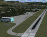
Tatoi AB is located north of Athens and is the home of the Air Training Comand of the Hellenic Air Force as well as all the Academys for basic training of all officer ranks of aircrew and ground crew for the Air Force. The Air force Museum is also based there with a substantial collection of historical static exhibits. Tatoi is also home of three Aeroclubs, the Athens Aeroclub, the Mesogion Aeroclub and Dekeleia Aeroclub as well as the Athens gliding club.
This addon will substantially revamp the scenery for LGTT as well as move the airport to its correct location. All buildings are custom made to represent the actual ones as closely as possible, based on existing photographs as well as my own experiences of being a member of the Athens Aeroclub and currently training there for my PPL.
| Filename: | Tatoi_Airbase_LGTT.zip |
| License: | Freeware |
| Added: | 25th June 2010, 22:10:09 |
| Downloads: | 3,503 |
| Author: | Vassilios Dimoulas |
| Size: | 13.5 MB |
| Category: Flight Simulator X - Aircraft Repaints, Textures and Modifications | |
| Lockheed Martin F-35A RNLAF 311 "Bald Eagle" Sqn update |
|
Images related to this file:
File Description:
Lockheed Martin F-35A for FSX by Dino Cattaneo in (yet fictional) RNLAF livery. My sixth paint resembles a future 311 Sqn livery, located at Volkel AB, The netherlands. This repaint is an update to my previously uploaded 311 Sqn repaint, with some minor changes in the tail section and engine nozzle. 311 Squadron is an old occupant of Volkel airbase soil. The squadron logo represents a North-American bald eagle in attack position. The predator bird is know for it's agility and fabulous hunting skills. Combine that with the squadrons task and aircraft flown in history (all fighters) and you will soon conclude to the squadrons motto; "Ut Aquila Praedans", which translates to "Hunting like the eagle". You need the excellent payware Lockheed Martin F-35A by Dino Cattaneo in order to use this repaint. Enjoy!
| Filename: | Lockheed_Martin_F35A_RNLAF_311_Bald_Eagle_Sqn_upda.zip |
| License: | Freeware |
| Added: | 17th August 2010, 00:44:32 |
| Downloads: | 168 |
| Author: | Rene Spaan |
| Size: | 19.44 MB |
| Category: Flight Simulator 2004 - Scenery | |
| PAMR - Merrill Field - Anchorage, Alaska |
|
Images related to this file:
File Description:
Merrill Field is in Anchorage Alaska, between Anchorage International to the southwest and and Elmendorf Air Force Base to the north. It caters for general aviation and is the land equivalent of the Lake Hood float plane base (see my post) with fuel and numerous maintenance facilities, and several hundred parking spots for small planes. There are three runways, and the longest is 4,000 feet of 100 feet wide asphalt, the second 2,635 feet of asphalt 75 feet wide, and the third 2,000 feet of 60 feet wide gravel. It is a controlled airfield with a modern control tower. There are almost 50 buildings on the field and three quarters of them have been modeled specifically for this scenery. The download includes a LITE version for older computers as there are a lot of static parked aircraft.
| Filename: | PAMR__Merrill_Field__Anchorage_Alaska.zip |
| License: | Freeware, limited distribution |
| Added: | 3rd January 2011, 23:11:31 |
| Downloads: | 1,123 |
| Author: | Roger Wensley |
| Size: | 6.94 MB |
| Category: Flight Simulator X - Scenery | |
| TNCC |
|
File Description:
Hato International Airport or Curacao International Airport (originally named Dr. Albert Plesman International Airport) (IATA: CUR, ICAO: TNCC) is the airport of Willemstad, Curacao. It has services to the Caribbean region, South America, North America and Europe. Hato Airport is a fairly large facility, with the third longest commercial runway in the Caribbean region (after Rafael Hern�¡ndez Airport and Pointe-a-Pitre International Airport). The airport was the hub of Air ALM and its successor Dutch Caribbean Airlines, the flag carriers of the former Netherlands Antilles until the latter ceased operations in 2004. The airport is now the home base of Dutch Antilles Express and Insel Air.
This file has the right coordinates, with the apron and characteristics of the airport, working jetways. The runways and runways were resized the gates placed on correct location.
| Filename: | TNCC.zip |
| License: | Freeware |
| Added: | 9th April 2011, 23:52:03 |
| Downloads: | 2,413 |
| Author: | Anwar Gonzalez |
| Size: | 22.3 KB |
| Category: Flight Simulator 2004 - Scenery | |
| Matheson Point CWMP in Nunavut, Canada |
|
Images related to this file:
File Description:
This was a DEW line I Station on the southeast shore of King William Island; the island is around 70 miles square and Gjoa Haven is also on the southeast corner, 20 miles to the south. The station was closed in 1963 and has now been totally dismantled and removed except for a fallen 300 feet communications tower. The runway is still there (mostly) and is around 3,360 feet of gravel 120' wide, aligned 146T/326T. There are no lights, signage, or windsock, or any building remaining. All of these DEW line stations are not particularly impressive or even interesting. However, you can bet that any pilot flying regularly in the north along the coast knows where all these runways are, in case one of them suddenly becomes his favourite in the whole world just after the sudden silence.
| Filename: | Matheson_Point_CWMP_in_Nunavut_Canada.zip |
| License: | Freeware, limited distribution |
| Added: | 22nd November 2012, 16:28:19 |
| Downloads: | 179 |
| Author: | Roger Wensley |
| Size: | 785.57 KB |
| Category: Flight Simulator X - Scenery | |
| KDAY - Dayton International Airport - Vandalia, Ohio |
|
Images related to this file:
File Description:
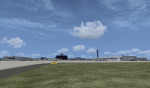
The Dayton International Airport, located 11 miles north of Dayton in Vandalia, Ohio, is a medium sized commercial airport serving nearly three million passengers annually with daily nonstop service to about twenty destinations.
This scenery includes a custom terminal building, moving jetways, and an AFX file with accurate parking assignments. Also modeled is the new air traffic control tower, terminal parking garage, the Fed Ex building, the PSA Airlines headquarters and maintenance hanger, the former Emery Worldwide cargo sort facility, the airport hotel, and hangers for fixed base operators Stevens Aviation and Wright Brothers Aero.
More than a thousand objects have been added to enhance detail around the airport using Flight 1's excellent instant scenery program. AI Traffic has been tested to ensure efficient flow. The landclass file has also been adjusted to better reflect the real airport.
| Filename: | KDAY__Dayton_International_Airport__Vandalia_Ohio.zip |
| License: | Freeware |
| Added: | 2nd December 2012, 22:32:37 |
| Downloads: | 1,568 |
| Author: | Matt Parr |
| Size: | 5.78 MB |
| Category: Flight Simulator 2004 - Scenery | |
| VFR of Lario, Area D2 - Como lake, Italy |
|
Images related to this file:
File Description:
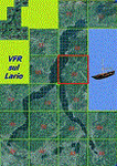
This is the seventh scenery of the "VFR of Lario" project, made with photorealistic terrain and some 3D GMax realistic objects. This scenery covers approximately an area of 7.5x6 kmt, from
north of Bellano (NW) to Casargo (NE), and from Fiumelatte (SW) to Cortenova (SE) and includes the NLC piers of Varenna and Bellano; it includes several dedicated buildings as Vezio castle (Perledo), villa Monastero, S.Giorgio church, marina, piers, hotel Olivedo, and some villas (Varenna), Tommaso Grossi square with pier and light fountain, S.Nazaro-Celso and S.Rocco-Sebastiano churches, Cantoni old cotton mill, group of houses by the lake (Bellano). There are also included four viaducts between the tunnels of the freeway 36, with moted traffic. Hydrofoil G. Marconi at Bellano pier together with other minor boats and docks alongside the lake coast; a moted traffic of motorboats is placed between Varenna's piers.
| Filename: | VFR_of_Lario_Area_D2__Como_lake_Italy.zip |
| License: | Freeware |
| Added: | 23rd July 2012, 15:45:14 |
| Downloads: | 1,260 |
| Author: | Aldo Della Vedova, Daniele Lanfranchi, Gian Mario Verga |
| Size: | 17.95 MB |


© 2001-2026 AVSIM Online
All Rights Reserved
Privacy Policy |