
Where Flight Simulation Enthusiasts Gather from Around the World!
AVSIM Library - Search Results

| Category: Flight Simulator X - Scenery | |
| X2AD - RAF Aston Down - Gloucestershire, England |

|
File Description:
Former RAF Aston Down (IACO X2AD) is located 2.5 miles (4.0 km) east of Minchinhampton, Gloucestershire, South West England and 6.9 miles (11.1 km) west of Cirencester, Gloucestershire.
The airfield was originally opened as RAF Minchinhampton and was first used in the First World War, serving as an aerodrome for the Australian Flying Corps with No. 2 Squadron AFC flying the Royal Aircraft Factory S.E.5a and the Sopwith Pup and No. 3 Squadron AFC flying the Avro 504. The airfield closed shortly afterwards.
In 1938 the airfield reopened under the new name of RAF Aston Down at the request of the residents of Minchinhampton village, which lies about 1 mile (1.6 km) to the west of the airfield, who feared not enemy attack, but a fall in the value of their houses.
During the Second World War the main unit present was No. 20 Maintenance Unit RAF (MU) which stored and prepared aircraft. The unit arrived during October 1938 and left in September 1960.
The airfield was used by the Royal Air Force from the First World War until 1967 when the Cotswold Gliding Club moved in from their previous base near Tetbury.
| Filename: | X2AD__RAF_Aston_Down__Gloucestershire_England.zip |
| License: | Freeware |
| Added: | 3rd May 2016, 13:55:23 |
| Downloads: | 175 |
| Author: | Terry Boissel |
| Size: | 1.97 MB |
| Category: Flight Simulator X - Scenery | |
| RAF Balderton |
|
File Description:
RAF Balderton is a former Royal Air Force station located 2.0 miles (3.2 km) south of Newark-on-Trent, sandwiched between the now extinct Great Northern Railway (GNR) Bottesford-Newark line and the A1 road in Nottinghamshire, England.
Opened in 1942, it was used by both the Royal Air Force and United States Army Air Forces. During the war it was used primarily as a troop carrier transport airfield and after for munitions storage before it was closed in 1957.
With the facility released from military control, Balderton was returned to agriculture, the runway concrete disappearing as hardcore under the AI road improvements of the 1960s. At that time, the developed Al was routed west of the original road, over the eastern perimeter track of the airfield, before coming back to the east to bypass Balderton village and Newark.
Gypsum open-pit mining has also taken its toll where quarrying has completely obliterated the airfield, with single track roads all that remain of the runway and perimeter track, and the occasional concrete runway end or pile of rubble.
Today the remains of the airfield are located on private property being used as agricultural fields.
| Filename: | RAF_Balderton.zip |
| License: | Freeware |
| Added: | 17th February 2016, 23:32:44 |
| Downloads: | 233 |
| Author: | Terry Boissel |
| Size: | 759.04 KB |
| Category: X-Plane - Scenery | |
| RAF Gutersloh ETUO |
|
Images related to this file:
File Description:
File Description:
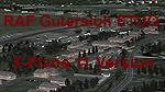
X-Plane 11 Scenery - RAF Gutersloh AB (ICAO: ETUO)
The scenery represents the former airbase of RAF Gutersloh, one of the most populated military bases in West Germany during the Cold War, due to its location near the former East/West border. This scenery reflects the era at the end of the 1980s/beginning of the 90s, when the Harrier GR3 was in operation there, along with Chinook helicopters.
The airfield was built in 1935 and was used by the German Air Force during WW2, flying the Junkers JU-86 and Heinkel H-111. The first British squadrons were stationed there from 1947, with Mosquitos, Vampires and then Canberras.
The first Harrier arrived at Gutersloh in January 1977 and 3 and 4 Squadrons became resident until their farewell in 1993, after the cold war had ended. The airfield is currently used by the British army, but they will leave in 2014 to relinquish the area to the Government of Gutersloh for civil usage.
High detailed scenery by Manfred Schyma and Pete Beeby, supported by the Airfield Construction Group. X-Plane Version designed by Dietmar Hanne
| Filename: | RAF_Gutersloh_ETUO.zip |
| License: | Freeware |
| Added: | 25th May 2018, 23:53:43 |
| Downloads: | 264 |
| Author: | Dietmar Hanne |
| Size: | 142.94 MB |
| Category: Flight Simulator 2004 - Scenery | |
| Inyokern Airport, Inyokern CA. , USA - Version 3 |
|
Images related to this file:
File Description:

FS2004 Scenery for Inyokern Airport (KIYK). SORRY everyone there were some libraries and textures missing from the recent release. This package contains all missing objects and libraries and is a complete replacement for ANY of my Inyokern sceneries previously installed, no other download required. (Nestled on the sunny side of the southern Sierras, Inyokern is a great jumping-off place for hi desert adventures. Known for decades for it's great soaring spots, Inyokern itself is busy enough with an average of 80 flights a day including it's United/Skywest commuter flights and occasional military traffic from the nearby China Lake Naval Weapons Test Center. Geographically, the airport is situated in the high desert of Southern California, 100 miles east-northeast of the county seat in Bakersfield, 80 miles north-northeast of the Lancaster and Palmdale areas, and 120 miles north-northwest of San Bernardino. The airport itself covers 1,640 acres at an elevation of 2,457 feet, with three asphalt paved runways that can accommodate almost any class of civilian, commercial, or military aircraft. Inyokern Airport is served by commercial airlines connecting through Los Angeles International Airport.)
| Filename: | Inyokern_Airport_Inyokern_CA__USA__Version_3.zip |
| License: | Freeware, limited distribution |
| Added: | 10th November 2013, 23:32:02 |
| Downloads: | 2,057 |
| Author: | John Stinstrom |
| Size: | 6.36 MB |
| Category: Flight Simulator 2004 - Scenery | |
| Deline CYWJ - Northwest Territories, Canada |
|
Images related to this file:
File Description:
This is the third in a series of airfields that follow in a southward direction that early access route to the Canadian northern shore, the Mackenzie River. Deline is south of Tuktuk, Inuvik, Fort McPherson, and Fort Good Hope, all already posted. Deline is at 704 feet asl and around 50 miles east of the the Mackenzie, where the Great Bear River flows out of the western end of Great Bear Lake on its way to the Mackenzie. This lake is huge. The town of Deline has a population of around 500, and the first trading post (of the North West Company) was established there as early as 1799. The Hudson Bay Company opened an outpost in 1825 to support the Franklin Arctic Exploration expedition, and it was then called Fort Franklin. The name was changed to Deline in 1993. The airport is just over a mile north of the town, and has almost 4,000 feet of gravel runway. There is no fuel available. The original airfield is still visible just to the north of the town, from before it was rebuilt on higher ground (better drainage) and away from the houses. AI will follow with later posts.
| Filename: | Deline_CYWJ__Northwest_Territories_Canada.zip |
| License: | Freeware, limited distribution |
| Added: | 5th July 2014, 14:47:36 |
| Downloads: | 241 |
| Author: | Roger Wensley |
| Size: | 2.54 MB |
| Category: Flight Simulator 2004 - Scenery | |
| Alma CYTF in Quebec Canada |
|
Images related to this file:
File Description:
This is the second of five sceneries around Lac Saint-Jean in Quebec, Canada. Alma, the town, is 7 miles east of Lac Saint-Jean, on both the northern and southern banks of the Saguenay River. The airfield is at the southern edge of the town, with a single 13-31 runway 5,000 feet long and approach lighting at both ends. There is a visible ILS sytem but this was no longer in operation by 2010, the approximate date setting of this scenery. The largest operation on the field, by far, is Panorama Helicopters (actually Helicopteres Panorama) and this is reflected in the AI and a parked static helicopter. The ai includes helicopters that were originally posted as part of the payware Alaska Fjords series, with the permission of FSAddon. There are also other planes listed that will be required here or for the future posts in this series and are included here. The amphibious Beaver AI plane will only be available if you already have the payware Aerosoft Beaver installed, and I should have made it clear that the float Beaver included in the CTD3 AI was also an Aerosoft plane.
| Filename: | Alma_CYTF_in_Quebec_Canada.zip |
| License: | Freeware, limited distribution |
| Added: | 6th November 2017, 19:30:34 |
| Downloads: | 227 |
| Author: | Roger Wensley |
| Size: | 17.42 MB |
| Category: Microsoft Flight Simulator (2020) - Aircraft Repaints, Textures and Modifications | |
| Ryan ST-A ZK-ABC |
|
Images related to this file:
File Description:
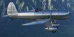
This folder contains a repaint for the Ryan ST-A by A1R Design Bureau. It shows Ryan ST-M ZK-ABC. After a 33 year restororation, Ryan STM-S2 ZK-ABC, serial number 492, nicknamed 'Charlie', took to the air over Hamilton back on 16 September 2013 with restorer and owner Noel Kruse at the controls.
Charlie served with the Netherlands East Indies Naval Air Service in Java in 1941, as S-56, and was evacuated to Australia when Japanese forces occupied the island. From 1942 to 1945 Charlie served with the Royal Australian Air Force as A50-29. Demobilised in 1946 Charlie flew with a number of Aero Clubs and private owners as VH-AHC, until he was 'retired' in 1977. In 1980 Charlie was found in a hay shed in Jerilderie NSW by Noel Kruse who started the long process of returning Charlie to flight. In 2006 Charlie and Noel moved to live in New Zealand and on 16 September 2013, 36 years since he last flew and 33 years since Noel found him, Charlie took to the air again as a genuine 'Warbird' with the New Zealand registration ZK-ABC. Repaint by Jan Kees Blom.
| Filename: | Ryan_STA_ZKABC.zip |
| License: | Freeware |
| Added: | 12th June 2021, 23:17:13 |
| Downloads: | 22 |
| Author: | Jan Kees Blom |
| Size: | 79.14 MB |
| Category: Flight Simulator 2004 - AFCAD Files | |
| Worcester Regional Airport |
|
File Description:
I have re-created Worcester Regional Airportt (KORH) located in Worcester, Massachusetts as accurately as possible. I have altered the apron extensively in order to match that of the real life Worcester Regional. The airport now contains cargo parking, general aviation parking, and two small aircraft gates. A tower view for the airport has been added. The old runway, now turned into taxiway "F" has been added with a small piece "hanging" off the east side of the apron. All edges off the apron have been accuartely designed to follow the real life apron. Worcester Regional Airport does not recieve regularily scheduled servcice from airlines. The last airline to fly to the airport was US Airways, who ceased operations at Worcester in Febuary, 2003. Although, you can fly into Worcester Regional all you'd like, thats the beauty of Microsoft Flight Simulator.
| Filename: | Worcester_Regional_Airport.zip |
| License: | Freeware |
| Added: | 27th October 2004, 05:08:39 |
| Downloads: | 710 |
| Author: | Josh Plave |
| Size: | 77.15 KB |
| Category: Flight Simulator X - Aircraft Repaints, Textures and Modifications | |
| "Holy Terror III" Boeing B-17G |
|
Images related to this file:
File Description:
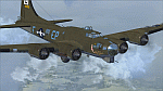
Repaint for the A2A B-17G in the colors of B-17G-10-VE 42-40056 "Holy Terror III" of the 100th BG, 351st BS. On March 8, 1944, "Holy Terror III" was shot down about 15 miles East of Berlin after mechanical difficulties made it impossible to maintain formation. All 10 crewmembers became POWs till the end of the war. An eyewitness account of the actual day the aircraft was lost states that pilot (2nd) Lt. (Norman L.) Chapman feathered #1 engine, then unfeathered it near Dummer Lake at 1240 hours. He continued with the formation, although straggling, to the I.P. where he was attacked by three (3) E/A. Escorting Fighters went down and picked him up. The aircraft appeared to be under control when last seen.
Repaint by Will "dafraz48" Turner, based on the A2A paintkit, October 2014.
| Filename: | Holy_Terror_III_Boeing_B17G.zip |
| License: | Freeware |
| Added: | 14th October 2014, 01:01:15 |
| Downloads: | 182 |
| Author: | Will Turner |
| Size: | 9.72 MB |
| Category: Flight Simulator 2004 - Scenery | |
| Campbell River floats CAE3 in BC Canada |
|
Images related to this file:
File Description:
Campbell River is a medium sized town on Vancouver Island, some 50 miles north of Vancouver. The base is just north and west of the town on Spit Road. And Ultimate Terrain is required for the cost to be in the right place. The docks are on the south side of the spit, on the (relatively) sheltered river side, though take offs and landings are requested to take place outside the harbour if conditions permit. The base is noted as used and run by Corilair, though in fact there is also another company based there, Vancouver Island Air, who like Coril Air also have two docks, one for boarding passengers and one for maintenance and refuelling tie-ups. At the river mouth there is a small marina, run by the same folks who run the trailer park, and next to that a dock for visiting float planes. There is a seventh dock at the end furthest from the river mouth; I don't know what that is used for but it is next to Vancouver Island Air and might be theirs. At low tide there are numerous sandbanks (and more permanent islands with bushes and trees) in the mouth of the Campbell River and I decided to ignore installing these with all the problems they would cause me. The main buildings and most of the others are modeled specifically for this scenery; minor items like parked cars are RWY12.
| Filename: | Campbell_River_floats_CAE3_in_BC_Canada.zip |
| License: | Freeware, limited distribution |
| Added: | 12th February 2010, 18:45:00 |
| Downloads: | 881 |
| Author: | Roger Wensley |
| Size: | 5.3 MB |


© 2001-2026 AVSIM Online
All Rights Reserved
Privacy Policy |