
Where Flight Simulation Enthusiasts Gather from Around the World!
AVSIM Library - Search Results

| Category: Flight Simulator 2004 - Scenery | |
| Haines Junction CYHT in Yukon Territory Canada |

|
Images related to this file:
File Description:
Haines Junction is a village in the Yukon Territory, Canada, amid the Rocky Mountains and around 80 miles west of Whitehorse. It is sited at the junction of the Haines Highway and the Alaska Highway, hence the name. The village was established in 1942 when the Alaska Highway was under construction, and the Haines Highway was built over the Chilkat Pass to connect to the town of Haines on the Alaska coast.
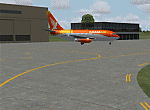
The date of this scenery is, as usual, around 2010. At that time there was a regular service (not always a daily one, depending on the time of year) by Yukon Air North, and in this case it is by an ATR 42-300. There is a helicopter company based at the airfield, Trans North Helicopters, and there is also Kluane Glacier Air Tours, which, as the name suggests, takes you to a glacier so you can stroll around on ice. And then brings you back. The gravel runway is 5,000 feet long and aligned 04-22, and is lit, with PAPI at both ends. Right hand circuits are required for runway 04 as the terrain is not flat.
This post will be followed by two other airfields to the northwest, Silver City and Burwash, both of which are on or close to the Alaska Highway.
| Filename: | Haines_Junction_CYHT_in_Yukon_Territory_Canada.zip |
| License: | Freeware, limited distribution |
| Added: | 22nd January 2022, 21:53:16 |
| Downloads: | 117 |
| Author: | Roger Wensley |
| Size: | 20.46 MB |
| Category: Flight Simulator 2004 - Scenery Design | |
| Global Aviiation Forestyr Services - Outpost #01 - |
|
File Description:
Global Aviation Firebase Operations - Outpost #01 - Stevensville, Montana.
Global Air Foresty Services (G.A.F.S.) is a subsidiary of the Global Aviation Network Corporation located just a few miles North/North East of Corporate Head Quarters near KFCA - Glacier Park International.
Global Aviation Fire Supersion Services,in fictional partnership with the U.S.F.S. provides both AIR & HELO Attack & Supression Services throught the state of Montana. The services are primarly limited to Fire Attack/Supression, but might include other services; Such as: Medivac, Medical Transportation Services (limited services), Search and Rescue, Deep or High Mountain Rescue, Natural Disaster Support & Relief.
Partnership and Mutial Aid agreements with neighboring states, and Canada have allowed extended operatonial options, as well extending many other roles they could be called upon from time to time.
For current versions or updates please check: http://www.globalaviationnetwork.org - Schedualed Base Releases will be posted soon, who knows- got any suggestions? for a great location? your selection could be picked! Outpost #1 is one of the 29 more Outpost/Bases to come- scattered thought the Whole state of Montana! For schedualed FREE releases keep watch and checks
| Filename: | Global_Aviiation_Forestyr_Services___Outpost_01_.zip |
| License: | Check within download |
| Added: | 22nd May 2007, 02:55:03 |
| Downloads: | 699 |
| Author: | Tobey "-Mort-" Ford |
| Size: | 17.22 MB |
| Category: Flight Simulator 2004 - AFCAD Files | |
| WIKK/WIKP/WIDK Depati Amir, Pangkal Pinang, Indonesia |
|
Images related to this file:
File Description:
Googlyafcad A&F Data file for Depati Amir, based on Google Earth satellite data. It is a domestic airport located on the east coast of the island on Bangka serving the serving the largest town on the island, Pangkal Pinang, which is also the capital of the province
Bangka-Belitung.
The facilities in Flight Simulator 2004 only allow for general aviation traffic, but the
airport is regularly served by Boeing jets of Adam Air, Batavia Air and Sriwijaya Air as
well as smaller prop-driven craft of airlines like Merpati Nusentara. These files will
allow you and your "AI" traffic to land, taxi, park and take off in a realistic manner.
Like many airports in Indonesia, the ICAO code has changed in recent years. Microsoft
Flight Simulator 2004 uses the old code (WIKK) but this changed first to WIPK (in error)
and now WIDK. These files allow you to continue using the old code or change to the new
one. [File re-uploaded at request of AVSIM]
| Filename: | WIKKWIKPWIDK_Depati_Amir_Pangkal_Pinang_Indonesia.zip |
| License: | Freeware |
| Added: | 29th May 2010, 09:30:30 |
| Downloads: | 755 |
| Author: | John Hinson |
| Size: | 69.96 KB |
| Category: Flight Simulator X - Scenery | |
| RAF Hilbaldstow - Lincolnshire, England |
|
File Description:
RAF Hibaldstow is a former Royal Air Force satellite airfield located south of Hibaldstow in Lincolnshire and 8.3 miles (13.4 km) south east of Scunthorpe, Lincolnshire, England. The airfield was built with greater things in mind, but it only became a satellite airfield for RAF Kirton-in-Lindsey in 1941. When the runways were constructed, some of the hardcore was made from material taken from demolished bungalows on the site.
The airfield was commissioned on 12 May 1941 when No. 255 Squadron RAF took up residence with their Boulton Paul Defiant night fighters. These planes had been drawn from RAF Kirton-in-Lindsey and made one 'kill': an He 111 which was shot down near Louth on 5 June 1941.
On 6 August 1947 the station finally closed and during 1960-61 it was sold off for use as agricultural land. It was also used for Sunday markets, as a skid-pan by Lincolnshire Police and by a local parachute club. The control tower was converted to a two-storey house in 1976.
| Filename: | RAF_Hilbaldstow__Lincolnshire_England.zip |
| License: | Freeware |
| Added: | 24th October 2015, 22:00:30 |
| Downloads: | 202 |
| Author: | Terry Boissel |
| Size: | 24.85 KB |
| Category: Flight Simulator X - Scenery | |
| Terra Firma Ground Detail |
|
File Description:
Well, most of you probably have used a couple of different detail1.bmp textures either for FS9 or FSX. Many of those seemed to be aimed at achieving a grassy look. With this texture however I have tried to create a more alround yet more detailed look that will work on pretty much any terrain, whether you fly over mountains, farming fields or beautiful forests.
I've kept the texture size at 1024 x 1024 simply because I think it blends in better that way with the underlying default textures. And even with high quality addons I prefer this specific texture to enhance the underlying textures, I don't feel it should dominate it.
I'm an avid virtual bushflyer so I find myself flying over natural areas most of the time. So with that in mind I didn't try to create this texture for urban areas, however I don't think it looks that bad over cities.
| Filename: | Terra_Firma_Ground_Detail.zip |
| License: | Freeware |
| Added: | 12th April 2009, 22:33:33 |
| Downloads: | 4,457 |
| Author: | Erik Hardenbol |
| Size: | 557.86 KB |
| Category: Flight Simulator 2004 - Scenery | |
| Fort Liard CYJF in the Northwest Territories, Canada |
|
Images related to this file:
File Description:
Fort Liard is the seventh in a series of airfields that follow (approximately) the Mackenzie River. At the far northern end of the river there is Tuktoyaktuk, then Inuvik, Fort McPherson, Fort Good Hope, Deline, Wrigley, and then Fort Simpson Island and Fort Simpson, all posted. Fort Liard is at 708 feet asl and on the east bank of the the Liard River, around 130 miles south of Fort Simpson where the Liard and Mackenzie join, and about 25 miles from the borders with both British Columbia and the Yukon. The town has a population of about 560 folks.
The airport is next to the town, and has almost 3,000 feet of gravel runway. I have no information regarding when it was built but it may be from the WW2 time; the cleared and grassed area is long enough for a runway 0f 6,000 feet. There are no scheduled flights but North Cariboo Air have a base at the airport for local charters to support survey teams etc. and are almost an on-demand-scheduled airline. I have also added a Buffalo DC3 and GA. There is fuel available, but only by prior arrangement with North Cariboo. Right hand circuits for runway 20.
| Filename: | Fort_Liard_CYJF_in_the_Northwest_Territories_Canad.zip |
| License: | Freeware, limited distribution |
| Added: | 11th July 2014, 13:38:49 |
| Downloads: | 303 |
| Author: | Roger Wensley |
| Size: | 10.07 MB |
| Category: Flight Simulator 2004 - Scenery | |
| CYQU - Grande Prairie, Alberta, Canada |
|
Images related to this file:
File Description:
Grande Prairie is at 2,195 feet asl, 65 miles southeast of Dawsons Creek, 90 miles southwest of Peace River and around 60 miles east of the Rockies. The town has a population of 55,000 and growing. The airport is just to the west of the town and was originally a military base, built during WW2. The two runways are 07-25 and 11-29 and when one is the active runway then the other is used as a taxiway. AI in FS9 doesn't like this, and just stops at the first hold short without ever reaching the active runway. I have found a way to overcome this and AI will now use taxiway A and whichever runway is inactive to feed to and from both ends of the active runway. The vertical red tanks are for de-icing fluid; de-icing is carried out before take-off in the winter. The industrial area to the southeast is now larger than I have made it, but I kept it to this minimum size to keep frame rates down. All the buildings are modeled specifically for CYQU. The AI includes Westjet, Air Canada Jazz, and others as listed. The GA AI uses only FS9 standard aircraft.
| Filename: | CYQU__Grande_Prairie_Alberta_Canada.zip |
| License: | Freeware, limited distribution |
| Added: | 9th May 2014, 10:05:40 |
| Downloads: | 670 |
| Author: | Roger Wensley |
| Size: | 18.33 MB |
| Category: Flight Simulator 2004 - Scenery | |
| Prudhoe Bay area on Alaska North Slope US |
|
Images related to this file:
File Description:
The Prudhoe Bay area of the Alaska north slope is dominated by all the equipment and machinery that is necessary for the extraction of oil and its transfer by the pipeline that reaches south to Valdez. Prudhoe Bay airport is now closed, and its replacement just to the south is Deadhorse PASC, with numerous storage, maintenance, and accomodation areas immediately to the north of the apron, and others adjacent to the road between the two. The runway is just under 6,500 feet with approach lights at both ends and ILS on 04 (true heading of 75 degrees). This scenery reflects the overall situation in 2011 and oil production facilities and buildings are included here. The airport buildings and those close to the airport are replicas of the real life buildings; while as distance increases the accuracy fades somewhat there are everywhere replica trucks and cross country vehicles that are true to life. Deadhorse handles around 7,000 passengers per month as staff are rotated in and out on Alaska Air and ERA flights and by oil company private flights. There are also freight flights to complement the trucking effort up the Dalton Highway. The Alaska Airlines terminal building and ERA (the red buildings nearby) are at one end of the apron, while at the other end is a very large and new green terminal, storage, hangar building built by the airport authority. All of the airport components, runways, taxiways, and aprons, are built up on a gravel base to raise them above the surrounding terrain that floods with melting snow, freezes, or dries out, according to the seasons. There are other new airstrips included here that serve the oil industry. Around 33 miles to the east is Badami PABP airport servicing a subsiduary oil producing area, with 5,000 feet of gravel runway. Some 28 miles to the west of Deadhorse is Ugnu-Kuparuk UBW with just over 6,000 feet of gravel (gravel in 2011, it is now asphalted) servicing oil production by Conoco Phillips, which uses 737's to fly staff in and out. A further 32 miles west is Alpine AK15 with 5,400 feet of gravel and also served by the Conoco Phillips 737's. To the south of Alpine and connected by road is the village of Nuiqsut. To the north of Alpine and reachable only by air in the delta of the Sagavanirktok River is CD-3, an oil collection and pump station area with another gravel runway of 3,000 feet. Other airstrips that were prviously posted are now updated, Nuiqsut and Oliktok. I experimented, but decided against trying to reproduce the several hundred miles of pipelines. The are new AI aircraft, and there are notes regarding downloading. There is a new "cement" texture (not its name, but used as that by SBuilder) for the built up gravel bases. It is slightly darker than the original but not so much that any previous use will be spoilt. You may wish to download my "Alaska Frozen Rivers and Lakes" which freezes lakes and the northern sea and makes them landable on wheels.
| Filename: | Prudhoe_Bay_area_on_Alaska_North_Slope_US.zip |
| License: | Freeware, limited distribution |
| Added: | 19th December 2017, 00:38:06 |
| Downloads: | 586 |
| Author: | Roger Wensley |
| Size: | 28.54 MB |
| Category: Flight Simulator 2004 - AI Flight Plans | |
| DHL Cargo *PART 2* DHL-European Air Transport (EAT) |
|
File Description:
Flightplan for the DHL-European Air Transport. DHL move his HUB at march 30th from Brussels to Leipzig. Leipzig are now the biggest HUb in Europe for a Cargo based Airline. Brussels still remains as a small local HUB like Stockholm, Bergamo, Nottingham/East Midlands and so on... With the second part of the DHL-flightplans comes the Belgium-division with 18 Airbus 300B4-200F converted freighters and 11 Boeing 757-200 special converted freighters, diverted into old and new colors. Also included in this part 2 all needed paints for the plan. Old color, new color, Three windows in the back by Boeing 757 and both colors with white nose. to install the liverys please read the "install instructions§ file inside this package. Many thanks to Josef Petric. He gives his blood in the last fiew weeks to create this plan, because it was very diffcult to get informations about the DHL-Flights. Stay tuned. some DHL-feeders will follow soon. You only need the Base files for the AIaardvark Boeing 757-200RR and the FSPainter Airbus A300B4-200F (. Base files package for FS2004 (aia_box.zip and ai_airbus_complete_120685.zip) available at Avsim
| Filename: | DHL_Cargo_PART_2_DHLEuropean_Air_Transport_EAT.zip |
| License: | Freeware |
| Added: | 18th April 2008, 19:38:00 |
| Downloads: | 4,184 |
| Author: | Josef Petric/Juergen Baumbusch |
| Size: | 2.54 MB |
| Category: Flight Simulator 2004 - AFCAD Files | |
| EHAM for NL2000, Multiple Runways, First Attempt |
|
File Description:
AFCAD2 File for :
Amsterdam, Schiphol Intl Airport, the Netherlands ( EHAM )
for NL2000 Scenery .
with Runways 06 and 36R for landings and 36L and 36C for take-offs .
NL2000 scenery can be found on Avsim as nl2kv291.zip .
All credits to NL2000 team for the NL2000 scenery, many many thanks .
( Not to bo used with the default scenery )
This Afcad file was originally made by Victor Nauta as af2nl2k29v2_eham.zip .
But now with breakthrough NON parallel runway assignment by Project AI, Jim Vile and
Reggie Fields, non-parallel runways can be used simultaniously .
Thanks to Jim .
Although created to use all runways, something I can't do about it is to make FS9
use South or West bound traffic .
Now only North bound traffic is possible as Victor Nauta also complained about and didn't see a solution as well .
Even with maximum wind from South-West ( a common thing in the Netherlands ) AI is still assigned to North or East bound .
I have closed Runway 9 as it is rarely used, and also Runway 4 ( Gen. Aviation ) closed to avoid smaller turboporops landing there .
Have fun, Silvester
| Filename: | EHAM_for_NL2000_Multiple_Runways_First_Attempt.zip |
| License: | Freeware |
| Added: | 8th October 2004, 20:18:30 |
| Downloads: | 1,728 |
| Author: | Silvester van Wijk / Victor Nauta / Project AI |
| Size: | 17.39 KB |


© 2001-2026 AVSIM Online
All Rights Reserved
Privacy Policy |