
Where Flight Simulation Enthusiasts Gather from Around the World!
AVSIM Library - Search Results

| Category: Flight Simulator X - Scenery | |
| NEW YORK CITY X DEMO |

|
Images related to this file:
File Description:

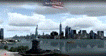
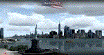
NEW YORK CITY X DEMO features a detailed scenery of New York city in the United States of America, fully compatible with FSX, FSX STEAM, P3D v1/v2/v3/v4 and FSW by Dovetail.
A demo version of New York City X is provided. This is a fully functional freeware scenery, perfectly aligned with the full payware version. This ensures no problems with online (VATSIM, IVAO and multiplayer) flying in case some users have the payware scenery and some don't. The demo gives you the most important (largest) downtown buildings with a low quality photoreal ground for Manhattan area, as well as low quality heliports.
This scenery add-on features 2500 sq km of terrain with autogen and over 6100 photoreal New York buildings in the city, which is the most populous in the United States and the center of the New York Metropolitan Area, one of the most populous urban agglomerations in the world.
The product is equipped with an automatic installer, which means that the scenery will be automatically added to the Flight Simulator Scenery Library.
Please uninstall all previous versions of similar sceneries you may have installed before. Please make also sure that no duplicated AFCAD files are installed.
Enjoy your virtual flying with Drzewiecki Design!
| Filename: | NEW_YORK_CITY_X_DEMO.zip |
| License: | Freeware, limited distribution |
| Added: | 10th August 2017, 18:05:30 |
| Downloads: | 2,790 |
| Author: | Drzewiecki Design |
| Size: | 25.8 MB |
| Category: Prepar3D V1-4 - Scenery | |
| NEW YORK CITY X DEMO |
|
Images related to this file:
File Description:
NEW YORK CITY X DEMO features a detailed scenery of New York city in the United States of America, fully compatible with FSX, FSX STEAM, P3D v1/v2/v3/v4 and FSW by Dovetail.
A demo version of New York City X is provided. This is a fully functional freeware scenery, perfectly aligned with the full payware version. This ensures no problems with online (VATSIM, IVAO and multiplayer) flying in case some users have the payware scenery and some don't. The demo gives you the most important (largest) downtown buildings with a low quality photoreal ground for Manhattan area, as well as low quality heliports.
This scenery add-on features 2500 sq km of terrain with autogen and over 6100 photoreal New York buildings in the city, which is the most populous in the United States and the center of the New York Metropolitan Area, one of the most populous urban agglomerations in the world.
The product is equipped with an automatic installer, which means that the scenery will be automatically added to the Flight Simulator Scenery Library.
Please uninstall all previous versions of similar sceneries you may have installed before. Please make also sure that no duplicated AFCAD files are installed.
Enjoy your virtual flying with Drzewiecki Design!
| Filename: | NEW_YORK_CITY_X_DEMO.zip |
| License: | Freeware |
| Added: | 10th August 2017, 18:06:09 |
| Downloads: | 698 |
| Author: | Drzewiecki Design |
| Size: | 25.8 MB |
| Category: Dovetail Games Flight Sim World - Scenery | |
| NEW YORK CITY X DEMO |
|
Images related to this file:
File Description:
NEW YORK CITY X DEMO features a detailed scenery of New York city in the United States of America, fully compatible with FSX, FSX STEAM, P3D v1/v2/v3/v4 and FSW by Dovetail.
A demo version of New York City X is provided. This is a fully functional freeware scenery, perfectly aligned with the full payware version. This ensures no problems with online (VATSIM, IVAO and multiplayer) flying in case some users have the payware scenery and some don't. The demo gives you the most important (largest) downtown buildings with a low quality photoreal ground for Manhattan area, as well as low quality heliports.
This scenery add-on features 2500 sq km of terrain with autogen and over 6100 photoreal New York buildings in the city, which is the most populous in the United States and the center of the New York Metropolitan Area, one of the most populous urban agglomerations in the world.
The product is equipped with an automatic installer, which means that the scenery will be automatically added to the Flight Simulator Scenery Library.
Please uninstall all previous versions of similar sceneries you may have installed before. Please make also sure that no duplicated AFCAD files are installed.
Enjoy your virtual flying with Drzewiecki Design!
| Filename: | NEW_YORK_CITY_X_DEMO.zip |
| License: | Freeware, limited distribution |
| Added: | 16th August 2017, 14:27:36 |
| Downloads: | 187 |
| Author: | Drzewiecki Design |
| Size: | 25.8 MB |
| Category: Prepar3D V1-4 - Aircraft Repaints, Textures and Modifications | |
| Avro Lancaster (NA-S) No.44 Sqn R5508 |
|
Images related to this file:
File Description:
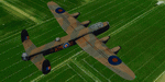
This folder contains a repaint for the AVRO Lancaster by Aeroplane Heaven, in the colors of Lancaster B.1 R5508 of No.44 Squadron based on Waddington, UK, as flown by Squadron Leader John Nettleton from South Africa during the low-level daylight raid on the MAN factory in Augsburg, Germany on 17 April, 1942. It involved six aircraft of 44 squadron and six of 97 squadron, that had to fly some 1000 miles over hostile terrain in daylight at low level. Only two of 44 sqn and five of 97 sqn reached the target, and two more aircraft were shot down near Augsburg by flak. Four 97 sqn aircraft returned to base under cover of darkness, but of 44 sqn, only Squadron Leader Nettletons aircraft, although heavily damaged, made it back to the UK. Nettleton received the VC for this raid, F/L Penman of 97 Sqn the DSO. 8 DFC's and 10 DFM's were awarded to other crew members. Nettleton died on 13 July 1943, returning from a raid on Turin. It is believed he was shot down near Brest by a FW190 of JG.2. His body and those of his crew were never recovered. Repaint by Jan Kees Blom, based on the paintkit by Aeroplane Heaven.
| Filename: | Avro_Lancaster_NAS_No44_Sqn_R5508.zip |
| License: | Freeware |
| Added: | 7th March 2020, 17:25:46 |
| Downloads: | 59 |
| Author: | Jan Kees Blom |
| Size: | 27.9 MB |
| Category: Flight Simulator 2004 - Scenery | |
| Stephenville CYJT in Newfoundland Canada |
|
Images related to this file:
File Description:
Stephenville is on the east coast of Canada, and the airport was an American base from 1941, when it was built, until 1966. It was named the "Ernest Harmon Airforce Base" and I will leave that for you to research if you wish to know more. Operating in my version (around 2010?) as a civilian airport, it's main features are a long 10,000 feet 09-27 runway (with ILS on 27) and acres of empty space. The runway was one of those designated as an emergency space shuttle landing runway if required. There is a shorter 20-02 runway (3,000 feet) that is not maintained during the winter (and which would be closed in 2018). The revised perimeter fence of the airport now encloses less than half of the original area, with the northern parts replanned as an industrial park. The attached screenshot from Google Earth shows this, and also that the main operating part of the airport is at the western end of the main runway, with only one hangar connecting to the runway from the eastern end. Like Gander, the airport is still shrinking, with taxiways and aprons not maintained (particularly in the winter) or even formally closed, and flight numbers falling. Until the early 1990's Stephenville was serving most of western Newfoundland and Air Canada, for instance, was one of the airlines that flew there. Deer Lake took over this task for western Newfoundland when the Provincial Government so decided. Stephenville remains as a port of entry, and planes with a total of 30 or less passengers can still be serviced there. My version is a mixture that cannot be precisely dated. For instance, I know there was a large hangar there until 2013 but as I do not have any photos to make it I have shown only the concrete square where it formerly stood. So 2008 or 2013, or somewhere in between? I have the airport being served by Provincial Airlines and also by Porter, though in fact Porter only flew there during the Summer months; I say "flew" as right now all flights are of course almost totally non-existent. As with Gander, I have made it clear which of the taxiways and aprons are still in regular use by showing them as asphalt, while those in the process of decaying disuse or removal are in the darker gravel or tarmac textures; this is somewhat realistic as when asphalt aprons are "ploughed" for removal the darker underside becomes visible. I have also shown the areas that now form part of the Industrial Park as cement, as this better matches the Ultimate Terrain road texture. It may seem odd that the new Canadian Coastguard hangar is not properly served by an asphalt taxiway instead of sitting on an apron that is not cleared in the winter, but it caters (mainly?) for helicopters. The original coastguard hangar is the large and decrepit one in the northeastern corner of the airport. Almost all of the buildings within the original perimeter of the airport are fairly accurately replicated here, whether still in use (Road Maintenance Department, Garbage Disposal, Armour Trucking Company, etc) or vacant (including the very strange atom-bomb-proof buried shelter) or still part of the airport (the east side of the main apron with Shell to the north, then the terminal, the Marine Institute, etc). The AI included here (a revised Gander AI) is for daily flights by Provincial Airlines, Porter, and some charter planes and GA. You will see, once the scenery is installed, that like Gander there two scenery folders called "Scenery summer" and "Scenery winter". Obviously in August you will want the summer scenery and you get this by editing the folder name down from "scenery summer" to just "scenery" and FS9 loads the summer ground textures. If FS9 decides that there is snow on the ground then you need the winter textures which do not show the aprons or taxiways that do not receive winter maintenance. One thing you must NOT DO is to edit both folders down at the same time.
| Filename: | Stephenville_CYJT_in_Newfoundland_Canada.zip |
| License: | Freeware, limited distribution |
| Added: | 24th June 2020, 18:01:58 |
| Downloads: | 235 |
| Author: | Roger Wensley |
| Size: | 43.78 MB |
| Category: Flight Simulator 2004 - Flight Plans | |
| Nepal 1 Flight Plan |
|
File Description:
It has been a few years since my last visit to Nepal/Himalaya, amazing place - amazing airfields. Hoping to give you a small taste of the real
adventure of flying there I created This FP which contains the following six short routes east of Kathmandu:
Kathmandu - Lukla - Rumjatar - Lamidada - Bhojpur - Tumlingtar - Kathmandu.The runways (except Kathmandu) are all grass/dust, although i think
that Lukla gots an asphalt one by now.I have used A Beechcraft King Air 350 plane, weather clear, 12.00' local time, visibility 48Km/30 mi.
If you want to try it hard (i am sure you do so after a while) change the weather conditions to storm/heavy storm.
Included -in friendly printable version- six images as well (one for each flight) which contains a map view and a Navigation log as layedout at fs, so
that you can have the hands on the stik all time and enjoy the flights without a stop.
| Filename: | Nepal_1_Flight_Plan.zip |
| License: | Freeware |
| Added: | 12th November 2003, 16:10:10 |
| Downloads: | 2,771 |
| Author: | Nikolas Vegas |
| Size: | 692.95 KB |
| Category: Flight Simulator X - Scenery | |
| YPTN RAAF Tindal, Australia |
|
File Description:
Ants Aussie Airports Vol 5 : RAAF Tindal is a military base about 290kms south east of Darwin near the town of Katherine in Australia's Northern Territory. Tindal is a major front-line operational air base and home to No. 75 Squadron Air Combat Group (F/A-18). There is also a civilian apron in the north west corner of the airfield. This scenery contains photoreal ground textures and these are designed to blend in with the payware FTX textures (available from www.fullterrain.com). It is therefore recommended that you have the FTX textures installed if you wish to see this airfield at its best. I have tried to make this airfield as accurate as possible although as Tindal is a military base there aren't a lot of photos available so a lot of the hangars are "educated guesses". Almost all of the models have been custom made with the use of library objects kept to the minimum.
| Filename: | YPTN_RAAF_Tindal_Australia.zip |
| License: | Freeware, limited distribution |
| Added: | 6th January 2009, 13:49:54 |
| Downloads: | 3,634 |
| Author: | Anthony Lynch |
| Size: | 30.62 MB |
| Category: Flight Simulator X - AFCAD Files | |
| Camden County Airport (19N), NJ |
|
File Description:
Located 01 miles SW of Berlin, New Jersey on 75 acres of land, Camden County Airport is a small general aviation airport privately owned by Albion Airport, Inc. The airport can handle small commuter planes (like the Cessna 208B) as well as small GA craft. Tiedowns are available on both the grass turf at the west end of the airport and the tarmac on the east end. Fuel is only available on the tarmac - park next to the fuel trucks. Trees are summer time ONLY.
Scenery constructed with use of Google Maps images/streetview, the author has not been there in person.
This scenery is meant to be used in conjunction with MegaScenery Earth New Jersey/Delaware 004. It is not required, but apron use is minimized to allow satellite scenery to show through as much as possible, and objects are placed based on the MSE textures - lack of it may make scenery look out of place.
| Filename: | Camden_County_Airport_19N_NJ.zip |
| License: | Freeware |
| Added: | 8th October 2010, 14:04:03 |
| Downloads: | 243 |
| Author: | Drew Sikora |
| Size: | 944.87 KB |
| Category: Flight Simulator X - AFCAD Files | |
| Australian Capital Cities & Regional Airports |
|
File Description:
This is a basic update of FSX default Australian Capital City & Regional Airports BGL airport files.
Many gates have been resized where possible to enable larger aircraft such as b747s, A380s park in the international terminals. I have also added several gates to a number of airports and assigned ATC (airline) parking codes to all the parking spots. These parking codes have been aligned to the correct terminals. Military parking spots have also been added to many airports.
Note Melbourne airport (YMML) has also been updated from my last posting.
The airports included in this pack include:
Melbourne Intl - YMML; Canberra - YSCB (includes military); Sydney Intl - YSSY; Brisbane Intl - YBBN; Darwin Intl - YPDN (includes military); Perth Intl - YPPH; Adelaide Intl - YPAD; Hobart Intl - YMHB; Albury - YMAY; Cairns Intl - YBSC; Townsville - YBTL (includes military); Gold Coast - YBCG; Launceston - YMLT; Devonport - YDPO; East Sale (Military) - YMES
These BGL AFCAD files has been tested with VOZ, PAI and RAAF AI aircraft.
There are 15 BGL AFCAD files in this download.
| Filename: | Australian_Capital_Cities__Regional_Airports.zip |
| License: | Freeware |
| Added: | 13th October 2007, 10:38:57 |
| Downloads: | 6,353 |
| Author: | Garry Appleby |
| Size: | 2.09 MB |
| Category: Flight Simulator 2004 - Scenery | |
| VFR of Lario, Area E2 - Como Lake, Italy (Update) |
|
Images related to this file:
File Description:
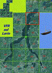
This 8th scenery covers approximately an area of 7.5x6 km, from S.Gregorio/Dongo (NW) to Colico (NE), and S.Siro (SW) to Tremenico/Aveno (SE) and includes six NLC piers: Dervio, Piona, Colico, Dongo, Musso, Pianello del Lario, in addition to the disused Cremia's one; a lot of dedicated buildings are included, as S.Tommaso of Canterbury church and fortification (Corenno), Cistercian abbey (Piona), pier and dock (Colico), S.Stefano church, factory buildings and airpollution control machinery (Dongo), Rezzonico's castle (S.Siro).
This VFR on Lario scenery includes several Dervio's details, and fully revises the previous Dervio scenery; Are included: Boldona's park office and stand, railway station, NLC shiphard, Pontile piers with Concordia steamer, dock bay with small floating pier and compass of the lake, S. Peter and Paul church and houses front of lake, hydro power station, Municipality and some other buildings, Castello's tower, windsurf school, windsurfers and kitesurfers on the lake, cross and Madonna on top of Legnoncino mountain. There are also included two viaducts between the tunnels of the freeway 36, with moted traffic. Catamarans Citta di Como and Tivano at Colico/Dongo piers together with other minor boats and docks alongside the lake coast; a moted regata with catamarans is placed in the lake between Pianello and Dervio.
This scenery SUPERSEDES AND CANCELS the previous "dervio_v2a" one, removed from the library. This is the eighth scenery of the "VFR of Lario" project, made with photorealistic terrain (multiseason & night) and with some 3D GMax realistic objects.
| Filename: | VFR_of_Lario_Area_E2__Como_Lake_Italy_Update.zip |
| License: | Freeware |
| Added: | 25th November 2012, 20:54:39 |
| Downloads: | 1,665 |
| Author: | Aldo Della Vedova, Daniele Lanfranchi, Gian Mario Verga |
| Size: | 39.39 MB |


© 2001-2026 AVSIM Online
All Rights Reserved
Privacy Policy |