
Where Flight Simulation Enthusiasts Gather from Around the World!
AVSIM Library - Search Results

| Category: Flight Simulator 2004 - Original Aircraft | |
| VAL and Flamenco "New livery" Britten-Norman BN-2 Islander Pack |

|
File Description:
Vieques Air Link and Air Flamenco are two Regional Airline based in Puerto Rico that transport Passengers as well as Cargo in the Caribbean
with their BN-2 Islanders Fleet. Here are their NEW Islanders and New paint scheme added to their fleets. Models have 2D Panel and Virtual Cockpit as well. Model by Marcel Kuhnt, files by Roberto "Rotol" Ayala and Repaints by Rafael "Fefi" Ortiz. Enjoy!!!!!
You can see them in action here: https://www.youtube.com/watch?v=xu1sL5Ksm_k
You can see my next project here: https://www.youtube.com/watch?v=RnnPAsOcO2Q
| Filename: | VAL_and_Flamenco_New_livery_BrittenNorman_BN2_Isla.zip |
| License: | Freeware |
| Added: | 9th December 2014, 01:07:53 |
| Downloads: | 533 |
| Author: | Rafael Ortiz |
| Size: | 25.66 MB |
| Category: Flight Simulator X - AFCAD Files | |
| RPMD - Francisco Bangoy International Airport/ Davao International Airport, Philippines |
|
File Description:
This Afcad/AFD for RPMD - Francisco Bangoy International Airport/ Davao International Airport in Davao City, Mindanao, Philippines was made with ADE V1.37 and is for the default RPMD airport in FSX. The Afcad/AFD was was made with ADE V1.37 and is for the default RPVM airport in FSX. It was made in response to a user request.
Francisco Bangoy/Davao International is a significant hub for the southern part of the Philippines and sees domestic traffic from Philippines Airlines (PAL Express through to A343's), Air Philippines, Cebu Pacific. Asian Spirit and South East Asian Airlines. The airport handles international traffic - currently limited to Cebu Pacific flights to and from Hong Kong and Singapore and Silkair flights from Singapore.
Aprons and taxiways have been changed, additional GA maintenance aprons added, taxiways re-aligned and surfaced correctly, jetways added, gates and parking spaces coded for airlines and aircraft types using the airport. The tower was changed to be more representative of the real thing.
The default airport lacks coding and the radius of gates is inadequate for the any of the commercial aircraft coming to RPMD, so use of this file very significantly increases traffic. Tested with WOAI, Henry Tomkiewicz's Cessna Props package and custom AI.
| Filename: | RPMD__Francisco_Bangoy_International_Airport_Davao.zip |
| License: | Freeware |
| Added: | 17th August 2008, 20:09:18 |
| Downloads: | 1,457 |
| Author: | Matthew Brooks |
| Size: | 5.86 KB |
| Category: Flight Simulator X - Gauges | |
| Flypad Gauge V2.0 |
|
Images related to this file:
File Description:
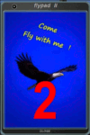
FSX, Flypad Gauge Version 2.0
This gauge has been developed on Win7 for FSX Flight Simulator SP2 or SP1.It should also work with Acceleration, but this is not guaranteed by the author. The gauge is a little extra addon based on the design of a smart phone and provides 9 different displays which are different from all of the standard gauge displays on a regular aircraft panel. It is mainly helpful for the user flying small propeller aircraft, and old timer aircraft.
However, the displays are as well attractive for sim pilots flying modern jet aircraft. Use it as if you just grabbed to your smart phone during a flight and check on the status of your aircraft, or how the terrain awareness situation looks like, how the AI traffic on the radar is, while you proceed with your flight plan. Enjoy the new design of a simple aircraft attitude display during an ILS approach. A new screen for LAT/LON coordination control and distance/bearing calculation has been added to this version in addition with a number of improvements.For credits look at the pdf documentation inside the zip file. By Dietmar Loleit
| Filename: | Flypad_Gauge_V20.zip |
| License: | Freeware |
| Added: | 2nd August 2014, 17:50:45 |
| Downloads: | 778 |
| Author: | Dietmar Loleit |
| Size: | 4 MB |
| Category: Flight Simulator 2004 - Scenery | |
| VFR of Lario, Area C2A - Como lake, Italy |
|
Images related to this file:
File Description:
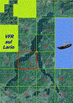
*** REPLACEMENT OF PREVIOUS ISSUE, due to a bug of an High Winter texture ***
This is the fifth scenery of the "VFR of Lario" project, made with photorealistic terrain (multiseason & night) and with some 3D GMax realistic objects.
Information: Como's lake is in the north of Italy, closed to the Helvetic border; this scenery covers approximately an area of 7.5x6 kmt, from la "Zoca de l'Oli" and mountains over Ossuccio (NW) to Tremezzo (NE), and from Colonno (SW) to Magreglio (SE) and includes the NLC piers of Sala Comacina, Comacina island, Campo, Lenno, Tremezzo, Bellagio (2), S. Giovanni, Lezzeno; it includes several dedicated buildings as Taverna Bleu hotel (Sala Comacina), S. Maria e S.Giacomo churches and villa Balbiano (Ossuccio), church and pier of S. Michele (Colonno), villa del Balbianello (Lenno), hotel Villa Marie, S. Lorenzo Church, villa La Quiete, Grand Hotel, villa Carlotta, hotel La Darsena, Pub motor ship Bisbino (Tremezzo), villa Melzi, villa Giulia, buildings Carillon e lungolago Manzoni, hotels Excelsior, Du Lac, Metropole (Bellagio). Two NLC ferry (moted on the way Bellagio-Cadenabbia) are placed together with other minor boats and docks placed alongside the coast, including platforms for seaplanes arrival.
Contents: GMax objects as above and other buildings, minor piers and boats together with autogen buildings and trees are fully spreaded on the scenery.
| Filename: | VFR_of_Lario_Area_C2A__Como_lake_Italy.zip |
| License: | Freeware |
| Added: | 22nd May 2012, 18:12:41 |
| Downloads: | 1,671 |
| Author: | Aldo Della Vedova, Daniele Lanfranchi, Gian Mario Verga, Diego Caligiuri |
| Size: | 28.49 MB |
| Category: Flight Simulator 2004 - Aircraft Repaints, Textures and Modifications | |
| Xpressmed Fleet |
|
File Description:
Express Medical (Xpressmed) is a fictional Air Ambulance Service - Mine is working
the eastcoast based out of Washington Dulles, however the name is generic enough that if you care to download could work out of anywhere in the world you choose.
Included are complete aircraft (except for panels) for the Xpressmed fleet - From
Beechcraft, the B200, and the Beechjet 400A, from Cessna the Citation II, and from
Gates/Lear the Lear 23 and the Lear 25.
| Filename: | Xpressmed_Fleet.zip |
| License: | Freeware |
| Added: | 18th December 2004, 15:02:22 |
| Downloads: | 787 |
| Author: | models and textures by Dee Waldron and/or Henry Tomkiewicz Repaints by Dale Caruso |
| Size: | 2.15 MB |
| Category: Flight Simulator 2004 - Scenery | |
| Hana Heli-Playground v1.0 |
|
Images related to this file:
File Description:
Hana Airport is a regional airport of the State of Hawaii on the east shore of the island of Maui, 3 NM northwest of the unincorporated town of Hana. The airport covers 119 acres and has one runway. It is primarily a commuter facility used by unscheduled air taxis and general aviation. This scenery is intended as a single/multiplayer helicopter obstacle course where heli pilots can meet to compete, show off, and share their helo skills. Since birdseye (Timm Turner) already did a neat scenery called Hana_Scenery_PHHN (search for "hana" in the HoverControl Downloads), we decided to convert PHHN to a full helicopter training area. Makes a great place for helo pilots to gather to practice and perfect their skills, and challenge other pilots! And keep an eye-out for that Hot Air Balloon, cruising around an altitude of 3000 feet (don't forget to wave at them!).
Another unique thing about this scenery is the neighboring islands (Honolulu Intl/Hickam AFB, Bellows AFB, Lanai City, Kahului, Molokai, etc). If you get frustrated during your heli obstacle course training, just take a heading of 275°, and relax at one of the neighboring islands.
| Filename: | Hana_HeliPlayground_v10.zip |
| License: | Freeware |
| Added: | 9th May 2010, 11:29:39 |
| Downloads: | 524 |
| Author: | Bob Ferguson |
| Size: | 27.79 MB |
| Category: Flight Simulator X - Aircraft Repaints, Textures and Modifications | |
| AeroMexico Boeing 777-200ER GE (N776AM) |
|
Images related to this file:
File Description:

This is a repaint of a Boeing 777-200ER, registration code N776AM, operated by AeroMexico, the flag carrier airline of Mexico, based in Mexico City and operating from Mexico City International Airport. The airline's logo shows the head of an Aztec Eagle Knight (Caballeros Aguilas), warriors who wore feathered helmets including an open beak. The Aztecs organized spectacular ceremonies that included military parades featuring the dance of the Eagle Knights, who leapt as if they were birds ready to take flight. AeroMexico operates flights to 78 destinations across the Americas, Europe and East Asia and currently operates 10 Boeing 777-200ERs.
This repaint has plenty of clear markings so if you enjoy exterior detail, then you will love this repaint. You can see (and read): Door opening instructions; Static port directions; Air vent warnings; Engine hazard area; No Step warnings; RAT caution; APU intake warning; Stabilizer compartment access; Ground power supply; Forward and aft access door instructions; Pitot, ADA probe, Ice detector and TAT probe markings; Visible rivets; Enhanced window frames; Authentic AeroMexico logo; Bold, colorful AeroMexico livery and authentic flags; Lovely AeroMexico flight attendant; No frame rate hit.
| Filename: | AeroMexico_Boeing_777200ER_GE_N776AM.zip |
| License: | Freeware |
| Added: | 24th February 2013, 20:36:36 |
| Downloads: | 1,524 |
| Author: | Garrett Rowley, Captain Sim |
| Size: | 28.36 MB |
| Category: Flight Simulator 2004 - Scenery | |
| Alaska North Slope 5 - Nuiqsut PAQT |
|
Images related to this file:
File Description:
The town of Barrow is in the far north of Alaska, and these are coastal villages or radar installations to the west, south, and now east of Barrow. There will be further additions. Nuiqsut is a mainly Inuit community on the west side of the Colville River, around 20 miles south of the coast, and with a slowly declining population of around 420 or so. The airfield is just south of the town and has a gravel runway 5,000 feet long and aligned 04-22 in FS9. The airfield is the only year-round contact route to the rest of the world, though there are plans for a permanent road. The AI includes daily passenger flights early and late in the day, cargo deliveries, and some GA. It seems that the only photos I had of the airport were either of the old building or were not of Nuiqsut at all. The only pic I have seen (recently, which is why I now have doubts) of the new building is insufficient to model it, so I am sticking with the old or maybe incorrect version.
| Filename: | Alaska_North_Slope_5__Nuiqsut_PAQT.zip |
| License: | Freeware, limited distribution |
| Added: | 21st June 2016, 21:45:32 |
| Downloads: | 245 |
| Author: | Roger Wensley |
| Size: | 4.37 MB |
| Category: Flight Simulator X - AFCAD Files | |
| Trenton-Robbinsville Airport (N87), NJ v1.1 |
|
File Description:
Located 01 miles E of Robbinsville, New Jersey on 139 acres of land, Trenton-Robbinsville Airport is a public asphalt strip 4275' in length. Airport improvements over stock include non-precision runway markings added, PAPI lights placed accurately and glide slopes adjusted, segment circle rendered and all parking locations placed. If a parking spot is labeled RAMP_GA it is occupied or blocked by a static scenery object and should not be selected by the user. (All static scenery by parking locations has collision disabled). All tiedown locations are RAMP_GA_SMALL that can accommodate planes with wingspans up to 40 feet. There is hangar parking, noted by a DOCK_GA parking identifier, that can handle aircraft with wingspans up to 60 feet. Fuel is available by stopping next to the fuel tank in the middle of the tarmac area. Windsock (wind tee within seg circle) is out of service indefinitely. Scenery constructed with use of satellite images/streetview/aerial photos - the author has not been there in person. This scenery is meant to be used in conjunction with MegaScenery Earth New Jersey/Delaware 002. It is not required, but apron use is minimized to allow satellite scenery to show through as much as possible, and objects are placed based on the MSE textures - lack of it may make scenery look out of place.
| Filename: | TrentonRobbinsville_Airport_N87_NJ_v11.zip |
| License: | Freeware |
| Added: | 17th July 2011, 02:18:52 |
| Downloads: | 208 |
| Author: | Drew Sikora |
| Size: | 965.92 KB |
| Category: Flight Simulator 2004 - Scenery | |
| LIMN Cameri, Italy (v2) - Museum |
|
Images related to this file:
File Description:
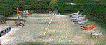
This scenery is complementary to the Cameri_v2 main one. It is builded-up mainly with existing aircrafts and objects.
Hystory infos: The museum is placed inside the Cameri's airport, on the main Command area, in front of the tombstone with all the names of the first 1500 pilots patented at Gambardini School, between 1913 and 1922. It was opened on 20 April 1999. The history of the above tombstone, made by E. Casarotti sculptor and inaugurated on October 15th 1921, came from the '20 when, to remember the first pilots on Cameri's aerodrome patented by the flight Gambardini school they decided to fix their mames on a plate. The troubles of the history pushed out this tombstone, dear and tangible sign of our history, from the airport place to a private terrain, lonely, forgot and to the way of decay. Only on 1999, after the action of Army Forces and thanks to Ing. Mondin from Meritor (ex Gambardini Works), this historical tombstone was moved and restored on the monument inside the airport, on the Historical Museum.
Contents: 11 static aircrafts as FIAT G46, FIAT G91R, FIAT G91Y, FIAT G91T, AERMACCHI MB326, Lockheed T33, Grumman HU16, Republic F84F, Republic RF84F, Lockheed F104 and Agusta Bell 47J; Some other objects as tractor, hoock, people and light.
You can find separate further scenery for Babini Army
| Filename: | LIMN_Cameri_Italy_v2__Museum.zip |
| License: | Freeware |
| Added: | 23rd October 2011, 14:12:41 |
| Downloads: | 1,584 |
| Author: | Aldo Della Vedova, Daniele Lanfranchi |
| Size: | 14.25 MB |


© 2001-2026 AVSIM Online
All Rights Reserved
Privacy Policy |