
Where Flight Simulation Enthusiasts Gather from Around the World!
AVSIM Library - Search Results

| Category: Flight Simulator X - Scenery | |
| San Diego Extras |

|
Images related to this file:
File Description:

Many extras around the San Diego area including carriers, cargo ships, criuse liners, destroyers, power and sail boats, various cranes, shoreline buildings and a strange but unique helipad built on huge rocks on the shoreline to the north on the coast. I thought there were too many open spots around the area so I filled most of them. Designed with a clean install of FSX so if you have addons such as Ultimate terrain, objects may appear where they were not intended to be. designed to enhance your FS world.
I'm keeping track of the number of downloads as to these "clean install" sceneries which will help me decide later in purchasing some addons to make my sceneries viewable to a larger number of users. An email would be appreciated regarding the success of you seeing the scenery properly.
Hope you do see the objects and thanks............enjoy!........savageale
| Filename: | San_Diego_Extras.zip |
| License: | Freeware |
| Added: | 11th July 2010, 09:40:52 |
| Downloads: | 2,501 |
| Author: | Tim Durham |
| Size: | 1 MB |
| Category: Flight Simulator 2004 - Scenery | |
| Comb Ridge, Rock Point (49AZ), Utah/Arizona, Photo-Scenery |
|
Images related to this file:
File Description:

Comb Ridge, Rock Point (49AZ), Utah/Arizona, Photo-Scenery (FS9 & FSX)
This scenery extends my Monument Valley scenery to the east. It covers the area between the San Juan River in the north down to Rock Point, AZ (49AZ). Most of the scenery lies on the Navajo Nation Reservation. It completes the southeastern corner of Utah and paves our way into Colorado.
High resolution versions of this scenery for FS9 and FSX (much sharper, but larger and multiple downloads) are available at www.blueskyscenery.com/CNY_South3West6.html . The screenies are taken from the high-res versions, so expect this version to be slightly more blurry. Thanks to Joop Mak for providing custom AFCADs that correct airport layouts so that they align with the photo-textures! They are available at www.blueskyscenery.com/AFCADs.html . YourDonation@Work: Dedicated to Olivier, Kevin and Ruben.
| Filename: | Comb_Ridge_Rock_Point_49AZ_UtahArizona_PhotoScener.zip |
| License: | Freeware, limited distribution |
| Added: | 9th April 2010, 21:57:41 |
| Downloads: | 1,356 |
| Author: | Gottfried Razek, blueskyscenery.com |
| Size: | 90.99 MB |
| Category: Flight Simulator 2004 - Scenery | |
| CYPX - Puvirnituq - Hudson Bay - Quebec, Canada, Modified V1 |
|
Images related to this file:
File Description:
This modified version installs new taxiway lights and windsocks, and the PAPI that has been recently installed at the airport, plus it modifies the AI. This is a complete version and does not require you to have installed the original. A new terminal building was opened in 2013, but as I unfortunately have not been there to take recent photos I am unable to model it, so this scenery is as it was in 2011. Puvirnituq is a village of 1,300 or so inhabitants at N60 W77 on the east shore of Hudson Bay in Quebec. It's name means "Putrid" in Inuit, and there are two different stories about how it got the name. The runway is a very generous 6,300 feet of gravel 148 feet wide aligned 01-19, which should be enough for almost anything.
| Filename: | CYPX__Puvirnituq__Hudson_Bay__Quebec_Canada_Modifi.zip |
| License: | Freeware, limited distribution |
| Added: | 23rd August 2014, 11:27:59 |
| Downloads: | 235 |
| Author: | Roger Wensley |
| Size: | 11.08 MB |
| Category: Flight Simulator X - AFCAD Files | |
| URKK - Krasnodar International Airport - Krasnodar, Russia |
|
File Description:
Krasnodar International Airport, Russia, also known as Pashkovsky Airport is the main airport serving the southern Russian city of Krasnodar. It is an international airport, and is located 12 km east of the centre of Krasnodar city.
It is the 9th busiest airport in Russia. In 2015, it handled more than 3.1 million passengers.
I have used ADEX, Google Earth and charts to rework this sirport. The airport is currently undergoing re-development as shown on Google Earth views dating from early in 2016. So, although the images on Google Earth show runway 05R - 23L to be closed and the taxiway looking as if it is used as a temporary runway, I have stuck with what the charts show as the working airport. Therefore the two active runways are designated 05L - 23R and 05R - 23L.
| Filename: | URKK__Krasnodar_International_Airport__Krasnodar_R.zip |
| License: | Freeware |
| Added: | 2nd September 2016, 21:13:25 |
| Downloads: | 648 |
| Author: | Mike Major |
| Size: | 7.27 MB |
| Category: Flight Simulator X - Scenery | |
| Lost River ASU Observatories |
|
Images related to this file:
File Description:
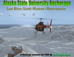
This is a fictitous scenery of the Alaska State University operated North-Western observatories.
It is located near LSR_Lost River and AK45_Lost River_2 on the Western coast of Alaska.
LSR, AK45 and KPC_Port Clarence have been upgraded with hangers and various objects.
LSR, AK45 and the (2) mountain top observatories have been upgraded with helipads along with various ground vehicles including snocats, aircraft, misc buildings and hangers. The main observatory complex has a main rooftop pad and a heli-tower. These helipads were designed for heli practice. some are on the ground and others are a bit more challenging.
There is a map included which shows the locations of the observatory complexes in relation to the airports. There is also a small research facility located to the east which is indicated on the map. This fictional scenery was design with default FSX 3D objects and (1) addon library, fa_ez-arctic_set by Finney Air, Robert Finnegan.
| Filename: | Lost_River_ASU_Observatories.zip |
| License: | Freeware |
| Added: | 11th November 2009, 19:11:39 |
| Downloads: | 557 |
| Author: | Tim Durham |
| Size: | 3.41 MB |
| Category: Flight Simulator 2004 - Scenery | |
| PACD - Cold Bay - Aleutian Islands, Alaska, USA |
|
Images related to this file:
File Description:
Cold Bay is in the eastern third of the Aleutian chain of islands in Alaska, around 175 miles east of Dutch Harbor. The small town has a population of just over 100 and is in existance solely because of the airport with its long runways, one just over 6,000 feet and the other over 10,000 feet and with an ILS. Goods are flown here for local redistribution. The airport was originally built to this size for use in WW2 and there are still quonset huts from this time visible in the area, though the majority of the rough-and-ready housing has now been cleared away. There are scheduled flights by Grant Aviation to neighbouring local airfields and flights to and from Anchorage by Peninsula Air (included in the AI posted with Adak) and Grant Aviation have space attached to their hangar that serves as a terminal. The Coastguard also make use of Cold Bay.
| Filename: | PACD__Cold_Bay___Aleutian_Islands_Alaska_USA.zip |
| License: | Freeware, limited distribution |
| Added: | 21st January 2015, 10:01:50 |
| Downloads: | 424 |
| Author: | Roger Wensley |
| Size: | 4.88 MB |
| Category: Flight Simulator 2004 - Scenery | |
| High Prairie CZHP in Alberta, Canada |
|
Images related to this file:
File Description:
High Prairie is at 1,974 feet asl, 15 miles west of Lesser Slave Lake, 70 miles southeast of Peace River CYPE, and 90 miles east of Grande Prairie CYQU (both already posted). The town has a population of around 2,600 and is based on agriculture, forestry, and oil and gas. The initial impetus behind its growth was the routing of the railroad in 1914. The airport is around 2 miles south of the town, and is fairly basic. There is a single runway just under 4,000 feet of asphalt aligned 07-25. There is a daily flight and around 2010 this was by Central Mountain Air. I believe that there is now a newer terminal building, but a lack of information leaves the older one in place here. There are runway and taxiway lights, unlike some of my recent posts. I made this to fill in the gap between Edmonton and the airports to the northwest such as Grande Prairie.
| Filename: | High_Prairie_CZHP_in_Alberta_Canada.zip |
| License: | Freeware, limited distribution |
| Added: | 9th December 2018, 17:21:09 |
| Downloads: | 120 |
| Author: | Roger Wensley |
| Size: | 3.16 MB |
| Category: Flight Simulator 2004 - Scenery | |
| Hawk Logging, for Holger Sandmann's scenery |
|
Images related to this file:
File Description:
This is a logging camp, on Admiral Island at the northern end of Chatham Strait in southern Alaska, around 30 miles south of Juneau. It is marked on the chart of the area; if you are chartless then there is a section of the chart included here. This scenery is designed specifically for use in the Tongass Fjord scenery (or Glacier, or Misty? I don't remember now which area it is in!) and probably does not work with just Ultimate Terrain; I haven't tried it. The camp has an identifying code so it will show up on a gps as PELC but there is no interaction with atc as there are no designated water runways; PELC on the GPS just acts as a waypoint. There will be further posts for use with Tongass Fjords, Misty Fjords, and Glacier Bay, and I still find these scenery areas by Holger and his crew the most satisfying in FS9.
| Filename: | Hawk_Logging_for_Holger_Sandmanns_scenery.zip |
| License: | Freeware, limited distribution |
| Added: | 8th November 2014, 22:42:24 |
| Downloads: | 317 |
| Author: | Roger Wensley |
| Size: | 12.37 MB |
| Category: Flight Simulator 2004 - Scenery | |
| KSGU-Saint George, Utah |
|
File Description:
The 6600' long St. George airport in southwestern Utah sits high on a mesa! You grasp your armrest hoping that you will become airborne before you fall off the cliff...Or just after landing you are nervously waiting for the pilot to apply the brakes as the end of the runway rushes up to meet you before you fall into nothingness! Such is the fate that awaits the pilot or passenger that ventures to the Saint George, Utah airport.
Actually, it is a very safe and delightful airport to base your flights from. Visit Southern Utah and see the many sights that await the adventurous soul. Take a trip from KSGU to Moab-KCNY or KVEL and marvel at the diversity of the landscape. ( I upgraded those 2 airports also.)
While designed for use with Ultimate Terrain, this enhancement should work with the default FS2004 setting. Please unzip to a temporary folder and follow the simple installation instructions.
| Filename: | KSGUSaint_George_Utah.zip |
| License: | Freeware |
| Added: | 23rd August 2008, 09:49:58 |
| Downloads: | 1,411 |
| Author: | Alan C. Heiner |
| Size: | 664.81 KB |
| Category: Flight Simulator 2002 - Scenery | |
| The Bolzano Challenge |
|
File Description:
Bolzano LIPB scenery for FS2002. Bolzano airport is situated in the Dolomiti Alps of North Italy surrounded by steep rising hills. The dangerous approach for this airport is one of Europe's hardest. In the color IFR charts included you will find what it takes to do the standard landing approach for rwy 01, the standard missed approach and the standard istrument departure. In real, only authorised pilots by Italy CAA are allowed to fly this demanding approach. The approach is an offset LOCDME, with a track that maintains terrain clearance, requiring you to fly a steep descent of 5 degrees where there is no glideslope guidance. When I saw that this amazing airport is FS2002 has only a runway and tower, I decided to create this addon which is a simple enhancing scenery for an airport left out empty by MS. The scenery includes, lighted taxiways, aprons, lighted terminal and hangars, perimeter fence, extra trees and correct approach lighting. ASD Textures included.
| Filename: | The_Bolzano_Challenge.zip |
| License: | Freeware |
| Added: | 28th November 2002, 03:13:52 |
| Downloads: | 4,741 |
| Author: | Kyprianos Biris |
| Size: | 1.71 MB |


© 2001-2026 AVSIM Online
All Rights Reserved
Privacy Policy |