
Where Flight Simulation Enthusiasts Gather from Around the World!
AVSIM Library - Search Results

| Category: Flight Simulator 2004 - Scenery | |
| UNNT Tolmachevo 2012 - Novosibirsk |

|
Images related to this file:
File Description:
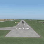
Tolmachevo airport is the largest airport complex in Siberia and the Far East of a Class A-1 with of a cargo capacity of more than 50,000 tonnes per year, 750 passengers per hour on international flights and 1,800 per hour on domestic routes.
The airport has two runways, the second one was put into operation in autumn 2010. It doesn't have any restrictions on take-off weight, and is certified for ICAO CAT II. Tolmachevo airport is included in a list of international hubs of Russia. In 2011 the airport handled 2,765,884 passengers (22.3% more than in 2010).
| Filename: | UNNT_Tolmachevo_2012__Novosibirsk.zip |
| License: | Freeware |
| Added: | 4th June 2012, 17:36:11 |
| Downloads: | 2,207 |
| Author: | Tolmachevo TEAM |
| Size: | 80.88 MB |
| Category: Flight Simulator X - Scenery | |
| KJYO - Leesburg Executive Airport - Virginia, USA |
|
Images related to this file:
File Description:

East Coast Simulations presents scenery for Leesburg Executive Airport (KJYO/JYO) for FSX/P3D! Leesburg Executive Airport at Godfrey Field (IATA: JYO, ICAO: KJYO, FAA LID: JYO) is a town-owned public-use airport located three nautical miles south of the central business district of Leesburg, a town in Loudoun County, Virginia, United States. It is a busy general aviation airport in the Washington, D.C. area, and a reliever for nearby Washington Dulles International Airport. This scenery includes all custom buildings and terminals with a season changing photoreal background. There are many custom ground polygons, and even 3-D PAPI lights are modeled.
| Filename: | KJYO__Leesburg_Executive_Airport__Virginia_USA.zip |
| License: | Freeware |
| Added: | 19th August 2015, 20:58:47 |
| Downloads: | 1,015 |
| Author: | Wesley Chin |
| Size: | 74.66 MB |
| Category: Prepar3D V1-4 - Aircraft Repaints, Textures and Modifications | |
| North American P-51D 359th FG (IV-M) 'Stinky' |
|
Images related to this file:
File Description:

This folder contains a repaint for the A2A WoP3 P-51D Mustang (with AccuSim), in the colors of P-51D-10-NA 44-14117 IV-M "Stinky", which was the assigned aircraft of Lt Joseph W. "Shoot anything that moves" Mejaski, of the 369th FS, 359th FG, based in East Wretham, UK. He completed 75 missions and 300 combat hours, and on 11 september 1944 destroyed two JU-88's and damaged 3 others on the ground south of Merseburg. Stinky was severely damaged in a crash landing on 7 march 1945. Repaint by Jan Kees Blom, based on the A2A paintkit.
| Filename: | North_American_P51D_359th_FG_IVM_Stinky.zip |
| License: | Freeware |
| Added: | 10th November 2018, 16:45:07 |
| Downloads: | 63 |
| Author: | Jan Kees Blom |
| Size: | 12.86 MB |
| Category: Flight Simulator 2004 - Scenery | |
| Studio F Simulations Phoenix Sky Harbor Update for Mach1 Designs PHX 2019 |
|
Images related to this file:
File Description:

This project was developed to enhance and personalize the existing freeware scenery for Phoenix Sky-Harbor International (FS9) by M1DG. You must already have a properly installed version of the scenery for these modifications to work.
Enhancements include a brand new, built from scratch, representation of Terminal 3, the newest terminal at the airport. It comes completely integrated into the existing legacy scenery for KPHX which was created before Terminal 3 existed in real life, the skytrain and track that rises above the airport to the east, and an all new afcad layout that reflects recent ground changes at the airport.
| Filename: | Studio_F_Simulations_Phoenix_Sky_Harbor_Update_for.zip |
| License: | Freeware |
| Added: | 30th May 2020, 18:10:08 |
| Downloads: | 479 |
| Author: | Studio F Simulations |
| Size: | 40.94 MB |
| Category: Flight Simulator X - Scenery | |
| Mach Loop Markers: Fast Jets |
|
Images related to this file:
File Description:
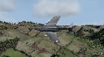
A series of markers around the famous "Mach Loop" in Wales to help sim flyers find and fly the
route.
The Mach Loop is a series of valleys in the United Kingdom in west-central Wales, notable for
their use as low-level training areas for fast aircraft. The system of valleys lies 13 km (8
mi) east of Barmouth between the towns of Dolgellau to the north and Machynlleth to the south,
from the latter of which it takes its name.
It is usually flown in an anti-clockwise direction.
Works in FSX and P3D.
| Filename: | Mach_Loop_Markers_Fast_Jets.zip |
| License: | Freeware |
| Added: | 10th October 2022, 14:02:20 |
| Downloads: | 86 |
| Author: | Peter J Forster |
| Size: | 2.31 MB |
| Category: Flight Simulator 2004 - Scenery | |
| Lapangan Terbang Sandakan, Sabah (WBKS) |
|
File Description:
Sandakan is a town in Sabah, eastern Malaysia, on the island of Borneo.
It is located on the east coast of Sabah and was the former capital of British North Borneo. Sandakan is famous as the gateway for ecotourism destinations such as the Sepilok Orang Utan Sanctuary,Turtle Islands Park, Kinabatangan River and Gomantong Cave. It is also infamous for being the site from where the Sandakan Death March commenced in 1945. For people living and working in the immediate area of Sandakan, the airport provides a fast access to the rest of the country. The airport is also a major tourism gateway
| Filename: | Lapangan_Terbang_Sandakan_Sabah_WBKS.zip |
| License: | Freeware |
| Added: | 25th August 2005, 13:19:24 |
| Downloads: | 3,407 |
| Author: | Mohammad Ibrahim Rahmat |
| Size: | 2.84 MB |
| Category: Flight Simulator 2002 - AFCAD Files | |
| Big Bear Lake, CA USA (L35) |
|
File Description:
This AFCAD file & VP update increases the number of parking/gate spaces from 6 to 18. This file also adds tower, ATIS, clearance, approach/departure, and ground control frequencies. Big Bear Lake City is a small sized municipal airport it is perfect for general aviation aircraft and learjets. . Located in the mountains just east of Los Angeles California, at an altitude of 6748 ft. Big Bear Lake is a ski resort in the winter and a mountain biking resort in the summer. Also included with this .zip file are two EditVoicepack (VP) updates for Big Bear City - L35.
| Filename: | Big_Bear_Lake_CA_USA_L35.zip |
| License: | Freeware, limited distribution |
| Added: | 17th December 2002, 13:23:51 |
| Downloads: | 1,014 |
| Author: | Joshiese |
| Size: | 25.81 KB |
| Category: Prepar3D V1-4 - Aircraft Repaints, Textures and Modifications | |
| KLM 1998 AI Package |
|
File Description:
By 1998, the KLM/Northwest alliance was in full swing, and KLM was serving MSP, DTW, and even MEM daily with it's own metal while Northwest took over from KLM from BOS, IAD, and some other cities. KLM had a vast route network spanning the globe, serving much of Africa and the Middle East with many "tag on" routes onward from Amsterdam. By 1998, KLM was flying the MD-11, 747-200SUD(stretched upper deck), 747-200SUD Combi, 747-300 Combi, 747-400, 747-400 Combi, 767-300ER, 737-300, 737-400, and 6 mainline Fokker 100s which were short lived before going to KLM UK in late 1998 then on to CityHopper. Unfortunately, in the OAG, KLM only specified if a 747 was a combi or not(as in 747=744/742 while 74M can be a combi version of the 742,743, or 744) and did not differentiate between 737-300s and 737-400s. I did my best using what data I had to make the routes realistic, but the aircraft numbers at least are correct except for some extra 767s and 737s that you may remove if you wish. I also had issues making sure the TPE flights were all operated by "KLM Asia" 747s, so I ended up assigning 1 extra 747(I have 5, in real life there were 4) the Asia livery to ensure that you do not see a standard KLM 747 at TPE as they did not visit in real life. You may switch this to a normal 747 if you choose. Repaints by Raphael Rodrigues for the AIA Fokker 100 and FAIB 737-300, 737-400, 767-300, 747-200SUD, 747-300, and 747-400 along with flightplans by Chasen Richardson are included. Note that the 747-200SUD uses the 747-300 model. As a Bonus, the KLM Cargo 747-200SUD is also included.Part of the 1998 Flight Simulator Project. Follow us on Facebook at facebook.com/flightsim98 and on instagram as @bayviationsim. For more Retro AI, check out the forums at: http://retroai.proboards.com/
| Filename: | KLM_1998_AI_Package.zip |
| License: | Freeware, limited distribution |
| Added: | 6th December 2019, 17:14:32 |
| Downloads: | 306 |
| Author: | Raphael Rodrigues, Chasen Richardson/Bayviation |
| Size: | 27.94 MB |
| Category: Flight Simulator X - Scenery | |
| Lake Pikauba - Quebec bush scenery |
|
File Description:
This scenery is fictitious and created for the pleasure of all. All the objects are already included in FSX and no other library was used. This scenery wants itself to be a fishing and resting resort. A dream place for the Aerovirtuel bush flying pilots. Lake Pikauba is about 10 km East of the intersection of roads 169 et 175 in the Réserve Faunique des Laurentides area.Must have before installing the Aerovirtuel bush flying sceneries:
1-Quebec Elevation 38m (LOD10) Gilles Gauthier sur http://avsim.com/ 5 files.
2-Quebec Scenery - Lakes and Rivers (1/5) http://avsim.com/ 5 files and one fix
3-Quebec Scenery - Addition of Roads http://avsim.com/
| Filename: | Lake_Pikauba__Quebec_bush_scenery.zip |
| License: | Freeware, limited distribution |
| Added: | 10th November 2007, 22:17:58 |
| Downloads: | 830 |
| Author: | Denis Dupuis |
| Size: | 308.74 KB |
| Category: Flight Simulator 2004 - Scenery | |
| SBGR - Sao Paulo Guarulhos - GRU v3.0 |
|
Images related to this file:
File Description:

This is a coplete rebuild of Guarulhos Int'l Airport. The passenger
terminals have been replaced with custom buildings, and many ramp vehicles sprinkled throughout. The AFCAD file
was built from the default version with AFX. This scenery was built using Flight1's Instant Scenery program.
Update:
This version contains contains much more realistic representations of the main terminals, remote stands, and jetway
layout. Also added are the parked storage aircraft toward the East end of the field and the ones stored on the still
unfinished taxiway A. The parking has been updated as well as some taxiways and sinage. Several other minor corrections
and perfections exist throughout.
| Filename: | SBGR__Sao_Paulo_Guarulhos__GRU_v30.zip |
| License: | Freeware |
| Added: | 20th March 2013, 06:27:25 |
| Downloads: | 20,062 |
| Author: | William Morgan / FRFStudio.net |
| Size: | 12.41 MB |


© 2001-2026 AVSIM Online
All Rights Reserved
Privacy Policy |