
Where Flight Simulation Enthusiasts Gather from Around the World!
AVSIM Library - Search Results

| Category: Flight Simulator X - Scenery | |
| KEMV - Emporia-Greenville Regional Airport - Virginia - USA |

|
Images related to this file:
File Description:
The airport is located 3 miles east of Emporia.
The runway was changed from 15/33 to 16/34. AirNav continues to list the runway as 15/33.
Changes were made based on Google Maps. Created with Airport Design Editor by ScruffyDuck Software using current FAA documentation and Google Earth measurements, this package offers a replacement for FSX's stock airport. All these enhancements are as close to the real airport as I can get with stock library objects.
| Filename: | KEMV__EmporiaGreenville_Regional_Airport__Virginia.zip |
| License: | Freeware |
| Added: | 11th September 2014, 00:41:51 |
| Downloads: | 301 |
| Author: | Wayne Roberts |
| Size: | 34.19 KB |
| Category: Flight Simulator 2004 - Scenery | |
| The Bermudas Islands |
|
Images related to this file:
File Description:
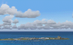
The Bermudas islands are located in the middle Atlantic. Their main island is in the 32 15 71 N and 64 52 50 W.Is a very broken into fragments island that it is part of s cluster of 150 islands distributed in an area of 53 square kms
This archipielago like superior vertex together with Puerto Rico island and the city of Lauderade-Hollywood in Florida U.S.A. tey form the celebrates TRIANGLE OF BERMUDAS that in the time 50 ships and 20 airplanes have disappeared. Most of these disappareances they can be explained, other nr.
Nevertheless to the one West of the island and a near a carrier to 2000-3000
feet high approximately I have discovery some ships floating in the space.
Not you if they are part of the disappareances....But they are there.
Discover it your same one....
| Filename: | The_Bermudas_Islands.zip |
| License: | Freeware |
| Added: | 8th November 2010, 04:31:29 |
| Downloads: | 1,810 |
| Author: | Toni Agramont |
| Size: | 14 MB |
| Category: Flight Simulator 2004 - Aircraft Repaints, Textures and Modifications | |
| Royal Hellenic Air Force Supermarine Spitfire Collection |
|
File Description:
This package includes all the Hellenic Spitfires expect the Spitfire pr Mk.XI witch appeared in one unit and pr Mk.XIII in three units. You can fly the spitfire mk.Vb/c, Spitfire mk.IXe LF/HF and Spitfire Mk.XVIe LF. Greece in 9/23/1938 ordered 12 Spitfires and 12 Anson. During the June of 1939 it was signed the order of 24 Spitfires which cost 9335 pounds each. When Hitler attacked to Poland, England used all the aircrafts that were under construction and of course the Greek were some of them. On 10/12/1943, the 336th Olympus Squadron received the first Spitfire and followed the 335th Tiger Squadron. The Spitfire mk.Vb/c replaced the Hurricane mk.IIb/c. When the two greek Squadrons were at North Africa, their Spitfires wore the
| Filename: | Royal_Hellenic_Air_Force_Supermarine_Spitfire_Coll.zip |
| License: | Freeware, limited distribution |
| Added: | 2nd December 2005, 19:59:29 |
| Downloads: | 3,887 |
| Author: | Delizisis Thanasis, Delizisis Panagiotis, Ken Harrison (Merlin66) |
| Size: | 19.6 MB |
| Category: Flight Simulator X - Scenery | |
| LGSM Samos International Airport, Greece |
|
Images related to this file:
File Description:
LGSM Samos International Airport, Greece.
The island of Samos lies in the Eastern Aegean and is a very popular tourist destination for flights from Berlin, Munich, Gatwick, Oslo, Copenhagen, Rome and many others. It is widely regarded as the most dangerous airport in Greece, mountainous terrain requires a sharp right hand turn onto runway 09 and landings are invariably subject to strong turbulence.
The airport has been designed to sit on the excellent photoreal scenery by Dimitris Ntaskas, which is available here on Avsim and called 'samos_305814.zip'. It also uses many objects from my lgkf_kefallinia.zip scenery also available here at Avsim. The scenery has been designed for and tested with DX9 and FSXA only, if used with the default terrain many objects will be misplaced.
The scenery features a very detailed airport, repositioned according to satellite imagery and is based on real photographs. Full night lighting is included with washed lighting of the apron and carparks. The nearby town of Pythagorio has been modelled and includes some local landmarks. I have included many autogen style buildings based on photographs of Samos and also autogen trees native to the region.
The airport includes many animations, including olive trees, flags, people, windsocks, birds, road traffic and waves. Local Air traffic between the neighbouring islands of Chios, Mykonos, Kos and Rhodes is included, as is a panoramic view from inside the new tower. All the files have been sub-divided and can be switched on or off according to user preference.
Full installation instructions, settings, hints and tips can be found in the readme file. Please enjoy and I hope you like my scenery as much as I enjoyed building it.
| Filename: | LGSM_Samos_International_Airport_Greece.zip |
| License: | Freeware, limited distribution |
| Added: | 27th February 2013, 02:45:01 |
| Downloads: | 23,207 |
| Author: | George Keogh |
| Size: | 47.62 MB |
| Category: Flight Simulator 2004 - Scenery | |
| Chatrapatti Shivaji international Airport, Mumbai/ VABB |
|
Images related to this file:
File Description:
Mumbai is having frequent commissioning and decommissioning of various features especially aprons and stands and twy changing nomenclature. However the inf. and resources used while developing the scenery are as on Tue, 22 Jun 2010 13:14:00 UTC. Middle marker for rwy 27 has been permanently withdrawn so the missed approach point of the GP inop. procedure had been amended as 1D ILS/DME in place of middle marker(mm). Navaid BMB freq 396khz withdrawn from service.
New contents include - Commissioning of TWY L4 De-commissioning of portion of Taxi lane L beyond parking stand A1 Aircraft from parking stand A1 to A3 to push back facing west on the taxi lane L, to taxi out via TWY L4 on to TWY N.* Portion of taxi lane L beyond parking stand A1 shall be decommissioned w.e.f. 0430 UTC on 1st July 2010.1. Renaming portion of TWY P from RWY 14 to its junction with TWY E as E4 & TWY Y
as TWY S7
2. Commissioning of TWYs E7, E8, E9 & E10
3. Commissioning of one additional code C Parking Stand on Apron A named A1
4. Decommissioning of Parking Stands T4 & T5
5. Commissioning of Parking Stand G7and Decommissioning of Parking Stand G10 & G14
6. Renaming of Apron K(as apron J ) alongwith it's Parking Stands & Commissioning of
one additional code E Parking stand(J4).
7. Renaming of Apron M ( as apron K).layout chart included.
Scenery features includes - 3 different models of twy edge lights, holding point 3d lights at major intersection.check out pics. if you want extremely frame rate rate friendly update, look for file in library named as - Default mumbai.
| Filename: | Chatrapatti_Shivaji_international_Airport_Mumbai_V.zip |
| License: | Freeware |
| Added: | 22nd June 2010, 22:19:54 |
| Downloads: | 7,270 |
| Author: | Ashish Singh |
| Size: | 63.93 MB |
| Category: Flight Simulator 2004 - Scenery | |
| Airstrips of the Falkland Islands |
|
Images related to this file:
File Description:
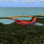
Inspired by Jim Keir's Falkland Islands mesh, coastlines and landclass, herewith a couple of dozen little strips from around the area, to give the opportunity to generate a bit of GA AI (and possibly a few scheduled flights) in an otherwise relatively ignored area in the South Atlantic. Please do note, other than Stanley, most of these airstrips are just that, a cleared strip of land in an otherwise empty landscape, (just as they are in real life), simply to provide a variety of destinations for the occasional aircraft to or from Stanley.
Most of the airfield locations are listed on WikiPedia and the layout confirmed using on-line satellite imagery. Other than the two main airports, none of these airstrips seem to have "official" ICAO codes, so I've generated a selection of alpha-numeric codes in the SF0* configuration, (as Stanley Airport has the ICAO code of SFAL), so the FS9 AI engine has some codes to work with and the airfields can be found on the map. Hopefully these pseudo-codes won't clash with anything else.
As with my other sceneries, the files for each airstrip can be easily identified by the ICAO code, even if the airfield names vary slightly, so you can pick and choose and mix and match to suit any sceneries you already have, should you so wish. There is no requirement for any other download. Each airstrip will exist as a stand-alone entity should you only want a few of them.
Having said that, Paul Denton's AFCAD and scenery for EGYP Mount Pleasant (available on AVSIM and possibly elsewhere) might be considered a worthwhile addition, especially if you want to see the twice-weekly scheduled RAF flights from Brize Norton (via Ascension Island), and the Saturday LATAM flight from Chile. Suitable AFCADs for EGVN Brize Norton and SCCI Punta Arenas may also be required. Appropriate traffic files and aircraft/texture suggestions are provided.
Please read the remainder of this "blurb" in the included text file, there may be a couple of details of interest.
| Filename: | Airstrips_of_the_Falkland_Islands.zip |
| License: | Freeware |
| Added: | 30th March 2025, 18:55:33 |
| Downloads: | 93 |
| Author: | Chris Eve |
| Size: | 295.87 KB |
| Category: Orbiter - Miscellaneous Files | |
| Alpha Centuri Solar System 1.0 Correction Patch |
|
File Description:
A patch for the Alpha_Centuri.cfg file to correct an error in the config file dealing with some of the moons of Alpha 6.
Basically a small repair of the Alpha_Centuri.cfg file. In debugging the final version, I tested diffrent scenereos. During construction of the Alpha_Centuri.cfg, I created a test config file not meant for release. That file was inadvertantly added to the final release. The system will still work, but visiting some moons at Alpha6 will plant you right in the middle of the star.
Requirements for the patch:
The Orbiter simulator program
The Alpha_Centuri Solar System 1.0 addon
| Filename: | Alpha_Centuri_Solar_System_10_Correction_Patch.zip |
| License: | Freeware |
| Added: | 4th January 2003, 22:38:23 |
| Downloads: | 4,154 |
| Author: | Jim Williams |
| Size: | 1.58 KB |
| Category: Flight Simulator X - Scenery | |
| EGPR - Barra - UK Airfields - Volume 27 v2 |
|
Images related to this file:
File Description:
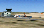
My volume 27 is a version 2 of my Barra-EGPR, which is on the foreshore of Traigh Mhor Bay, Island of Barra, Outer Hebrides, Scotland. For this update of my 2008 Barra I have replaced the original Generic buildings with custom made ones.The FSX Stock Barra is wrongly placed in the middle of the north end of the island. Landings are actually done on the sand in Traigh Mhor Bay at low tide.
I also enclose a small mod to my Vol.26 Lashenden in case anyone is still having problems removing the black unpainted static aircraft.
| Filename: | EGPR__Barra__UK_Airfields__Volume_27_v2.zip |
| License: | Freeware |
| Added: | 14th March 2013, 14:17:48 |
| Downloads: | 2,672 |
| Author: | Alf Denham |
| Size: | 2.84 MB |
| Category: Flight Simulator 2004 - Scenery | |
| Lapangan Terbang Sandakan, Sabah (WBKS) |
|
File Description:
Sandakan is a town in Sabah, eastern Malaysia, on the island of Borneo.
It is located on the east coast of Sabah and was the former capital of British North Borneo. Sandakan is famous as the gateway for ecotourism destinations such as the Sepilok Orang Utan Sanctuary,Turtle Islands Park, Kinabatangan River and Gomantong Cave. It is also infamous for being the site from where the Sandakan Death March commenced in 1945. For people living and working in the immediate area of Sandakan, the airport provides a fast access to the rest of the country. The airport is also a major tourism gateway
| Filename: | Lapangan_Terbang_Sandakan_Sabah_WBKS.zip |
| License: | Freeware |
| Added: | 25th August 2005, 13:19:24 |
| Downloads: | 3,407 |
| Author: | Mohammad Ibrahim Rahmat |
| Size: | 2.84 MB |
| Category: Flight Simulator 2004 - Scenery | |
| Manapouri-Te Anau Airport 2008, New Zealand. NZMO. |
|
File Description:
Welcome to the new Manapouri-Te Anau Airport, which underwent a 7 million dollar upgrade in late 2007. The airport is situated 3 nautical miles North-East of the town of Manapouri, and is nestled beside the Southland region's beautiful Lake Manapouri, in the lower South-Western part of the South Island of New Zealand.
The scenery reflects the upgrades done to the airport, and includes custom terminal buildings and signs (textures included). The scenery also contains an official GNZLAP AI Traffic file update by Charl Du Toit. Requires some EZ Scenery Object Sets (see INSTALL instructions for details).
| Filename: | ManapouriTe_Anau_Airport_2008_New_Zealand__NZMO.zip |
| License: | Freeware, limited distribution |
| Added: | 21st November 2008, 13:36:48 |
| Downloads: | 1,122 |
| Author: | Lawrie Roache / Godfrey Tier |
| Size: | 2 MB |


© 2001-2026 AVSIM Online
All Rights Reserved
Privacy Policy |