
Where Flight Simulation Enthusiasts Gather from Around the World!
AVSIM Library - Search Results

| Category: Flight Simulator X - Scenery | |
| Ridge Soaring 79N Julian PA |

|
Images related to this file:
File Description:
Ridge Soaring Gliderport (79N) is a public-use glider airport located two nautical miles (4 km) southwest of the central business district of Unionville, in Centre County, Pennsylvania, United States. It is privately owned by Knauff & Grove, Inc. Tom Knauff and Doris grove are among the whos who in American and International soaring community.
Portions of the 1999 movie The Thomas Crown Affair were filmed here.
Co-owner Thomas L. Knauff set five FAI world records, and over 50 NAA national records flying from this airport.
Co-owner Doris Grove set three FAI feminine world records flying from this airport, and was the first woman to fly a glider more than 1000 km.
This FBO airport is world famous for ridge, thermal and wave soaring. It is located on U.S. Route 220 (alternate) 8 miles south of Interstate 80, between Unionville and Julian, at the base of the Bald Eagle Mountain ridge. It is approximately 10 miles from State College and approximately midway between Altoona and Lock Haven in the Bald Eagle Valley. Visitors can look at an entire wall of U.S. National and World records that have been set from this airfield.
Sadly as with so many small airports, Ridge Soaring is in risk of disappearing. for sale for many years, with no takers it may be sold to developers and disappear forever.
In FSX the airport was on the wrong side of the highway and cut into a mountain, I moved it to its proper location and heading, made the runway the correct size and heading, and added all the current buildings.
| Filename: | Ridge_Soaring_79N_Julian_PA.zip |
| License: | Freeware |
| Added: | 11th June 2014, 16:24:59 |
| Downloads: | 292 |
| Author: | Jon Davidson |
| Size: | 16.52 MB |
| Category: Flight Simulator X - Aircraft Repaints, Textures and Modifications | |
| FSX/P3D TWA 707-331Adv 1969 |
|
Images related to this file:
File Description:
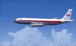
This is a repaint of the 707-300 in TWA 'Star Stream' colors. The payware 707-300 by Captain Sim is needed for this repaint. TWA was one of the two great U.S. intercontinental carriers of the jetliner golden era, the other being PanAm. They plied the world with their shiny 707s, DC-8s, and 747s, well before many other US carriers did so. TWA was also interesting, as it was run by the enigmatic Howard Hughes. On January 25,1959 TWA launched its first jet service on between New York and San Fransisco. The route was chosen by Howard Hughes himself, to compete with American Airlines new jet service between New York and Los Angeles. The plane, a 707-131, sported the new 'Star Stream' double globe livery, one of the most iconic liveries in civil aviation history. TWA carried this livery for almost 20 years, when it was phased out in the late 1970s. This repaint is of a TWA 707-331 Advanced, reg: N18701. It was one of the 127 which went into TWA service in the long history of the airline. It was delivered new in January 1966. Sadly, it was damaged beyond repair in Milan Italy on 22 December 1975, when it landed outside the runway, struck a transmissometer and a CAT II television camera. The landing gear and all 4 engines separated in the subsequent slide. The aircraft came to a rest, with the nose broken off behind the forward cabin door. There were no fatalities. Textures are 32bit DDS. This repaint was tested FSX-SE. It should work on FSX & P3D v1-3.
| Filename: | FSXP3D_TWA_707331Adv_1969.zip |
| License: | Freeware |
| Added: | 27th November 2019, 18:56:40 |
| Downloads: | 173 |
| Author: | Ted Giana |
| Size: | 20.29 MB |
| Category: Flight Simulator 2004 - Scenery Design | |
| FSDEM 1.1 |
|
File Description:
FSDEM is a graphical tool designed to help on the editing and correction of NASA SRTM (Shuttle Radar Topography Mission) terrain elevation meshes, and to create terrain mesh scenery to be used in Microsoft Flight Simulator 2002/2004.
Program main features:
This version fixes some bugs and adds minor improvements. See the included file history.htm for details.
| Filename: | FSDEM_11.zip |
| License: | Freeware, limited distribution |
| Added: | 4th August 2004, 20:51:02 |
| Downloads: | 5,125 |
| Author: | Emerson de Oliveira |
| Size: | 377.03 KB |
| Category: Flight Simulator X - AFCAD Files | |
| LIPZ - Venice Tessera Intl. Airport "Marco Polo" |
|
File Description:
Afcad file of LIPZ (Venice Tessera "Marco Polo") airport for FSX default scenery. In order to make the scenery as close as possible to the real airport the layout is based on the newest Jeppesen parking chart of LIPZ, on the Aeronautical Information Publication Italy and on photos of the real airport.
Main things that have been changed:
- RWY 4L/22R has been converted into main taxiway (as it is in the real LIPZ);
- runway strips and stopways have been added;
- Precision Approach Path Indicators with 3° slope have been added on both sides of RWY 4R/22L;
- according to ICAO documents, since RWY 4R/22L is a precision runway of the 3rd category the holding positions have been moved at 90 m and taxiways and apron links have been reduced to 23, 18 and 15 m;
- the approach lighting system has been modified to look as close as possible like the real one;
- parking codes have been added to match the latest airport timetable.
Note: In real life nearly 100% of the departures from RWY 4R (which is the runway in use during day almost all days of the year - RWY 22L is in use during night when the wind's direction changes) use SIDs based on the CHI VOR which means that even the airlines which fly to north once airborn won't turn left but right and make half circle in order to head north. I tried to make the aircraft fly like the real ones assigning right hand pattern to RWY 4R but seems that it doesn't work - aircraft that fly to north, after takeoff will turn left instead of turning right and making half circle.
| Filename: | LIPZ__Venice_Tessera_Intl_Airport_Marco_Polo.zip |
| License: | Freeware |
| Added: | 19th January 2007, 01:32:01 |
| Downloads: | 4,078 |
| Author: | Claudio A. Dobre / Skycolors Team |
| Size: | 303.91 KB |
| Category: Flight Simulator 2004 - Original Aircraft | |
| Piaggio P-166CL2 |
|
File Description:
Thanks to Andrew Spring of www.p166.com!!
The fifth of the coming P-166 aircraft series. I'm going to build the whole family of these graceful twins.
This file covers the whole production line of the P-166CL2!!! (Well, just 2...(-:)
The Piaggio P-166A is a light small twin. An Exotic two-engined prop that sold all over the world including America, UK, and Australia. he P-166CL2 was developed to take advantage of the cabin spaciousness of the P-166 series: a new landing gear that retracts under the fuselage into two small blisters lets expand the internal useful area more bakwards between the wings, as there is no central section. This lets the P-166CL2 accomodate 12 poassengers + pilot. The old gear bays at the side of te fuselage were replaced with two large windows that give a strange top-down view for the passenger. Tiptanks are optionally unattachable, as using them plus 12 passengers makes the plane go overweight. Means that the 12 passengers can only be transported on a considerabily short range. Only 2 P-166CL2s were built, due to the low-range caused by the small old-type tiptanks and the unstability of the new landing gear, that gave serious problems while taxiing. The P-166C is dated October '64, and converted to CL2 in 1972. The aircraft is still in production in a slightly modified turboprop version, the P-166D-P1. This model is 760 Kbs with c.a. 23000 polygons in c.a.170 assemblies. Features Clickable Dynamic VC with non-planar throttle quadrant. Detailed internals. Fully compatible with FS 2002 (pro edition)
| Filename: | Piaggio_P166CL2.zip |
| License: | Freeware |
| Added: | 4th April 2004, 18:02:21 |
| Downloads: | 5,617 |
| Author: | Mario Noriega |
| Size: | 7.23 MB |
| Category: Flight Simulator 2004 - Scenery | |
| Beaver Creek CYXQ in Yukon Territory, Canada |
|
Images related to this file:
File Description:
Beaver Creek is located at mile 1202 of the Alaska Highway, just east of the Alaska/Yukon border. The populaton is around 100 and the main employment is with the Border Agency, the White River First Nation, or with local tourist lodges. The airfield is a mile north of the town and close to the Canadian border post, which is included in the scenery. It was built by Jack Stalberg in the 1960's, and I have no further information beyond the fact that he loved to fly. The airport serves as an "airport of entry", though it is restricted in hours of opening and in the size of aircraft that it can handle; up to a maximum of only 15 seats. The single runway is 3,745 feet long and 100 feet wide, gravel, aligned 13-31 in FS9, lit, and with vasi at both ends. Righthand circuits for runway 13. There is a 340 feet threshold displacement to runway 31, which is of course unmarked on a gravel runway. The terminal building was recently reclad; I don't like it, but they didn't consult me. The ai reflects the sort of traffic the airfield gets; ie brief paperwork stopovers for GA or small charter flights into Canada from Alaska, usually in the mornings.I have adjusted the local scenery terrain levels to remove adjacent hills that I believe do not exist in real life but are part of the Northern Canada terrain mesh that I have installed. If you do not have this mesh you may find that the scenery works fine for you without the API flatten that is included here. The airfield is at 2,129 feet ASL.
| Filename: | Beaver_Creek_CYXQ_in_Yukon_Territory_Canada.zip |
| License: | Freeware, limited distribution |
| Added: | 28th January 2019, 06:19:20 |
| Downloads: | 174 |
| Author: | Roger Wensley |
| Size: | 4.68 MB |
| Category: Flight Simulator 2004 - Scenery | |
| Sproat Lake CAA9 on Vancouver Island in British Columbia, Canada |
|
Images related to this file:
File Description:
Sproat Lake is in the middle of southern Vancouver Island, 6 miles west of the town of Port Alberni and 30 miles directly south of Comox Valley Airport. It is some 14 miles long and around the eastern shores has a large number of houses with docks and boats. Plus, in the offshoot called Upper Sproat Lake, it has the Sproat Lake Tankerbase CAA9, home to two rather large Martin Mars firefighting planes. Their history is interesting, and their capacity for carrying water for dousing forest fires during the summer months has kept them in use since their construction in the 1940's. They have finally been retired from fighting fires in 2013, having been first retired from military service in 1958. This scenery is made for use with Ultimate Terrain; there was another version made several years ago which either predated or ignored UT. This scenery is for the month when a Mars was being repainted before retiring to a museum as a military plane, date unkown but perhaps 2013? If it is a time when there were three in existance then it is sometime in the 1960's; take your pick. Because of hills adjacent to the lake the landing of the AI Mars may or may not take place, depending on wind direction and whether or not it flies into rock before landing. Take off and departure seem to be more reliable than landing on a daily basis. The Mars flies to Vancouver Harbour, but only in theory; it does not land and park as there is no parking available for such a large aircraft. The AI follows in the second post.
| Filename: | Sproat_Lake_CAA9_on_Vancouver_Island_in_British_Co.zip |
| License: | Freeware, limited distribution |
| Added: | 11th December 2016, 06:44:50 |
| Downloads: | 261 |
| Author: | Roger Wensley |
| Size: | 14.88 MB |
| Category: Flight Simulator 2004 - Gauges | |
| Integrated Simavionics: Dreamfleet 727 GNS Edition 1.0 |
|
File Description:
Here's probably the best addition to your favorite Trijet! The Dreamfleet 727 sure is one of the best simulated classic airliners out there for Flight Simulator, but being a classic, it also brings some problems when flown in a modern air traffic environment. Radio navigation alone just won't do it anymore, especially if you fly online with real controlers. A "go direct XXX" instruction can easily turn into a nightmare - nowadays technology offers some things to ease the workload and increase safety, and it's time to use these means wherever possible.
Boeing 727 jets are still being flown in almost all parts of the world, mostly as freighters, and almost all of them have been updated with modern avionics, ranging from small GPS devices up to full blown glass cockpits with flight management computers.
Thanks to Ernie Alston and his "Integrated Simavionics", you will now be able to equip your fleet of Dreamfleet 727 aircraft with a GNS, allowing not only detailed flight planning but also access to many informations that will very useful during your flights. In case you haven't already done so, now would be a good time to pick up the manuals that came with the "Integrated Simavionics Package" to learn about the many new possibilities you will gain by adding the GNS to your cockpit. The gauges will be added both to the 2D and 3D cockpits!
Another benefit you get with this package: the Virtual Cockpit textures will now appear in a much higher resolution, providing crisp and clear instruments and a much better look! Note that this is only enabled with the GNS-equipped cockpits.
| Filename: | Integrated_Simavionics_Dreamfleet_727_GNS_Edition_.zip |
| License: | Freeware |
| Added: | 6th December 2007, 16:08:58 |
| Downloads: | 3,618 |
| Author: | Nick "MeatWater" Schreger |
| Size: | 793.25 KB |
| Category: Flight Simulator 2004 - AI Aircraft | |
| McDonnell Douglas F-4J(UK) Phantom F.3 (AI Phantoms Phorever Part 5) |
|
Images related to this file:
File Description:
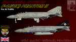
McDonnell Douglas F-4J(UK) Phantom F.3 (AI Phantoms Phorever Part 5). This is one of the most iconic military aircraft of all time, ushering in the modern age of air combat; from Asia to the Middle East; and many of the 5,195 manufactured airframes are still in active use today, after over five decades of excellent service. This model set utilized FSDS source files for Nick Black's original F-4E Phantom II 8-LOD AI model, and has been heavily modified for this project. Numerous changes are listed in the extensive documentation with this file. This file contains one F-4J(UK) base model, but is split into two time periods, representing use of both Sparrow and Sky Flash missiles. There are two full squadron paints for 74 Squadron, including eight loadouts and 15 serials per squadron; representing these aircraft in service from 1984-1990. I am not including the usual paint kit because these aircraft were only used by one RAF squadron, and I have included all serials. This project is the next part of what will hopefully be a comprehensive and fairly complete (AI traffic) history of this aircraft. I learned a lot from previous releases, and these models are vastly improved from the original releases I have done recently (v2 models for those will be forthcoming). I did not do this alone by any means, and all contributors that I can think of are listed in the documentation. This is the complete aircraft, with all main FS textures and effects included. Original FSDS source and paint kit by Nick Black; FDE by Mike MacIntyre, all model/paint kit modifications and repaints by Michael Pearson.
| Filename: | McDonnell_Douglas_F4JUK_Phantom_F3_AI_Phantoms_Pho.zip |
| License: | Freeware |
| Added: | 22nd February 2012, 16:08:07 |
| Downloads: | 879 |
| Author: | Michael Pearson |
| Size: | 14.46 MB |
| Category: Flight Simulator 2004 - Scenery | |
| CYRL & CKS4 - Red Lake & Fishing Lodge Outposts - Ontario, Canada |
|
Images related to this file:
File Description:
Red Lake is in Ontario, 90 miles east of the Manitoba border & 120 miles north of the US border. The town is at what was the northern end of "the road" for many years, & this has led to it becoming a centre for floatplane flights north to fishing lodges etc. It has also become THE centre of Noorduyn Norseman floatplanes in Canada & there is a Norseman on display & an annual Norseman festival. Red Lake CYRL airport is 3 miles north of the town with 5,000 feet of asphalt runway aligned 08-26 with PAPI at both ends. The apron is in two parts; the western for the fire fighting planes & the eastern for the new terminal & the hangars for North Star, Superior, and Wasaya. There is also a scruffy hangar that is used for storage & to the south of the east apron some private hangars. The town & the float base (CKS4) are at the southern end of Howey Bay. Planes taxi north before going to full power for take off, & there are two main companies based at CKS4, Chimo & Green's, both of them using Norsemans (or Norsemen?) among other planes. Chimo service their fishing lodge & outposts in the Roderick Lake area, & Green's (who have a base on the west side of Howey Bay) service their own outposts on Trout Lake & Nungesser Lake in the AI. There are other Red Lake float operations using Norsemans from further north on the lake & they service fishing lodges in the AI on Peisk Lake and Uchi Lake. The AI also includes some GA float planes, & there are numerous GA & scheduled flights into CYRL.
| Filename: | CYRL__CKS4__Red_Lake__Fishing_Lodge_Outposts__Onta.zip |
| License: | Freeware, limited distribution |
| Added: | 15th November 2015, 14:29:42 |
| Downloads: | 500 |
| Author: | Roger Wensley |
| Size: | 32.92 MB |


© 2001-2026 AVSIM Online
All Rights Reserved
Privacy Policy |