
Where Flight Simulation Enthusiasts Gather from Around the World!
AVSIM Library - Search Results

| Category: X-Plane - Scenery | |
| BR MA SNCW - Alcantara Launch Center v1.0.0 |

|
Images related to this file:
File Description:
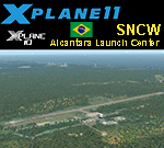
This is an X-Plane 11 and X-Plane 10 scenery package for Alcântara Launch Center Airport, Airbase, and Space Center (ICAO: SNCW, no IATA code), which is a military airport in the city of Alcantara, Maranhao, in Brazil. It includes corrected aprons, ramps, gates, taxiways, lighting system, village buildings, the satellite launching base, ortho-photoscenery for the airfield area, and (XP11 only) airport ground services (like push back). The SNCW airfield is located 16nm (30km) NW of São LuÃs Intl Airport (SBSL/SLZ). The Alcântara Launch Center (Portuguese: Centro de Lançamento de Alcântara - CLA) is a satellite launching base of the Brazilian Space Agency. This scenery was tested and is operational (as of January 11, 2018) in "X-Plane 11.11 64 bit", Windows 10 Home. It was also tested and is also operational (as of January 11, 2018) in "X-Plane 10.51 64 bit", Windows 10 Home. Only the default X-Plane 11 libraries, by Laminar Research, are needed. No third party libraries are used. A few extra objects are used and included in the package, thanks to autor and artist ThePrivateer. They are included in the package, no need to download them.
| Filename: | BR_MA_SNCW__Alcantara_Launch_Center_v100.zip |
| License: | Freeware |
| Added: | 12th January 2018, 00:09:54 |
| Downloads: | 68 |
| Author: | Rui Mesquita |
| Size: | 60.72 MB |
| Category: Flight Simulator 2004 - Scenery | |
| ISD Milan (Bergamo) Orio al Serio - Update 2013 |
|
Images related to this file:
File Description:
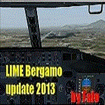
Cari Amici Simmer Dear friends and lovers of the eternal FS2004, thanks to the work carried out by the Bgl Mr. Gianluca Giovannini, the tower by luca Manineti, airport objects of Mr. Andrei Visan, the upgrades from the ISD project, and the new frequency vor Fabio Iaria and the grass in 3d by MrKobbe Farwick. I tried an update of the Milan-Bergamo "Orio al Serio", the undisputed leader of the panorama Low fare in Italy. The scenery is not a new job, but an adaptation and updating of files scanrio isd 2002. In the new work will, therefore, the new tower of the city near the airport, the outline of trees along the surface of the airport, new airport objects, 3D grass, industrial buildings on the highway, night lights and a new reconstruction of the new terminal. I also realizizzato an urban area to recreate the city of Bergamo Orio al Serio and Bergmao and Alta. Compatible with AES latest version.
not assume responsibility for any errors that may occur, for information [email protected] "Fafo's air production."
A greeting and good flights - Fabio Ferrari, Castione della Presolana (BG) Italy.
Long life fs 2004! And Best regards from Italy
| Filename: | ISD_Milan_Bergamo_Orio_al_Serio__Update_2013.zip |
| License: | Freeware, limited distribution |
| Added: | 24th January 2013, 03:06:34 |
| Downloads: | 4,966 |
| Author: | Fabio Ferrari, Gianluca Giovannini, Luca Mainenti |
| Size: | 103.44 MB |
| Category: Prepar3D V1-4 - Utilities | |
| GENav pro Navigation |
|
Images related to this file:
File Description:

Previous payware product at SimMarket, now 100% free.
With GENav pro you will view all AIRAC navigation data and terminal procedures inside Google Earth. GENav pro run under Windows and require only Google Earth for displaying. You can also edit your own routes or just copy routes into GENav to view in Google Earth. You can search for example an airport or a fix by short or long name, Google Earth will take you there.
You can connect to Microsoft Flight Simulator to view your aircraft. Moving map and heading is available.
GENav pro is highly optimized for best performance and clear views without clutter. There are smart filters to select relevant data to display, all AIRAC items are available. You will find all data such as nav-aid frequencies, airport runways with ILS frequencies by click the displayed icons in Google Earth.
You can edit routes visual direct inside Google Earth by click. The database can always be updated with Navigraph's latest AIRAC data.
With GENav you can easy build valid routes. Unlike other common autorouting program, GENav is the tool for you to build routes with correct airway direction and correct connected to SID/STAR's. You will easy draw your routes most stright and correct to destination. It is also excellent for visual and instrument navigation flights.
FEATURES:
*** Display airports, nav aids, waypoints
*** Display High/Low airways and airways direction
*** Display SID/STAR, Approaches and Transitions
*** Display ARTCC/FIR border
*** AIRAC data available by click
*** Search airport and fixes
*** AIRAC data compatible Navigraph data
*** Visual editable routes
*** VOR to VOR route navigation data
*** Display your aircraft
BASIC SYSTEM REQUIREMENTS:
*** Windows with Google Earth installed
( Notice, no flightsim program required )
OPTIONALLY REQUIREMENTS:
*** SID/STAR require the Navigraph purchase or an alternative free source
*** Airways direction & high/low info require the Navigraph purchase
*** To display aircraft, Microsoft Flight Simulator or Prepare3D v1/v2, with free FSUIPC is required.
*** To display aircraft at a separate computer, also the payware WideFS is required.
| Filename: | GENav_pro_Navigation.zip |
| License: | Freeware |
| Added: | 25th May 2016, 11:24:52 |
| Downloads: | 654 |
| Author: | Lennart Vedin |
| Size: | 4.5 MB |
| Category: Flight Simulator 2004 - Utilities | |
| GENav pro Navigation |
|
Images related to this file:
File Description:

Previous payware product at SimMarket, now 100% free.
With GENav pro you will view all AIRAC navigation data and terminal procedures inside Google Earth. GENav pro run under Windows and require only Google Earth for displaying. You can also edit your own routes or just copy routes into GENav to view in Google Earth. You can search for example an airport or a fix by short or long name, Google Earth will take you there.
You can connect to Microsoft Flight Simulator to view your aircraft. Moving map and heading is available.
GENav pro is highly optimized for best performance and clear views without clutter. There are smart filters to select relevant data to display, all AIRAC items are available. You will find all data such as nav-aid frequencies, airport runways with ILS frequencies by click the displayed icons in Google Earth.
You can edit routes visual direct inside Google Earth by click. The database can always be updated with Navigraph's latest AIRAC data.
With GENav you can easy build valid routes. Unlike other common autorouting program, GENav is the tool for you to build routes with correct airway direction and correct connected to SID/STAR's. You will easy draw your routes most stright and correct to destination. It is also excellent for visual and instrument navigation flights.
FEATURES:
*** Display airports, nav aids, waypoints
*** Display High/Low airways and airways direction
*** Display SID/STAR, Approaches and Transitions
*** Display ARTCC/FIR border
*** AIRAC data available by click
*** Search airport and fixes
*** AIRAC data compatible Navigraph data
*** Visual editable routes
*** VOR to VOR route navigation data
*** Display your aircraft
BASIC SYSTEM REQUIREMENTS:
*** Windows with Google Earth installed
( Notice, no flightsim program required )
OPTIONALLY REQUIREMENTS:
*** SID/STAR require the Navigraph purchase or an alternative free source
*** Airways direction & high/low info require the Navigraph purchase
*** To display aircraft, Microsoft Flight Simulator or Prepare3D v1/v2, with free FSUIPC is required.
*** To display aircraft at a separate computer, also the payware WideFS is required.
| Filename: | GENav_pro_Navigation.zip |
| License: | Freeware |
| Added: | 25th May 2016, 11:24:32 |
| Downloads: | 533 |
| Author: | Lennart Vedin |
| Size: | 4.5 MB |
| Category: Flight Simulator X - Scenery | |
| HALA - Hawassa Intl. - Hawassa, Ethiopia |
|
Images related to this file:
File Description:
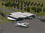
This project adds the booming city of Hawassa, Ethiopia, creates the new international airport (HALA), moves (and rebuilds) the downtown airport (recoded to HALX), and includes AI flight plans for the Ethiopian Airlines service that began April 2016. Tested in both the default FSX: Acceleration and with FTX Global/Vector, accurate coastlines, lakes, road data, and SRTMGL1 (30m) mesh, as well as corrected landclass are provided based on the latest available satellite imagery. The Hawassa International Airport was created using information from the current satellite footprint and the promotional video from Ethiopian Airports Enterprise (EAE). Although there is still very little published data on the airport, it is fully functional.
Updates were created or rebuilt in a manner which carefully aligns airport data with current satellite imagery. Scenery was created using Airport Design Editor X v1.70.6042, SBuilderX 3.13, and the FSX Object Placement Tool. Scenery objects were added and modified from stock FSX scenery to resemble as closely as possible the actual airports. The FSX apron lights included are from the set created by Jim Dhaenens. Thanks to Ron Blehm for bringing this part of the world to my attention.
| Filename: | HALA__Hawassa_Intl___Hawassa_Ethiopia.zip |
| License: | Freeware |
| Added: | 20th July 2016, 09:06:40 |
| Downloads: | 1,022 |
| Author: | Carlyle Sharpe |
| Size: | 10.41 MB |
| Category: Flight Simulator 2004 - Scenery | |
| Antique Scenery, San Jose de Buenavista, Antique, Philippines |
|
File Description:
ANTIQUE SCENERY,Full Version 2.0
October 10,2003
Enjoy this ANTIQUE SCENERY located at San Jose de Buenavista,Antique,Philippines.This scenery features the new EVELIO B. JAVIER airport terminal,ATO building, and the Antique airport CRASH AND FIRE RESCUE STATION with full night lighting.
This scenery is designed to optimize framerates.Special thanks goes to CAPT. JOHN L. MAKANI for the AERIAL and CLOSE UP shots he made at this new Antique airport.
Asian Spirit now serves this airport three times a week. Using the ASIAN SPIRIT YS-11, or sometimes using the ASIAN SPIRIT LET-410,it serves antique airport on Mondays, Wednesdays and Fridays.Install the included TRAFFIC TOOLS FILES and watch out for the ASIAN SPIRIT YS-11 land perfectly in this airport M-W-F at 11:35 a.m.from Manila and take off again at 12:05 p.m. back to Manila.Install the included AFCAD files and watch your favorite genav aircraft land and take off perfectly at the center of the runway.Install the included Editvoicepack VCPMOD file and hear the Antique Tower pronounce the word "Antique" correctly or hear the ATC say "Antique" instead of "Romeo Papa Victory Sierra".
| Filename: | Antique_Scenery_San_Jose_de_Buenavista_Antique_Phi.zip |
| License: | Shareware, time limited |
| Added: | 11th October 2003, 02:08:18 |
| Downloads: | 4,115 |
| Author: | Ver Walter L. Gulfan |
| Size: | 1.73 MB |
| Category: Flight Simulator 2004 - AFCAD Files | |
| Belfast - Aldergrove International Airport, Northern Ireland (EGAA) |
|
File Description:
An AFCAD2 for Belfast/Aldergrove (EGAA) airport, UK. The airport has been completely reconfigured to provide as many parking spots as possible. It features all current real life taxiways and near real parking. Additional taxiways and parking positions have also been added to the airport. Both runways have been slightly extended, new approach lighting has been addd and by using the crosswind runway techniqe, both runways are now available for simultaneous use. Assigned parking for all airlines serving this airport, including UK Air Force and Army military transports, is included. This is for the default FS2004 airport only.
| Filename: | Belfast__Aldergrove_International_Airport_Northern.zip |
| License: | Freeware |
| Added: | 27th February 2005, 20:23:02 |
| Downloads: | 2,277 |
| Author: | Lee Brompton |
| Size: | 29.09 KB |
| Category: Flight Simulator 2002 - AFCAD Files | |
| Russian Airports |
|
File Description:
Some AfCad Files for main Russia airports
Include
Domodedovo Airport (UUDD).Russia. uudd2002.zip on AVSIM By Gary V.
UUDD1.txt
Sheremetyevo internationl airport. uuee2003.zip on AVSIM By Gary V.
UUEEall.txt Complete Airport , Use 7R/25L for landing and 7L/25R for Takeoff
UUEE1.txt Sheremetyevo-1 ICAO UUEE use 7L/25R for landing/takeoff
UUEE2.txt Sheremetyevo-2 ICAO UUE2 use 7R/25L for landing/takeoff
Vnukovo airport. moscow.zip on AVSIM By Gary V.
UUWW1.txt
Pulkovo Airport St Petersburg pulkovo1.zip on avsim.ru by Pavel Scukin
ULLI1.txt
3.3.2003 by Vladimir Svoboda (Cesmina) [email protected]
| Filename: | Russian_Airports.zip |
| License: | Freeware |
| Added: | 3rd March 2003, 16:48:52 |
| Downloads: | 1,902 |
| Author: | Vladimir Svoboda (Cesmina) |
| Size: | 27.89 KB |
| Category: Prepar3D V1-4 - Scenery | |
| OEMA Sode Jetways GSX Level 2 By MAE Scenerys For Freeware Medina Airport |
|
Images related to this file:
File Description:
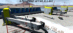
OEMA Sode Jetways GSX Level 2 By MAE Scenerys For Freeware Medina Airport By Muhammad Affan Ellahi For Freeware Medina Airport OEMA (Prince Mohammad Bin Abdulaziz International Airport OEMA Saudi Arabia) And Plz Download This OEMA Freeware Beatuiful Scenery By MOHAMED SALAMONI!
!!!!YOU MUST HAVE GSX AND GSX LEVEL 2 EXP TO WORK THIS SODE JETWAYS AND ALSO Freeware Medina Airport OEMA (Prince Mohammad Bin Abdulaziz International Airport OEMA Saudi Arabia) By By MOHAMED SALAMONI! Here Is The Link https://library.avsim.net/esearch.php?DLID=200004!!!!!
OEMA SCENERY COPYRIGHTS MOHAMED SALAMONI
OEMA SODE JETWAYS COPYRIGHTS MUHAMMAD AFFAN ELLAHI
| Filename: | OEMA_Sode_Jetways_GSX_Level_2_By_MAE_Scenerys_For_.zip |
| License: | Freeware |
| Added: | 7th October 2018, 01:54:35 |
| Downloads: | 1,498 |
| Author: | MUHAMMAD AFFAN ELLAHI |
| Size: | 1.74 MB |
| Category: Flight Simulator X - AFCAD Files | |
| FXMM - Moshoeshoe I International Airport - Maseru, Lesotho |
|
File Description:
Moshoeshoe I International Airport (IATA: MSU, ICAO: FXMM) is an airport serving Maseru, the capital city of Lesotho. The airport is located in the town of Mazenod, about 18 km (11 mi) southeast of downtown Maseru.
The airport is at an elevation of 5,348 feet (1,630 m) above mean sea level. It has two asphalt paved runways: 04/22 measuring 3,200 by 45 metres (10,499 ft by 148 ft) and 11/29 measuring 1,010 m by 23 m (3,314 ft by 75 ft).
Airport runways were corrected also the aprons and buildinds.
This work is dedicated to West Wind Airlines.
| Filename: | FXMM__Moshoeshoe_I_International_Airport__Maseru_L.zip |
| License: | Freeware |
| Added: | 24th June 2013, 05:16:52 |
| Downloads: | 307 |
| Author: | Anwar Gonzalez |
| Size: | 7.83 KB |


© 2001-2026 AVSIM Online
All Rights Reserved
Privacy Policy |