
Where Flight Simulation Enthusiasts Gather from Around the World!
AVSIM Library - Search Results

| Category: Flight Simulator X - AI Aircraft | |
| SkyEurope Airlines Boeing 737-700 WL |

|
File Description:
Boeing 737-700 with winglets in SkyEurope Airlines livery; aircraft's registration: OM-NGD. This is a photoreal repaint. Original B737 made by AI Aardvark, painted in SkyEurope Airlines colours by Claudiu A. Dobre / Skycolors Team (http://www.skycolors.com). On our website you can also find SkyEurope Airlines' special livery "Adriana".
| Filename: | SkyEurope_Airlines_Boeing_737700_WL.zip |
| License: | Freeware |
| Added: | 23rd March 2007, 14:54:33 |
| Downloads: | 2,543 |
| Author: | Claudiu A. Dobre / Skycolors Team, AIA (AI Aardvark) |
| Size: | 1.4 MB |
| Category: Flight Simulator X - AI Aircraft | |
| Avianca Boeing 757-200 RR |
|
File Description:
Boeing 757-200 in Avianca livery; aircraft's registration: EI-CEY. This is a photoreal repaint. Original B752 made by AIA (AI Aardvark), coloured in Avianca livery by Claudio A. Dobre / Skycolors Team (http://www.skycolors.com). For more repaints made by us visit our website. Good wind!
| Filename: | Avianca_Boeing_757200_RR.zip |
| License: | Freeware |
| Added: | 13th March 2007, 01:16:28 |
| Downloads: | 4,277 |
| Author: | Claudio A. Dobre / Skycolors Team, AIA (AI Aardvark) |
| Size: | 1.34 MB |
| Category: Flight Simulator X - AFCAD Files | |
| ZSGS - Zhuhai Janwan Airport - Zhuhai, China |
|
File Description:
The Zhuhai Sanzao airport (ZGSD/ZUH, China), close to Macao, was built on request of someone who found it included in the FMC of PMDGs 737NGX, but missed in FSX. I used ADE and the Google based old version 2 of Plan-G (thanks to both authors) and some charts being available in the internet. However, it is equipped with standard buildings which are roughly adapted to the real dimensions well. Lighting, windsocks, taxisigns and moving jetways. Of course I added both ILS as well. There is a big exhibition apron on the airport which is modeled but blocked for AI traffic. You will see the lines of the taxiways nevertheless. The latest temporary chart (Nov 2012) shows a third apron which is not realised and I'm not planning to do so (obviously the whole site is still under construction).
As being built on a FSX island (which is now a peninsula) and default coast lines not fitting to the real position of the airport (Rwy05 was hanging in the water) I decided to compromise in a way that I corrected the area in the vicinity of the airport but respected the remaining part as it was in the default scenery. The attached pictures should give an impression even if I'm not using the pure default scenery. Therefore this little patch should be compatible to advanced mesh sceneries.
| Filename: | ZSGS___Zhuhai_Janwan_Airport__Zhuhai_China.zip |
| License: | Freeware |
| Added: | 2nd May 2013, 07:56:18 |
| Downloads: | 688 |
| Author: | Axel Birsul |
| Size: | 614.11 KB |
| Category: Flight Simulator 2004 - Scenery | |
| LFRD2004 Dinard/St-Malo VFR Scenery |
|
Images related to this file:
File Description:
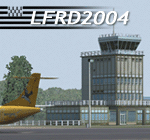
LFRD is a regional airport in Brittany, France. This scenery was created entirely with GMax and the latest Microsoft compilers. Everything was made to ensure maximum framerate while giving maximum visual impact, even on humbler machines. This scenery will run just as fast as the default one (which is very bare) with your current settings, even though there are literally thousands of houses, buildings, trees and a detailed airport.
This is a complete package:
-SRTM local mesh with custom coast trimming
-Custom phototexture (200sq km), with seamless blending into FS9 standard landclass
-Full autogen with custom local texture
-Custom landclass and waterclass
-AFCAD2 file with parking codes
-Custom Hi-res photographic textures at airport.
-Gmax buildings and xml librairy objects.
It was made by a real life pilot and is totally aimed at recreating the feeling of being there, not so much on the ground (after all, this is a FLIGHT simulator), but at circuit altitudes. This is not about recreating an airport in all its glorious details at the cost of framerate, but instead an exercise in balancing visual cues and details as viewed from up there to make it 'as real as it gets' within the limits of FS9. Scenery made by Vauchez (http://mapage.noos.fr/euro_vauchez/)
| Filename: | LFRD2004_DinardStMalo_VFR_Scenery.zip |
| License: | Freeware, limited distribution |
| Added: | 28th April 2010, 18:06:05 |
| Downloads: | 46,567 |
| Author: | Etienne Vauchez |
| Size: | 10.55 MB |
| Category: Flight Simulator X - Utilities | |
| FSX/FS2004 Flight Calculator Ver 1.6.5 |
|
Images related to this file:
File Description:
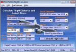
FS Flight Calculator will calculate distance and arrival times for both FSX and FS2004. The program has four input components, Local TimeZone, Departing Airport, Destination Airport and the Aircraft to be used for the flight. The program calculates the distance in nautical miles between two FlightSim Airports. It determines the flight length in hours based on the aircraft's speed and then calculates the Arrival time. If the flight time passes midnight the arrival day is incremented by a day. In addition this version takes into account the timezones of both departing and destination airports and calculates the timezone offset between them allowing display of the arrival in local time at the destination airport. The distances and times are based on point to point calculations and do not allow for taxi out, taxi in, start-up times etc. To compensate for this you can input a time period in minutes which is automatically added to the flight time to give a more accurate estimate of arrival times. This version also adds a Flight Summary Window to the main screen, the ability to create multi leg routes and a utility to create a new Aircraft.txt file. Freeware By Dave Westbury
| Filename: | FSXFS2004_Flight_Calculator_Ver_165.zip |
| License: | Freeware, limited distribution |
| Added: | 29th September 2011, 01:10:39 |
| Downloads: | 3,482 |
| Author: | Dave Westbury |
| Size: | 4.29 MB |
| Category: Flight Simulator X - Scenery | |
| AR09 - Bella Vista Field - Arkansas, USA |
|
Images related to this file:
File Description:
This is my first attempt at creating an airport for FSX. This airfield is located in Gravette, Arkansas, and is currently owned by Hendren Aviation. I added a few assets, so that it would appeal more to the casual simmer. Such changes, for example, is adding a helicopter pad, when in real life there isn't one. The changes are very mild, and are pointed out on the included BMP. This airport should definitely appeal to anyone who is a bush pilot. The approach from the south is a bit challenging.
You must have the Acceleration addon. This is version 2.0, which supersedes version 1.0.Version 1.0 was given to only 2 people for testing purposes, and it shouldn't have found it's way onto the internet. Please contact me if you ever come across version 1.0.
Future updates will include accurate models of the buildings, accurate night lighting (it's a grass airstrip, and as of right now, the only lighting comes from street lights and buildings), and a few changes to the airport background.
I hope everyone enjoys this scenery as much as I enjoyed learning and creating it.
| Filename: | AR09__Bella_Vista_Field__Arkansas_USA.zip |
| License: | Freeware, limited distribution |
| Added: | 14th May 2015, 17:25:41 |
| Downloads: | 295 |
| Author: | JackRiordan |
| Size: | 8.25 MB |
| Category: Flight Simulator 2004 - Scenery | |
| Kogd-Ogden,Utah |
|
Images related to this file:
File Description:
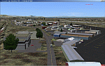
KOGD-Ogden,Ut
Take your sailboat to the Great Salt Lake inland sea or hike the many mountains and enjoy the vistas offered atop the lofty peaks. Visit the quiet mountain valley town of Eden to the east of KOGD with its annual balloon festival and summer fun on Pineview dam or spend the day shopping the shops of Brigham City to the north or Salt Lake City to the south. Fly over the Great Salt Lake to the west.
See the Ogden airport come alive with this must have add-on. With the help of Google Earth and FS Earth I have recreated the Ogden airport, with its new taxiway A (from a site visit), and the surrounding cities and towns to look as real as possible.
Made with Ultimate Terrain, but the airport should be ok with default FS9. (No guarantee though ;-)
The scenery enhancements were made with Ultimate Terrain in place. I modified the landclass to look more like the real thing. The airport is very close to a exact replica of KOGD! The crane by the tower was there when I took the pictures so I included it.
| Filename: | KogdOgdenUtah.zip |
| License: | Freeware |
| Added: | 20th January 2009, 13:42:09 |
| Downloads: | 1,345 |
| Author: | Alan C. Heiner |
| Size: | 15.59 MB |
| Category: Flight Simulator 2004 - Scenery | |
| Kogd-Ogden,Utah |
|
Images related to this file:
File Description:
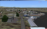
KOGD-Ogden,Ut Take your sailboat to the Great Salt Lake inland sea or hike the many mountains and enjoy the vistas offered atop the lofty peaks. Visit the quiet mountain valley town of Eden to the east of KOGD with its annual balloon festival and summer fun on Pineview dam or spend the day shopping the shops of Brigham City to the north or Salt Lake City to the south. Fly over the Great Salt Lake to the west. See the Ogden airport come alive with this must have add-on. With the help of Google Earth and FS Earth I have recreated the Ogden airport, with its new taxiway A (from a site visit), and the surrounding cities and towns to look as real as possible. Made with Ultimate Terrain, but the airport should be ok with default FS9. (No guarantee though ;-) The scenery enhancements were made with Ultimate Terrain in place. I modified the landclass to look more like the real thing. The airport is very close to a exact replica of KOGD! The crane by the tower was there when I took the pictures so I included it.
| Filename: | KogdOgdenUtah.zip |
| License: | Freeware |
| Added: | 15th December 2009, 00:45:07 |
| Downloads: | 725 |
| Author: | Alan C. Heiner |
| Size: | 15.59 MB |
| Category: Flight Simulator 2004 - AI Flight Plans | |
| !UPDATED! Enerjet Summer 2010 |
|
Images related to this file:
File Description:

Project: UPDATED Enerjet Summer 2010 Flightplans (2 aircraft)
Date: 14 September 2010 (very late release)
Enerjet is a new charter airline based in Canada. It operates to popular destinations from Canada and their
base at Calgary International Airport, Vancouver - Vancouver International Airport and Toronto - Pearson International Airport.
Currently Enerjet operates two Boeing 737-700w aircraft for Suncor Energy on a long-term contract transporting their employees to the
Oil Sands projects. Also, Sunwing/Signature Vacations flights for summer from Calgary, Edmonton and Vancouver to Puerto Vallarta and
Cancun. To fill out the flight plans I have added some sun destinations which were previously served by now defunct carrier
Skyserice. Enerjet was one of the carriers which was selected to finish out their summer flights.
*** I highly recommend you download and install my "Suncor Energy CRJ 900 Flightplans and Oil Sands Airfields AFCAD2s" found on Avsim - suncorenergycrj900_winter_2008-2009.zip
The flightplans use my AFCAD2s for the following private airfields:
AF2_CFG6 - Fort McKay/Firebag Aerodrome, Firebag River, Alberta
Again a "big" thank you to Darren Belanger for providing the airport charts for these airfields and the repaints for Enerjet - enerjet_737w_dtb.zip
| Filename: | UPDATED_Enerjet_Summer_2010.zip |
| License: | Freeware |
| Added: | 14th October 2010, 03:49:05 |
| Downloads: | 1,118 |
| Author: | Jerel Gregory Hayes |
| Size: | 6.34 KB |
| Category: Flight Simulator X - Scenery | |
| Frankfurt Main Airport v5 (EDDF) scenery |
|
Images related to this file:
File Description:
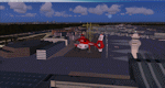
This major release commemorates the opening of the new Northwest Runway. Using ADE 1.50, this scenery package represents the layout of the airport as of October 2011 and includes major updates to the land class data to provide the most realistic environment around the airport.
Other major features include the new 07L/25R runway setup for landings only plus associated navaids, taxiway signs, high-speed taxiways and also reconfigures the other runways as per current operations.
In addition, adds several new features, such as new Gmax models for the DB Schenker and CCT hangars at South Cargo City, a new animated rotating beacon to the North control tower, brand new G gate apron area (9 new parking spots with night lighting) at the site of Terminal 3 as well as a host of other airport buildings and parking lots added on the south side. Other updates include construction work on taxiway Sierra as per real airport as well as latest runway/taxiway textures.
A number of other miscellaneous updates are also featured so see the readme file for more details. Stay tuned for v6 which will add further updates to this freeware FSX Frankfurt scenery.
| Filename: | Frankfurt_Main_Airport_v5_EDDF_scenery.zip |
| License: | Freeware |
| Added: | 25th November 2011, 09:14:18 |
| Downloads: | 2,422 |
| Author: | Mark Aldridge |
| Size: | 4.98 MB |


© 2001-2026 AVSIM Online
All Rights Reserved
Privacy Policy |