
Where Flight Simulation Enthusiasts Gather from Around the World!
AVSIM Library - Search Results

| Category: Flight Simulator 2004 - Scenery | |
| Lanseria International Airport (FALA), Johannesburg, South Africa |

|
Images related to this file:
File Description:
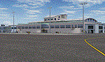
Lanseria international airport is Johannesburg's second international airport and mostly cater to private jets, low cost airlines and many private general aviation and flightschool aircraft. It is a privately owned airport and can accomodate aircraft up to the size of a Boeing 757-300. This airport has seen John Travolta use it with his Boeing 707, the Hilton family with a private Boeing 757 and even the USAF have landed their C-17 Globemasters at the airport when Air Force one came here in the past with the latter landing at AFB Waterkloof.
This package started out as a conversion of the wonderfull FSX scenery of the airport by Lee Hall and converted with permission from the original author. It quickly expanded however to a project that now additionally includes photoreal ground textures that changes with seasons, many added fences and gates around the airport, inclusion of the shaded parking areas with parked cars, static airplanes (RWY12 and EZ scenery libraries needed to see this) as well as numerous objects around the airport and apron made by myself in Gmax to give the airport some FS9 life.
Also included is the wonderfull "apron light splashes" by Hans Günther Schnell who kindly gave me permission to use it for the night times.
I have also included a local mesh for the area for users of FSGlobal 2010 to eliminate the extreme elevation anomoly around the airport.
| Filename: | Lanseria_International_Airport_FALA_Johannesburg_S.zip |
| License: | Freeware, limited distribution |
| Added: | 11th August 2023, 16:03:37 |
| Downloads: | 288 |
| Author: | Kobus van Wyk, Lee Hall |
| Size: | 37.64 MB |
| Category: Flight Simulator 2004 - Original Aircraft | |
| Airspeed AS.5 Courier |
|
File Description:
FSDS V3.0 Airspeed Courier.
Has reflective Textures, usual animations, 2D Panel using all default Gauges plus a VC.
The Airspeed AS.5 Courier was a British six-seat single-engined light aircraft that saw some use as an airliner. Production aircraft were built by Airspeed (1934) Limited at Portsmouth. It first flew on 10 April 1933 and was the first British type with a retractable undercarriage to go into production, with a total of 16 built.
The prototype Courier was designed by Hessell Tiltman (co-founder of Airspeed Limited) and was built in 1932 by Airspeed at York for an attempt by Sir Alan Cobham to carry out a non-stop flight to India, using airborne refuelling. Airspeed moved from York to Portsmouth before the Courier G-ABXN first flew on 10 April 1933. The Courier was a wooden low-winged cabin monoplane; it had a novel feature for the day of a retractable undercarriage. The prototype was powered by an Armstrong Siddeley Lynx engine. The prototype had two minor accidents, in April 1933 at Portsmouth and in June 1933 at RAF Martlesham Heath. The aircraft was repaired on both occasions.
After a year spent perfecting airborne refuelling, Alan Cobham took off from Portsmouth in the prototype Courier on an attempted flight to India on 24 September 1934, being refuelled from a Handley Page W.10 before making a forced landing at Malta due to a broken throttle.
| Filename: | Airspeed_AS5_Courier.zip |
| License: | Freeware |
| Added: | 16th April 2017, 08:48:20 |
| Downloads: | 421 |
| Author: | Julian Higgs |
| Size: | 10.09 MB |
| Category: Flight Simulator X - Panels | |
| Project Black Panels v6.3 |
|
Images related to this file:
File Description:
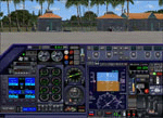
Looking for a functional all-in-one panel? This package might be worth a look then. With a consistent layout for all instrumentation except aircraft type specific gauges (like engine displays and controls), this package offers panels for nearly all possible aircraft types. These IFR compatible 2D panels use the proper autopilot system for the aircraft type and have all the bells and whistles in easy reach; including an upgraded PFD, backup gauges, full IFR gauges (including ADF), fuel request, jetway toggle, engine startup and shutdown ability, a speed reduction system with auto spoilers, auto reverse thrust and auto taxi after landing, automatic gear, a true auto-smoke gauge that works with any aircraft having an engine smoke system, ground handling and popups like a custom exits control gauge, flight information computer and a TCAS radar plus much more. No attempt was made to replicate an actual aircraft panel, these were designed to allow flight of any aircraft in any location or situation without having to figure out how to use a different panel for each plane, and to assure all the necessary controls are present.
v6.3 is a Major Upgrade with a cleaner, more uniform look and tons of updated graphics, along with a load of new and improved features, including a functional TOGA system and, for piston engine aircraft, an Auto-Takeoff system. Complete package, no previous version required.
Support & Updates for this package can be found here:
http://www.thecurrentpage.com/?page_id=2686
| Filename: | Project_Black_Panels_v63.zip |
| License: | Freeware, limited distribution |
| Added: | 18th June 2010, 01:50:04 |
| Downloads: | 1,866 |
| Author: | Don Janusz |
| Size: | 28.84 MB |
| Category: Flight Simulator X - AFCAD Files | |
| Vineland-Downstown Airport (28N), NJ |
|
File Description:
Located 04 miles NE of Vineland, New Jersey on 45 acres of land, Vineland-Downstown Airport is a turf field that mainly services crop dusting operations for the surrounding farms. It also can serve firefighting aircraft - in fact the second runway (12/30) is specifically for that purpose along with agricultural use. This airport as modeled in FSX is kind of inbetween the current layout and the past layout. Based on various images both satellite and other, it seems 28N has undergone some serious expansion since the MSE textures were created. A large paved area to the west of the airport has been built and has parking aprons for up to around 25 aircraft. If you use an add-on traffic program you might want to think about reconfiguring it to assign more flights to this airport because it can certainly handle them now. You can fuel up in your plane by stopping near the fuel tank on the north end of the west tarmac or in your helicopter by landing on the concrete patch north of the runway.
Scenery constructed with use of satellite images/streetview, the author has not been there in person.
This scenery is meant to be used in conjunction with MegaScenery Earth New Jersey/Delaware 004. It is not required, but apron use is minimized to allow satellite scenery to show through as much as possible, and objects are placed based on the MSE textures - lack of it may make scenery look out of place.
| Filename: | VinelandDownstown_Airport_28N_NJ.zip |
| License: | Freeware |
| Added: | 11th October 2010, 06:13:42 |
| Downloads: | 206 |
| Author: | Drew Sikora |
| Size: | 324.96 KB |
| Category: Flight Simulator X - AFCAD Files | |
| Salem Airfield Airport (NJ74), NJ |
|
File Description:
Located 01 miles E of Salem, New Jersey on 14 acres of land, Salem Airfield is a private turf strip 2200' in length. The hard surface runway has been removed so have your mesh settings as high as possible to get the most out of landing/taking off on actual terrain. The surrounding area has been highly detailed with as much forestation as possible included to block out the horizon as much as possible considering the many open spaces surrounding the airport. Tie downs are located next to the middle of the runway, look for the marker cones or start in any RAMP_GA_SMALL parking locations. A hangar is available as well, and attendant is on call on NAV2 to open the door. You can start inside the hangar in the DOCK_GA parking spot or outside the hangar in the RAMP_GA parking spot. All parking is for aircraft with wingspans no greater than 40 feet. There is no fuel available. The field is lit for night use, but the windsock is not so check your weather before flying in!
Scenery constructed with use of satellite images/streetview/aerial photos - the author has not been there in person.
This scenery is meant to be used in conjunction with MegaScenery Earth New Jersey/Delaware 004. It is not required, but apron use is minimized to allow satellite scenery to show through as much as possible, and objects are placed based on the MSE textures - lack of it may make scenery look out of place.
| Filename: | Salem_Airfield_Airport_NJ74_NJ.zip |
| License: | Freeware |
| Added: | 10th August 2011, 02:05:51 |
| Downloads: | 176 |
| Author: | Drew Sikora |
| Size: | 910.96 KB |
| Category: Flight Simulator X - Aircraft Repaints, Textures and Modifications | |
| Airbus A318 FD Special Version V2 |
|
Images related to this file:
File Description:
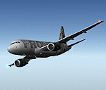
After my initial work on the Project airbus A318 (V1.2) and on the project Airbus A319 (A319 Special Version V2), I present my special version of the Project Airbus A318 Version 2, which includes many improvements and new features.
The instrument panel has been adapted of the Stefan Liebe work, on which I have added many changes. I created a vertical navigation gauge (VNAV gauge) which manages automatically the climb of the aircraft like a FMC (it can be work in several stage), with pre-programmed data according the weight of the aircraft and the altitude. The autopilot is constant MACH, with a transition altitude of 25000ft, thus avoiding the risk of overspeed. The ND will display information page in real time on the flight plan, an information page on the destination airport and display the radar map of the terrain, with AI traffic in real time.
All instruments are active in the VC and 2D panel. The instruments were completed by a multitude of small details. I have improved the autolanding function, with a soft landing (rounded). There is a complete operating manual in PDF format, in English and in French. Of course, TOGA mode and Autobrake mode works. Only compatible with FSX SP2 or Acceleration. See the readme file and the user manual for information and copyright. This version is also a big upgrade on the A318 special version 1.0 and 1.2. This is not an update, but a new aircraft. Francois Dore.
| Filename: | Airbus_A318_FD_Special_Version_V2.zip |
| License: | Freeware, limited distribution |
| Added: | 6th April 2012, 19:59:27 |
| Downloads: | 11,992 |
| Author: | Francois Dore, Project Airbus, Stefan Liebe |
| Size: | 134.71 MB |
| Category: Flight Simulator X - Scenery | |
| YKLN Kulin Town and YJLN Kulin, Jilakin Rock, Western Australia |
|
File Description:
YKLN Kulin Town and YJLN Kulin, Jilakin Rock. Kulin is located in the upper great southern Wheatbelt of Western Australia, the Shire of Kulin covers an area of 4,790 square kilometres. It encompasses the towns of Kulin, Pingaring, Dudinin, Jitarning, and Holt Rock. The Kulin economy is based on agriculture and was settled by pastoralists in 1905. The crosswind runway is actually 7 miles to the east at Jilakin Rock and slopes uphill to the east. For convenience, I have used fictitious YJLN. Jilakin Downs is a Dorper sheep stud farm and the home of the Kulin Bush Races. Dorpers are currently under a cloud in Western Australia as the local abatoirs claim their hair is contaminating the meat and won't accept them. "We welcome air traffic to our 2012 Kulin Bush Races Weekend. A crosswind airstrip is available, with a shuttle bus service to the Jilakin Track. GPS position is S32-39-95 E118-18-71 and the elevation is 950 feet. The strip is 7 nautical miles east of the town of Kulin. Camping and toilets are close to the strip so that you can camp near your plane.
Kulin airstrip is also available for landing and takeoff during the weekend, a shuttle bus is available to take you out to the race track. If this option is chosen please contact Barry West. Please contact Barry West for flying information on 9880 9021" www.kulin.wa.gov.au/tourism_and_local_events/kulin_bush_races/flying_visit.html REQUIRES Blencowe_LibraryKit.zip
REQUIRES blencowe_librarykit_309494.zip (Available HERE)
| Filename: | YKLN_Kulin_Town_and_YJLN_Kulin_Jilakin_Rock_Wester.zip |
| License: | Freeware |
| Added: | 28th February 2013, 13:52:31 |
| Downloads: | 225 |
| Author: | Alan Blencowe |
| Size: | 5.73 MB |
| Category: Flight Simulator 2004 - Scenery | |
| Allakaket 6A8 Runway and Taxiway Lighting in Alaska |
|
Images related to this file:
File Description:
Allakaket is on the Koyukuk River in Alaska, 40 miles southwest of Bettles. This posting adds proper runway and taxiway lighting to the scenery, as shown in the screenshots. There will be lights on top of traffic cones visible during the day, just as there are at Allakaket in real life so that pilots can still see them after a snowfall. At night there will be lit lights that properly illuminate the runway for landing, and at a lower level of brightness the taxiway. Put the bgl's into the existing scenery folder of your Allakaket 6A8 installation and say yes to replace the existing bgl's that have the same names. Add the texture bmp's to the texture folder. That's all, and in fact you could try it without the textures in the Allakaket 6A8 texture folder, but read on. Instal the Library objects once and for all by placing the CONTENTS of the Lighting Library scenery folder in your static objects scenery folder and the CONTENTS of the texture folder in the static objects texture folder (which is how I install scenery objects libraries). Alternatively, put them in the scenery and texture folders of your Add on scenery folder, or even in the main scenery and texture folders. They just have to be in related scenery and texture folders that are always active when FS9 is running. There will be further retro upgrades to other recent scenery that was posted with temporary lighting. Say thank you to Greg Putz for making the lighting.
| Filename: | Allakaket_6A8_Runway_and_Taxiway_Lighting_in_Alask.zip |
| License: | Freeware, limited distribution |
| Added: | 23rd November 2019, 20:30:02 |
| Downloads: | 117 |
| Author: | Roger Wensley |
| Size: | 711.35 KB |
| Category: Prepar3D V1-4 - Aircraft Repaints, Textures and Modifications | |
| Douglas C-47 (X-1) Dutch Air Force |
|
Images related to this file:
File Description:
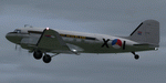
This folder contains a repaint for P3Dv4.5 PBR version of the Douglas C-47 by Manfred Jahn and colleagues in the colors of X-1 of the Dutch Air Force. The Dutch Air Force received her first Dakota's in 1952, although they owned one in 1946, but that crashed near Katwijk the same year and was destroyed. That one carried the registration X-1, but that is not the subject of my paint... The Air Force later leased one C-47 from the KLM, gave it the military registration X-2, but it kept its civil registration, PH-TBV, on the tail. Later they leased a few more, and clearly they liked them, because they bought a few more in 1952. The first one was taken on charge in 1952 and was numbered X-1 as depicted in this repaint. The makers badge with its construction number was missing however, and nobody seems to know where this aircraft came from. The logbook mentions the aircraft was 'found'. There was a rumour that the aircraft had been used by refugees from the east and landed at Valkenburg airfield without registration. About a year later, the aircraft made an emergency landing near Valkenburg after taking off for a relief flight for the flooded areas in the south of the Netherlands on 6 februari 1953 and was written off. Repaint by Jan Kees Blom for Manfred Jahn's C-47 for P3Dv4.5, with PBR, Rivet and bump detail by Ted (Tufun) Wolfgang."
| Filename: | Douglas_C47_X1_Dutch_Air_Force.zip |
| License: | Freeware |
| Added: | 26th January 2020, 17:55:48 |
| Downloads: | 152 |
| Author: | Jan Kees Blom |
| Size: | 25.1 MB |
| Category: Flight Simulator 2004 - Flight Plans | |
| Military Base Tour - Pacific Rim |
|
File Description:
Military Base Tour – Pacific Rim (MFPR) contains 21 Flight Plans (.PLN) for flights to various military air bases along the Pacific Rim, across the Pacific to CONUS and ending at Andrews AFB/NAF where the Military Flights Series began. It is the continuation of Military Flight Plans (MF) (mf_flights.zip) published in Avsim on 29th March 2004, Military Flight Plans – Europe (MFE) (mfe_flights.zip) published in Avsim on 17th June 2004 and Military Base Tour – West Asia (MFWA) (mfwa_flights.zip) published in Avsim on 6th August 2004 and Military Base Tour – South Asia (MFSA) (mfsa_flights.zip) published in Avsim on 20th November 2004. There are a total of 128 flight plans in this Military Flight Series - Round the World Tour of Military Bases. (See Military Flights Master Itinerary– included in this .zip.) The itinerary contains a list of all the plans in the five uploaded files.) There are Briefing documents for each flight in Microsoft Word (.doc) and Text (.txt). The Flight Plans use the autopilot from takeoff to landing. The speed, altitude, weather, radios and various other controls are the pilot’s responsibility. Many landings are IFR and all are under the control of the autopilot. It is suggested that the pilot set up a separate Folder (“MFPR Flights” for example) and unzip this file there to store the .PLN and Briefing files. The .PLN can then be copied to the “Flight Simulator Files” and used to set up the flight and the Briefings printed and available for quick reference during the flight.
| Filename: | Military_Base_Tour__Pacific_Rim.zip |
| License: | Freeware |
| Added: | 9th April 2005, 04:39:05 |
| Downloads: | 1,382 |
| Author: | John Resch |
| Size: | 282.22 KB |


© 2001-2026 AVSIM Online
All Rights Reserved
Privacy Policy |