
Where Flight Simulation Enthusiasts Gather from Around the World!
AVSIM Library - Search Results

| Category: Flight Simulator 2004 - Original Aircraft | |
| United Airlines, Boeing 747-422 (N194UA) - 'Last OOC' |

|
Images related to this file:
File Description:

N194UA- The Last United 744 wearing the Old livery- Brought back into service in June-2010 and to be sent to storage in Late November*** 2010- was mainly used on the Chicago- San Francisco route for the Summer Season. but has occasionally done the odd Long-haul flight- mainly being sent to Shanghai and Incheon Int.
Project Opensky 747-400 V4. Model Features include fully animated control surfaces, fully independent suspension, main gear steering, trim animation, opening passenger doors, opening cargo doors, dynamic flexing wings, animated tilting bogies, rolling wheels, animated thrust reversers, fully reflective textures ( each part has different degree of reflection based on material ), accurate flight dynamics ( accurate FDE with full profiles for wheels, tires, struts, leading/trailing struts, engine types ... Tested by real pilots.), newly re-defined individual part damage profiles, accurate spoiler animation, detailed textures, full night lighting, visible landing lights from the cockpit, reflective cockpit windows, crash effects, transparent nav light lenses, newly re-defined individual part damage profiles.
Model Designer Hiroshi Igami. Flight Dynamics Designer Warren C. Daniel. Tested by Project Open Sky Members. Master textures by Corey Ford/Yosuke Ube. Repaint by Ryan Chadwick
| Filename: | United_Airlines_Boeing_747422_N194UA__Last_OOC.zip |
| License: | Freeware |
| Added: | 14th November 2010, 20:17:34 |
| Downloads: | 1,318 |
| Author: | Ryan Chadwick, Project Opensky |
| Size: | 11.81 MB |
| Category: Flight Simulator X - AFCAD Files | |
| Stoe Creek Farm Airport (7NJ2), NJ |
|
File Description:
Located 01 miles S of Canton, New Jersey, Stoe Creek Farm is a private turf field 1725' in length. The runway is largely clear of obstructions although on approach for Runway 05 you will deal with 20-30' trees a few hundred feet back from the threshold and there are transmission towers along the approach corridor to Runway 23 you should watch out for. The runway does have edge lighting, although the windsock is not lit at night and daytime VFR is still recommended. There are no services for transient craft at this airfield. Since you will be landing on terrain, it is recommended that your mesh complexity is set as high as possible.
Scenery constructed with use of satellite images/streetview/aerial photos - the author has not been there in person.
This scenery is meant to be used in conjunction with MegaScenery Earth New Jersey/Delaware 004. It is not required, but apron use is minimized to allow satellite scenery to show through as much as possible, and objects are placed based on the MSE textures - lack of it may make scenery look out of place.
| Filename: | Stoe_Creek_Farm_Airport_7NJ2_NJ.zip |
| License: | Freeware |
| Added: | 14th February 2011, 18:32:24 |
| Downloads: | 163 |
| Author: | Drew Sikora |
| Size: | 700.91 KB |
| Category: Flight Simulator X - Gauges | |
| Twin jet engine EICAS for Instrument Panel Version 2. |
|
Images related to this file:
File Description:
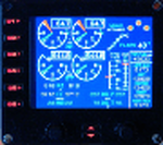
For Saitek Pro Flight Instrument Panel. This is the second version, you can delete previous one.
This folder contains 17 types of EICAS (Engine Indicating and Crew Alerting System) for Lear45, CRJ700, B737-800, B767-300, MD83, A300B1, A300B2, A350, CRJ100, CRJ300, B777-200, A320, A321, A310-100, A300B4, A350-800, B777-200ER, B787, A310 standard, A310-300, A330-200 and B777-200LR.
They replace older tje xml files, they have been improved and provide following utilities:N1, ITT, N2, fuel flow, Vibration, Oil pressure, Oil temperature, Landing gear position, Flaps positions, Pitch trim, Spoilers positions, Total, main tanks and auxiliaries tanks fuel.
The left knob activate spoilers, the right knob adjusts the N1 bug for autopilot.
Added two extra xml, if you do not find your favorite aircraft you can use the tje_full_range.xml which has total fuel of 6 digits, 5 digits for all tanks and full 8 flaps steps, this should fit with any twin jet engine aircraft. If this is not sufficient then use tje_extra_range.xml with 6 digits for all fuel and 8 steps for flaps. If you need more, that means you are flying a military tanker !
| Filename: | Twin_jet_engine_EICAS_for_Instrument_Panel_Version.zip |
| License: | Freeware |
| Added: | 7th September 2011, 22:24:35 |
| Downloads: | 1,121 |
| Author: | Philippe Verhaege |
| Size: | 567.42 KB |
| Category: Flight Simulator X - AFCAD Files | |
| Suwannee County Airport - 24J |
|
Images related to this file:
File Description:
Located two miles west of the bustling town of Live Oak, Suwannee County Airport is a public use airport serving 40,000+ citizen of Suwannee County, Florida. Featuring a newly resurfaced 4,000ft runway
with numerous lighting upgrades, this airport is quickly becoming a frontrunner in GA service for Northern Florida. Home to Fessler Aviation and Suwannee County FBO, and the rapidly-developing Suwannee Landing residential community, this is a great fuel stop for inbound/outbound
pilots and virtual aviators alike! Come visit this quickly expanding airport!
Things added:
Expanded Taxiway "A" all the way to Runway 7 (which was paved in back in 1999, I do not know how ACES/Microsoft missed this...)
Lengthened Runway 7/25 from 4,035ft to its actual 4,037 feet
Added appropriate runway markings per real life
Added appropriate VASI and runway lighting systems per real life
Fixed the taxiway width and adjusted it to proper coordinates
Added 24 parking spots!
Moved Tower Viewpoint to FBO location
Increased traffic scalar from 0.70 to 1.00
Added AWOS frequency and adjusted the names of the UNICOM/CTAF
Changed apron texture from Asphalt to Concrete and added sections of temp resurfacing (all appropriate to RL airport)
Added taxiway signs
| Filename: | Suwannee_County_Airport__24J.zip |
| License: | Freeware |
| Added: | 27th January 2012, 15:16:50 |
| Downloads: | 212 |
| Author: | Alex Melia |
| Size: | 335.29 KB |
| Category: Flight Simulator 2004 - Scenery | |
| Embrun CPR2 in Ontario Canada 2012 Revision |
|
Images related to this file:
File Description:
Embrun is in Ontario a few miles southeast of Ottawa, and southwest of my posted strips Russel Farm, Russellet Strip, and Indian Creek. It is a real airfield, used by Embrun Flying Club, and there is now fuel since the owner built a house on the field and moved in, and more hangars than there used to be. All in all a nice airfield with a grass runway 2,260 feet long, and in this REVISED version with a new windsock. There are electric cables strung along the road at the eastern end of the runway, marked by visibility balls; watch out for those. At the western end there are some old grain silos; these shouldn't be a problem, and if you are flying a taildragger give you something to aim at until the tail comes up. I did my first grass field landing and take off there when I was learning to fly, and it is just the right distance from Rockcliffe for a nice afternoon training flight. Look out for geese taking off from the fields to the west when you use 26; that departure from Embrun along with 50 geese was more entertaining than most.
| Filename: | Embrun_CPR2_in_Ontario_Canada_2012_Revision.zip |
| License: | Freeware, limited distribution |
| Added: | 9th February 2012, 01:31:31 |
| Downloads: | 303 |
| Author: | Roger Wensley |
| Size: | 3.8 MB |
| Category: Flight Simulator X - Scenery | |
| NZWV - Waihi Beach Airfield, New Zealand |
|
Images related to this file:
File Description:
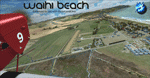
Waihi Beach (ICAO: NZWV) is a small airstrip north of Tauranga and near the small beach settlement of the same name, in the Bay of Plenty of New Zealand. It is a grass strip with offset thresholds giving usable landing lengths of 640m and 517m for RWY 13 and 31 respectively, a width of 55m and a group rating of 5. No night lighting or fuel is available. A very basic airstrip, there is only one recently built hanger and the airstrip is slowly being encroached on by
new housing developments. The airstrip itself is usually very sodden due to its low elevation but is a nice stop over for sightseeing from Tauranga and up the Coromandel peninsula.
The FSX model includes custom textures and models placed on a high resolution aerial image and a 15m mesh. It makes extensive use of items from the free VLC object libraries which are required to be installed (Available from www.vectorlandclass.co.nz Downloads menu). This scenery and
the VLC libraries have been funded by sales of VectorLandClass and although you do not need VLC to use it, your purchase helps further development.
| Filename: | NZWV__Waihi_Beach_Airfield_New_Zealand.zip |
| License: | Freeware, limited distribution |
| Added: | 1st November 2012, 10:01:38 |
| Downloads: | 1,006 |
| Author: | Tim Barnes / VectorLandClass |
| Size: | 11.13 MB |
| Category: X-Plane - Original Aircraft | |
| Piaggio P180 Avanti II |
|
Images related to this file:
File Description:
Features:
-Flight model within 10% of the real aircraft (as per manual);
-Autopilot operations as the real aircraft;
-Many functions and screen indications are SASL driven;
-X-Plane 10 64 bit full compatible;
-Main landing gear object has added (was missing for XP10 in the previous version);
-Electronic checklist in MFD;
-Real clock functions;
-Engine indication turn red when limits exceeded;
-UFMC and X-FMC config files are included. Those files have been adapted specially for this aircraft;
-New 2-page checklist to be printed in a single sheet;
-Updated Operating manual;
-You can use now the condition levers and flap lever by mouse.
PAY ATTENTION:
Use caution when using the throttles! As in the real aircraft, be advancing the throttles too full, torque limits can be exceeded by a lot!
PLEASE: Any questions or problems post them to the forum for this aircraft. I'm visiting it daily so I can respond as quick as possible.
At last, I want to THANK Tony Day, who, with his experience and work, helped me to make this aircraft as real as possible.
| Filename: | Piaggio_P180_Avanti_II.zip |
| License: | Freeware |
| Added: | 24th April 2013, 23:20:42 |
| Downloads: | 631 |
| Author: | Ilias Tselios |
| Size: | 49.42 MB |
| Category: Flight Simulator 2004 - Aircraft Repaints, Textures and Modifications | |
| NAC de Havilland DH-114 Heron 1B |
|
Images related to this file:
File Description: In 1957 they were written from use. One Heron was sold to the UK but sadly suffered a fatal crash on delivery. The other three, including ZK-BBM, were stored and in 1960 sold to Fiji Airways (later Air Pacific). In November 1975 Rotorua-based Air North bought ZK-BBM from Air Pacific. Already in 1978 she made her final landing and was stored for years at Ardmore Airfield. Classic Flyers NZ, based at Tauranga Airport acquired the Heron in March 1989. Since then she has been restored for static display at the Classic Flyers Museum.
You will need the DH-114 package available at Classic British Flightsim.
New Zealand National Airways Corporation (NAC) was the first operator to receive the DH-114. From 1952 till 1957 NAC flew with four Herons 1B's, which were acquired to serve those airfields which could not take NAC's standard airliner of those days, the Douglas DC-3. The Herons primarily flew across Cook Strait (Rongotai-Blenheim-Nelson) and later also to Hamilton and Rotorua. Since many modifications were required for this new airliner, the Herons proved too costly.
| Filename: | NAC_de_Havilland_DH114_Heron_1B.zip |
| License: | Freeware, limited distribution |
| Added: | 14th March 2014, 05:31:12 |
| Downloads: | 180 |
| Author: | Maarten Brouwer |
| Size: | 1.85 MB |
| Category: Flight Simulator 2004 - Scenery | |
| CYCQ - Chetwynd - British Columbia, Canada |
|
Images related to this file:
File Description:
The town of Chetwynd (population around 2,600) is on the east side of the Rocky Mountains, the first town to be encountered when descending from the Rockies on highway 97. Previously known as Little Prairie, the town name was changed in 1962. The main occupations of the town are linked to forestry, fossil fuels, and transportation; there are railway lines north to Fort St John, east to Dawson Creek, and south to Prince George. The airport is on the southern side of the town, with one runway aligned 05-23, asphalted in 1975 and just under 4,500 feet long. There are no scheduled services, although a new terminal building was constructed in 2008, and the helicopter operations by at least two companies (oil and gas and medical evacuation flights) are the primary operations from the field. These are included in the AI, incorporating helicopter modifications made by Holger Sandmann so that they function properly as AI at an airfield. As an aside, landing like a plane and using the runway and taxiways is in fact exactly what a helicopter does at a normal airfield in real life; everyone does the same thing so that guessing is unneccesary.
| Filename: | CYCQ__Chetwynd__British_Columbia_Canada.zip |
| License: | Freeware, limited distribution |
| Added: | 28th March 2016, 21:36:33 |
| Downloads: | 301 |
| Author: | Roger Wensley |
| Size: | 18.84 MB |
| Category: Flight Simulator 2004 - Scenery | |
| Port McNeill CAM8 float base in British Columbia, Canada |
|
Images related to this file:
File Description:
This is the seventh in a series of new and renovated float bases in BC. Port McNeill is a float base in a sheltered inlet on the northeast coast of Vancouver Island, close to the town and just under 20 miles east of the Port Hardy float base. There is no fuel available as the Port Hardy floatbase (already posted) acts as a refuelling centre for this and other float bases in the neighbourhood. The dock is to the west of the marina and east of the log raft area. The AI is a further adaptation of the CF36 AI and involves Beavers as listed in the AI folder. At Port McNeill all the AI works for both landing and takeoff for all of the planes, no matter what the wind direction is. All of these float bases can be installed together in the same folders, with a saving in duplicate textures. So a series called BC Floats (or whatever you want to call it) or individually installed float bases; your choice. The next in the series was suposed to be Sullivan Bay, another floating marina, but I digressed to Port Hardy and Port McNeill.
| Filename: | Port_McNeill_CAM8_float_base_in_British_Columbia_C.zip |
| License: | Freeware, limited distribution |
| Added: | 21st January 2017, 19:11:03 |
| Downloads: | 171 |
| Author: | Roger Wensley |
| Size: | 5.07 MB |


© 2001-2026 AVSIM Online
All Rights Reserved
Privacy Policy |