
Where Flight Simulation Enthusiasts Gather from Around the World!
AVSIM Library - Search Results

| Category: Flight Simulator 2004 - Scenery | |
| Embrun CPR2 in Ontario Canada 2012 Revision |

|
Images related to this file:
File Description:
Embrun is in Ontario a few miles southeast of Ottawa, and southwest of my posted strips Russel Farm, Russellet Strip, and Indian Creek. It is a real airfield, used by Embrun Flying Club, and there is now fuel since the owner built a house on the field and moved in, and more hangars than there used to be. All in all a nice airfield with a grass runway 2,260 feet long, and in this REVISED version with a new windsock. There are electric cables strung along the road at the eastern end of the runway, marked by visibility balls; watch out for those. At the western end there are some old grain silos; these shouldn't be a problem, and if you are flying a taildragger give you something to aim at until the tail comes up. I did my first grass field landing and take off there when I was learning to fly, and it is just the right distance from Rockcliffe for a nice afternoon training flight. Look out for geese taking off from the fields to the west when you use 26; that departure from Embrun along with 50 geese was more entertaining than most.
| Filename: | Embrun_CPR2_in_Ontario_Canada_2012_Revision.zip |
| License: | Freeware, limited distribution |
| Added: | 9th February 2012, 01:31:31 |
| Downloads: | 303 |
| Author: | Roger Wensley |
| Size: | 3.8 MB |
| Category: Flight Simulator X - AFCAD Files | |
| Suwannee County Airport - 24J |
|
Images related to this file:
File Description:
Located two miles west of the bustling town of Live Oak, Suwannee County Airport is a public use airport serving 40,000+ citizen of Suwannee County, Florida. Featuring a newly resurfaced 4,000ft runway
with numerous lighting upgrades, this airport is quickly becoming a frontrunner in GA service for Northern Florida. Home to Fessler Aviation and Suwannee County FBO, and the rapidly-developing Suwannee Landing residential community, this is a great fuel stop for inbound/outbound
pilots and virtual aviators alike! Come visit this quickly expanding airport!
Things added:
Expanded Taxiway "A" all the way to Runway 7 (which was paved in back in 1999, I do not know how ACES/Microsoft missed this...)
Lengthened Runway 7/25 from 4,035ft to its actual 4,037 feet
Added appropriate runway markings per real life
Added appropriate VASI and runway lighting systems per real life
Fixed the taxiway width and adjusted it to proper coordinates
Added 24 parking spots!
Moved Tower Viewpoint to FBO location
Increased traffic scalar from 0.70 to 1.00
Added AWOS frequency and adjusted the names of the UNICOM/CTAF
Changed apron texture from Asphalt to Concrete and added sections of temp resurfacing (all appropriate to RL airport)
Added taxiway signs
| Filename: | Suwannee_County_Airport__24J.zip |
| License: | Freeware |
| Added: | 27th January 2012, 15:16:50 |
| Downloads: | 212 |
| Author: | Alex Melia |
| Size: | 335.29 KB |
| Category: Flight Simulator 2004 - Aircraft Repaints, Textures and Modifications | |
| Air Canada "Gimli Glider" Boeing 767-233 (C-GAUN) |
|
Images related to this file:
File Description:

SkySpirit2010 767-200 v5. FS2004 and FSX package! Model features High resolution textures, Dynamic flexing wings, Body gear steering, Nose gear steering, Rudder lock, Ground spoilers, Low speed aileron locks at high speed, Fully animated control surfaces, Fully independent suspension, Trim Animation, Opening Passenger Doors, Animated tilting bogies, Rolling wheels, Animated thrust reverser's with reverser block doors, Detailed textures, Full night lighting, Crash affects, Ground Service Vehicles And more. Model Designer Hiroshi Igami/Yosuke Ube. Flight Dynamics Designer Warren C. Daniel. Textures by Philip Foglar. Livery by Stephen Groom
The Gimli Glider is the nickname of an Air Canada aircraft that was involved in a notable aviation incident in July 1983. On 23 July, Air Canada Flight 143, a Boeing 767-233 jet, ran out of fuel at an altitude of 41,000 feet (12,500 m) ASL, about halfway through its flight from Montreal to Edmonton via Ottawa. The crew was able to glide the aircraft safely to an emergency landing at Gimli Industrial Park Airport, a former Royal Canadian Air Force base in Gimli, Manitoba. The plane survived and flew for Air Canada until its retirement in 2008
| Filename: | Air_Canada_Gimli_Glider_Boeing_767233_CGAUN.zip |
| License: | Freeware, limited distribution |
| Added: | 3rd February 2013, 22:46:43 |
| Downloads: | 1,622 |
| Author: | Stephen Groom / Skyspirit 2010 |
| Size: | 10.59 MB |
| Category: Flight Simulator X - Gauges | |
| Advanced Radar System 4 (ARS4) |
|
Images related to this file:
File Description:
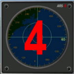
This gauge has been developed for FSX Flight Simulator SP1 or SP2. It
has also been tested with Microsoft Acceleration also, but compatibility is not guaranteed by the author.
This new Advanced Radar System (ARS 4) includes significant new features,
functions and displays for FSX AI traffic. The new key features are:
1)AI traffic display for air targets and boat/ship targets.
2)Auto landing on carrier if the carrier is part of the scenery MECOPS.
3)Allows switching between air target display and boat target display.
4) Provides for air and boat display to optionally insert airport and/or basic terrain display on the screen.
5)Different screen presentations for air and boat targets.
6)Simplified installation procedure.
7)The A2A re-fuel function remains the same as in the ARS2 version.
8)The auto tracking function remains the same as well as in the ARS2 version.
All displays for air, or boat/ship traffic, can be selected in a range of 5, 10, 20, and 40 miles.
For installation and additional information look at the ARS4 documentation inside the zip file. For copyrights and credits please look at the documentation for this gauge.
| Filename: | Advanced_Radar_System_4__ARS4.zip |
| License: | Freeware |
| Added: | 5th March 2013, 15:53:52 |
| Downloads: | 3,811 |
| Author: | Dietmar Loleit |
| Size: | 1.18 MB |
| Category: Flight Simulator X - Scenery | |
| NZWV - Waihi Beach Airfield, New Zealand |
|
Images related to this file:
File Description:
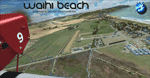
Waihi Beach (ICAO: NZWV) is a small airstrip north of Tauranga and near the small beach settlement of the same name, in the Bay of Plenty of New Zealand. It is a grass strip with offset thresholds giving usable landing lengths of 640m and 517m for RWY 13 and 31 respectively, a width of 55m and a group rating of 5. No night lighting or fuel is available. A very basic airstrip, there is only one recently built hanger and the airstrip is slowly being encroached on by
new housing developments. The airstrip itself is usually very sodden due to its low elevation but is a nice stop over for sightseeing from Tauranga and up the Coromandel peninsula.
The FSX model includes custom textures and models placed on a high resolution aerial image and a 15m mesh. It makes extensive use of items from the free VLC object libraries which are required to be installed (Available from www.vectorlandclass.co.nz Downloads menu). This scenery and
the VLC libraries have been funded by sales of VectorLandClass and although you do not need VLC to use it, your purchase helps further development.
| Filename: | NZWV__Waihi_Beach_Airfield_New_Zealand.zip |
| License: | Freeware, limited distribution |
| Added: | 1st November 2012, 10:01:38 |
| Downloads: | 1,006 |
| Author: | Tim Barnes / VectorLandClass |
| Size: | 11.13 MB |
| Category: X-Plane - Original Aircraft | |
| Piaggio P180 Avanti II |
|
Images related to this file:
File Description:
Features:
-Flight model within 10% of the real aircraft (as per manual);
-Autopilot operations as the real aircraft;
-Many functions and screen indications are SASL driven;
-X-Plane 10 64 bit full compatible;
-Main landing gear object has added (was missing for XP10 in the previous version);
-Electronic checklist in MFD;
-Real clock functions;
-Engine indication turn red when limits exceeded;
-UFMC and X-FMC config files are included. Those files have been adapted specially for this aircraft;
-New 2-page checklist to be printed in a single sheet;
-Updated Operating manual;
-You can use now the condition levers and flap lever by mouse.
PAY ATTENTION:
Use caution when using the throttles! As in the real aircraft, be advancing the throttles too full, torque limits can be exceeded by a lot!
PLEASE: Any questions or problems post them to the forum for this aircraft. I'm visiting it daily so I can respond as quick as possible.
At last, I want to THANK Tony Day, who, with his experience and work, helped me to make this aircraft as real as possible.
| Filename: | Piaggio_P180_Avanti_II.zip |
| License: | Freeware |
| Added: | 24th April 2013, 23:20:42 |
| Downloads: | 631 |
| Author: | Ilias Tselios |
| Size: | 49.42 MB |
| Category: Flight Simulator 2004 - Aircraft Repaints, Textures and Modifications | |
| NAC de Havilland DH-114 Heron 1B |
|
Images related to this file:
File Description: In 1957 they were written from use. One Heron was sold to the UK but sadly suffered a fatal crash on delivery. The other three, including ZK-BBM, were stored and in 1960 sold to Fiji Airways (later Air Pacific). In November 1975 Rotorua-based Air North bought ZK-BBM from Air Pacific. Already in 1978 she made her final landing and was stored for years at Ardmore Airfield. Classic Flyers NZ, based at Tauranga Airport acquired the Heron in March 1989. Since then she has been restored for static display at the Classic Flyers Museum.
You will need the DH-114 package available at Classic British Flightsim.
New Zealand National Airways Corporation (NAC) was the first operator to receive the DH-114. From 1952 till 1957 NAC flew with four Herons 1B's, which were acquired to serve those airfields which could not take NAC's standard airliner of those days, the Douglas DC-3. The Herons primarily flew across Cook Strait (Rongotai-Blenheim-Nelson) and later also to Hamilton and Rotorua. Since many modifications were required for this new airliner, the Herons proved too costly.
| Filename: | NAC_de_Havilland_DH114_Heron_1B.zip |
| License: | Freeware, limited distribution |
| Added: | 14th March 2014, 05:31:12 |
| Downloads: | 180 |
| Author: | Maarten Brouwer |
| Size: | 1.85 MB |
| Category: Flight Simulator 2004 - Aircraft Repaints, Textures and Modifications | |
| Alitalia "Positano" Boeing 777-243/ER (EI-ISO) |
|
Images related to this file:
File Description:

Alitalia is the flag carrier and national airline of Italy, which took over the name, the landing rights, many planes and some other assets from the liquidation process of the old Alitalia, Linee Aeree Italiane and all of Air One. The company has its head office in Fiumicino, Italy. Its main hub is Leonardo da Vinci-Fiumicino Airport, Rome, with the secondary hubs in Milan's Linate Airport and Malpensa Airport respectively.
Alitalia Boeing 777-243/ER. Alitalia livery painted on SkySpirit2012 Boeing 777-200 aircraft (model included). The textures are saved in 32bit format for quality graphics. Its features are Opening doors & Cargo doors, detailed textures, accurate paint, dynamic shine & effects, dynamic flexing wings that respond to turbulence, fully independent suspension, trim animation, gear steering, accurate flight dynamics, spoiler animation, reflective cockpit windows, crash effects, animated tilting bogies, full night lighting, ground service vehicles when cargo door open, transparent navigation light lenses and many more.
Visit my Facebook page "Sky Level Textures" for news, updates and previews on my future repaint projects. Thanks for downloading & Happy flying. HD GAMING EXPERIENCE inside. https://www.facebook.com/SkyLevelTextures
| Filename: | Alitalia_Positano_Boeing_777243ER_EIISO.zip |
| License: | Freeware |
| Added: | 30th May 2014, 21:47:19 |
| Downloads: | 1,488 |
| Author: | Giacomo Tomasini | Sky Level textures |
| Size: | 21.19 MB |
| Category: Flight Simulator X - AFCAD Files | |
| Stoe Creek Farm Airport (7NJ2), NJ |
|
File Description:
Located 01 miles S of Canton, New Jersey, Stoe Creek Farm is a private turf field 1725' in length. The runway is largely clear of obstructions although on approach for Runway 05 you will deal with 20-30' trees a few hundred feet back from the threshold and there are transmission towers along the approach corridor to Runway 23 you should watch out for. The runway does have edge lighting, although the windsock is not lit at night and daytime VFR is still recommended. There are no services for transient craft at this airfield. Since you will be landing on terrain, it is recommended that your mesh complexity is set as high as possible.
Scenery constructed with use of satellite images/streetview/aerial photos - the author has not been there in person.
This scenery is meant to be used in conjunction with MegaScenery Earth New Jersey/Delaware 004. It is not required, but apron use is minimized to allow satellite scenery to show through as much as possible, and objects are placed based on the MSE textures - lack of it may make scenery look out of place.
| Filename: | Stoe_Creek_Farm_Airport_7NJ2_NJ.zip |
| License: | Freeware |
| Added: | 14th February 2011, 18:32:24 |
| Downloads: | 163 |
| Author: | Drew Sikora |
| Size: | 700.91 KB |
| Category: Flight Simulator 2004 - Scenery | |
| PADL - Dillingham - Alaska, USA |
|
Images related to this file:
File Description:
Dillingham is a town with a population of around 2,300 at the southeast corner of the Bering Sea in Bristol Bay, 70 miles west of King Salmon. The town's economical well being is based on the commercial price of salmon and the numerous surrounding sport fishing lodges. FS9 shows the town as way more extensive than it is; the landclass textures correct this. The airport is a mile west of the town and has a single runway 6,400 feet long and orientated 01-19. There are scheduled passenger flights by Alaska Air (numerous in summer and non-existant in winter) and PenAir (year around) plus cargo flights by Everts and Northern Air Transport, and local scheduled flights by Grant Air; the AI includes these, plus GA. The GA gravel apron is behind the main apron and across a road, which is unusual. The parking on the asphalt apron is marked; in actuality there are no markings but landing at a field in FS9 that doesn't have a control tower leaves one wondering where to go; the six spots at the far northern end are unused by AI and free for visitors.
| Filename: | PADL__Dillingham__Alaska_USA.zip |
| License: | Freeware, limited distribution |
| Added: | 14th May 2015, 17:35:29 |
| Downloads: | 395 |
| Author: | Roger Wensley |
| Size: | 10.39 MB |


© 2001-2026 AVSIM Online
All Rights Reserved
Privacy Policy |