
Where Flight Simulation Enthusiasts Gather from Around the World!
AVSIM Library - Search Results

| Category: Flight Simulator X - Scenery | |
| RCMQ Ching Chuan Kang Air Base, Taiwan |

|
File Description:
This is an improvement of the default RCMQ Ching Chuan Kang Air Base, a dual-use airport in Central Taiwan that was built by the US in 1960s to serve as a divert base for B-52 bombers during Vietnam War. It is now the home of ROCAF 427th Tactical Fighter Wing flying F-CK-1 Ching-Kuo fighters. It is also served by airlines with flights to domestic destinations as well as Hongkong, China, and Vietnam. Satellite imagery available online were used to reposition taxiways, add and resize aprons, and add civilian gates and military aircraft parking. Prominent buildings were represented using stock library objects. Created using Airport Design Editor 1.39b by Mike Huang.
| Filename: | RCMQ_Ching_Chuan_Kang_Air_Base_Taiwan.zip |
| License: | Freeware |
| Added: | 7th February 2009, 19:31:44 |
| Downloads: | 2,691 |
| Author: | Mike Huang |
| Size: | 522.5 KB |
| Category: Civil Flight Simulators - Looking Glass Flight Unlimited 3 | |
| Outer terrain north expansion |
|
Images related to this file:
File Description:
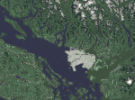
This outer terrain expansion kit will expand the OT area of flight3
from 41x56 tiles to 41x60 including the northern area of Vancouver up
to 50 degrees north.
This expansion has 2 parts:
1. OutTagD.tag : Vancouver area 4x12 tiles full configured
with terrain class and terrain hight.
2. OutTagE.tag : a needed space holder expansion of 29x4 flat forest
tiles to make the total rectangle of 41x60 tiles.
You don't need the line : use_loose_gtls in flt3.cfg
If you want to use use_loose_gtls then you must move all gtl files from
the folder GTLs into the outterr folder.
Vancouver Int. airport YVR is integrated as a simple example into this kit.
Select it using the Outter map.
| Filename: | Outer_terrain_north_expansion.zip |
| License: | Freeware, limited distribution |
| Added: | 2nd December 2009, 03:59:47 |
| Downloads: | 97 |
| Author: | Andre Meystre |
| Size: | 11.86 MB |
| Category: Flight Simulator 2004 - Scenery | |
| Circle Line Ferry Cruising New York Harbor |
|
Images related to this file:
File Description:
New York Harbor cruise - passing by Ellis Island, the Statue of Liberty and the Verrazano-Narrows Bridge - featuring the marvelous model of the Circle Line Ferry, created by Ron Jeffers. This package includes a custom Afcad - using the invisible runway and taxiway technique - and a flightplan which has the Ferry cruising around the harbor every 1/2 hour. Each cruise lasts approximately 30 minutes. This enhancement has been designed for use with the default FS2004 scenery. It has not been tested with Ultimate Terrain but may work in that environment if the Afcad is adjusted. Please unzip to a temporary folder and follow the simple installation instructions. Compiled for your flying enjoyment by
David "Opa" Marshall.
| Filename: | Circle_Line_Ferry_Cruising_New_York_Harbor.zip |
| License: | Freeware |
| Added: | 10th December 2009, 12:40:19 |
| Downloads: | 3,126 |
| Author: | David "Opa" Marshall |
| Size: | 330.07 KB |
| Category: Flight Simulator 2004 - AI Flight Plans | |
| Sky King Airlines Summer 2010 -- Updated |
|
Images related to this file:
File Description:

It was pointed out to me on the AIG Forums that I had two duplicate flightplans included in my previous upload. Also, thanks to Ghiom of the AIG Forum, I came into possession of a Sky King flight schedule for the month of July. Although my flightplans are based upon FlightAware for the period of June 27 - July 3, I have placed the correct aircraft at the correct hub. Additionally, for those who are adventurous, I've added N465AT to the plan. On July 1 & 2, this aircraft was in Greenland (yup, that Green Land the BIG Island) and flew over to Anchorage on July 3 and on to Miami on July 4.
| Filename: | Sky_King_Airlines_Summer_2010__Updated.zip |
| License: | Freeware |
| Added: | 16th July 2010, 02:09:19 |
| Downloads: | 520 |
| Author: | Steve Lewis |
| Size: | 3.25 KB |
| Category: Flight Simulator X - Aircraft Repaints, Textures and Modifications | |
| Cessna O-1A Birddog, RNoAF #7375 |
|
Images related to this file:
File Description:
The files contained in this zip are intended for the SibWings payware Cessna O-1 Birddog for FSX. These textures are intended for version 1.2 of the aircraft.
The aircraft as depicted, served with the Royal Norwegian Air Force in the late 80s. Colour-scheme worn is Olive Green Field Colour upper surfaces and Grey Field Colour (appears a bit tan) lower surfaces. Last 4 figures of the US Army serial number appears on the vertical tail. Last 3 was normally used but an F-5 had the serial 375. I also created new external bump maps using the method described in the FSX SDK. Instrument panel textures are also custom made.
| Filename: | Cessna_O1A_Birddog_RNoAF_7375.zip |
| License: | Freeware |
| Added: | 3rd September 2010, 02:10:59 |
| Downloads: | 180 |
| Author: | Dag Roger Stangeland |
| Size: | 3.98 MB |
| Category: Flight Simulator 2004 - Scenery | |
| St Marys Municipal KOYM |
|
Images related to this file:
File Description:
FS2004 Scenery - St. Marys Municipal Airport (IATA: STQ, ICAO: KOYM, FAA LID: OYM) is a city-owned public-use airport three miles (5 km) southeast of the central business district of St. Marys, a city in Elk County, Pennsylvania, United States..[1] This general aviation airport is located off South Michael Road in St. Marys. St. Marys Municipal Airport covers an area of 283 acres (115 ha) and contains one runway designated 10/28 with a 4,300 x 75 ft (1,311 x 23 m) asphalt pavement. For the 12-month period ending October 31, 2007, the airport had 6,730 aircraft operations, an average of 18 per day: 85% general aviation, 15% air taxi and
| Filename: | St_Marys_Municipal_KOYM.zip |
| License: | Freeware, limited distribution |
| Added: | 2nd November 2010, 01:35:14 |
| Downloads: | 311 |
| Author: | John B. Loney, Jr. |
| Size: | 947.83 KB |
| Category: Flight Simulator X - Scenery | |
| St Marys Municipal KOYM |
|
Images related to this file:
File Description:
FSX Scenery - St. Marys Municipal Airport (IATA: STQ, ICAO: KOYM, FAA LID: OYM) is a city-owned public-use airport three miles (5 km) southeast of the central business district of St. Marys, a city in Elk County, Pennsylvania, United States..[1] This general aviation airport is located off South Michael Road in St. Marys. St. Marys Municipal Airport covers an area of 283 acres (115 ha) and contains one runway designated 10/28 with a 4,300 x 75 ft (1,311 x 23 m) asphalt pavement. For the 12-month period ending October 31, 2007, the airport had 6,730 aircraft operations, an average of 18 per day: 85% general aviation, 15% air taxi and
| Filename: | St_Marys_Municipal_KOYM.zip |
| License: | Freeware, limited distribution |
| Added: | 2nd November 2010, 01:35:54 |
| Downloads: | 536 |
| Author: | John B. Loney, Jr. |
| Size: | 1.06 MB |
| Category: Flight Simulator 2004 - Aircraft Repaints, Textures and Modifications | |
| USAF Pilatus PC-12/ U-28A (319th SOS) |
|
Images related to this file:
File Description:
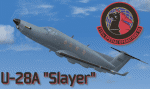
This packet contains a repaint of the PC-12 in the livery of USAF AFSOC, 1st SOW, 319th SOS, Hurlburt Field FL, c/n 05-0573. This is complete repaint the pilot and crew are repainted as-well. The U-28A utility aircraft provides intra-theater support for US special operations forces. The U-28A is the Air Force variant of the Pilatus PC-12 and was selected for its versatile performance characteristics and ability to operate from short and unimproved runway surfaces. The U-28A is also certified to land on dirt and grass strips. Texture only, to be used with the payware Pilatus PC-12 from Flight 1. http://www.flight1.com/
| Filename: | USAF_Pilatus_PC12_U28A_319th_SOS.zip |
| License: | Freeware, limited distribution |
| Added: | 8th January 2011, 18:59:55 |
| Downloads: | 335 |
| Author: | Marcel Ritzema |
| Size: | 3.43 MB |
| Category: Flight Simulator 2004 - Panels | |
| Panel for G4M1 Mitsubishi Betty FS2004 and FSX |
|
Images related to this file:
File Description:
FS2004/FSX panel with many additional views for the G4M1 Mitsubishi Betty bomber from Stuart Green, upgraded to FS2004/FSX by A.F.Scrub (Requires betty-1.zip). Features: 9 additional panel views for FS2004 or 7 aircraft cameras and 7 panel camera views for FSX. Regarding the animated Co pilot who climbs up to the opening roof window to give the pilot taxiing instructions, you can get that view forward and rearwards, see the working areas for the radiomen and the navigator, watch the animated rear, waist- or tailgunners (FSX). For FSX there are also 2 wingman views. Smoke and light effects for guns, bombs and flak puffs are included. Configuration from Erwin Welker.
| Filename: | Panel_for_G4M1_Mitsubishi_Betty_FS2004_and_FSX.zip |
| License: | Freeware |
| Added: | 22nd February 2011, 02:07:25 |
| Downloads: | 203 |
| Author: | Erwin Welker |
| Size: | 1.97 MB |
| Category: Flight Simulator X - Scenery | |
| Northeast New Jersey 5 Meter Mesh Terrain |
|
Images related to this file:
File Description:
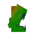
High Resolution Northeast New Jersey 5 Meter Mesh Terrain by Wally-Bob represents a significant improvement over FSX default 38 meter mesh terrain. The results are also dramatic compared to 10 meter compressed payware mesh as lossless compression compilation (read no data loss) is used. Lossless compiling produces renderings that have the Crispness of the Real World Terrain. Fly the Hudson River and view the Palisades as they are in real life, see the screen shots enclosed. High Quality 5 meter mesh terrain is a must have for mountainous areas especially where photo scenery is also used to render the virtual world. Manual includes FSX configuration and scenery installation tips. USGS LiDAR 1/9 Arc-Second source data.
| Filename: | Northeast_New_Jersey_5_Meter_Mesh_Terrain.zip |
| License: | Freeware, limited distribution |
| Added: | 26th February 2011, 21:35:52 |
| Downloads: | 1,101 |
| Author: | Walter Roberts |
| Size: | 135.89 MB |


© 2001-2026 AVSIM Online
All Rights Reserved
Privacy Policy |