
Where Flight Simulation Enthusiasts Gather from Around the World!
AVSIM Library - Search Results

| Category: Flight Simulator 2004 - Scenery | |
| Simpson Lake CWSL in Nunavut, Canada |

|
Images related to this file:
File Description:
This was a DEW line I Station in the lower reaches of the Boothia Peninsula, 80 miles south of Taloyoak and 40 miles east of Shepherd Bay. The station was closed in 1963 and the buldings and other items have been removed apart from the garage and some diesel tanks. A NWS automated station was opened there in 1991. The runway is still there and is just over 3,500 feet of gravel 100' wide, aligned 044T/224T, and at 790 feet ASL. There are no lights, signage, or windsock. This is one of the less interesting DEW line stations to visit and walk around.
| Filename: | Simpson_Lake_CWSL_in_Nunavut_Canada.zip |
| License: | Freeware, limited distribution |
| Added: | 24th November 2012, 02:53:06 |
| Downloads: | 210 |
| Author: | Roger Wensley |
| Size: | 929.41 KB |
| Category: Flight Simulator 2004 - Scenery | |
| Mackar Inlet CWMI in Nunavut, Canada |
|
Images related to this file:
File Description:
Mackar Inlet was a DEW line Auxiliary Station on the west shore of the Melville Peninsula, which is part of the northern Canadian mainland. The station was closed only in 1992, so it is relatively intact. Hall Beach is 120 miles to the east, on the eastern shore of the peninsula, and Kugaaruk is just over 100 miles to the west. The runway is still in good condition and is around 3,800 feet of gravel 110' wide, aligned 164T/344T and at 100 feet ASL. The station buildings are up on the hill at 1,350 feet ASL and 5 miles to the south. None of these DEW line stations are particularly impressive or even interesting. However, you can bet that any pilot flying regularly in the north along the coast knows where all these runways are, in case one of them suddenly becomes his favourite in the whole world just after the sudden silence. I should have mentioned a long time ago that to see the apron lights working (on my fields that HAVE apron lights) requires you to have the "lights_ss_v2" by Sidney Schwartz installed.
| Filename: | Mackar_Inlet_CWMI_in_Nunavut_Canada.zip |
| License: | Freeware, limited distribution |
| Added: | 2nd December 2012, 17:58:34 |
| Downloads: | 218 |
| Author: | Roger Wensley |
| Size: | 1.16 MB |
| Category: Flight Simulator 2004 - Scenery | |
| Hat Island CWHI in Nunavut, Canada |
|
Images related to this file:
File Description:
This was a DEW line I Station on Hat Island; the island is around 4 miles square and just under 50 miles southeast of Jenny Lind Island. The station was closed in 1963 and has now been totally dismantled and removed, a fairly easy task given the size. The runway is still there and is a shade over 3,000 feet of gravel 100' wide. There are no lights, signage, or windsock. A North Warning System station was built in 1991 on the site of the I Station, just north of the runway. Most of these DEW line stations are not particularly impressive or even interesting. However, you can bet that any pilot flying regularly in the north along the coast knows where all these runways are, in case one of them suddenly becomes his favourite in the whole world just after the sudden silence.
| Filename: | Hat_Island_CWHI_in_Nunavut_Canada.zip |
| License: | Freeware, limited distribution |
| Added: | 15th November 2012, 13:55:41 |
| Downloads: | 196 |
| Author: | Roger Wensley |
| Size: | 1.08 MB |
| Category: Flight Simulator 2004 - Scenery | |
| Sturt Point CWSP in Nunavut, Canada |
|
Images related to this file:
File Description:
Sturt Point was a DEW line I Station on the south coast of Victoria Island, 50 miles east of Cambridge Bay. It was closed in 1963 but remains in place, though a 5 man I Station has such a small impact on its surroundings that it is hardly visible. The runway is 3,420 feet of gravel aligned 117T/297T, and there are no lights, signage, or windsock, but there are ruts in the gravel. A North Warning System station was built 15 miles inland and closer to Cambridge Bay, operating from 1991 onwards. This has a short (1,280'?) gravel runway aligned 138T/318T (and named CWSX here). No ruts in the gravel, but also still no lights, signage, or windsock.
| Filename: | Sturt_Point_CWSP_in_Nunavut_Canada.zip |
| License: | Freeware, limited distribution |
| Added: | 11th November 2012, 21:07:18 |
| Downloads: | 208 |
| Author: | Roger Wensley |
| Size: | 1.35 MB |
| Category: Flight Simulator 2004 - Scenery | |
| Hall Beach CYUX in Nunavut, Canada |
|
Images related to this file:
File Description:
Hall Beach is on the Melville Peninsula, part of the mainland of Canada, south and west of Baffin Island. It is around 40 miles south of Igloolik and 50 miles west of Rowley, both of them my previous posts. The airfield was built to support the construction and operation of a main DEW line radar station and to support the rest of the associated chain. Because of the employment opportunities this brought, a village developed nearby. The airfield continues in regular use and the runway, though still gravel, is 5,400' long and 150' wide and lighted; the alignment is 124T and 304T as this is in northern domestic airspace and bearings are given as 'true" and not "magnetic". There are scenery folders for the village, roads, grass, etc, and AI for two airlines with regular service to Hall Beach.
| Filename: | Hall_Beach_CYUX_in_Nunavut_Canada.zip |
| License: | Freeware, limited distribution |
| Added: | 22nd November 2011, 14:33:08 |
| Downloads: | 458 |
| Author: | Roger Wensley |
| Size: | 3.83 MB |
| Category: Flight Simulator 2004 - Scenery | |
| Tuktoyaktuk CYUB in Northwest Territories, Canada |
|
Images related to this file:
File Description:
Tuktoyaktuk is on the northern coast of Canada, 70 miles north of Inuvik and to the east of the Mackenzie River delta. It has a population of around 900 and because of its natural harbour is a centre for oil exploration activity on the surrounding land and on the Beaufort Sea, with sizeable but now under-used yards dating back to the peak of activity in the late 1970's. On land work is restricted to the winter half of the year, as only the freeze-up makes it possible to move on land with heavy equipment, and during the winter further supples are driven over an ice road from Inuvik up to Tuk. The ice-free summer months are used for floating equipment from Yuk along the coast on barges and then up the rivers to inland sites in preparation for the winter activity. Before the oil there was a DEW line station here, and there is still an automated station on the same site and included here, as are the yards. The airfield is on the coast close to the town and the yards, at 15' ASL. The gravel runway 09/27 is 5,000' feet long and 150' wide; both thresholds are displaced by 200', but of course there are no markings on the gravel. The large apron is on the north side at the centre of the runway and is large enough to accomodate several large planes. Inuvik revised should be installed first, now Tuk, then last of the three Sachs Harbour which has AI for Aklak Airlines flights (operated by Kenn Borek) for all three airfields. There is a separate AI file included here, featuring freight delivery by Buffalo Airways and small planes.
| Filename: | Tuktoyaktuk_CYUB_in_Northwest_Territories_Canada.zip |
| License: | Freeware, limited distribution |
| Added: | 14th May 2012, 17:19:20 |
| Downloads: | 620 |
| Author: | Roger Wensley |
| Size: | 8.99 MB |
| Category: Flight Simulator X - AI Aircraft | |
| BN-2 Islander in OLT Colours |
|
Images related to this file:
File Description:
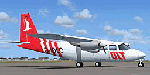
4 paints for HTAI Britten Norman Islanders, flying for OLT (Ostfriesische Lufttransport GmbH) in Germany. Flightplans also available at this site.
| Filename: | BN2_Islander_in_OLT_Colours.zip |
| License: | Freeware |
| Added: | 6th June 2010, 08:24:01 |
| Downloads: | 13,463 |
| Author: | Johann Alberts |
| Size: | 673.91 KB |
| Category: Flight Simulator 2004 - Scenery | |
| KCMI Willard airport in Champaign, IL |
|
File Description:
This is a new and improved version of KCMI Willard airport in Champaign, IL. It is a close to the real airport as I can manage to do, some minor glitches like the power lines not lining up exactly. But it finally looks more like the real thing than what Microsoft's idea of what our airport looks like. You will need EZ-Scenery scenery add on in order to see all of the eye candy.
| Filename: | KCMI_Willard_airport_in_Champaign_IL.zip |
| License: | Freeware |
| Added: | 29th January 2006, 22:07:43 |
| Downloads: | 1,529 |
| Author: | Lawrence F Dorries |
| Size: | 1.76 MB |
| Category: Flight Simulator 2004 - Scenery | |
| Kuujjuarapik CYGW in northern Quebec, Canada |
|
Images related to this file:
File Description:
Kuujjuarapik is in northern Quebec at the southern end of Hudson Bay, 90 miles east of James Bay and on the north shore of the Great Whale River; Kuujjuarapik means Small Great River in Inuktitut. Once again the Hudson Bay trading post that opened (in 1820) was the catalyst for the establishment of first a seasonal encampment and then the beginnings of a town in the late 1930's.
The two adjacent villages that now form the town have a total population (mainly Cree and Inuit) of around 1,500. When the Quebec hydo-electric project was under construction in the early 1980's a large portion of the Inuit population voted to move to a new settlement called Umiujaq (my post) 100 miles to the north.
The airport is to the west of the town, between the town and the sea. The gravel and sand runway (which I have made as gravel as there is no convincing way to mix the two) is 5,500 feet long, 150 feet wide, and aligned 17/35, which is approximately parallel to the coast. There is fuel available, both 100LL and JetA, delivered by truck. The AI included here is for Air Inuit and Wasaya, with Air Inuit making three flights per day plus a fourth flight by the Air Inuit Twotter C-GNDO that is based at the airport, and private flights by various aircraft. Yes, there really is a golf course to the south of the airport, and the last thing to note is that Kuujjuarapik has a mandatory radio frequency and that taking into consideration the scheduled flights I have included the tower radio frequency that makes this a controlled airport in FS9.
| Filename: | Kuujjuarapik_CYGW_in_northern_Quebec_Canada.zip |
| License: | Freeware, limited distribution |
| Added: | 16th February 2013, 00:33:20 |
| Downloads: | 307 |
| Author: | Roger Wensley |
| Size: | 2.8 MB |
| Category: Flight Simulator X - AFCAD Files | |
| Ouagadougou airport (DFFD) in Burkina Faso |
|
File Description:
The airport of Ouagadougou is the only international airport of the country of Burkina Faso in Africa.
Here is the AFCAD update of FSX stock airport of Ouagadougou. Aprons, Runways and taxiways now very close to real.
| Filename: | Ouagadougou_airport_DFFD_in_Burkina_Faso.zip |
| License: | Freeware |
| Added: | 20th November 2017, 18:32:51 |
| Downloads: | 1,079 |
| Author: | Giannis Dedes |
| Size: | 7.34 KB |


© 2001-2026 AVSIM Online
All Rights Reserved
Privacy Policy |