
Where Flight Simulation Enthusiasts Gather from Around the World!
AVSIM Library - Search Results

| Category: Flight Simulator 2004 - Scenery | |
| Quesnel CYQZ in British Columbia, Canada |

|
File Description:
Quesnel is around 65 miles south of Prince George, at the junction of the Fraser and Quesnel Rivers. It has a population of less than 10,000 and is reliant on the timber industry and tourism (hiking, canoeing, fishing, hunting) in the surrounding area for it's income. The date for this scenery is, once again, around 2010. The airport is on the northern edge of the town and has a runway of 5,500 feet aligned 13-31 with PAPI at both ends. Because of the surrounding terrain runway 13 has a right hand VFR circuit. Parking for GA aircraft is organised by the Quesnel Flying Club in a grassed area adjacent to the concrete and asphalt apron. Also adjacent to the apron is the extraordinary terminal building, and next to that is the comparatively very ordinary building that houses the flying club. There are the usual airfield and plane maintenance buildings, and at the southern end of the runway two private hangars. There is also a Fire Base housing personnel that either drive from the base or fly by helicopter to deal with local forest fires at ground level. The AI included here is for Central Mountain Air and GA. I added to and adjusted the CYXS AI so that there are GA flights between CYXS and CYQZ, so just replace your current CYXS AI with this new one. Please email me if you find faults, such as a plane without textures. Note my newish email address at the end of these notes.
| Filename: | Quesnel_CYQZ_in_British_Columbia_Canada.zip |
| License: | Freeware, limited distribution |
| Added: | 19th December 2022, 19:27:14 |
| Downloads: | 148 |
| Author: | Roger Wensley |
| Size: | 9.49 MB |
| Category: Flight Simulator X - Scenery | |
| Santa Lucia airport (MMSM) in Mexico |
|
Images related to this file:
File Description:
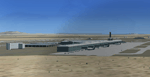
Santa Lucia airport is a new facility serving Mexico City, opened in 2022. The FSX scenery of this airport was built with the Airport Design Editor program, based on satellite images from Google Earth and on actual Jeppesen charts. The buildings are made with GMAX.
| Filename: | Santa_Lucia_airport_MMSM_in_Mexico.zip |
| License: | Freeware |
| Added: | 23rd December 2022, 21:34:40 |
| Downloads: | 755 |
| Author: | Winfried Orthmann |
| Size: | 5.49 MB |
| Category: Flight Simulator 2004 - Scenery | |
| North Manitoba Airfields 20# in Canada |
|
Images related to this file:
File Description:
This is the Google Earth screenshot that I meant to include with the post of the 20 airfields in northern Manitoba to show their locations.
| Filename: | North_Manitoba_Airfields_20_in_Canada.zip |
| License: | Freeware |
| Added: | 8th April 2021, 05:35:52 |
| Downloads: | 60 |
| Author: | Roger Wensley |
| Size: | 785.95 KB |
| Category: Flight Simulator 2004 - Scenery | |
| North Manitoba Airfields 20# in Canada |
|
Images related to this file:
File Description:
These are 20 airfields in north Manitoba, Canada. They were all previously posted individually But not on Avsim. There is a screenshot of Google Earth showing their names and locations amid other airfields. "Lodge" indicates the fact that there is a fishing lodge and airfield at that location but that I have no information to enable me to make the scenery. There are also some airfields that I downloaded years ago and are part of my FS9 set up, such as Flin Flon. There is AI with the supply flights that are vital for these isolated outposts. Gillam is a northern airfield that is connected to the rest of Canada by a railroad that continues north to Churchill Manitoba on the Hudson Bay coast and is used for grain exports during the ice-free summer months. A large number of the supply flights originate from Gillam. You may wonder about the numbers of fuel tanks at these airfields. These are not for the airfield use, they are for the settlement to be able to generate electricity and also to provide heating in the winter. If you find an error email me please, and note that my email address has been changed to rogwens at Gmail dot com.
| Filename: | North_Manitoba_Airfields_20_in_Canada.zip |
| License: | Freeware, limited distribution |
| Added: | 7th April 2021, 17:09:34 |
| Downloads: | 84 |
| Author: | Roger Wensley |
| Size: | 35.99 MB |
| Category: Flight Simulator 2004 - Gauges | |
| Missing Gear Gauge in Nimrod MR2 |
|
File Description:
This installs the gear gauge omitted from the Nimrod MR2
| Filename: | Missing_Gear_Gauge_in_Nimrod_MR2.zip |
| License: | Freeware |
| Added: | 29th November 2004, 14:28:39 |
| Downloads: | 5,918 |
| Author: | Brian Franklin |
| Size: | 61.45 KB |
| Category: Flight Simulator X - Scenery | |
| Roros Airport (ENRO) in Roros, Norway |
|
Images related to this file:
File Description:
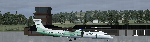
Roros Airport (IATA: RRS, ICAO: ENRO; Norwegian: Roros lufthavn) is a regional airport located 2 kilometers (1.2 mi) from the town of Roros, Norway. The asphalt runway has the physical dimensions 1,740 by 40 meters (5,710 by 130 ft) and is aligned 14/32. Scheduled services are provided to Oslo by Wideroe. The main general aviation user is Rørosfly, a pilot school, and the aviation club Roros Flyklubb. (Source of information: Wikipedia August 20, 2016)
| Filename: | Roros_Airport_ENRO_in_Roros_Norway.zip |
| License: | Freeware |
| Added: | 20th August 2016, 15:40:59 |
| Downloads: | 685 |
| Author: | Hans Christian Knudsen and Knudsenair Simulations |
| Size: | 121.82 KB |
| Category: Flight Simulator 2004 - Scenery | |
| Cape Dyer CWFD in Nunavut, Canada |
|
Images related to this file:
File Description:
Cape Dyer is on the southeast corner of Baffin Island, around 120 miles east of Pangnirtung at approximately N66 45 W61 30. There is a fine view north up the Davis Strait between Baffin Island and Greenland, and this is the whole reason for the airfield's existance as it was built to support the construction and operation of a DEW line radar station, which has now been updated to a North Warning System site. There are two camps; the upper camp is on the east side of the Cape and is where the radars are located, linked by a gravel road to the lower camp, which is on the west and more sheltered side of the Cape on the clifs above Sunneshine Fjord. The runway is 5,000' of 150' wide gravel, and it is lighted and at 1,320' feet ASL. Cape Dyer is now listed as abandoned in the Canada Flight Supplement. It is, however, still there and presumably is still used for access to the North Warning System equipment, which is automated and generally unmanned. The buildings were modeled for this scenery and include a hanagar large enough to accommodate a C-130. Ultimate Terrain is not required as it does not cover northern Canada.
| Filename: | Cape_Dyer_CWFD_in_Nunavut_Canada.zip |
| License: | Freeware, limited distribution |
| Added: | 21st June 2011, 19:30:07 |
| Downloads: | 491 |
| Author: | Roger Wensley |
| Size: | 1.9 MB |
| Category: Flight Simulator X - Scenery | |
| Merida Airport (MMMD) in Yucatan, Mexico |
|
Images related to this file:
File Description:
This is a scenery of Manuel Crescencio Rejón International Airport (ICAO: MMMD) in Merida, Mexico, for FSX. It was made with the Airport Design Editor program. Airport layout and approaches correspond to the latest Jeppesen charts. Buildings are made with GMAX.
| Filename: | Merida_Airport_MMMD_in_Yucatan_Mexico.zip |
| License: | Freeware, limited distribution |
| Added: | 7th December 2022, 16:58:57 |
| Downloads: | 327 |
| Author: | Winfried Orthmann |
| Size: | 2.61 MB |
| Category: Flight Simulator 2004 - Aircraft Repaints, Textures and Modifications | |
| PBY Catalina in fictional "Numa" scheme |
|
Images related to this file:
File Description:
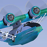
Re-uploaded scheme for the ALPHASIM PBY Catalina in fictional "Numa" scheme
| Filename: | PBY_Catalina_in_fictional_Numa_scheme.zip |
| License: | Freeware |
| Added: | 15th May 2010, 02:05:37 |
| Downloads: | 383 |
| Author: | Repaints by pierre lheureux - Plane by Alphasim |
| Size: | 4.14 MB |
| Category: Flight Simulator X - Missions | |
| AlsaceTour3.zip |
|
File Description:
Intermediate helicopter mission. Take passengers on an aerial tour of the Alsace Region of France. This is tour 3 of 4. Requires an addtional download of the Alsace scenery if you did not get it for tour 1 or 2. Instructions included in the zip file.
| Filename: | AlsaceTour3zip.zip |
| License: | Freeware |
| Added: | 2nd October 2020, 18:26:41 |
| Downloads: | 101 |
| Author: | helomissionman |
| Size: | 15.7 MB |


© 2001-2026 AVSIM Online
All Rights Reserved
Privacy Policy |