
Where Flight Simulation Enthusiasts Gather from Around the World!
AVSIM Library - Search Results

| Category: Flight Simulator X - AFCAD Files | |
| Winchelsea Airport (8NJ0), NJ |

|
File Description:
Located 01 miles W of Port Republic, New Jersey, Winchelsea Airport is a private turf strip. Pay very, very close attention to the published length of this grass runway: 980'. This is in addition to 50ft tree obstacles at either end of the runway. Double-check your aircraft's takeoff and landing distances before visiting this airfield!! A strong headwind is suggested for operations out of this location. Also take note the traffic patterns vary for each runway. There are no transient services offered and the airport is not lit at night so daytime VFR use only is suggested. There is no hard surface runway so set your terrain mesh slider as high as you can for the best effect of landing on terrain.
Scenery constructed with use of satellite images/streetview/aerial photos - the author has not been there in person.
This scenery is meant to be used in conjunction with MegaScenery Earth New Jersey/Delaware 003. It is not required, but apron use is minimized to allow satellite scenery to show through as much as possible, and objects are placed based on the MSE textures - lack of it may make scenery look out of place.
| Filename: | Winchelsea_Airport_8NJ0_NJ.zip |
| License: | Freeware |
| Added: | 24th March 2011, 19:28:46 |
| Downloads: | 162 |
| Author: | Drew Sikora |
| Size: | 396.23 KB |
| Category: Flight Simulator X - AFCAD Files | |
| High Meadow Farms Airport (9NJ8), NJ |
|
File Description:
Located 02 miles SW of Hope, New Jersey on 88 acres of land, High Meadow Farms Airport is a private turf strip 1850' in length. Take notice that the traffic pattern for Runway 13 is Right while the pattern for Runway 31 is Left. There is no hard surface runway so have your terrain mesh set as high as possible. There is tie down space available next to the paved area by the other parked aircraft however there are no official services offered for transient aircraft. This is a great airport to depart from to see some nice hilly terrain in northern NJ, it is just a few miles from the Delaware River Water Gap.
Scenery constructed with use of satellite images/streetview/aerial photos - the author has not been there in person.
This scenery is meant to be used in conjunction with MegaScenery Earth New York 007. It is not required, but apron use is minimized to allow satellite scenery to show through as much as possible, and objects are placed based on the MSE textures - lack of it may make scenery look out of place.
| Filename: | High_Meadow_Farms_Airport_9NJ8_NJ.zip |
| License: | Freeware |
| Added: | 7th April 2011, 00:16:49 |
| Downloads: | 200 |
| Author: | Drew Sikora |
| Size: | 641 KB |
| Category: Flight Simulator 2002 - Scenery | |
| Mercier bridge, Montreal, Quebec, Canada. for those WITHOUT the CYHU 29-Apr-2004 kits. |
|
File Description:
Re-upload. It is imperative to install Gilles Gauthier's MESHes, from
library.avsim.net/search.php?CatID=root&SearchTerm=gilles+gauthier&Sort=Added&ScanMode=1&Go=Change+View
What's listed for FS2002 is OK for 2004. NOT reverse.
FS2004, get Some Islands of St.Lawrence river & Quebec Terrain Mesh (1 @ 5).
FS2002, get the kit CYHU, or MERCIER2 & Quebec Terrain Mesh (1 @ 5).
| Filename: | Mercier_bridge_Montreal_Quebec_Canada_for_those_WI.zip |
| License: | Freeware |
| Added: | 1st June 2010, 01:28:16 |
| Downloads: | 481 |
| Author: | Jean Morissette |
| Size: | 23.55 KB |
| Category: Civil Flight Simulators - Looking Glass Flight Unlimited 3 | |
| Fence 30 |
|
File Description:
This is a fence for Looking Glass Studios Flight Unlimited 3, Seattle Region for use on un-even, hilly terrain.
| Filename: | Fence_30.zip |
| License: | Freeware |
| Added: | 3rd August 2002, 20:49:17 |
| Downloads: | 158 |
| Author: | Jim Buffett |
| Size: | 36.67 KB |
| Category: Flight Simulator 2004 - Scenery | |
| Raiatea Airport, Uturoa, French Polynesia, NTTR |
|
File Description:
This is a total update of the airport at Raiatea in French Polynesia. It is the largest airport in the Society Islands outside of Tahiti. This scenery contains a new realistic terminal, the rustic hangar area, and the tower, along with tropical landscaping, and an afcad by Ray Smith. This island along with all of the Society Islands of French Polynesia are among the most beautiful paradises on Earth. They can all be greatly enhanced by using the terrain mesh by John Applegate, and Rolf Keibel, updated for FS2004 under the name of fpsimesh.zip. There are also some new landclass files for this area which will also greatly enhance this forgotten area in FS, and their location is available in the read me file of this scenery.
| Filename: | Raiatea_Airport_Uturoa_French_Polynesia_NTTR.zip |
| License: | Freeware |
| Added: | 21st May 2004, 15:24:33 |
| Downloads: | 10,659 |
| Author: | Bill Melichar |
| Size: | 3.15 MB |
| Category: Flight Simulator X - Scenery | |
| Mesh South America / MeSA Islands |
|
File Description:
FSX Mesh South America Project:
This terrain mesh file is a part of a whole project covering all the Continent of South America and some islands, divided in tiles identified in a map by its column (letters) and rows (numbers).
Those files were multi-LOD compiled from 90m SRTM2 source data, reprocessed with 3DEM to remove voids and spikes, providing a 76.4m (LOD9) horizontal resolution topography intended for use only in FSX updated with SP1.
Although not well documented, to improve performance, the updated FSX loads DEM files in threads and only the closer terrain (about 5 NM from the point of view) is rendered in high detail, while at far distances FSX shows up its default low resolution mesh, when there is not a third part terrain mesh compiled in all others intermediate level of details (multi-LOD).
THIS FILE: FSX_MeSA_Islands (Ascencion, Georgia, Gough and Trindade)
| Filename: | Mesh_South_America__MeSA_Islands.zip |
| License: | Freeware |
| Added: | 10th June 2007, 23:59:44 |
| Downloads: | 1,141 |
| Author: | Hely Heck Junior and José Lôbo |
| Size: | 2.75 MB |
| Category: Flight Simulator X - Scenery | |
| Nunavik project for Ultimate Terrain X Canada |
|
Images related to this file:
File Description:
Scenery files for 16 « forgotten » towns located in the northen part of Quebec, the Nunavik. Must have Ultimate Terrain X Canada installed. Airports modified to permit helicopter traffic and Air Inuit and First Air flights. More info in the *.rtf files.
| Filename: | Nunavik_project_for_Ultimate_Terrain_X_Canada.zip |
| License: | Freeware |
| Added: | 6th November 2009, 23:52:24 |
| Downloads: | 873 |
| Author: | Pierre Fauteux |
| Size: | 6.24 MB |
| Category: Civil Flight Simulators - Looking Glass Flight Unlimited 3 | |
| FU3 Outer Terrain GTL Tile Editor v2.0 |
|
Images related to this file:
File Description:
This spreadsheet allows you to view, edit and save changes to the outer terrain's GTL tiles. Tiles are loaded into a 256x256 grid and the 13 default terrain textures are represented by cell background colours, i.e. the Mesa texture is represented by a reddish-brown background colour. The controls for loading and saving tiles are deliberately located on a separate worksheet. When loading and saving tiles I recommend that you do NOT select the main FU3 GTL Editor worksheet until a message box informs you that the load/save has finished. Otherwise, load/saves times (approx. 30 seconds for an average tile) will increase dramatically if you watch the tile while it is being populated or saved.
This 2.0 version also allows you to load a tile's terrain elevation. This is useful because the rules-based approach to modifying the OT was based on altitude constraints and it helps to be able to view the elevation (on the same scale as the tile itself) when modifying the terrain. However, in order to load the elevation you must first load the corresponding GTL tile. There is no provision to modify or save the elevation, because we already have Andre's excellent tools for that.
A complete map of the outer terrain's 2296 GTL files (plus Andre's 164 tile extension to the north) is provided in a separate worksheet. This includes a search facility you can use to identify tiles based on FU3 world co-ordinates.
| Filename: | FU3_Outer_Terrain_GTL_Tile_Editor_v20.zip |
| License: | Freeware |
| Added: | 26th December 2009, 02:11:13 |
| Downloads: | 49 |
| Author: | Jonathan Stonehouse |
| Size: | 103.36 KB |
| Category: Civil Flight Simulators - Looking Glass Flight Unlimited 3 | |
| Outer Terrain GTL Grid Structure Map v2.0 |
|
Images related to this file:
File Description:
This version of my GTL grid structure map includes Andre's new outer terrain area north of Seattle and adds a search facility, which enables you to search for a tile using FU3 world co-ordinates. To find out the world co-ordinates of any OT area simply open Fled, set the top-down view to the latitude/longitude of the area you're interested in and click the latitude/longitude figures that appear in the bottom left hand corner of the screen. The latitude/longitude figures will disappear and be replaced by FU3 world co-ordinates as easting and northing values. Enter these values into my FU3 GTL Map, click the button and the spreadsheet will map these co-ordinates to the correct tile and return the tile name. If you don't know the latitude/longitude of the area you're interested in then you can always obtain this from within the game itself. Just start a flight in the area you're interested in and press Ctrl-z at any time to enter Zoar mode. This will pause the game and display the current latitude/longitude in the top left hand corner of the screen.
| Filename: | Outer_Terrain_GTL_Grid_Structure_Map_v20.zip |
| License: | Freeware |
| Added: | 29th December 2009, 23:16:52 |
| Downloads: | 35 |
| Author: | Jonathan Stonehouse |
| Size: | 198.97 KB |
| Category: Flight Simulator 2004 - Scenery | |
| Vancouver Default Object Corrections for Ultimate Terrain |
|
Images related to this file:
File Description:
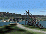
The default shorelines that come with Microsoft Flight Simulator 2004 are inaccurately placed. Consequently roads and other features are misplaced. Ultimate Terrain (R) from Flight One Software corrects this, however the Microsoft default objects are then misplaced. This software corrects the Lions Gate Bridge, Canada Place, Harbour Centre, Burrard Bridge, Science World and BC Place Stadium. Further it excludes a number of generic MS buildings that are now placed in False Creek. For developers, the XML code is included. Users may delete this file. Ultimate Terrain required. By Jon Patch
| Filename: | Vancouver_Default_Object_Corrections_for_Ultimate_.zip |
| License: | Check within download |
| Added: | 5th May 2010, 21:43:07 |
| Downloads: | 3,518 |
| Author: | Jon Patch |
| Size: | 288.76 KB |


© 2001-2026 AVSIM Online
All Rights Reserved
Privacy Policy |