
Where Flight Simulation Enthusiasts Gather from Around the World!
AVSIM Library - Search Results

| Category: Flight Simulator X - Scenery | |
| Mesh South America / MeSA Islands |

|
File Description:
FSX Mesh South America Project:
This terrain mesh file is a part of a whole project covering all the Continent of South America and some islands, divided in tiles identified in a map by its column (letters) and rows (numbers).
Those files were multi-LOD compiled from 90m SRTM2 source data, reprocessed with 3DEM to remove voids and spikes, providing a 76.4m (LOD9) horizontal resolution topography intended for use only in FSX updated with SP1.
Although not well documented, to improve performance, the updated FSX loads DEM files in threads and only the closer terrain (about 5 NM from the point of view) is rendered in high detail, while at far distances FSX shows up its default low resolution mesh, when there is not a third part terrain mesh compiled in all others intermediate level of details (multi-LOD).
THIS FILE: FSX_MeSA_Islands (Ascencion, Georgia, Gough and Trindade)
| Filename: | Mesh_South_America__MeSA_Islands.zip |
| License: | Freeware |
| Added: | 10th June 2007, 23:59:44 |
| Downloads: | 1,141 |
| Author: | Hely Heck Junior and José Lôbo |
| Size: | 2.75 MB |
| Category: Flight Simulator X - Sounds | |
| Croatia Airlines Cabin Announcements - Dash 8 Q400 - v1.4 |
|
Images related to this file:
File Description:

This zip file contains Croatia Airlines ( Star Alliance ) announcements and music sound files with included written transcript CRO & ENG of audio files for the fantastic Majestic Software Dash 8-Q400 which from version 1.00803 and above supports the livery-specific announcements as special feature. This is unofficial modification to Majestic Software's Dash-8 Q400.
| Filename: | Croatia_Airlines_Cabin_Announcements__Dash_8_Q400_.zip |
| License: | Freeware |
| Added: | 24th May 2015, 12:51:19 |
| Downloads: | 1,951 |
| Author: | Davorin Robotic |
| Size: | 30.86 MB |
| Category: Flight Simulator X - AFCAD Files | |
| Winchelsea Airport (8NJ0), NJ |
|
File Description:
Located 01 miles W of Port Republic, New Jersey, Winchelsea Airport is a private turf strip. Pay very, very close attention to the published length of this grass runway: 980'. This is in addition to 50ft tree obstacles at either end of the runway. Double-check your aircraft's takeoff and landing distances before visiting this airfield!! A strong headwind is suggested for operations out of this location. Also take note the traffic patterns vary for each runway. There are no transient services offered and the airport is not lit at night so daytime VFR use only is suggested. There is no hard surface runway so set your terrain mesh slider as high as you can for the best effect of landing on terrain.
Scenery constructed with use of satellite images/streetview/aerial photos - the author has not been there in person.
This scenery is meant to be used in conjunction with MegaScenery Earth New Jersey/Delaware 003. It is not required, but apron use is minimized to allow satellite scenery to show through as much as possible, and objects are placed based on the MSE textures - lack of it may make scenery look out of place.
| Filename: | Winchelsea_Airport_8NJ0_NJ.zip |
| License: | Freeware |
| Added: | 24th March 2011, 19:28:46 |
| Downloads: | 162 |
| Author: | Drew Sikora |
| Size: | 396.23 KB |
| Category: Flight Simulator X - AFCAD Files | |
| High Meadow Farms Airport (9NJ8), NJ |
|
File Description:
Located 02 miles SW of Hope, New Jersey on 88 acres of land, High Meadow Farms Airport is a private turf strip 1850' in length. Take notice that the traffic pattern for Runway 13 is Right while the pattern for Runway 31 is Left. There is no hard surface runway so have your terrain mesh set as high as possible. There is tie down space available next to the paved area by the other parked aircraft however there are no official services offered for transient aircraft. This is a great airport to depart from to see some nice hilly terrain in northern NJ, it is just a few miles from the Delaware River Water Gap.
Scenery constructed with use of satellite images/streetview/aerial photos - the author has not been there in person.
This scenery is meant to be used in conjunction with MegaScenery Earth New York 007. It is not required, but apron use is minimized to allow satellite scenery to show through as much as possible, and objects are placed based on the MSE textures - lack of it may make scenery look out of place.
| Filename: | High_Meadow_Farms_Airport_9NJ8_NJ.zip |
| License: | Freeware |
| Added: | 7th April 2011, 00:16:49 |
| Downloads: | 200 |
| Author: | Drew Sikora |
| Size: | 641 KB |
| Category: Flight Simulator 2004 - Scenery | |
| Raiatea Airport, Uturoa, French Polynesia, NTTR |
|
File Description:
This is a total update of the airport at Raiatea in French Polynesia. It is the largest airport in the Society Islands outside of Tahiti. This scenery contains a new realistic terminal, the rustic hangar area, and the tower, along with tropical landscaping, and an afcad by Ray Smith. This island along with all of the Society Islands of French Polynesia are among the most beautiful paradises on Earth. They can all be greatly enhanced by using the terrain mesh by John Applegate, and Rolf Keibel, updated for FS2004 under the name of fpsimesh.zip. There are also some new landclass files for this area which will also greatly enhance this forgotten area in FS, and their location is available in the read me file of this scenery.
| Filename: | Raiatea_Airport_Uturoa_French_Polynesia_NTTR.zip |
| License: | Freeware |
| Added: | 21st May 2004, 15:24:33 |
| Downloads: | 10,659 |
| Author: | Bill Melichar |
| Size: | 3.15 MB |
| Category: Flight Simulator 2004 - Scenery | |
| Private Strips Vol.3 - Grass Strips |
|
File Description:
A collection of 50+ mostly obscure and inconspicuous grass strips from around the country for FS2004, (plus a few with a bit more detail). The altitudes and alignments have been adjusted to suit the "Visual Flight" UK VFR Scenery and VFR Terrain.
| Filename: | Private_Strips_Vol3__Grass_Strips.zip |
| License: | Freeware, limited distribution |
| Added: | 10th August 2006, 01:41:18 |
| Downloads: | 895 |
| Author: | Chris Eve |
| Size: | 99.09 KB |
| Category: Flight Simulator X - Scenery | |
| Kwinamass River dirt strips |
|
File Description:
Dirt strips and seaplane docks between Prince Rupert CYPR and Nass Bay along the beautiful north coast of British Columbia. Great fun flying for Challenger Ultralight and small bush planes. For use with Ultimate Terrain Canada FSX only. Freeware by Doug Keech.
| Filename: | Kwinamass_River_dirt_strips.zip |
| License: | Freeware |
| Added: | 21st December 2008, 08:38:49 |
| Downloads: | 892 |
| Author: | Doug Keech |
| Size: | 1011.17 KB |
| Category: Flight Simulator X - Scenery | |
| CJCR update Piano FSX landclass towns |
|
Images related to this file:
File Description:
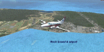
CJCR update
This update adds landclass towns from Rock Sound and south
to the FSX default terrain. Towns
added are:Rock Sound, Greencastle,
Princess Cays Beach, Princess Cays,
Freetown (MYZ2) improvements also
to CJCR with fencing,
GA terminal, lighting and more.
jimmy R martin
| Filename: | CJCR_update_Piano_FSX_landclass_towns.zip |
| License: | Freeware |
| Added: | 17th July 2010, 23:35:09 |
| Downloads: | 1,136 |
| Author: | jimmy R martin |
| Size: | 8.8 MB |
| Category: Flight Simulator X - Scenery | |
| FIX Henry's _Lake IDAHO_FSX |
|
Images related to this file:
File Description:
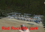
FIX for U53 Henry's Lake FSX
This adds the Red Rock RV park,
removes "flying" helo pads and
two sailboats in the mountains
above Henry's Lake town. Includes
updated objects libraries list.
Features work best with Ultimate Terrain X.
jimmy R martin
| Filename: | FIX_Henrys__Lake_IDAHO_FSX.zip |
| License: | Freeware |
| Added: | 21st July 2010, 00:58:58 |
| Downloads: | 402 |
| Author: | jimmy R martin |
| Size: | 771.9 KB |
| Category: Flight Simulator 2004 - Scenery | |
| Aerodromo ULM da Tojeira (Magoito) - Portugal |
|
Images related to this file:
File Description:
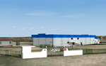
Tojeira ULM Airfield. This scenery is fully compatible with Portugal Terrain from PTSIM (http://www.ptsim.com) and is based on digital pictures, accurate real measures by Aerodromos de Portugal (http://www.pelicano.com.pt/zmapa.html) and Google Earth. Freeware. For Microsoft FS2004. NOT tested for FSX
| Filename: | Aerodromo_ULM_da_Tojeira_Magoito__Portugal.zip |
| License: | Freeware |
| Added: | 31st January 2013, 20:18:12 |
| Downloads: | 457 |
| Author: | Joao A. Graca Ferreira |
| Size: | 7.78 MB |


© 2001-2026 AVSIM Online
All Rights Reserved
Privacy Policy |