
Where Flight Simulation Enthusiasts Gather from Around the World!
AVSIM Library - Search Results

| Category: Flight Simulator 2004 - Scenery | |
| "Himalayan Peaks" LOD10 Mesh, Volume 4 - Annapurna |

|
Images related to this file:
File Description:
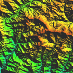
Highly detailed terrain mesh of the Annapurna area, N28-30 E83-85. The files in this package are based on Shuttle Radar (SRTM) Version 2 data but with many of the void areas, especially the most significant sections, filled with elevation data generated from topographic maps by Jonathan de Ferranti. While Jonathan's work is unrelated to flight simulation he kindly gave me permission to compile his data for use in FS. The result is a wonderful improvement in detail and accuracy over any existing mesh file, freeware or commercial, based on SRTM or DTED data alone.
Due to the large area of the Himalayas I've compiled the source data as two separate series: the "Himalayan Peaks" series covers prominent mountains and ranges in higher detail and locally overrides any existing LOD9 terrain mesh. In addition, a LOD9 "base mesh" series covering the entire Himalayas will be available for those who do not yet have an add-on terrain mesh of these beautiful mountains.
| Filename: | Himalayan_Peaks_LOD10_Mesh_Volume_4__Annapurna.zip |
| License: | Freeware, limited distribution |
| Added: | 29th May 2010, 08:59:29 |
| Downloads: | 10,470 |
| Author: | Holger Sandmann, Jonathan de Ferranti |
| Size: | 15.07 MB |
| Category: Flight Simulator 2004 - Scenery | |
| "Himalayan Peaks" LOD10 Mesh, Volume 5 - Garhwal |
|
File Description:
Highly detailed terrain mesh of the Garhwal area, N30°-32° E78°-81°. The files in this package are based on Shuttle Radar (SRTM) Version 2 data but with many of the void areas, especially the most significant sections, filled with elevation data generated from topographic maps by Jonathan de Ferranti. While Jonathan's work is unrelated to flight simulation he kindly gave me permission to compile his data for use in FS. The result is a wonderful improvement in detail and accuracy over any existing mesh file, freeware or commercial, based on SRTM or DTED data alone. Due to the large area of the Himalayas I've compiled the source data as two separate series: the "Himalayan Peaks" series covers prominent mountains and ranges in higher detail and locally overrides any existing LOD9 terrain mesh. In addition, a LOD9 "base mesh" series covering the entire Himalayas will be available for those who do not yet have an add-on terrain mesh of these beautiful mountains.
| Filename: | Himalayan_Peaks_LOD10_Mesh_Volume_5__Garhwal.zip |
| License: | Freeware, limited distribution |
| Added: | 18th February 2006, 23:16:47 |
| Downloads: | 10,141 |
| Author: | Holger Sandmann and Jonathan de Ferranti |
| Size: | 27.72 MB |
| Category: Flight Simulator 2004 - Scenery | |
| "Himalayan Peaks" LOD10 Mesh, Volume 6 - Jammu and Kashmir |
|
Images related to this file:
File Description:
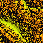
Highly detailed terrain mesh of the Jammu and Kashmir areas, N31-36 E76-78. The files in this package are based on Shuttle Radar (SRTM) Version 2 data but with many of the void areas, especially the most significant sections, filled with elevation data generated from topographic maps by Jonathan de Ferranti. While Jonathan's work is unrelated to flight simulation he kindly gave me permission to compile his data for use in FS. The result is a wonderful improvement in detail and accuracy over any existing mesh file, freeware or commercial, based on SRTM or DTED data alone.
Due to the large area of the Himalayas I've compiled the source data as two separate series: the "Himalayan Peaks" series covers prominent mountains and ranges in higher detail and locally overrides any existing LOD9 terrain mesh. In addition, a LOD9 "base mesh" series covering the entire Himalayas will be available for those who do not yet have an add-on terrain mesh of these beautiful mountains.
| Filename: | Himalayan_Peaks_LOD10_Mesh_Volume_6__Jammu_and_Kas.zip |
| License: | Freeware, limited distribution |
| Added: | 29th May 2010, 08:55:43 |
| Downloads: | 9,675 |
| Author: | Holger Sandmann, Jonathan de Ferranti |
| Size: | 52.19 MB |
| Category: Flight Simulator 2004 - Scenery | |
| "Himalayan Peaks" LOD10 Mesh, Volume 7 - K2 and Karakoram |
|
Images related to this file:
File Description:
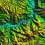
Highly detailed terrain mesh of the Karakoram area, N35-37 E73-77. The files in this package are based on Shuttle Radar (SRTM) Version 2 data but with many of the void areas, especially the most significant sections, filled with elevation data generated from topographic maps by Jonathan de Ferranti. While Jonathan's work is unrelated to flight simulation he kindly gave me permission to compile his data for use in FS. The result is a wonderful improvement in detail and accuracy over any existing mesh file, freeware or commercial, based on SRTM or DTED data alone.
Due to the large area of the Himalayas I've compiled the source data as two separate series: the "Himalayan Peaks" series covers prominent mountains and ranges in higher detail and locally overrides any existing LOD9 terrain mesh. In addition, a LOD9 "base mesh" series covering the entire Himalayas will be available for those who do not yet have an add-on terrain mesh of these beautiful mountains.
| Filename: | Himalayan_Peaks_LOD10_Mesh_Volume_7__K2_and_Karako.zip |
| License: | Freeware, limited distribution |
| Added: | 30th May 2010, 09:56:27 |
| Downloads: | 9,488 |
| Author: | Holger Sandmann, Jonathan de Ferranti |
| Size: | 38.58 MB |
| Category: Flight Simulator 2004 - Original Aircraft | |
| Thomas Cook/Condor Hybrid Scheme Boeing 757-230 |
|
File Description: The Project Opensky Boeing 757-200 series aircraft. Below are just some of the features included!, you will need to download the Virtual Cockpit textures which can be found in the library.(POSKY 757 VC.zip) Dynamic shine, Wingview or Virtual Cockpit, Opening Doors & cargo doors, 3d Flight Attendants in the cabin, All normal animations, realistic FDE, accurate dimensions, accurate specifications, accurate flight performance based on performance charts, accurate flight performance based on certified pilot input, full damage profiles for major body locations, flaps, struts, tires and engines, different engine variants, different engine performance, thrust maps, and fuel burn per different engine type, default and alternate gear points for aircraft look vs. performance feel and new detailed lighting effects for FS2004.
This example of the Boeing 757-230 is painted in the hybrid color scheme of Thomas Cook.(D-ABNF)
| Filename: | Thomas_CookCondor_Hybrid_Scheme_Boeing_757230.zip |
| License: | Freeware |
| Added: | 8th September 2004, 18:52:49 |
| Downloads: | 5,395 |
| Author: | Posky, Clemens Pieper |
| Size: | 7.16 MB |
| Category: Flight Simulator 2004 - Original Aircraft | |
| Thomas Cook Boeing 757-230 (powered by Condor) |
|
File Description: The Project Opensky Boeing 757-200 series aircraft. Below are just some of the features included!, you will need to download the Virtual Cockpit textures which can be found in the library.(POSKY 757 VC.zip) Dynamic shine, Wingview or Virtual Cockpit, Opening Doors & cargo doors, 3d Flight Attendants in the cabin, All normal animations, realistic FDE, accurate dimensions, accurate specifications, accurate flight performance based on performance charts, accurate flight performance based on certified pilot input, full damage profiles for major body locations, flaps, struts, tires and engines, different engine variants, different engine performance, thrust maps, and fuel burn per different engine type, default and alternate gear points for aircraft look vs. performance feel and new detailed lighting effects for FS2004.
This example of the Boeing 757-230 is painted in the colors of Thomas Cook (powered by Condor).(D-ABNH)
| Filename: | Thomas_Cook_Boeing_757230_powered_by_Condor.zip |
| License: | Freeware |
| Added: | 8th September 2004, 18:53:13 |
| Downloads: | 10,738 |
| Author: | Posky, Clemens Pieper |
| Size: | 7.24 MB |
| Category: Flight Simulator X - AFCAD Files | |
| MYNN - Lynden Pindling Intl - Nassau, Bahamas |
|
Images related to this file:
File Description:
MYNN - Lynden Pindling Intl - Nassau, Bahamas
Lynden Pindling International Airport was formerly known as Nassau International Airport and is the largest airport in the Bahamas, and the largest international gateway into the country.
It is a major hub for Bahamasair and is located in western New Providence island near to the capital city of Nassau. The airport contains U.S. Border preclearance facilities allowing all US flights to operate as domestic flights upon arrival at their destination.
Currently, the airport has 2 runways, more than 30 gates and 482,000 sq ft (44,800 m2) of terminal space. The redevelopment updated the airport facilities to world-class standards and expanded terminal capacity. The work was carried out in three stages. The first stage was completed in March 2011.
Using ADEx 1.50, aeronautical maps and Google Earth all these and future changes have been built into the default FSX airport. Crosswind Runway Technique has been implemented to open up all runways.
| Filename: | MYNN__Lynden_Pindling_Intl__Nassau_Bahamas.zip |
| License: | Freeware |
| Added: | 4th December 2012, 17:33:06 |
| Downloads: | 1,965 |
| Author: | Menno C. Robert |
| Size: | 4.16 MB |
| Category: Flight Simulator 2004 - Scenery | |
| Himalayan Peaks LOD10 Mesh, Volume 1 - Mt. Everest and Kula Kangri |
|
File Description:
Highly detailed terrain mesh of the Mt. Everest and Kula Kangri areas, N26°-29° E85°-92°. The files in this package are based on Shuttle Radar (SRTM) Version 2 data but with many of the void areas, especially the most significant sections, filled with elevation data generated from topographic maps by Jonathan de Ferranti. While Jonathan's work is unrelated to flight simulation he kindly gave me permission to compile his data for use in FS. The result is a wonderful improvement in detail and accuracy over any existing mesh file, freeware or commercial, based on SRTM or DTED data alone. Due to the large area of the Himalayas I've compiled the source data as two separate series: the "Himalayan Peaks" series covers prominent mountains and ranges in higher detail and locally overrides any existing LOD9 terrain mesh. In addition, a LOD9 "base mesh" series covering the entire Himalayas will be available for those who do not yet have an add-on terrain mesh of these beautiful mountains.
| Filename: | Himalayan_Peaks_LOD10_Mesh_Volume_1__Mt_Everest_an.zip |
| License: | Freeware, limited distribution |
| Added: | 9th February 2006, 22:13:00 |
| Downloads: | 37,060 |
| Author: | Holger Sandmann and Jonathan de Ferranti |
| Size: | 52.01 MB |
| Category: Flight Simulator X - AFCAD Files | |
| MSLP - El Salvador/Comalapa International Airport / San Salvador, El Salvador |
|
Images related to this file:
File Description:
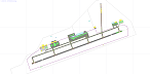
MSLP - El Salvador/Comalapa International Airport / San Salvador, El Salvador
This airport update was made with the latest version of ADE (Airport Design Editor) and made for FSX as a replacement for the stock (default) airport. I've made several changes to the airport which are listed below. All these enchancements are as close to the real airport as I can get with stock library objects. I've used satellite images, terminal photos and maps throughout the whole process so building locations are as accurate as possible. Happy landings in the sunny El Salvador!
Features:
*Fixed parking apron
*Main terminal building with its jetways
*Seperate parking apron for GA traffic
*Hangars and other airport buildings added
*Airport vehicles and objects throughout the airport
*Military cargo apron
*Parking lots with static vehicles
*Airport fire station with fire trucks
*Cargo area
*ILS heading error in stock file corrected
*Runway 18/36 closed as in the real world
| Filename: | MSLP__El_SalvadorComalapa_International_Airport__S.zip |
| License: | Freeware |
| Added: | 28th July 2012, 08:42:46 |
| Downloads: | 890 |
| Author: | Jaison Diaz / Endeavour ai |
| Size: | 128.88 KB |
| Category: Flight Simulator X - Scenery | |
| Victoria Inner Harbor Airport (CYWH) |
|
Images related to this file:
File Description:
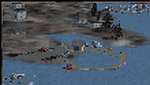
This airport was made using Airport Facilitator X, and Instant Scenery 2. Victoria Inner Harbor Airport is a water airport located in southern Victoria, British Columbia, Canada. The airlines that fly there are Harbor Air, West Coast Air, Kenmore Air, and Whistler Air. This is an airport that flight simulator does not have. I put docks for seaplanes with two seaplanes. I even made it so that you can start off at the dock. I made the small terminal and a parking lot with cars and light poles. I also put the surrounding docks with many boats. There is also a small heliport 0.73 miles away from Victoria Inner Harbor called Shoal Point Heliport. I have made this heliport because it too is another one flight simulator forgot. This was all based on Google Earth and Bing Maps. Please read the read me for instructions on how to install. This is for Flight Simulator X only. By Tyler Lawrence.
| Filename: | Victoria_Inner_Harbor_Airport_CYWH.zip |
| License: | Freeware |
| Added: | 16th January 2012, 23:53:12 |
| Downloads: | 1,493 |
| Author: | Tyler Lawrence |
| Size: | 9.98 MB |


© 2001-2026 AVSIM Online
All Rights Reserved
Privacy Policy |