
Where Flight Simulation Enthusiasts Gather from Around the World!
AVSIM Library - Search Results

| Category: Microsoft Flight Simulator (2020) - Aircraft Repaints, Textures and Modifications | |
| Aerosoft F-16C HO 88-0412 49 WG 'Tutor Et Ultor' Repaint Textures |

|
Images related to this file:
File Description:

This is a repaint for the payware Aerosoft F-16 depicting Holoman AFB F-16C 88-0412 in the special '49 WG Tutor Et Ultor' paint scheme. I pulled out all the stops for this repaint and gave it the kind of attention to detail a CO's jet should get!
To give these textures a nice "HD/Sharp" look, I painted them in 2048 resolution, reduced them (w sharpening) to Aerosoft's "native" 1024 resolution, then saved them with DXT5 and no mip maps. For those of you with high-end systems, I've also included those 2048 textures for you to try!
You'll notice that the all grey markings/decals from nose to tail have been repainted and have a "sharp" look to them now. I also custom painted the P&W engine, pilot, ejection seat, and weapons textures as well. AND, I created special "Specular" files to give the tail surfaces that "high gloss paint" look like the real jet has!
| Filename: | Aerosoft_F16C_HO_880412_49_WG_Tutor_Et_Ultor_Repai.zip |
| License: | Freeware |
| Added: | 6th May 2024, 14:14:07 |
| Downloads: | 37 |
| Author: | Daniel Gregory |
| Size: | 27.6 MB |
| Category: Flight Simulator X - AFCAD Files | |
| MDPP - Gregorio Luperon International Airport / Puerto Plata, Dominican Republic |
|
Images related to this file:
File Description:
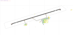
This airport update was made with the latest version of ADE (Airport Design Editor) and made for FSX as a replacement for the stock (default) airport. I've made several changes to the airport which are listed below. All these enchancements are as close to the real airport as I can get with stock library objects. I've used satellite images, terminal photos and maps throughout the whole process so building locations are as accurate as possible. Happy landings in the sunny Dominican Republic!
Features:
*Expanded parking apron
*Stock main terminal building (left mostly unchanged as it is relatively accurate)
*Jetways added where applicable and other spots for commercial air traffic added
*Seperate parking areas for GA traffic
*Hangar and other airport buildings added
*Airport vehicles and objects throughout the airport
*Airport fire station with fire truck
*Helipad
*Static people 'easter eggs' on the airport property
*A few fishing and recreational vessels in the waters around the airport
| Filename: | MDPP__Gregorio_Luperon_International_Airport__Puer.zip |
| License: | Freeware |
| Added: | 4th August 2012, 06:38:12 |
| Downloads: | 570 |
| Author: | Jaison Diaz / Endeavour ai |
| Size: | 91.54 KB |
| Category: Flight Simulator X - AFCAD Files | |
| Ixtapa-Zihuatanejo International Airport / Zihuatanejo, Mexico (MMZH) |
|
Images related to this file:
File Description:
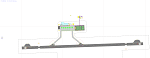
MMZH - Ixtapa-Zihuatanejo International Airport / Zihuatanejo, Mexico
This airport update was made with the latest version of ADE (Airport Design Editor) and made for FSX as a replacement for the stock (default) airport. I've made several changes to the airport which are listed below. All these enchancements are as close to the real airport as I can get with stock library objects. I've used satellite images, terminal photos and maps throughout the whole process so building locations are as accurate as possible. Happy landings in warm Mexico!
Features:
*Expanded parking apron
*Main terminal building with parking area for commercial traffic
*Seperate parking area for GA traffic
*Misc airport buildings added
*Airport vehicles and objects throughout the airport
*Fuel tanks and power plant near airport property
*Birds flying near runway (beware)
*Static people near terminal
*Palm trees/vegitation added near terminal
(For more information on Endeavourai please visit our site at endeavourai.com or our forums at http://endeavourai.boards.net/)
| Filename: | IxtapaZihuatanejo_International_Airport__Zihuatane.zip |
| License: | Freeware |
| Added: | 7th August 2012, 15:21:58 |
| Downloads: | 651 |
| Author: | Jaison Diaz / Endeavour ai |
| Size: | 78.31 KB |
| Category: Flight Simulator X - AFCAD Files | |
| MSLP - El Salvador/Comalapa International Airport / San Salvador, El Salvador |
|
Images related to this file:
File Description:
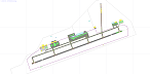
MSLP - El Salvador/Comalapa International Airport / San Salvador, El Salvador
This airport update was made with the latest version of ADE (Airport Design Editor) and made for FSX as a replacement for the stock (default) airport. I've made several changes to the airport which are listed below. All these enchancements are as close to the real airport as I can get with stock library objects. I've used satellite images, terminal photos and maps throughout the whole process so building locations are as accurate as possible. Happy landings in the sunny El Salvador!
Features:
*Fixed parking apron
*Main terminal building with its jetways
*Seperate parking apron for GA traffic
*Hangars and other airport buildings added
*Airport vehicles and objects throughout the airport
*Military cargo apron
*Parking lots with static vehicles
*Airport fire station with fire trucks
*Cargo area
*ILS heading error in stock file corrected
*Runway 18/36 closed as in the real world
| Filename: | MSLP__El_SalvadorComalapa_International_Airport__S.zip |
| License: | Freeware |
| Added: | 28th July 2012, 08:42:46 |
| Downloads: | 887 |
| Author: | Jaison Diaz / Endeavour ai |
| Size: | 128.88 KB |
| Category: Flight Simulator X - Flight Plans | |
| Evacuate NOW!!!!! |
|
File Description:
For months Mount St Helens has shown sign of an emminent eruption. This adventure takes place just a
few days before the cataclismic explosion . You and your amphibian will fly to lakes and mountain hideouts.
The land is trembling and no one knows when the Volcano will blow its top!!!....Fly low and slow but don´t waste any time...Darth Vaskar the famous fisherman is waiting at lake Kooly, Ane Marie Burzz has parked her glider at Ranger Creek Field and is eager to see you, Aunt Milly Nowhety does not want to leave her cows at her farm by lake Moose and Natalio Bartuzzi has closed all gas pumps at the Mounty Gas Tanks Ltd and is waiting for you. Go get them pilot officer, no time for fooling around !!! ..Warning:If you are not experienced at bush flying and reading maps you should decline from this flight..It is too dangerous).
| Filename: | Evacuate_NOW.zip |
| License: | Freeware, limited distribution |
| Added: | 20th September 2007, 09:39:53 |
| Downloads: | 1,579 |
| Author: | Gera Godoy C |
| Size: | 95.66 KB |
| Category: Flight Simulator X - Scenery | |
| Victoria Inner Harbor Airport (CYWH) |
|
Images related to this file:
File Description:
This airport was made using Airport Facilitator X, and Instant Scenery 2. Victoria Inner Harbor Airport is a water airport located in southern Victoria, British Columbia, Canada. The airlines that fly there are Harbor Air, West Coast Air, Kenmore Air, and Whistler Air. This is an airport that flight simulator does not have. I put docks for seaplanes with two seaplanes. I even made it so that you can start off at the dock. I made the small terminal and a parking lot with cars and light poles. I also put the surrounding docks with many boats. There is also a small heliport 0.73 miles away from Victoria Inner Harbor called Shoal Point Heliport. I have made this heliport because it too is another one flight simulator forgot. This was all based on Google Earth and Bing Maps. Please read the read me for instructions on how to install. This is for Flight Simulator X only. By Tyler Lawrence.
| Filename: | Victoria_Inner_Harbor_Airport_CYWH.zip |
| License: | Freeware |
| Added: | 16th January 2012, 23:53:12 |
| Downloads: | 1,488 |
| Author: | Tyler Lawrence |
| Size: | 9.98 MB |
| Category: Flight Simulator X - AFCAD Files | |
| MZBZ - Philip S. W. Goldson International Airport / Belize City, Belize (v2.0) |
|
Images related to this file:
File Description:

This airport update was made with the latest version of ADE (Airport Design Editor) and made for FSX as a replacement for the stock (default) airport. I've made several changes to the airport which are listed below. All these enchancements are as close to the real airport as I can get with stock library objects. I've used satellite images, terminal photos and maps throughout the whole process so building locations are as accurate as possible. Happy landings in Belize, scuba diving heaven!
Features:
*Expanded parking apron
*Terminal building with parking for commercial aircraft
*Assigned parking for Maya Island Air flights
*Ramp extension construction
*Runway 7/25 expanded to 9,695ft
*Taxiway corrections
*Autogen exclusion for trees that occupy field in stock scenery (no other files needed)
*Palm trees and vegetation
*Airport hangars and static aircraft
*Airport vehicles and objects
*Parking lot with static vehicles
*Birds in proximity to airfield
(For more information on Endeavourai please visit our site at endeavourai.com or our forums at http://endeavourai.boards.net/)
| Filename: | MZBZ__Philip_S_W_Goldson_International_Airport__Be.zip |
| License: | Freeware |
| Added: | 21st August 2012, 23:13:12 |
| Downloads: | 1,173 |
| Author: | Jaison Diaz / Endeavour ai |
| Size: | 96.25 KB |
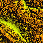
| Category: Flight Simulator 2004 - Scenery | |
| "Himalayan Peaks" LOD10 Mesh, Volume 4 - Annapurna |
|
Images related to this file:
File Description:

Highly detailed terrain mesh of the Annapurna area, N28-30 E83-85. The files in this package are based on Shuttle Radar (SRTM) Version 2 data but with many of the void areas, especially the most significant sections, filled with elevation data generated from topographic maps by Jonathan de Ferranti. While Jonathan's work is unrelated to flight simulation he kindly gave me permission to compile his data for use in FS. The result is a wonderful improvement in detail and accuracy over any existing mesh file, freeware or commercial, based on SRTM or DTED data alone.
Due to the large area of the Himalayas I've compiled the source data as two separate series: the "Himalayan Peaks" series covers prominent mountains and ranges in higher detail and locally overrides any existing LOD9 terrain mesh. In addition, a LOD9 "base mesh" series covering the entire Himalayas will be available for those who do not yet have an add-on terrain mesh of these beautiful mountains.
| Filename: | Himalayan_Peaks_LOD10_Mesh_Volume_4__Annapurna.zip |
| License: | Freeware, limited distribution |
| Added: | 29th May 2010, 08:59:29 |
| Downloads: | 10,459 |
| Author: | Holger Sandmann, Jonathan de Ferranti |
| Size: | 15.07 MB |
| Category: Flight Simulator 2004 - Scenery | |
| "Himalayan Peaks" LOD10 Mesh, Volume 7 - K2 and Karakoram |
|
Images related to this file:
File Description:

Highly detailed terrain mesh of the Karakoram area, N35-37 E73-77. The files in this package are based on Shuttle Radar (SRTM) Version 2 data but with many of the void areas, especially the most significant sections, filled with elevation data generated from topographic maps by Jonathan de Ferranti. While Jonathan's work is unrelated to flight simulation he kindly gave me permission to compile his data for use in FS. The result is a wonderful improvement in detail and accuracy over any existing mesh file, freeware or commercial, based on SRTM or DTED data alone.
Due to the large area of the Himalayas I've compiled the source data as two separate series: the "Himalayan Peaks" series covers prominent mountains and ranges in higher detail and locally overrides any existing LOD9 terrain mesh. In addition, a LOD9 "base mesh" series covering the entire Himalayas will be available for those who do not yet have an add-on terrain mesh of these beautiful mountains.
| Filename: | Himalayan_Peaks_LOD10_Mesh_Volume_7__K2_and_Karako.zip |
| License: | Freeware, limited distribution |
| Added: | 30th May 2010, 09:56:27 |
| Downloads: | 9,473 |
| Author: | Holger Sandmann, Jonathan de Ferranti |
| Size: | 38.58 MB |
| Category: Flight Simulator 2004 - Scenery | |
| "Himalayan Peaks" LOD10 Mesh, Volume 6 - Jammu and Kashmir |
|
Images related to this file:
File Description:
Highly detailed terrain mesh of the Jammu and Kashmir areas, N31-36 E76-78. The files in this package are based on Shuttle Radar (SRTM) Version 2 data but with many of the void areas, especially the most significant sections, filled with elevation data generated from topographic maps by Jonathan de Ferranti. While Jonathan's work is unrelated to flight simulation he kindly gave me permission to compile his data for use in FS. The result is a wonderful improvement in detail and accuracy over any existing mesh file, freeware or commercial, based on SRTM or DTED data alone.
Due to the large area of the Himalayas I've compiled the source data as two separate series: the "Himalayan Peaks" series covers prominent mountains and ranges in higher detail and locally overrides any existing LOD9 terrain mesh. In addition, a LOD9 "base mesh" series covering the entire Himalayas will be available for those who do not yet have an add-on terrain mesh of these beautiful mountains.
| Filename: | Himalayan_Peaks_LOD10_Mesh_Volume_6__Jammu_and_Kas.zip |
| License: | Freeware, limited distribution |
| Added: | 29th May 2010, 08:55:43 |
| Downloads: | 9,661 |
| Author: | Holger Sandmann, Jonathan de Ferranti |
| Size: | 52.19 MB |
© 2001-2026 AVSIM Online
All Rights Reserved
Privacy Policy |