
Where Flight Simulation Enthusiasts Gather from Around the World!
AVSIM Library - Search Results

| Category: Flight Simulator 2004 - Scenery | |
| Kenmore Village Field CF08 near Ottawa in Ontario, Canada |

|
Images related to this file:
File Description:
Kenmore Village Field is in Ontario, at the northwest corner of the village of Kenmore. Kenmore is around 13 miles southeast of Ottawa airport and 3 miles east of Bank Farm Field. The village doesn't appear in FS as it is too small, but I have recreated it based on the roads that show in Ultimate Terrain. There is a grass runway 09/27 (actually 086/266) that is 3,100 feet long, and the grass is good, and with lights. The field is owned by a gentleman in his mid 70's who sold his plane five years ago and less than two years later discovered that he really didn't want to give up flying; he then went out and bought another slightly older and cheaper version of the one he sold. The house is in a direct line with the runway approach from the east; try to miss it. There is a large hangar and workshop behind the house and to the north of the runway center line, and a second older hangar on the same side a bit further along, both modeled specifically for this.
| Filename: | Kenmore_Village_Field_CF08_near_Ottawa_in_Ontario_.zip |
| License: | Freeware, limited distribution |
| Added: | 9th February 2010, 13:39:57 |
| Downloads: | 394 |
| Author: | Roger Wensley |
| Size: | 10.69 MB |
| Category: Prepar3D V5 - AI Aircraft | |
| Boeing 707 for AI Traffic (DWAI Models) |
|
Images related to this file:
File Description:

Boeing 707 for AI Traffic (DWAI Models). This is the P3Dv4.5/5.2 conversion of Dee Waldron's entire 707 family for AI traffic, with permission kindly given by Dee Waldron. These models are intended as a stop-gap measure until a new 707 family specifically modeled for the 64-bit sims comes along, and I may have something to do with that this fall. This package has all seven of Dee's original models, and includes 707-120/B, 707-138, 707-320/420, 707-320BC, and 720-020/B. I have also added in a small collection of the paints I have done over the years. Seven main aircraft variants with a total of twelve models and 55 repaints are included here. This is only meant to get the AI 707 into the 64-bit sims, and I pretty much did straight conversions without too many upgrades. However, these aircraft, with special instructions included, are compatible with all prior paints available in the usual places. Original aircraft by Dee Waldron et. al, MCX and RADiator utilites by Arno Gerretsen, P3Dv4/5 conversion and all release repaints by Michael Pearson.
| Filename: | Boeing_707_for_AI_Traffic_DWAI_Models.zip |
| License: | Freeware, limited distribution |
| Added: | 5th September 2021, 16:55:26 |
| Downloads: | 306 |
| Author: | Michael Pearson |
| Size: | 12.15 MB |
| Category: Flight Simulator 2004 - Original Aircraft | |
| Lockheed C-130H |
|
File Description:
FS2004 Lockheed C-130H Hercules
This aircraft is built for FS2004. It should work with FS2002 without any problems, but I no longer support FS2002.
This package is configured with a default panel. It is intended for use with the custom panel made by Ken Mitchel. You must obtain the panel in a seperate download. If you have not done so, it is available on my site.
The base textures folder in this zip file contains base (unpainted) texture files for use in repainting.
Note that the aircraft supplied in this package is supplied as is. While I endeavor to correct problems with the aircraft, I make no guarantee that any problem real or perceived will be fixed. Suggestions for enhancements and fixes will be implemented solely at my discretion. Please don't waste my time with subjective "perceived" issues like "The nose is too round", "The tail is too small", "The wing is the wrong color", etc. I have made every effort to make the model as accurate as I am able and willing, and will not modify it further to fit anyone's personal specifications.
| Filename: | Lockheed_C130H.zip |
| License: | Freeware |
| Added: | 13th August 2003, 03:01:47 |
| Downloads: | 18,231 |
| Author: | Mike Stone |
| Size: | 450.79 KB |
| Category: Prepar3D V1-4 - Scenery Design | |
| "Gerald R. Ford Intl "KGRR" P3Dv4/5" |
|
Images related to this file:
File Description:
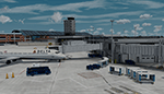
Prepar3D v4/5 Welcome to A "Fully Modeled" Gerald R. Ford International Airport (KGRR) for P3DV4/5,
With Dynamic Lighting.
All 3D Buildings including Runways, Taxiways and Photoreal, Even to the the smallest detail is custom hand made, through blender modeling tool.AI Traffic including Airport vehicles Work Perfectly. All Scenery is original work, This was a 3 year Long project, and was finally finished on 2021 of June.
Main Features to this scenery is Custom 3D Building, Custom Seasonal Photoreal, Dynamic Lights, Custom Fully modeled Airport, Custom Parked Static Vehicles throughout the airport, Custom Fences, Custom Runway and Taxiways, Custom taxi Edge lights, Working Ai Traffic, Custom small Detail and so much more...
Note to have it fully functional, GSX level 2 is Required to Power the Jetways, there's also a option to have static jetways, if you don't have GSX.
Please Don't Modify, Change, Re-upload, Reuse 3d objects or Textures. The airport is intended to be Freeware. This is a Cheer-Up Gift to all Simulation Aviation community Pilots. Please enjoy! Fly lots "Keep-Climbing "Please Share the news of this Airport being released Thankyou.
| Filename: | Gerald_R_Ford_Intl_KGRR_P3Dv45.zip |
| License: | Freeware, limited distribution |
| Added: | 4th July 2021, 05:46:03 |
| Downloads: | 1,453 |
| Author: | Dillon Rocque |
| Size: | 387.29 MB |
| Category: Flight Simulator 2004 - Scenery | |
| Alaska North Slope 10; Kivalina KVL in Alaska |
|
Images related to this file:
File Description:
The town of Barrow is in the far north of Alaska, and these are coastal villages or radar installations to the west, south, and east of Barrow on the North Slope. There will be further additions. Kivalina is a small village (population around 350) midway in the 150 mile gap between Point Hope to the north and Kotzebue to the south. The village is on a spit of land that is growing smaller and smaller with every year of erosion and the rise of sea level. The runway is 3,500 feet of gravel aligned 12-30 to the north of the village on the same spit. It was expected that 2025 would see the end of both village and runway, and possibly also the natural harbour that is the reason for the village's location. The modified width of the spit shown here is halved from the original FS9, and erosion has continued, enough that a sea defence wall has now been built. The AI has a daily flight by an ERA Alaska Cessna 208B, and some GA; read the note about the 208 to be downloaded and/or properly installed.
| Filename: | Alaska_North_Slope_10_Kivalina_KVL_in_Alaska.zip |
| License: | Freeware, limited distribution |
| Added: | 27th July 2016, 21:12:15 |
| Downloads: | 244 |
| Author: | Roger Wensley |
| Size: | 2.87 MB |
| Category: Flight Simulator 2004 - Scenery | |
| Camden Field in Trinidad |
|
File Description:
Camden Field was once a wartime American airfield, which shows up in the wide east-west runway that has more recently been partly resurfaced. There are no runway markings beyond a centre line, and it just sort of tapers off at the sides and the eastern end into the bush. In contrast to the renovated hangar to the north of the western end of the runway the buildings to the south haven't been touched by any recent tender-loving-care. There is a wonderful patched-together shed and a small control tower, which was built on the edge of the existing runway. This makes it appear rather close to the edge of the resurfaced runway area. Do not be fooled, this is not an illusion; it IS close to the edge of the runway. Just take comfort in the thought that the prevailing southeast winds (for much of the year) will tend to blow you away from it as you approach for a landing from the west. And I kept the pre-renovation version of the old hangar when I found some old pics of the crop dusting operation from five years ago.
| Filename: | Camden_Field_in_Trinidad.zip |
| License: | Freeware |
| Added: | 14th December 2008, 01:32:05 |
| Downloads: | 537 |
| Author: | Roger Wensley |
| Size: | 2.73 MB |
| Category: Prepar3D V1-4 - Aircraft Repaints, Textures and Modifications | |
| Mandarin Airlines 1998 AI Package |
|
File Description:
Mandarin Airlines was a fully-owned affiliate of China Airlines based in RCTP. Today, Mandarin does mostly regional flying, but 1998 represented the final years of widebody operations for the carrier. The 747SPs were retired soon after, and the MD-11s and 747-400 gradually returned to China Airlines. Mandarin operated most of the US, Australian, European, and Middle Eastern flights for China Airlines at the time. Mandarin aircraft frequently swapped back and forth onto China Airlines routes and vice versa. As Mandarin had a small fleet, I elected to have Mandarin planes on Mandarin routes, but my China Airlines plans will also utilize Mandarin colors MD-11s on China Airlines routes, so the repaints in this file are required for China Airlines 1998. Swap out the aircraft as you see fit. Repaints by the talented Ranmori Scythe included for the FAIB 747-400, 747SP, and FSPX MD-11 included with flightplans by the not-so-talented Chasen Richardson. Part of the 1998 Flight Simulator Project. Follow us on Facebook at facebook.com/flightsim98 and on instagram as @bayviationsim. For more Retro AI, check out the forums at: http://retroai.proboards.com/
| Filename: | Mandarin_Airlines_1998_AI_Package.zip |
| License: | Freeware, limited distribution |
| Added: | 21st November 2019, 19:18:20 |
| Downloads: | 248 |
| Author: | Ranmori Scythe, Chasen Richardson/Bayviation |
| Size: | 8.86 MB |
| Category: Flight Simulator X - Aircraft Repaints, Textures and Modifications | |
| Boeing B-17G 91st BG (LG-P) "Sweet Dish" |
|
Images related to this file:
File Description:

This folder contains a repaint for the A2A WoP2 B-17G in the colors of B-17G 44-6596 LG-P "Sweet Dish" of the 322nd BS/ 91st BG based in Bassingbourne UK. She arrived in Bassingbourne on the 4th of November 1944 and flew her first mission 5 days later, after which she was assigned to Lt Bob Roach and his crew. He suggested naming her Sweet Dish, after his wife, who was known to the crew. Tony Starcer painted her portrait, based on a pocket photograph. By war's end, she would have completed 46 missions by the war's end, including 24 flown by BoB Roach. Her hairiest mission was to Berlin on 5 december. Flak knocked out no.1 engine and set fire to no.2. During the dive to eliminate the fire, the engineer bailed out, and the navigator and bomb aimer followed him. The fire was extinguished however, and 'Sweet Dish' flew home on two engines. They counted 365 holes in the ship next day, and it took until the end of december to get her in the air again. At the end of the war, she took a group of ground crew on a flight over the damaged cities of Germany, so that they too could see the effect of their work, and in may she helped repatriate released PoW's. In june 1945, she flew back to the States, where she was scrapped at Kingman, Arizona in december 1945.
Repaint by Jan Kees Blom, based on the paintkit by A2A.
| Filename: | Boeing_B17G_91st_BG_LGP_Sweet_Dish.zip |
| License: | Freeware |
| Added: | 7th October 2019, 18:25:00 |
| Downloads: | 108 |
| Author: | Jan Kees Blom |
| Size: | 19.97 MB |
| Category: Flight Simulator X - Miscellaneous Files | |
| Drivable and Flyable Grey Van |
|
Images related to this file:
File Description:
The Drivable and Flyable Grey Van is derived from a stationary Euro Van model by the following modifications / additions:
-land-vehicle instrument panel
-sound files
-FSX effects and custom exhaust smoke effects files
-modified .CFG and .AIR files
The vehicle is powered by a single aircraft piston engine with modified flaps to serve as a gear-shift. High gear allows the vehicle to speed up to 70 Kt on wide highways, while the low gear restricts the speed to about 12 Kt, but enables the vehicle to ascend steep slopes for exploring terrain scenery.
At speeds around 65-70 Kt (in gear 4), pulling back on the yoke will allow the vehicle to take off and fly at level-flight speeds around 70 Kt. This is an interesting way to go island-hopping, overcome insurmountable terrain obstacles, or cover larger straight-line distances without using the slew mode.
An autopilot with hold altitude and hold heading options is operable during flight only.
All dashboard instruments are fully functional, including the Radio-Magnetic Indicator (RMI) during flight. Needles 1 and 2 are activated if correct frequencies are entered in the ADF and VOR radios.
The vehicle has lights which are toggled by pressing [L]. Lights are associated with a very thin exhaust smoke effect. Thick exhaust smoke is toggled by pressing [I].
Driving vehicles through FSX scenery in different seasons presents a whole new aspect to the simulation. It allows us to imagine discovering innumerable places on the planet which are in practice beyond our reach.
I hope you enjoy!
| Filename: | Drivable_and_Flyable_Grey_Van.zip |
| License: | Freeware |
| Added: | 29th January 2024, 15:24:50 |
| Downloads: | 37 |
| Author: | Rudy E. Kokich |
| Size: | 38.63 MB |
| Category: Flight Simulator 2004 - Scenery | |
| PAMR (Merrill Field, Anchorage), 5HO (Hope), 9Z9 (Lawing) - Alaska, USA |
|
Images related to this file:
File Description:
This stand-alone combined V2 version of Merrill Field 2016 includes: windsocks, a parked Fedex 727 that was recently donated to the University of Alaska, some missing taxiway lights, and small corrections to the apron layout. It also includes Hope 5HO and Lawing 9Z9. The 2016 version of Merrill Field PAMR dealt with a spectacular malfunction reported by one recent downloader; see the two screenshots. Merrill Field is in Anchorage Alaska, between Anchorage International to the southwest and and Elmendorf Air Force Base to the north. It caters for general aviation and is the land equivalent of the Lake Hood float plane base, with fuel and numerous maintenance facilities, and several hundred parking spots for small planes. There are three runways, and the longest is 4,000 feet of 100 feet wide asphalt, the second 2,635 feet of asphalt 75 feet wide, and the third 2,000 feet of 60 feet wide gravel. The first two have runway lights. It is a controlled airfield with a relatively new control tower to cater for the numerous flights and to coordinate with Elmensdorf and Anchorage International, the latter also controlling flights from Lake Hood and the adjacent gravel strip Z41 (see my Lake Hood scenery). The gravel runway at Merrill Field is not connected with active taxiways to the rest of the airfield; this avoids you being ordered to land on it when flying a plane too large to do so. The enclosed layout shows the runways and the taxiways complete with their assigned letters to help you find your way around, but note that this shows the current gravel runway with its wandering magnetic headings, not the ones prevailing when I made Merrill. The signage on the airfield is not total. The main taxiways are signed and each entry to a runway has a runway sign, but intermediate taxiways to or from a runway are not; if you have turned off the runway at the first possible exit you could then whether it is R or T is, I suppose, irrelevant. Try not to turn onto Merrill Field Drive at an intersection, this is a road that runs through the field. There are almost 50 buildings on the field and threequarters of them have been modelled from photographs specifically for this scenery; some of them were modelled from photos that were of not very good quality, but when the photos were taken I wasn't thinking that I would ever model the field. Which explains why there are buildings I had no photos of at all, of any sort of quality.
| Filename: | PAMR_Merrill_Field_Anchorage_5HO_Hope_9Z9_Lawing__.zip |
| License: | Freeware, limited distribution |
| Added: | 26th February 2016, 09:54:17 |
| Downloads: | 758 |
| Author: | Roger Wensley |
| Size: | 22.64 MB |


© 2001-2026 AVSIM Online
All Rights Reserved
Privacy Policy |