
Where Flight Simulation Enthusiasts Gather from Around the World!
AVSIM Library - Search Results

| Category: Flight Simulator 2004 - Scenery | |
| Paul Farm Field CF16 in Ontario, Canada |

|
Images related to this file:
File Description:
Paul Field is on the south side of Highway 174, four miles east of Hawkesbury Windover Field and five miles west of the town of Hawkesbury; the town is on the south bank of the Ottawa River approximately midway between Ottawa and Montreal. I first saw the field when I was on the way to Windover a few years ago. I asked some old timers at Windover who the grass strip belonged to and they said "Paul". It may not be what Paul calls it, but it's the only name I know it by. Probably Paul doesn't call it anything, it's just the field where he keeps his plane. There is a grass runway approximately north-south and 2,000 feet long, and two hangars which look to be an old one and a new one. In real life the runway isn't so north-south as it lines up with the farm fields alignment which is of course in FS is auto-generated and not actuality-accurate.
| Filename: | Paul_Farm_Field_CF16_in_Ontario_Canada.zip |
| License: | Freeware, limited distribution |
| Added: | 6th February 2010, 02:36:49 |
| Downloads: | 291 |
| Author: | Roger Wensley |
| Size: | 997.17 KB |
| Category: Flight Simulator 2004 - Scenery | |
| "Himalayan Peaks" LOD10 Mesh, Volume 3 - Namcha Barwa |
|
File Description:
Highly detailed terrain mesh of the Namcha Barwa area, N29°-31° E94°-96°. The files in this package are based on Shuttle Radar (SRTM) Version 2 data but with many of the void areas, especially the most significant sections, filled with elevation data generated from topographic maps by Jonathan de Ferranti. While Jonathan's work is unrelated to flight simulation he kindly gave me permission to compile his data for use in FS. The result is a wonderful improvement in detail and accuracy over any existing mesh file, freeware or commercial, based on SRTM or DTED data alone. Due to the large area of the Himalayas I've compiled the source data as two separate series: the "Himalayan Peaks" series covers prominent mountains and ranges in higher detail and locally overrides any existing LOD9 terrain mesh. In addition, a LOD9 "base mesh" series covering the entire Himalayas will be available for those who do not yet have an add-on terrain mesh of these beautiful mountains.
| Filename: | Himalayan_Peaks_LOD10_Mesh_Volume_3__Namcha_Barwa.zip |
| License: | Freeware, limited distribution |
| Added: | 18th February 2006, 23:15:17 |
| Downloads: | 12,185 |
| Author: | Holger Sandmann and Jonathan de Ferranti |
| Size: | 15.09 MB |
| Category: Flight Simulator 2004 - Scenery | |
| "Himalayan Peaks" LOD10 Mesh, Volume 4 - Annapurna |
|
Images related to this file:
File Description:

Highly detailed terrain mesh of the Annapurna area, N28-30 E83-85. The files in this package are based on Shuttle Radar (SRTM) Version 2 data but with many of the void areas, especially the most significant sections, filled with elevation data generated from topographic maps by Jonathan de Ferranti. While Jonathan's work is unrelated to flight simulation he kindly gave me permission to compile his data for use in FS. The result is a wonderful improvement in detail and accuracy over any existing mesh file, freeware or commercial, based on SRTM or DTED data alone.
Due to the large area of the Himalayas I've compiled the source data as two separate series: the "Himalayan Peaks" series covers prominent mountains and ranges in higher detail and locally overrides any existing LOD9 terrain mesh. In addition, a LOD9 "base mesh" series covering the entire Himalayas will be available for those who do not yet have an add-on terrain mesh of these beautiful mountains.
| Filename: | Himalayan_Peaks_LOD10_Mesh_Volume_4__Annapurna.zip |
| License: | Freeware, limited distribution |
| Added: | 29th May 2010, 08:59:29 |
| Downloads: | 10,460 |
| Author: | Holger Sandmann, Jonathan de Ferranti |
| Size: | 15.07 MB |
| Category: Flight Simulator 2004 - Scenery | |
| "Himalayan Peaks" LOD10 Mesh, Volume 5 - Garhwal |
|
File Description:
Highly detailed terrain mesh of the Garhwal area, N30°-32° E78°-81°. The files in this package are based on Shuttle Radar (SRTM) Version 2 data but with many of the void areas, especially the most significant sections, filled with elevation data generated from topographic maps by Jonathan de Ferranti. While Jonathan's work is unrelated to flight simulation he kindly gave me permission to compile his data for use in FS. The result is a wonderful improvement in detail and accuracy over any existing mesh file, freeware or commercial, based on SRTM or DTED data alone. Due to the large area of the Himalayas I've compiled the source data as two separate series: the "Himalayan Peaks" series covers prominent mountains and ranges in higher detail and locally overrides any existing LOD9 terrain mesh. In addition, a LOD9 "base mesh" series covering the entire Himalayas will be available for those who do not yet have an add-on terrain mesh of these beautiful mountains.
| Filename: | Himalayan_Peaks_LOD10_Mesh_Volume_5__Garhwal.zip |
| License: | Freeware, limited distribution |
| Added: | 18th February 2006, 23:16:47 |
| Downloads: | 10,131 |
| Author: | Holger Sandmann and Jonathan de Ferranti |
| Size: | 27.72 MB |
| Category: Flight Simulator 2004 - Scenery | |
| "Himalayan Peaks" LOD10 Mesh, Volume 6 - Jammu and Kashmir |
|
Images related to this file:
File Description:
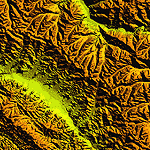
Highly detailed terrain mesh of the Jammu and Kashmir areas, N31-36 E76-78. The files in this package are based on Shuttle Radar (SRTM) Version 2 data but with many of the void areas, especially the most significant sections, filled with elevation data generated from topographic maps by Jonathan de Ferranti. While Jonathan's work is unrelated to flight simulation he kindly gave me permission to compile his data for use in FS. The result is a wonderful improvement in detail and accuracy over any existing mesh file, freeware or commercial, based on SRTM or DTED data alone.
Due to the large area of the Himalayas I've compiled the source data as two separate series: the "Himalayan Peaks" series covers prominent mountains and ranges in higher detail and locally overrides any existing LOD9 terrain mesh. In addition, a LOD9 "base mesh" series covering the entire Himalayas will be available for those who do not yet have an add-on terrain mesh of these beautiful mountains.
| Filename: | Himalayan_Peaks_LOD10_Mesh_Volume_6__Jammu_and_Kas.zip |
| License: | Freeware, limited distribution |
| Added: | 29th May 2010, 08:55:43 |
| Downloads: | 9,663 |
| Author: | Holger Sandmann, Jonathan de Ferranti |
| Size: | 52.19 MB |
| Category: Flight Simulator 2004 - Scenery | |
| "Himalayan Peaks" LOD10 Mesh, Volume 7 - K2 and Karakoram |
|
Images related to this file:
File Description:

Highly detailed terrain mesh of the Karakoram area, N35-37 E73-77. The files in this package are based on Shuttle Radar (SRTM) Version 2 data but with many of the void areas, especially the most significant sections, filled with elevation data generated from topographic maps by Jonathan de Ferranti. While Jonathan's work is unrelated to flight simulation he kindly gave me permission to compile his data for use in FS. The result is a wonderful improvement in detail and accuracy over any existing mesh file, freeware or commercial, based on SRTM or DTED data alone.
Due to the large area of the Himalayas I've compiled the source data as two separate series: the "Himalayan Peaks" series covers prominent mountains and ranges in higher detail and locally overrides any existing LOD9 terrain mesh. In addition, a LOD9 "base mesh" series covering the entire Himalayas will be available for those who do not yet have an add-on terrain mesh of these beautiful mountains.
| Filename: | Himalayan_Peaks_LOD10_Mesh_Volume_7__K2_and_Karako.zip |
| License: | Freeware, limited distribution |
| Added: | 30th May 2010, 09:56:27 |
| Downloads: | 9,474 |
| Author: | Holger Sandmann, Jonathan de Ferranti |
| Size: | 38.58 MB |
| Category: Flight Simulator 2004 - Original Aircraft | |
| ELVA / FlyUK Boeing 777 Package v2.5 |
|
Images related to this file:
File Description:

Euro Link Meljet B747 Package (Final). This is an exceptional package (one of many) MELJET BOEING 777. Liveries: Euro Link VA OC & NC, Air France, Alitalia, British Airways 'Chelsea Rose', British Airways 'Rendezvous', British Airways 'Union', British Airways 'Wings', Finnair, KLM and LOT. All aircraft are equipped with professional sounds and a professional panel. He also integrated the up to date Server Info gauge into all aircraft for use with VATSIM. The usual push back gauge is also included along with the crew announcements. A new added feature to this package is V Speed readouts, which were not included in the last release. Please see the readme file for more information and how to install ServInfo. By Peter Slater, Gareth Abbott. Visit his web site for his other projects at http://fsprojects.webs.com or search 'peter slater' here on AVSIM. You can watch a promo video at http://www.youtube.com/watch?v=tTepYmNtXw8, requires psb777ud.zip
| Filename: | ELVA__FlyUK_Boeing_777_Package_v25.zip |
| License: | Freeware |
| Added: | 16th January 2012, 04:18:34 |
| Downloads: | 4,119 |
| Author: | Peter Slater, Gareth Abbott |
| Size: | 46.67 MB |
| Category: Flight Simulator 2004 - Panels | |
| 737 757 767 777 VRIF GG PANEL v13 |
|
File Description:
This is Greetmir Goodeguard's modification of Ken Mitchell's great Boeing 757 panel. He has made these modifications to comply with his "VRIF" criteria. (Visibility Readablility Information & Functionality) This panel has been thoroughly tested and is believed it to be totally funtional as well as VERY FSNAV friendly.
Although this panel modification is designed to be an ideal panel for the Boeing 767 series, it surely can be used in any two engine jet especially Boeing 737's, 757's and 777's. Features of this panel include Ken Mitchell's super PFD and MFD gauges, Eric Mariciano's excellent sweep-hand TCAS Radar Gauge. Bob Guy's very informative Fuel Statistics Gauge and the MSFS 2004 GPS System.
This is a stand-alone panel with all files, gauges, bitmaps and installation as well as PFD and MFD use instructions included. This panel is intended for FS2004 (FS9) and has NOT been tested on FS2002 or FS2000.
| Filename: | 737_757_767_777_VRIF_GG_PANEL_v13.zip |
| License: | Freeware |
| Added: | 4th January 2006, 14:45:40 |
| Downloads: | 74,697 |
| Author: | Greetmir Goodeguard |
| Size: | 22.76 MB |
| Category: Flight Simulator X - Flight Plans | |
| Flying For Furs.....A Danger in the Mountain Gorges, Ravines, and Canyons of The Canadian West... |
|
File Description:
Joshua Buckhorn is getting ready for his trip into the Canadian Wester Fur Route. As a trader of furs and FBO owner things up here in North Washington
are hard in this year of 1949. Just 5 years ago he was flying a huge B-17 over Germany. Now a new life has brought him into the dangers on Bush Flying.
As always before these flights, new oil and spark plugs must be placed in the plane, tyres must be just right and the fuel tanks got to be full to the top.
It is 5:45 AM and a big breakfast is a must before the flight, eggs, grits, potatoes, ham, bacon and NO beans since the gas they produce will disrupt the fligh. And don´t forget the "P" Bottle.----I hope you know how to balance a plane with all those furs and hides you will acquire in this trip full of danger in approaches and take offs from, indeed, very dangerous fields. ( Bonus you get 4 new airports for future flights if the business pays off)..:)
| Filename: | Flying_For_FursA_Danger_in_the_Mountain_Gorges_Rav.zip |
| License: | Freeware, limited distribution |
| Added: | 22nd August 2008, 23:09:46 |
| Downloads: | 1,078 |
| Author: | Gera Godoy Canova |
| Size: | 365.52 KB |
| Category: Flight Simulator X - Scenery | |
| Harris Hill - 4NY8 |
|
Images related to this file:
File Description:
Harris Hill is known as the soaring Capital of the U.S. because of its' history, Martin Schempp (German soaring pioneer) "discovered" the area while traveling on business in the 1930's. (He worked in Pittsburgh PA at the time) Elmira NY is situated in a valley surrounded by hills facing several different prevailing wind possibilities. Presented with outstanding bungee launch points for any wind condition, several national soaring contests were held there before World War Two. Harris Hill is the only remaining of the original slope sites, and is now home to Harris Hill soaring Corporation and the National Soaring Museum.
The former Schweizer Aircraft Co.is located below Harris Hill at KELM, was before its closing, the only family owned sailplane manufacturer and aerospace contractor in the U.S. They ceased making sailplanes in the 1980's and continued in the Aircraft manufacturing business until selling to Sikorsky in 2004.
This package includes Harris Hill field, The Harris hill Youth camp site, and Harris hill Park and Driving range.All buildings are represented as close as possible to the actual structures.
| Filename: | Harris_Hill__4NY8.zip |
| License: | Freeware |
| Added: | 9th June 2014, 14:06:51 |
| Downloads: | 470 |
| Author: | Jon Davidson |
| Size: | 16.52 MB |


© 2001-2026 AVSIM Online
All Rights Reserved
Privacy Policy |