
Where Flight Simulation Enthusiasts Gather from Around the World!
AVSIM Library - Search Results

| Category: Flight Simulator 2004 - Scenery | |
| Himalayas LOD9 Base Mesh, Volume 1 - Southeastern Ranges |

|
Images related to this file:
File Description:
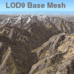
Detailed terrain mesh of the Southeastern Himalayan Ranges, N26-32 E90-98. The files in this package are based on Shuttle Radar (SRTM) Version 2 data but with many of the void areas, especially the most significant sections, filled with elevation data generated from topographic maps by Jonathan de Ferranti. While Jonathan's work is unrelated to flight simulation he kindly gave me permission to compile his data for use in FS. The result is a wonderful improvement in detail and accuracy over any existing mesh file, freeware or commercial, based on SRTM or DTED data alone.
Due to the large area of the Himalayas I've compiled the source data as two separate series: the "Himalayan Peaks" series covers prominent mountains and ranges in higher detail and locally overrides any existing LOD9 terrain mesh. In addition, a LOD9 "base mesh" series, with LOD8 and LOD7 "buffer" mesh files, covering the entire Himalayas, is meant for those who do not yet have an add-on terrain mesh of these beautiful mountains.
| Filename: | Himalayas_LOD9_Base_Mesh_Volume_1__Southeastern_Ra.zip |
| License: | Freeware, limited distribution |
| Added: | 29th May 2010, 09:01:26 |
| Downloads: | 10,298 |
| Author: | Holger Sandmann, Jonathan de Ferranti |
| Size: | 71.82 MB |
| Category: Flight Simulator 2004 - Scenery | |
| Himalayas LOD9 Base Mesh, Volume 3 - Southwestern Ranges |
|
Images related to this file:
File Description:
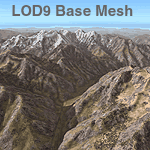
Detailed terrain mesh of the Southwestern Himalayan Ranges, N28-37 E78-82. The files in this package are based on Shuttle Radar (SRTM) Version 2 data but with many of the void areas, especially the most significant sections, filled with elevation data generated from topographic maps by Jonathan de Ferranti. While Jonathan's work is unrelated to flight simulation he kindly gave me permission to compile his data for use in FS. The result is a wonderful improvement in detail and accuracy over any existing mesh file, freeware or commercial, based on SRTM or DTED data alone.
Due to the large area of the Himalayas I've compiled the source data as two separate series: the "Himalayan Peaks" series covers prominent mountains and ranges in higher detail and locally overrides any existing LOD9 terrain mesh. In addition, the LOD9 "base mesh" series, with LOD8 and LOD7 "buffer" mesh files, covering the entire Himalayas, is meant for those who do not yet have an add-on terrain mesh of these beautiful mountains.
| Filename: | Himalayas_LOD9_Base_Mesh_Volume_3__Southwestern_Ra.zip |
| License: | Freeware, limited distribution |
| Added: | 30th May 2010, 10:00:26 |
| Downloads: | 155,808 |
| Author: | Holger Sandmann, Jonathan de Ferranti |
| Size: | 62.16 MB |
| Category: Flight Simulator 2004 - Original Aircraft | |
| ELVA / FlyUK Boeing 767 Package v2.5 |
|
Images related to this file:
File Description:
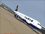
Euro Link POSKY B767 Package (Final). This is an exceptional package (one of many) Project Opensky Boeing 767. Liveries: Euro Link VA OC & NC, DHL, Air Europa, Air Holland, Air Portugal (TAP), Alitalia, Britannia, British Airways 'Landor', British Airways 'Union', Condor, Icelandair, KLM, LOT, LTU, Qantas, Varig. All aircraft are equipped with professional sounds and a professional panel. He also integrated the up to date Server Info gauge into all aircraft for use with VATSIM. The usual push back gauge is also included along with the crew announcements. A new added feature to this package is V Speed readouts, which were not included in the last release. Please see the readme file for more information and how to install ServInfo. Sorry about the size but 3 professional sound packages are also included (GE, RR and P&W). By Peter Slater, Gareth Abbott. Visit his web site for his other projects at http://fsprojects.webs.com or search 'peter slater' here on AVSIM. You can watch a promo video at http://www.youtube.com/watch?v=MCZR_oOy1lQ, requires psb767ud.zip
| Filename: | ELVA__FlyUK_Boeing_767_Package_v25.zip |
| License: | Freeware |
| Added: | 16th January 2012, 04:17:27 |
| Downloads: | 3,132 |
| Author: | Peter Slater, Gareth Abbott |
| Size: | 77.17 MB |
| Category: Flight Simulator 2004 - Original Aircraft | |
| ELVA / FlyUK Boeing 757 Package v2.5 |
|
Images related to this file:
File Description:

Euro Link POSKY B757 Package (Final). This is an exceptional package (one of many) Project Opensky Boeing 757. Liveries: Euro Link VA NC & OC (inc winglet model), Aerlingus, Air Holland, Aruba, Britannia, British Airways (Union, Wings, Blue Peter) inc winglet models, Condor, DHL, Excel Airways, First Choice, Iberia (inc winglet model), Icelandair, LTU, Monarch, My Travel, Thomas Cook and XL Airways. All aircraft are equipped with professional sounds and a professional panel. He also integrated the up to date ServInfo gauge into all aircraft for use with VATSIM. The usual push back gauge is also included along with the crew announcements. A new added feature to this package is V Speed readouts, which were not included in the last release. Please see the readme file for more information and how to install ServInfo. By Peter Slater, Gareth Abbott. Visit his web site for his other projects at http://fsprojects.webs.com or search 'peter slater' here on AVSIM. You can watch a promo video at http://www.youtube.com/watch?v=5RuvcshSfQA, requires psb757ud.zip
| Filename: | ELVA__FlyUK_Boeing_757_Package_v25.zip |
| License: | Freeware |
| Added: | 16th January 2012, 04:16:18 |
| Downloads: | 4,299 |
| Author: | Peter Slater, Gareth Abbott |
| Size: | 41.89 MB |
| Category: Flight Simulator 2004 - Scenery | |
| Himalayas LOD9 Base Mesh, Volume 4 - Kashmir and Jammu |
|
File Description:
Detailed terrain mesh of the Kashmir and Jammu Ranges, N30-39 E76-78. The files in this package are based on Shuttle Radar (SRTM) Version 2 data but with many of the void areas, especially the most significant sections, filled with elevation data generated from topographic maps by Jonathan de Ferranti. While Jonathan's work is unrelated to flight simulation he kindly gave me permission to compile his data for use in FS. The result is a wonderful improvement in detail and accuracy over any existing mesh file, freeware or commercial, based on SRTM or DTED data alone.
Due to the large area of the Himalayas I've compiled the source data as two separate series: the "Himalayan Peaks" series covers prominent mountains and ranges in higher detail and locally overrides any existing LOD9 terrain mesh. In addition, the LOD9 "base mesh" series, with LOD8 and LOD7 "buffer" mesh files, covering the entire Himalayas, is meant for those who do not yet have an add-on terrain mesh of these beautiful mountains.
| Filename: | Himalayas_LOD9_Base_Mesh_Volume_4__Kashmir_and_Jam.zip |
| License: | Freeware, limited distribution |
| Added: | 22nd February 2006, 20:32:50 |
| Downloads: | 7,504 |
| Author: | Holger Sandmann, Jonathan de Ferranti |
| Size: | 29.24 MB |
| Category: Flight Simulator 2004 - Scenery | |
| Himalayas LOD9 Base Mesh, Volume 5 - Hindu Kush and Pamir |
|
Images related to this file:
File Description:
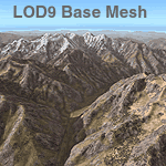
Detailed terrain mesh of the Hindu Kush and Pamir Ranges, N32-40 E70-76. The files in this package are based on Shuttle Radar (SRTM) Version 2 data but with many of the void areas, especially the most significant sections, filled with elevation data generated from topographic maps by Jonathan de Ferranti. While Jonathan's work is unrelated to flight simulation he kindly gave me permission to compile his data for use in FS. The result is a wonderful improvement in detail and accuracy over any existing mesh file, freeware or commercial, based on SRTM or DTED data alone.
Due to the large area of the Himalayas I've compiled the source data as two separate series: the "Himalayan Peaks" series covers prominent mountains and ranges in higher detail and locally overrides any existing LOD9 terrain mesh. In addition, the LOD9 "base mesh" series, with LOD8 and LOD7 "buffer" mesh files, covering the entire Himalayas, is meant for those who do not yet have an add-on terrain mesh of these beautiful mountains.
| Filename: | Himalayas_LOD9_Base_Mesh_Volume_5__Hindu_Kush_and_.zip |
| License: | Freeware, limited distribution |
| Added: | 29th May 2010, 08:57:29 |
| Downloads: | 7,604 |
| Author: | Holger Sandmann, Jonathan de Ferranti |
| Size: | 85.72 MB |
| Category: Flight Simulator 2004 - Scenery | |
| Himalayas LOD9 Base Mesh, Volume 2 - Southcentral Ranges |
|
Images related to this file:
File Description:
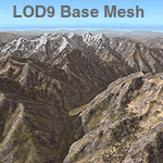
Detailed terrain mesh of the Southcentral Himalayan Ranges, N26-32 E82-90. The files in this package are based on Shuttle Radar (SRTM) Version 2 data but with many of the void areas, especially the most significant sections, filled with elevation data generated from topographic maps by Jonathan de Ferranti. While Jonathan's work is unrelated to flight simulation he kindly gave me permission to compile his data for use in FS. The result is a wonderful improvement in detail and accuracy over any existing mesh file, freeware or commercial, based on SRTM or DTED data alone.
Due to the large area of the Himalayas I've compiled the source data as two separate series: the "Himalayan Peaks" series covers prominent mountains and ranges in higher detail and locally overrides any existing LOD9 terrain mesh. In addition, a LOD9 "base mesh" series, with LOD8 and LOD7 "buffer" mesh files, covering the entire Himalayas, is meant for those who do not yet have an add-on terrain mesh of these beautiful mountains.
| Filename: | Himalayas_LOD9_Base_Mesh_Volume_2__Southcentral_Ra.zip |
| License: | Freeware, limited distribution |
| Added: | 29th May 2010, 09:05:56 |
| Downloads: | 9,450 |
| Author: | Holger Sandmann, Jonathan de Ferranti |
| Size: | 90.25 MB |
| Category: Flight Simulator 2004 - Scenery | |
| "Himalayan Peaks" LOD10 Mesh, Volume 8 - Tirich Mir and Pamir |
|
Images related to this file:
File Description:
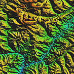
Highly detailed terrain mesh of the Tirich Mir and Pamir areas, N36-39 E71-74. The files in this package are based on Shuttle Radar (SRTM) Version 2 data but with many of the void areas, especially the most significant sections, filled with elevation data generated from topographic maps by Jonathan de Ferranti. While Jonathan's work is unrelated to flight simulation he kindly gave me permission to compile his data for use in FS. The result is a wonderful improvement in detail and accuracy over any existing mesh file, freeware or commercial, based on SRTM or DTED data alone.
Due to the large area of the Himalayas I've compiled the source data as two separate series: the "Himalayan Peaks" series covers prominent mountains and ranges in higher detail and locally overrides any existing LOD9 terrain mesh. In addition, a LOD9 "base mesh" series covering the entire Himalayas will be available for those who do not yet have an add-on terrain mesh of these beautiful mountains.
| Filename: | Himalayan_Peaks_LOD10_Mesh_Volume_8__Tirich_Mir_an.zip |
| License: | Freeware, limited distribution |
| Added: | 29th May 2010, 08:52:47 |
| Downloads: | 9,104 |
| Author: | Holger Sandmann, Jonathan de Ferranti |
| Size: | 47.94 MB |
| Category: Flight Simulator X - Aircraft Repaints, Textures and Modifications | |
| FS2004/FSX/P3D TDS Zipair Tokyo JA822J Boeing 787-8 Dreamliner |
|
Images related to this file:
File Description:

(TEXTURES ONLY)
(ONLY TESTED IN FSX: STEAM EDITION)
I separated this from the Japan Airlines JA822J / N1003W textures as both combined would be more than half a gigabyte big. This was inspired by Marco Revilla's Zipair Tokyo 787 Liveries, which he handed me his paint kit of it when I asked for it, but ultimately did not use it as instead I decided to make my own anyway.
I had to make lots of changes to the door details as well as the ports since they warp the lower they go. I also made sure the handle is aligned with the bump, compared to the original paint kit which is not. I am thinking of making a few more JAL and Zipair Tokyo fictional liveries involving this same registration but not confirmed yet.
Making the lightmaps here isn't that easy as because of the cutouts for the TDS 787's lightmaps, I couldn't really extend the lights without it being cutoff.
| Filename: | FS2004FSXP3D_TDS_Zipair_Tokyo_JA822J_Boeing_7878_D.zip |
| License: | Freeware |
| Added: | 19th April 2026, 20:23:06 |
| Downloads: | 55 |
| Author: | Ryubunao |
| Size: | 82.07 MB |
| Category: Flight Simulator 2004 - AI Flight Plans | |
| DHL Cargo *PART 1* DHL-Air UK |
|
File Description:
Flightplan for the DHL-Air UK. DHL move his HUB at march 30th from Brussels to Leipzig. Leipzig are now the biggest HUB in Europe for a cargo based airline. Brussels still remains as a small local HUB like Stockholm, Bergamo, Nottingham/East Midlands and so on... With the first part of the DHL-flightplans comes the UK-division with 22 Boeing 757-200 converted sepcial freighters, diverted into old and new colors. Also included in this part 1 all needed paints for this plan. Old color, new color and both colors with white nose. All Paints were made with the new Paintkit from AIAardvark. To install the liverys please read the "install instructions" file inside this package. Many thanks to Josef Petric. He gives his blood in the last fiew weeks to create this plan, because it was very diffcult to get informations about the DHL-flights. Stay tuned. European Air Transport (EAT) Belgium division wil follow soon. You only need the Base files for the AIAardvark Boeing 757-200RR. Base files package for FS2004 (aia_box.zip) available at Avsim
| Filename: | DHL_Cargo__PART_1_DHLAir_UK.zip |
| License: | Freeware |
| Added: | 16th April 2008, 20:24:18 |
| Downloads: | 3,659 |
| Author: | Josef Petric/Juergen Baumbusch |
| Size: | 1.37 MB |


© 2001-2026 AVSIM Online
All Rights Reserved
Privacy Policy |