
Where Flight Simulation Enthusiasts Gather from Around the World!
AVSIM Library - Search Results

| Category: Flight Simulator 2004 - Scenery | |
| Northbrook East CF47 and Northbrook West CF48, Ontario, Canada |

|
File Description:
Thirty five miles north of the 401 on Highway 41 is a small town called Northbrook, and in the town itself is a dirt strip with a runway 11/29 1,830 feet long, which for the sake of telling them apart I have called Northbrook East. I have no idea of the history, or even of the reason why. Less than a mile west of the town is a second dirt strip with a runway 04/22 2,200 feet long. This one (Northbrook West) was built to support construction of the electrical power line installation and there is a dirt clearing between the strip and the power lines. There is absolutely nothing at either of these fields, no fuel, no oil, no hangar, and a very rough surface. Although I have made these as grass strips in fact they are dirt; the reason I didn't make them dirt is that dirt in FS9 stands out for miles and looks awful.
| Filename: | Northbrook_East_CF47_and_Northbrook_West_CF48_Onta.zip |
| License: | Freeware |
| Added: | 6th February 2010, 02:36:22 |
| Downloads: | 272 |
| Author: | Roger Wensley |
| Size: | 192.25 KB |
| Category: Flight Simulator 2004 - Scenery | |
| Paul Farm Field CF16 in Ontario, Canada |
|
Images related to this file:
File Description:
Paul Field is on the south side of Highway 174, four miles east of Hawkesbury Windover Field and five miles west of the town of Hawkesbury; the town is on the south bank of the Ottawa River approximately midway between Ottawa and Montreal. I first saw the field when I was on the way to Windover a few years ago. I asked some old timers at Windover who the grass strip belonged to and they said "Paul". It may not be what Paul calls it, but it's the only name I know it by. Probably Paul doesn't call it anything, it's just the field where he keeps his plane. There is a grass runway approximately north-south and 2,000 feet long, and two hangars which look to be an old one and a new one. In real life the runway isn't so north-south as it lines up with the farm fields alignment which is of course in FS is auto-generated and not actuality-accurate.
| Filename: | Paul_Farm_Field_CF16_in_Ontario_Canada.zip |
| License: | Freeware, limited distribution |
| Added: | 6th February 2010, 02:36:49 |
| Downloads: | 291 |
| Author: | Roger Wensley |
| Size: | 997.17 KB |
| Category: Flight Simulator 2004 - Scenery | |
| Gunnison (KGUC), Colorado, Photo-Scenery |
|
Images related to this file:
File Description:
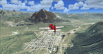
Gunnison (KGUC), Colorado, Photo-Scenery (FS9 & FSX)
Extends my Aspen scenery to the south from Crested Butte to Gunnison (KGUC) and beyond. Contains the West Elk Wilderness Area and the Curecanti Nat'l. Rec. Area around Morrow Point Reservoir. This scenery brings you another 3.500 sq km of beautiful Colorado in 4.7m/pix quality.
High resolution versions of this scenery for FS9 and FSX (much sharper, but larger and multiple downloads) are available at www.blueskyscenery.com/GNB_South3West2.html . The screenies are taken from the high-res versions, so expect this version to be slightly more blurry. YourDonation@Work: Dedicated to Alain, Jacques and Lefevre.
| Filename: | Gunnison_KGUC_Colorado_PhotoScenery.zip |
| License: | Freeware, limited distribution |
| Added: | 6th February 2010, 11:08:59 |
| Downloads: | 1,733 |
| Author: | Gottfried Razek, blueskyscenery.com |
| Size: | 90.83 MB |
| Category: Flight Simulator 2004 - Scenery | |
| Bangalore HAL VOBG Light |
|
Images related to this file:
File Description:
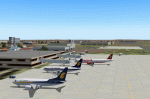
Bangalore HAL VOBG Light scenery FS9. Built with RWY12 objects. Because AI packages still use this old Bangalore Airport. Corrected position of RWY/TWY and parking according to Google Earth and Airports Authority of India Documents. By Gernot Zander 2010-02-07.
| Filename: | Bangalore_HAL_VOBG_Light.zip |
| License: | Freeware |
| Added: | 7th February 2010, 08:00:46 |
| Downloads: | 1,196 |
| Author: | Gernot Zander |
| Size: | 820.33 KB |
| Category: Flight Simulator 2004 - Scenery | |
| London City LCY EGLC Light |
|
Images related to this file:
File Description:
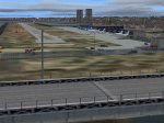
London City LCY EGLC Light scenery FS9. Simple, but custom terminal building and RWY12 objects. New apron platform and building, opened 2008. Corrected coast line (FS9 version only), RWY/TWY and position of the dock. Connaught Bridge, Sir Steve Redgrave Bridge, Woolwich Manor Way Bridge (standard FS bridges). Positions taken from Google Earth. By Gernot Zander, 2010-02-07.
| Filename: | London_City_LCY_EGLC_Light.zip |
| License: | Freeware |
| Added: | 7th February 2010, 11:15:16 |
| Downloads: | 2,587 |
| Author: | Gernot Zander |
| Size: | 1.22 MB |
| Category: Flight Simulator 2004 - Scenery | |
| Buena Vista, Central Colorado Reg. (KAEJ form. 7V1), Colorado, Photo-Scenery (FS9 & FSX) |
|
Images related to this file:
File Description:
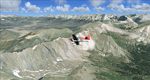
This region covers the area around Buena Vista and Central Colorado Reg. (KAEJ form. 7V1). It extends
my Leadville scenery to the south and brings you another 3.500 sq km of beautiful Colorado in 4.7m/pix quality. High resolution versions of this scenery for FS9 and FSX (much sharper, but larger and multiple downloads) are available at www.blueskyscenery.com/GNB_South3West.html . The screenies are taken from the high-res versions, so expect this version to be slightly more blurry. YourDonation@Work: Dedicated to Matias and Markus.
| Filename: | Buena_Vista_Central_Colorado_Reg_KAEJ_form_7V1_Col.zip |
| License: | Freeware, limited distribution |
| Added: | 7th February 2010, 11:31:14 |
| Downloads: | 1,578 |
| Author: | Gottfried Razek - blueskyscenery.com |
| Size: | 93.89 MB |
| Category: Flight Simulator 2004 - Scenery | |
| Rockcliffe Flying Club modifications for the Flight Ontario Rockcliffe CYRO scenery in Ontario, Canada |
|
Images related to this file:
File Description:
Flight Ontario posted their scenery for Rockcliffe CYRO in 2008, having worked with all the information they had but not all the information they would have liked (the usual situation with all scenery designers, including me). I learnt to fly at RFC and know Rockcliffe well so there are some additions and modifications here including the refueling point near the RFC buildings, revised apron shape, gravel car park, parked cars, extended perimeter fence, deck in front of the RFC clubhouse, more parked planes, the large and old willow tree, and the float dock in the river. Of course, since then the willow tree was felled by a tornado and there are now other major modifications including a new hangar, so watch this space.
| Filename: | Rockcliffe_Flying_Club_modifications_for_the_Fligh.zip |
| License: | Freeware, limited distribution |
| Added: | 7th February 2010, 13:55:27 |
| Downloads: | 444 |
| Author: | Roger Wensley |
| Size: | 1.17 MB |
| Category: Flight Simulator 2004 - Scenery | |
| Aerodromo Iztapa (MGIZ) NDB 400 Guatemala CA |
|
File Description:
Mesh and scenery
| Filename: | Aerodromo_Iztapa_MGIZ_NDB_400_Guatemala_CA.zip |
| License: | Freeware |
| Added: | 7th February 2010, 22:40:20 |
| Downloads: | 818 |
| Author: | Jose Luis Aguila Boudib |
| Size: | 2.12 MB |
| Category: Flight Simulator 2004 - Scenery | |
| Indian Creek Farm Field CF07 near Ottawa in Ontario, Canada |
|
Images related to this file:
File Description:
Indian Creek farm field (Re-upload WITH THE MISSING TEXTURES!) is in Ontario and southeast of Ottawa, less than two miles east of two other real-life farm fields I have already posted (Russell Farm, and Russellette Strip). The creek is just north of the runway in the trees, though it doesn't show in FS with or without Ultimate Terrain.
There is a grass runway 08/26 that is 2,100 feet long and has lights; the grass could be better (I mean there could be more of it) but the drainage is good. There is a large hangar that is right by the house and is heated (wow!); this is for the owner. There are also eight other hangars which are slightly basic and without doors, which means boxes over the wheels so the tires don't get chewed by the wild life and canvas hangar fronts for the winter. All the hangar buildings are modeled specifically for this scenery. The runway has been there for 22 years, and before that (though with a large gap between) there was a military grass strip as a relief field for nearby Pendleton .
| Filename: | Indian_Creek_Farm_Field_CF07_near_Ottawa_in_Ontari.zip |
| License: | Freeware, limited distribution |
| Added: | 8th February 2010, 09:45:16 |
| Downloads: | 443 |
| Author: | Roger Wensley |
| Size: | 11.35 MB |
| Category: Flight Simulator 2004 - Scenery | |
| One Hundred Mile House CAV3, British Columbia, Canada |
|
Images related to this file:
File Description:
One Hundred Mile House is eight miles south of 108 Mile Airport in BC and this version HAS THE MISSING TEXTURES! It is also 75 miles northwest of Kamloops. The runway 08/26 is 1,900 feet long and asphalt (except in the winter, when it is described as "snow"; there is also a note about limited winter maintenance) and almost in the middle of town. The apron is at the eastern (town) end of the runway and on the south side of this there is a large pond which attracts ducks and other water birds. Try to avoid the geese, they can weigh 14lb and come through the prop AND the perspex and up close have dark brown eyes; I speak from an experience 50 feet above the Rockcliffe runway.
| Filename: | One_Hundred_Mile_House_CAV3_British_Columbia_Canad.zip |
| License: | Freeware, limited distribution |
| Added: | 8th February 2010, 09:50:00 |
| Downloads: | 810 |
| Author: | Roger Wensley |
| Size: | 4.02 MB |


© 2001-2026 AVSIM Online
All Rights Reserved
Privacy Policy |