
Where Flight Simulation Enthusiasts Gather from Around the World!
AVSIM Library - Search Results

| Category: Flight Simulator 2004 - Scenery | |
| Smithers CYYD in British Columbia, Canada, Updated |

|
Images related to this file:
File Description:
Made in December 2018 as an update of the original post of 2014, to correct the apron markings, revise the AI, increase the number of GA parking spots, and most importantly to correct the runway lighting by adding the missing approach lights. This scenery is complete and can be installed as-is without first installing the 2014 version. Smithers is in northwest BC, 60 miles east and a bit north of Terrace, and directly east of the southern border of Alaska. The town has a population of 5,500 and is set in a north-south valley between mountains, the most impressive of which is Hudson Bay Mountain to the west. The airport is to the north of the town and has a single runway of 7,544 feet, aligned 33-15. The main user is Central Mountain Air, who are headquartered in Smithers and have a large maintenance hangar there next to the terminal building. The airport has scheduled flights by Central Mountain Air, Jazz, and Hawk Air, which are in the AI. The AI provided here is a new CYYD traffic bgl; in total the AI also includes a Dawson Creek traffic bgl (recently revised and posted) plus a Terrace traffic bgl (which will shortly be revised and posted). An Electra of Conair (who are the largest operator of fire fighting planes in BC, and have re-fill tanks in Smithers) is included and also a HS 748 of Air North.
| Filename: | Smithers_CYYD_in_British_Columbia_Canada_Updated.zip |
| License: | Freeware, limited distribution |
| Added: | 4th January 2019, 18:08:03 |
| Downloads: | 214 |
| Author: | Roger Wensley |
| Size: | 14.22 MB |
| Category: Flight Simulator 2004 - Scenery | |
| One Hundred Mile House CAV3, British Columbia, Canada |
|
Images related to this file:
File Description:
One Hundred Mile House is eight miles south of 108 Mile Airport in BC and this version HAS THE MISSING TEXTURES! It is also 75 miles northwest of Kamloops. The runway 08/26 is 1,900 feet long and asphalt (except in the winter, when it is described as "snow"; there is also a note about limited winter maintenance) and almost in the middle of town. The apron is at the eastern (town) end of the runway and on the south side of this there is a large pond which attracts ducks and other water birds. Try to avoid the geese, they can weigh 14lb and come through the prop AND the perspex and up close have dark brown eyes; I speak from an experience 50 feet above the Rockcliffe runway.
| Filename: | One_Hundred_Mile_House_CAV3_British_Columbia_Canad.zip |
| License: | Freeware, limited distribution |
| Added: | 8th February 2010, 09:50:00 |
| Downloads: | 806 |
| Author: | Roger Wensley |
| Size: | 4.02 MB |
| Category: Flight Simulator 2004 - Scenery | |
| Echo Bay CAA7 in British Columbia, Canada |
|
Images related to this file:
File Description:
This is the fifth in a series of new and renovated float bases in BC. Echo Bay is a floating marina on the northwest coast of Gilford Island, just 6 miles northwest of Health Bay (the previous post in this series). It is run by a beard called Pierre and his wife, and the food seems to attract crowds. Watch the video, and others about the marina; some of the more interesting buildings are replicated here, others are representative. There is no fuel or oil available but you can post a letter as there is a post office in the store that sells food etc to boaters. The AI is a further adaptation of the CF36 AI and involves a Baxter Beaver flying from Port Hardy on a round trip in the area through Port McNeill, Health Bay, Echo Bay, and Sullivan Bay, plus Harbour Air from Vancouver, and small GA. At Echo Bay the AI appears to work for both landing and takeoff for the Beaver and sometimes for the Otter, depending on wind direction. All of these float bases can be installed together in the same folders, with a saving in duplicate textures. So a series called BC Floats (or whatever you want to call it) or individually installed float bases; your choice. The next in the series will be Sullivan Bay, another floating marina. I have used what was a RWY12 boat here, but my RWY12 no longer includes the "Port and Sea" part that included this and other boats. Somewhere I must still have the textures as they are showing up as required, but I cannot find them to include them here. Hopefully your installation will find them on your hard drive and use them. If not, complain to me and I will attempt to demonstrate diligence.
| Filename: | Echo_Bay_CAA7_in_British_Columbia_Canada.zip |
| License: | Freeware, limited distribution |
| Added: | 18th January 2017, 17:09:19 |
| Downloads: | 202 |
| Author: | Roger Wensley |
| Size: | 6.92 MB |
| Category: Flight Simulator 2004 - Scenery | |
| Hatay Airport V2 LTDA |
|
File Description:
Highly detailed scenery of Hatay New Airport V2 (LTDA) in The Turkey.
Antakya or Hatay, as its official name is today, was founded in 300 BC as Antioch-ad-Orontes by Seleucos Nicator, one of Alexander's generals. Antakya grew quickly to become a city of half a million people and, under the Romans, became one of the main centers of the Christian faith. The city survived a massive earthquake in the 5th century killing 250,000 people. It was later fought over by Persians, Byzantines, Arabs, Armenians, Seljuks, Crusaders and Mamluks. The latter literally wiped out the city and it never regained its former glory. Antakya was part of the French protectorate of Syria until 1939, became independent as the Republic of Hatay for a short period and then joined the Republic of Turkey on 23 July 1939.
| Filename: | Hatay_Airport_V2_LTDA.zip |
| License: | Freeware |
| Added: | 8th March 2008, 22:36:31 |
| Downloads: | 2,059 |
| Author: | Vedat Sencan |
| Size: | 2.07 MB |
| Category: Flight Simulator 2004 - Scenery | |
| USA Landclass AddOn - Vegetation Part 1 UPDATE 1.5 |
|
Images related to this file:
File Description:
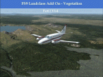
Complete Update, please delete all the old scenery folders. Compatible with Ultimate Terrain, incl. some fixes for UT. Sorry for the update 1.4 called final. Pleas note the readme file. Udate V1.5 concerns mainly British Columbia, the boring LC from CYLW to CYKA to CYWL to CYQZ and to CYXS. Now it is varied, made again with satellite maps. Also change the wrong green LC from KASE (Aspen) to KRIL (Glenwood Springs) and some LC Border correction. BC requires for one LC good replacement textures(026b2.bmp) to enjoy the changes or do it by yourself. Birds Eye View textures includes a good texture. For GEpro Users there is a example picture how to make it with texture 024b2 and 052b2 and a Paintshop Software. For a fast Textureswitch, Batch files are included, also inf and raw files for changing for your according to your taste.
| Filename: | USA_Landclass_AddOn__Vegetation__Part_1_UPDATE_15.zip |
| License: | Freeware |
| Added: | 5th March 2015, 19:32:31 |
| Downloads: | 291 |
| Author: | Markus Balz |
| Size: | 4.01 MB |
| Category: Flight Simulator 2004 - Scenery | |
| Fort Graham CBW3 in British Columbia Canada |
|
Images related to this file:
File Description:
Fort Graham is what looks like a very small village on the eastern shore of Williston Lake in northern British Columbia, around 100 miles north of Mackenzie (a previous post). The lake, while not large by Canadian standards, is well over 100 miles long but squeezed in width to a maximum of 5 miles amid the surrounding Rockies. The airfield has a gravel runway of 5,000 feet aligned 13-31 and at 2,230 feet ASL. There is no lighting. The operator of the airfield (and presumably the "village" too) is Finlay River Outfitters, a company that is based in Mackenzie and "outfits" hunting trips in the local area. I have posted this as Fort Graham CBW3, but I suggest that you just add it to your previously created "BC airfields" and avoid the inevitable doubling up of common textures etc. Up to you. If you find a defect, email me.
| Filename: | Fort_Graham_CBW3_in_British_Columbia_Canada.zip |
| License: | Freeware, limited distribution |
| Added: | 23rd November 2020, 20:13:11 |
| Downloads: | 105 |
| Author: | Roger Wensley |
| Size: | 7.75 MB |
| Category: Flight Simulator 2004 - Scenery | |
| CYCQ - Chetwynd - British Columbia, Canada |
|
Images related to this file:
File Description:
The town of Chetwynd (population around 2,600) is on the east side of the Rocky Mountains, the first town to be encountered when descending from the Rockies on highway 97. Previously known as Little Prairie, the town name was changed in 1962. The main occupations of the town are linked to forestry, fossil fuels, and transportation; there are railway lines north to Fort St John, east to Dawson Creek, and south to Prince George. The airport is on the southern side of the town, with one runway aligned 05-23, asphalted in 1975 and just under 4,500 feet long. There are no scheduled services, although a new terminal building was constructed in 2008, and the helicopter operations by at least two companies (oil and gas and medical evacuation flights) are the primary operations from the field. These are included in the AI, incorporating helicopter modifications made by Holger Sandmann so that they function properly as AI at an airfield. As an aside, landing like a plane and using the runway and taxiways is in fact exactly what a helicopter does at a normal airfield in real life; everyone does the same thing so that guessing is unneccesary.
| Filename: | CYCQ__Chetwynd__British_Columbia_Canada.zip |
| License: | Freeware, limited distribution |
| Added: | 28th March 2016, 21:36:33 |
| Downloads: | 298 |
| Author: | Roger Wensley |
| Size: | 18.84 MB |
| Category: Flight Simulator 2004 - Scenery | |
| Colorado Lakes Project II |
|
File Description:
This project features the Blue Mesa Reservoir and the Black Canyon of the Gunnison and adds over 300 highly detailed lakes to the central portion of western Colorado. Three reservoirs, named for corresponding dams on the Gunnison River, form the heart of Curecanti National Recreation Area. Panoramic mesas, fjord-like reservoirs, and deep, steep and narrow canyons abound. Blue Mesa Reservoir is Colorado's largest body of water, and is the largest Kokanee Salmon fishery in the United States. Morrow Point Reservoir is the beginning of the Black Canyon of the Gunnison and below it is Crystal Reservoir.
These lakes are specifically designed to show off their photo realistic detail when used in combination with "FSGenesis-The Rockies 38.2m Terrain Mesh-Colorado" available as "fsg_dem38m_usrk_co.zip" at avsim.com, or comparable mesh. The free FSGenesis US National Landclass Project Beta 6 also adds beautifully to the landscape. These lakes work equally as well with the default mesh.
All lake information was projected from satellite imagery and compiled with a beta version of Jim Keir's "Slartibartfast" utility. Much thanks to Holger Sandmann and Jim Keir for their help and advice on interpreting the satellite data properly.
| Filename: | Colorado_Lakes_Project_II.zip |
| License: | Freeware |
| Added: | 1st June 2004, 02:34:42 |
| Downloads: | 6,050 |
| Author: | Carlyle Sharpe |
| Size: | 332.25 KB |
| Category: Flight Simulator 2004 - Scenery | |
| Twin Lakes Airstrips in British Columbia Canada |
|
Images related to this file:
File Description:
There are three grass airstrips within sight of each other from the air at Twin Lakes in BC, which is between the close junction of Elkin Lake and Vedan Lake. The two lakes are similarly shaped and sized and in the same narrow valley between high ground that runs north-south; hence the name. Elkin is to the north, and Vedan is to the south. Twin Lakes CAG4 is on the strip of land between the two lakes and it is unclear to me who it belongs to etc. It is not in the Nav Canada copy that I have with me which is from 2010, and the online version does not cover grass strips. It is probably owned by whoever lives in the house next to the red hangar. The runway is 3,600 feet of grass aligned 14-32 at 3,945 feet ASL. Chaunigan Lake Lodge CF83 is over to the northwest from Twin Lakes by around 2 miles or so and as the name suggests it services the Lodge of that name, which is on the northeast corner of Chaunigan Lake. The runway is 2,600 feet of grass aligned 02-20 at 4,900 feet ASL. You might want to read about altitude power reductions for the take off. Elkin Creek Guest Ranch CBL9 is at the southern end of Vedan Lake and serves the ranch. This appears to be another high-budget operation and the runway is 3,670 feet of grass aligned 36-18 at 3,999 feet ASL. I have posted this as three separate airstrips, but I suggest that you add these to your "BC airfields" folder as previously suggested. Up to you. If you find a defect, email me. Ignore the post of Chilanko Lodge posted today. I requested Avsim to delete it but it seems they didn't read the email. It was originally posted as a correction for the original post of the three posted here.
| Filename: | Twin_Lakes_Airstrips_in_British_Columbia_Canada.zip |
| License: | Freeware, limited distribution |
| Added: | 21st November 2020, 23:29:09 |
| Downloads: | 123 |
| Author: | Roger Wensley |
| Size: | 25.39 MB |
| Category: Flight Simulator 2004 - Scenery | |
| Williams Lake CYWL |
|
Images related to this file:
File Description:
Founded in 1860, Williams Lake is located in the beautiful central British Columbia region known as the Cariboo. With a population of about 11,000, Williams Lake is the largest urban center between Kamloops and Prince George. The airport has one 7,000' (2,100m) runway and is served by Central Mountain Air and Pacific Coastal Airways.
This complete rebuild of CYWL features all new taxiways, aprons and buildings, an accurate custom terminal building, and the usual fences, trees, ramp objects, etc. Many thanks to Shawn Lund, Air Attack Officer, BC Wildfire Management Branch, Kamloops Fire Centre, for the photos of the terminal building and his permission to use them. Included are the Nav Canada aerodrome diagram and the two instrument approach plates. (These approach plates are out of date and obviously NOT for real world use.)
This scenery was designed for use with Ultimate Terrain and was not tested in the default scenery. It may or may not work in FSX.
| Filename: | Williams_Lake_CYWL.zip |
| License: | Freeware |
| Added: | 21st December 2010, 07:17:50 |
| Downloads: | 1,071 |
| Author: | Sidney Schwartz & Peter Ham |
| Size: | 2.07 MB |
© 2001-2026 AVSIM Online
All Rights Reserved
Privacy Policy |