
Where Flight Simulation Enthusiasts Gather from Around the World!
AVSIM Library - Search Results

| Category: Flight Simulator 2004 - Scenery | |
| Canlaon Volcano Eruption Scenery |

|
File Description:
Canlaon Volcano is located at the center of Negros Island,Philippines.The twin-peaked massif of Canlaon Volcano (aka Mt. Kanlaon) rises 2,465 meters above the island of Negros just 40-km southwest of the capital Bacolod.This file will add the crater to Canlaon Volcano and will enhance the Landclass surrounding the crater.The crater is real with water.This also adds Visual Effects such as steam,volcanic ashes and lava that will erupt every now and then.Ash falls will fall in the vulnerable surrounding villages of Pula, Malaiba, and Lumanao.The last volcanic activity of Canlaon Volcano recorded by Phivolcs was on June 1-18,2003.
Fly from Bacolod City(RPVB)to Tagbilaran City(RPVT)or Mactan(RPVM) and pass through the highest point of the Island of Negros and behold the beauty of the Canlaon Volcano eruption.
Special steam,ash,and lava effects are visible at daytime and at nighttime.The new Philippine Mesh by Jacques Marie is recommended for achieving realistic topography.You may find it here at avsim,too.
| Filename: | Canlaon_Volcano_Eruption_Scenery.zip |
| License: | Freeware |
| Added: | 10th December 2003, 22:41:38 |
| Downloads: | 3,878 |
| Author: | Ver Walter L. Gulfan |
| Size: | 5.04 KB |
| Category: Flight Simulator 2004 - Scenery | |
| Yellowknife CYZF, 2010 |
|
Images related to this file:
File Description:
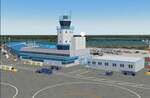
Founded as a gold town in 1936, Yellowknife is now the capital city of the Canadian Northwest Territories, and its airport, CYZF, is the busiest airport in northern Canada. Located only 250 miles south of the Arctic Circle, it is also subject to some of the harshest and most dangerous climate conditions in the world.
This version features:
*All ramps and taxiways completely redone to be more accurate
*All default buildings replaced
*Realistic Gmax models of the main terminal and tower, the First Air, CAF Squadron 440, and Buffalo Airways hangers
*Static aircraft for the First Air, CAF Squadron 440, Air Tindi and Buffalo Airways ramps
*Visual models of the arrestor cables on the main runway
*Fences, ramp lights, cargo, ground vehicles and all the other details that bring an airport to life
*Modular construction. The main buildings, ramp objects and static aircraft are in separate files and can be selectively deactivated to improve frame rates.
| Filename: | Yellowknife_CYZF_2010.zip |
| License: | Freeware |
| Added: | 16th January 2010, 10:31:02 |
| Downloads: | 6,915 |
| Author: | Sidney Schwartz, Peter Ham |
| Size: | 15.42 MB |
| Category: Flight Simulator 2004 - Scenery | |
| Prince George CYXS in British Columbia, Canada |
|
File Description:
Prince George is centrally located in British Columbia, mid way between the border with the USA in the south and the northern border with the Northern Territories, and around 100 miles west of the eastern border with Alberta. The town now has a population of around 74,000 and is regarded as the province's northern capital. It is at the meeting point of the Fraser and Nechako rivers and the crossroads of highways 16 and 97. It started out as Fort George in the early 1800's when a trading post was established by the Northwest Company,serviced by paddle boats on the rivers. The railway arrived in the area in 1914 and growth continued, albeit slowly due to wars and the financial collapse of the 1930's. Timber and timber products were and still are the mainstay of the area, along with a military and governmental presence.
The date for this scenery is around 2010. I have made some new buildings from memory and the available information online. They are not totally accurate reproductions; for instance I know that the terminal building is brick faced and also has parts that are stone (or metal?) faced, but where? So I used brick everywhere. The control tower is also brick faced, but is not exactly the right shape. The airport management team have continued to grow the activity and services provided with the result that flights and passenger numbers continue to increase. The 15-33 runway was lengthened to the south, (in the period 2003 to 2005) from the original FS9 scenery 7,400 feet to my updated 11,450 feet with central lighting and ILS at the northern end. This made it the third longest runway in Canada. At the same time a loading/unloading cargo area was created with professionally run storage and also a large scale refueling storage. If DHL want to refuel their 737 then they can do so without making prior arrangements.
The AI included here is for Air Canada Jazz and an Air Canada 737, Westjet 737 and Dash8, a helicopter company that is based there, Pacific Coastal, Central Mountain Air, and GA. The range of airlines and planes reflects the "northern capital" status of the town.
| Filename: | Prince_George_CYXS_in_British_Columbia_Canada.zip |
| License: | Freeware, limited distribution |
| Added: | 11th November 2022, 23:10:19 |
| Downloads: | 165 |
| Author: | Roger Wensley |
| Size: | 28.04 MB |
| Category: Flight Simulator 2004 - Scenery | |
| Baton Rouge,La. ( KBTR v2 ) |
|
File Description:
FS2004 KBTR Baton Rouge,La. v2.0
This is an updated version from my old EZ Mega KBTR version 1.0
This Scenery is optimized for use with Ultimate Terrain USA,but should work OK with default land scenery.
This package features a lot of objects around the city of Baton Rouge, such as an accurate rendition of the 473foot tall State capital Building, Cortana mall,Seigen Village Mall,strip malls,banks,restaurants,gas stations,Chemical plants,River Barge Traffic,USS Kidd Destroyer,the two casino boats,the Marriott Hotel off College drive,Louisiana State Police headquarters with its own AFCAD and Helo pads and lots of other stuff.This version does not feature my custom built terminal and hangers,that will come in version 3.
The Airport AFCAD has been once again reworked as well to reflect the newly lengthened Rwy 22R-4L and other stuff.
This has been my test bed for the upcoming version 3 release which will be released by Christmas hopefully.
In the meantime,enjoy this new version equipped with familiar landmarks.
As Always...Enjoy!!!
| Filename: | Baton_RougeLa__KBTR_v2_.zip |
| License: | Freeware |
| Added: | 11th October 2008, 02:15:38 |
| Downloads: | 2,875 |
| Author: | Joe DeGregorio |
| Size: | 13.04 MB |
| Category: Flight Simulator 2004 - Scenery | |
| Chiang Mai Photo scenery (Chiangmai city) |
|
Images related to this file:
File Description:
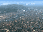
Chiang Mai was founded in the late 13th century. It was once the capital of Lanna, an independent Thai Kingdom and has preserved its unique cultural heritage to a marked degree. It is located 700 km (435 mi) north of Bangkok, among the highest mountains in the country. The city is on the Ping river, a major tributary of the Chao Phraya river. Culture of Chiang Mai is architecture reflects Lanna Thai,Burmese,Sri Lankan and Mon influences.There are some 300 temples in the city and on its outskirts. The Golden Age of Lanna-Chiang Mai lies some 500 years back in the time of king Tilokarat,but the city has recently been undergoing a process of regeneration,and while full of the bustle of modern life,it hasn't lost touch with its glorious past.
This scenery just only preview the real thing. If you visit Thailand, this city is the "must" see in your trip. The best time to go to Chiangmai is winter time since the weather is cool and bright sunny.
| Filename: | Chiang_Mai_Photo_scenery_Chiangmai_city.zip |
| License: | Freeware |
| Added: | 30th August 2010, 13:13:46 |
| Downloads: | 2,573 |
| Author: | PARIWAT LORDNGERN / Thaiflight Simulator |
| Size: | 26.31 MB |
| Category: Flight Simulator 2004 - Scenery | |
| EPWA - Warsaw Chopin Airport - Warsaw, Poland ** UPDATED VERSION `` |
|
Images related to this file:
File Description:

EPWA WARSAW CHOPIN AIRPORT 2015 DEMO features an extremely detailed scenery of EPWA Chopin airport in Warsaw, Poland, fully compatible with FS2004.
This product is a fully functional DEMO version of the commercial payware product. It features same airport layout as in the full version but with limited 3D objects and low resolution textures. Using this free demo ensures no problems with online (VATSIM, IVAO, multiplayer etc.) flying in case some users use the payware scenery and some don't.
Warsaw Chopin Airport (WAW / EPWA) is is an international airport located in Warsaw, Poland's capital, which handles just under 40% of the country's air passenger traffic. There are two crossing runways (2800m and 3690m), a number of hangars, a cargo terminal and a passenger terminal, completely rebuilt in 2008-2015.
The product is equipped with an automatic installer, which means that the scenery will be automatically added to the Flight Simulator Scenery Library. Please uninstall all previous versions of this airport you may have installed before. Please make also sure that no duplicated AFCAD files are installed.
Enjoy your virtual flying with Drzewiecki Design!
| Filename: | EPWA__Warsaw_Chopin_Airport__Warsaw_Poland___UPDAT.zip |
| License: | Freeware, limited distribution |
| Added: | 4th March 2016, 15:54:50 |
| Downloads: | 1,039 |
| Author: | Drzewiecki Design |
| Size: | 15.67 MB |
| Category: Flight Simulator 2004 - Scenery | |
| CYQR Regina (Regina International Airport and Roland Groome Field) Version 2 |
|
Images related to this file:
File Description:

Regina International Airport can trace its history back to 1919, when Regina airport became the first registered air harbour in Canada. This virtual model of CYQR represents the airport as it was in spring of 2007. CYQR airport is the gateway to southern Saskatchewan, Canada and is situationed in Regina, which is the provincial capital. The airport is served by Air Canada, Air Canada JAZZ, Westjet, West Wind, Express Air, Northwest Airlines and United Airlines. The airport is named for Roland Groome, who was the first registered pilot in Canada.
This scenery is a re-upload of version 2 of the scenery, which was lost in the AVSIM hack. Nothing has changed.
This scenery was constructed using GMAX and includes nearly every airport and commercial building on the airport property. Beyond the airport itself this scenery also includes, as an option, the major landmark buildings in the city of Regina proper and those on the runway approaches. Regina City buildings are meant to enhance the realism of virtual flying in the Regina area.
| Filename: | CYQR_Regina_Regina_International_Airport_and_Rolan.zip |
| License: | Freeware |
| Added: | 7th May 2010, 12:49:25 |
| Downloads: | 6,911 |
| Author: | Gregory Putz |
| Size: | 10.99 MB |
| Category: Flight Simulator 2004 - Scenery | |
| Houn, Libyan (HLON/HUQ) |
|
File Description:
Googly scenery for HLON Hon, Libya, a small domestic airport serving the oasis town (which is correctly spelt Houn) about 250 miles south-east of Tripoli. It is the capital of the Al Jufrah region. Although the airport holds ICAO and IATA status, as far as I can establish there are
currently no scheduled services to this airport, so present-day traffic is limited to the occasional charter, cargo or private flight. Flight Simulator 2004 has made no provision for traffic with only a runway provided and this scenery seeks to redress the situation so that you and your "AI" traffic can use the airport. The scenery does not purport to be ultra-accurate. Based on high quality satellite imagery from Google Earth, the layout is proportionally correct but the
added airport features, such as buildings, are built from default Microsoft objects
and add-on libraries so will not look exactly like the real thing. You are not obliged to download and install any additional scenery libraries, but to enjoy this scenery in its entirety, you may wish to. It will work fine, with or without.
| Filename: | Houn_Libyan_HLONHUQ.zip |
| License: | Freeware |
| Added: | 18th April 2008, 09:51:02 |
| Downloads: | 842 |
| Author: | John Hinson |
| Size: | 65.71 KB |
| Category: Flight Simulator 2004 - Scenery | |
| Jetways & Terminals For ACOF Package Final |
|
Images related to this file:
File Description:
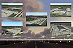
The Final Package of the "Jetways & Terminals" program with all 38 updated and improved sceneries: EDDH Hamburg Fuhlsbuettel, EDDM Munich Muenchen Franz Josef Strauss, FACT Cape Town D.F.Malan, HKJK Nairobi Jomo Kenyatta, KLAS Las Vegas McCarran, KLAX Los Angeles, KLGA New York La Guardia, KOAK Oakland Metro, KSAN San Diego Lindbergh, KSFO San Francisco, KSNA Santa Ana John Wayne Orange County, NZAA Auckland, RCTP Taipei Taiwan Taoyuan, RJAA Tokyo Narita, RKSI Seoul Incheon, RPLL Manila Ninoy Aquino, SBGL Rio De Janeiro Galeão, SCEL Santiago De Chile Arturo Merino Benitez, SKBO Bogotá El Dorado, SLLP La Paz El Alto, VHHH Hongkong Chek Lap Kok, VIDP Delhi Indira Gandhi, VMMC Macau Airport, VOBL Bangalore Bengaluru, VOHS Hyderabad Rajiv Gandhi, VTBS Bangkok Suvarnabhumi, WMKK Kuala Lumpur Sepang, WMKP Penang Bayan Lepas, WSSS Singapore Changi, YBBN Brisbane, YMML Melbourne Tullamarine, YSSY Sydney Kingsford Smith, ZBAA Beijing Capital, ZGGG Guangzhou New Baiyun, ZGKL Guilin Liangjiang, ZGSD Zhuhai Sanzao, ZGSZ Shenzhen Huangtian, ZSPD Shanghai Pudong. All AFCAD files included. Landclass files and XML ILS-Approaches included. Please visit the forum threads and read the online Installation Guide in english and german language (see read me file fs2004-jetways-terminals-final.txt for links).
| Filename: | Jetways__Terminals_For_ACOF_Package_Final.zip |
| License: | Freeware |
| Added: | 26th November 2008, 11:45:05 |
| Downloads: | 49,053 |
| Author: | Jan Martin |
| Size: | 2.99 MB |
| Category: Flight Simulator 2004 - Scenery | |
| Hewanorra TLPL on Saint Lucia in the eastern Caribbean |
|
Images related to this file:
File Description:
St Lucia island is to the north of the Grenadines, between Martinique and Saint Vincent. St Lucia is nearly 30 miles long and has a population of 175,000, with two airports. Hewanorra International is at the southern end of the island, the end furthest from the capital, Castries. The reason for this is that at the southern end it was possible to build a runway almost 9,000 feet long, while the airport in the north (Vigie) could not be extended further to accomodate the largest jets. The airport was originally a USAAF base, converted to commercial use.
All buildings are made with photographic textures and include the new terminal and a new control tower. The apron has been extended so that 747's etc can be accommodated, and there are regular international flights by Virgin, BA, Air Canada, Air France, etc and local connecting flights by LIAT; the AI includes both major international airlines and LIAT. The towns around the airport (Vieux Fort etc) are included here: the scenery is based on the "Lesser Antilles Mesh" which is required and can be downloaded for free.
| Filename: | Hewanorra_TLPL_on_Saint_Lucia_in_the_eastern_Carib.zip |
| License: | Freeware, limited distribution |
| Added: | 11th June 2013, 16:23:49 |
| Downloads: | 837 |
| Author: | Roger Wensley |
| Size: | 4.25 MB |


© 2001-2026 AVSIM Online
All Rights Reserved
Privacy Policy |