
Where Flight Simulation Enthusiasts Gather from Around the World!
AVSIM Library - Search Results

| Category: Flight Simulator 2004 - Scenery | |
| UUEE Moscow Sheremetyevo 2015 DEMO |

|
Images related to this file:
File Description:
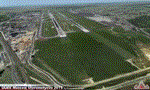
UUEE MOSCOW SHEREMETYEVO 2015 DEMO is a scenery of UUEE Sheremetyevo airport in Moscow, Russia, fully compatible with FS2004.
This product is a fully functional DEMO version of the commercial payware product. Most objects are modelled as in the full version but covered with low resolution textures. Using this free demo ensures no problems with online (VATSIM, IVAO, multiplayer etc.) flying in case some users use the payware scenery and some don't.
Moscow is the capital city and the most populous federal subject of Russia. The city is a major political, economic, cultural and scientific center in Russia and in Eastern Europe. Sheremetyevo International Airport (SVO/UUEE) is an international airport located in Khimki, Moscow Oblast. It is a hub for passenger operations of the Russian international airline Aeroflot, and is one of the three major airports that serve Moscow, along with Domodedovo International Airport and Vnukovo International Airport
The product is equipped with an automatic installer, which means that the scenery will be automatically added to the Flight Simulator Scenery Library. Please uninstall all previous versions of this airport you may have installed before. Please make also sure that no duplicated AFCAD files are installed.
Enjoy your virtual flying with Drzewiecki Design!
| Filename: | UUEE_Moscow_Sheremetyevo_2015_DEMO.zip |
| License: | Commercial demo |
| Added: | 4th April 2016, 21:52:46 |
| Downloads: | 851 |
| Author: | Drzewiecki Design |
| Size: | 13.68 MB |
| Category: Flight Simulator 2004 - Scenery | |
| E T Joshua TVSV on Saint Vincent in the eastern Caribbean |
|
Images related to this file:
File Description:
Saint Vincent island is the northernmost of the group of islands known as St Vincent and the Grenadines, just south of St Lucia. St Vincent is around 17 miles long and 10 miles wide and by far the largest in the group, and the islands have a total population of around 120,000. E T Joshua is at the southern end of the island, adjacent to the capital Kingstown. There is a new airport under construction a few miles to the east which will have a longer runway and a larger apron, and when it is ready E T Joshua will probably be closed and redeveloped.
The terminal and the other smaller buildings are all made with photographic textures; the terminal is now quite old and has seen better days. The airport is a hub for small local airlines and also has regular LIAT flights connecting to other islands. The runway is just a shade under 4,700 feet of asphalt, so there are no direct flights from Europe. The new airport to the east is depicted as under construction; obviously I have not flown there and I have not tried to depict the terminal building which is also under construction but a mystery to me.
| Filename: | E_T_Joshua_TVSV_on_Saint_Vincent_in_the_eastern_Caribbean.zip |
| License: | Freeware, limited distribution |
| Added: | 11th June 2013, 16:29:42 |
| Downloads: | 538 |
| Author: | Roger Wensley |
| Size: | 3.13 MB |
| Category: Flight Simulator 2004 - Scenery | |
| Kangiqsualujjuaq CYLU in northern Quebec, Canada |
|
Images related to this file:
File Description:
Kangiqsualujjuaq is in northern Quebec on the east side of Ungava Bay, which is to the east of Hudson Bay and around 150 miles wide and 120 miles deep. Kuujjuaq, the administrative capital of northern Quebec, is 100 miles to the southwest. The town is on the bank of the George River, and has also been known as Fort George River, George River, etc. There was a Hudson Bay trading post at the town's location as early as 1838, though it was closed and reopened more than once and the town did not grow because of the trading post; the Inuit lived on the coast during the summer but moved 30 miles inland in winter for trapping. A cooperative was formed in 1959 to market fish, and this was the creative force that brought about establishment of the town; a school was built in 1963.
The airport is to the north of the town in a valley between the surrounding hills at 215 feet ASL. The gravel runway is just over 3,500 feet long and aligned 16/34; there is no PAPI, but there is fuel available, both 100LL and JetA. There are flights by Air Inuit and a warning of caribou on the runway during October and November.
| Filename: | Kangiqsualujjuaq_CYLU_in_northern_Quebec_Canada.zip |
| License: | Freeware, limited distribution |
| Added: | 1st February 2013, 21:24:55 |
| Downloads: | 279 |
| Author: | Roger Wensley |
| Size: | 2.76 MB |
| Category: Flight Simulator 2004 - Scenery | |
| Denver (KDEN), Colorado, Photo-Scenery |
|
Images related to this file:
File Description:
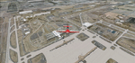
Denver (KDEN), Colorado, Photo-Scenery for FS9 & FSX.
This package covers Denver, the capital of Colorado which is also nicknamed Mile-High City because its elevation is one mile (5.280 ft). The sixth RW (16R/34L) of Denver Int'l. Airport (KDEN) is the longest commercial RW in the US with a length of 16.000ft. This allows fully loaded B747's to take off in Denvers mile-high altitude during hot summer days, when density altitudes can approach 9.000(!) ft.
KDEN is a major hub for United Airlines and the headquarters for Frontier Airlines. The airports distinctive white tent-like fabric roof is designed to be reminiscent of the snow-covered peaks of the Rocky Mountains which you can see on approach or departure.
Other important airports covered by this region are Centennial Airport (KAPA), Buckley AFB (KBKF) and Rocky Mountain Metropolitan Airport (KBJC). Extends my Mt.Evans/Georgetown package to the east and provides another 3.500 sq km in 4.7m/pix quality.
High resolution versions for FS9 and FSX (much sharper, but larger and multiple downloads) are available at www.blueskyscenery.com/GNB_SouthEast.html
. The screenies are taken from the high-res versions, so expect this version to be slightly more blurry. YourDonation@Work: Dedicated to Mark and Charles. Thanks!
| Filename: | Denver_KDEN_Colorado_PhotoScenery.zip |
| License: | Freeware, limited distribution |
| Added: | 31st October 2009, 11:24:39 |
| Downloads: | 7,291 |
| Author: | Gottfried Razek, blueskyscenery.com |
| Size: | 95.21 MB |
| Category: Flight Simulator 2004 - Scenery | |
| VAOZ Nashik/Ozar, India |
|
File Description:
Googly scenery for Ozar, a small domestic airport located in Nashik (or
Nasik), 111 miles from Mumbai (Bombay). Nashik is a fast-expanding city in
the Maharashtra state in the Western Ghats located on the western edge of the Deccan
peninsula and is known as the Wine Capital of India or Grape City.
Owing to its close proximity to Mumbai, the airport has not proved popular as
the journey by taxi, bus or rail is not much greater after taking into account
check-in times etc. Air Deccan recently withdrew all flights from Ozar and as
far as I can establish the only airline now serving Ozar is Jagson Airlines,
using Dornier 228 turboprops. There is also a military presence at the east
end of the airport.
Flight Simulator 2004 has only provided a runway at this airport and this scenery
seeks to redress the situation so that you and your "AI" traffic can use the
airport.
The scenery does not purport to be ultra-accurate. Based on high quality
satellite imagery from Google Earth, the layout is proportionally correct but the
added airport features, such as buildings, are built from default Microsoft objects
and add-on libraries so will not look exactly like the real thing.
You are not obliged to download and install any additional scenery libraries,
but to enjoy this scenery in its entirety, you may wish to. It will work fine,
with or without.
| Filename: | VAOZ_NashikOzar_India.zip |
| License: | Freeware |
| Added: | 22nd April 2008, 07:55:32 |
| Downloads: | 737 |
| Author: | John Hinson |
| Size: | 118.11 KB |
| Category: Flight Simulator 2004 - Scenery | |
| HCMM - Mogadishu International Airport, Mogadishu/Petrella, Somalia |
|
Images related to this file:
File Description:
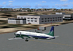
Googly scenery for HCMM Mogadishu/Petrella, the capital airport of Somalia.
Astonishingly, in Flight Simulator 2004 this international airport is depicted as little
more than a runway! Whilst in the real world the airport can hardly be
described as busy, it is served by the country's sole airline - Jubba
Airways, with their wonderful Ilyushin IL-18, and many African and Eastern
European operators call by with cargo flights. In fact, the vast proportion of
the aircraft seen here are Russian-built.
These scenery files add aprons, taxiways, buildings and other airport features to Flight Simulator's limited representation and allow "AI" traffic to land, taxi, park and take off in a realistic manner. But do watch out for cars on the runway and taxiways as they
appear to be regularly used as a by-pass to the perils of driving through the city!
The scenery does not purport to be ultra-accurate. Based on high-detail satellite
imagery from Google Earth, the layout is proportionally correct but the added
airport features, such as buildings, are built from default Microsoft objects
and add-on libraries so will not look exactly like the real thing.
You are not obliged to download and install any additional scenery libraries,
but to enjoy this scenery in its entirety, you may wish to. It will work fine,
with or without. [File re-uploaded at request of AVSIM]
| Filename: | HCMM__Mogadishu_International_Airport_MogadishuPet.zip |
| License: | Freeware |
| Added: | 28th May 2010, 20:46:31 |
| Downloads: | 2,791 |
| Author: | John Hinson |
| Size: | 61.51 KB |
| Category: Flight Simulator 2004 - Scenery | |
| Maurice Bishop TGPY on Grenada in the Caribbean |
|
Images related to this file:
File Description:
Grenada island is 17 miles south of the southernmost island of the Grenadines, Carriacou; there are some smaller islands between the two. Grenada is 18 miles long and around 8 miles wide, has an estimated population of 110,000, and produces a very large part of the world's annual nutmeg harvest. The capital, St Georges, is by far the largest town and is at the southern end of the island, with the airport close by.
The airport is now called Maurice Bishop, but for some years was called Point Salines. The runway is just over 9,000 feet long and oriented 10/28. Point Salines replaced Pearl Airport, which is on the east coast 12 miles northeast of St Georges and was difficult to expand as the runway had mountains at one end and the sea at the other. Pearl is now closed; it is included here but only as a visual landmark with "closed" markings. There are regular international flights from North America and Europe, some of which are seasonal only (Air Canada for instance) and local connecting flights by LIAT and SVG. I retained the default control tower as it is some distance away. In real life it is also some distance away and on a hill northwest of the terminal. Which is why I did not take photos from which I would have made the real one. The hill does not feature in FS9.
| Filename: | Maurice_Bishop_TGPY_on_Grenada_in_the_Caribbean.zip |
| License: | Freeware, limited distribution |
| Added: | 11th June 2013, 23:28:17 |
| Downloads: | 828 |
| Author: | Roger Wensley |
| Size: | 7.38 MB |
| Category: Flight Simulator 2004 - Scenery | |
| Warsaw City 2015 DEMO |
|
Images related to this file:
File Description:

WARSAW CITY 2015 DEMO is a sophisticated scenery package, featuring a detailed scenery of Warsaw city in Poland with surrounding airports, fully compatible with FS2004.
This product is a fully functional DEMO version of the commercial payware product. It features same layouts as in the full version but with limited 3D objects and low resolution textures. Using this free demo ensures no problems with online (VATSIM, IVAO, multiplayer etc.) flying in case some users use the payware scenery and some don't.
Warsaw is the capital and the largest city of Poland located on the Vistula (Wisla) River. Warsaw City 2015 gives you a possibility to fly over an extremely large area of Warsaw city. We have included a photoreal ground textures of about 5200 square km. The city centre has hundreds of custom buildings modeled, there are all VFR-important landmarks on the whole included area too. We have also created 13 variously detailed airports and heliports for the project: Modlin EPMO, Babice EPBC, Chrcynno/Nasielsk, Sobienie EPSJ, Goraszka EPGO, Konstancin-Jeziorna, Konstancin Heliport, Reczaje (lite), Kroczewo (lite), Trebki Nowe (lite), Wincentow 1 (lite), Wincentow 2 (lite), Zabia Wola (lite).
The product is equipped with an automatic installer, which means that the scenery will be automatically added to the Flight Simulator Scenery Library. Please uninstall all previous versions of similar sceneries you may have installed before. Please make also sure that no duplicate AFCAD files are installed.
Enjoy your virtual flying with Drzewiecki Design!
| Filename: | Warsaw_City_2015_DEMO.zip |
| License: | Commercial demo |
| Added: | 2nd September 2015, 22:23:02 |
| Downloads: | 932 |
| Author: | Drzewiecki Design |
| Size: | 23.41 MB |
| Category: Flight Simulator 2004 - Scenery | |
| Havana 1962 Scenery |
|
File Description:
This scenery includes Havana as it was in 1962 (a mysterious city of much fascination for me) including El Morro Fortress on its rocky outcropping at the entrance to Havana harbor, the largest such fortress in the Caribbean, and its adjacent lighthouse. In downtown Havana you will see the capital building and several old cathedrals. Near the Malicon sea walk by the beach, you will find 3 famous hotels and former casinos, the Flamingo, the Riviera, and the Havana Hilton. The Havana Hilton opened just days before Castro seized power and nationalized it. When he first came to power he occupied the top floor for some time. Havana Airport opened originally as Rancho Los Boyeos Airport, located just southwest from the city in the village of the same name, which was then mostly farms, small ranches, and tiny communities. The original terminal was a very pretty Spanish colonial building, which the dictator Fulgencio Batista had remodeled in a 1950's cubist-tudor style. It was at the time of this remodeling (1957) that the airport's name was changed to Jose Marti International Airport, named after the famous Cuban revolutionary and poet of the 19th century. Jose Marti Airport was in the 1950s and 1960s the primary port of entry airport for Cuba. Up until the January 1st 1959 revolution many US airlines served Havana, but due to mounting tensions, the crisis of the Bay of Pigs attack, and later on the October 1962 missile crisis, traffic and tourism was ended as the US led blockade of Cuba took hold. By the time of this scenery, April 1962, the once former bustling Jose Marti airport had become quite sedate.
| Filename: | Havana_1962_Scenery.zip |
| License: | Freeware, limited distribution |
| Added: | 4th March 2010, 23:36:41 |
| Downloads: | 3,867 |
| Author: | Mike Stevens and Tom Gibson |
| Size: | 9.72 MB |
| Category: Flight Simulator 2004 - Scenery | |
| Fort Nelson CYYE in British Columbia, Canada |
|
Images related to this file:
File Description:
Fort Nelson is close to the Peace River in the northeast corner of British Columbia, around 70 miles from the northern border, 90 from the eastern border, and 80 miles east of the Rockies. The wartime construction of the Alaska Highway actually started from Fort Nelson, as there was already a road from Fort St John (which is close to Dawson Creek) north to Fort Nelson. The airfield was part of this construction effort and after the wartime ferrying of planes to Russia it was used by the US Army Air Force and then by the Canadian Air Force. Fort Nelson flourished with the oil and gas exploration of the 1950's and the following years, and this continued to grow until the collapse of the oil price in 2014.
The town of Fort Nelson became the capital of the Northern Rockies Regional District when it was founded in 2009, and as a result the official name of the Fort Nelson airport is the Northern Rockies Regional Airport. The date for this scenery is around 2016, by which time the economic fortunes of the town were in decline. Five times per day flights by Central Mountain Air were starting to be reduced in number to the current (in 2022) one per day and none on Sunday; in the AI included here there are two flights per day. The main resident users of the airport are four helicopter companies, the helicopters presumably used for maintenance trips to whatever parts of the oil and gas fields that are still in use in the surrounding area.
There are two runways, the main one is aligned 03-21, 6,400 feet long and 200 feet wide, with ILS at the southern end and PAPI at the northern. The second runway (a narrower rebuild on a previously existing runway) is aligned 07-25 and 77 feet wide, and is without any lights. These are the alignments as per the original build of FS9 and not as per the approximate 2016 date of the buildings; I had a problem at a very late stage in making this scenery which prevented me from continuing with some final details.
On YouTube there is a series of posts by Angle of Attack showing the preparation and then the flight of an old Cessna 172 from Homer to Oshkosh for the installation of modern instruments. Interesting for me as they visit or fly over airfields I have made (Homer, Merrill, Tok Junction, Burwash, Silver City, Haines Junction, Watson Lake, Fort Nelson, and Grande Prairie) but in the winter so it all looks very different.
| Filename: | Fort_Nelson_CYYE_in_British_Columbia_Canada.zip |
| License: | Freeware, limited distribution |
| Added: | 23rd January 2022, 20:11:18 |
| Downloads: | 188 |
| Author: | Roger Wensley |
| Size: | 28.35 MB |


© 2001-2026 AVSIM Online
All Rights Reserved
Privacy Policy |