
Where Flight Simulation Enthusiasts Gather from Around the World!
AVSIM Library - Search Results

| Category: Flight Simulator 2004 - Scenery | |
| ZSNT - Nantong Xingdong Airport |

|
Images related to this file:
File Description:

Skysoft Simulation ZSNT Nantong Xingdong Airport Scenery. The civilian airport is located in Tongzhou District, Nantong, Jiangsu Province. There are various destinations with flights commenced from ZSNT, such as Beijing Capital, Guangzhou and Kunming. As the airport is only 120 kilometers from Shanghai, China Eastern Airlines and Shanghai Airlines made ZSNT as their training base for new pilots. Due to frequent military air traffic movement in adjacent airports, the airspace is highly restricted. Departing and arriving planes must strictly follow the ATC's instructions.
Please refer to the readme file before installing, and read the manuals once they are extracted. We wish you a pleasant flight!
**Require removal of the ZSNT files in China Airport Scenery Package made by ai-china, if applicable**
| Filename: | ZSNT__Nantong_Xingdong_Airport.zip |
| License: | Freeware, limited distribution |
| Added: | 3rd January 2013, 01:41:48 |
| Downloads: | 2,900 |
| Author: | Alex Chao, Skysoft Simulation |
| Size: | 43 MB |
| Category: Flight Simulator 2004 - Scenery | |
| CYWG Winnipeg 2020 |
|
Images related to this file:
File Description:
CYWG is an international airport located in the city of Winnipeg, which is the capital of the Province of Manitoba, in the western part of Canada. This scenery provides an accurate depiction of CYWG for Flight Simulator FS2004. It includes the entire airport as well as many of the surrounding industrial and warehouse buildings. The scenery includes static aircraft, an extensive array of ground support equipment representative of types and operators at CYWG, vibrant night lighting and seasonal texture variations.
CYWG WINNIPEG 2020 is a very detailed scenery best run on a higher-end PC. To make the airport more flyable for a greater range of FS9 users, CYWG Winnipeg comes packaged with options for three editions and ability to turn certain features on and off.
| Filename: | CYWG_Winnipeg_2020.zip |
| License: | Freeware, limited distribution |
| Added: | 6th July 2020, 18:19:02 |
| Downloads: | 1,662 |
| Author: | Gregory Putz |
| Size: | 104.68 MB |
| Category: Flight Simulator 2004 - Scenery | |
| DGSI Kumasi, Ghana |
|
Images related to this file:
File Description:
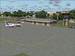
Googly scenery for Kumasi - a small domestic airport in Ghana for which no facilities
are provided in Flight Simulator 2004. These scenery files add taxiways, aprons,
buildings and other airport features, so that you and your "AI" traffic can land,
taxi, park and take off in a realistic manner.
The airport serves the city of Kumasi (capital of the Ashanti region) and sees
regular flights using turboprop airliners operated by Accra based operators
Antrak Air and Citylink.
The scenery does not purport to be ultra-accurate. Based on high-detail satellite
imagery from Google Earth, the layout is proportionally correct but the added
airport features, such as buildings, are built from default Microsoft objects
and add-on libraries so will not look like the real thing.
[File re-uploaded at request of AVSIM]
| Filename: | DGSI_Kumasi_Ghana.zip |
| License: | Freeware |
| Added: | 23rd May 2010, 01:25:23 |
| Downloads: | 1,420 |
| Author: | John Hinson |
| Size: | 80.3 KB |
| Category: Flight Simulator 2004 - Scenery | |
| Sao Luis (Brazil) - Photoreal |
|
Images related to this file:
File Description:
Sao Luis is a Brazilian city, capital of Maranhao state, founded on September 8, 1612. It is located on the island Upaon-Acu (the name was given by the Indians tupinambas meaning "Big Island"), South Atlantic, between the bays of San Marcos and San Jose. It is one of three Brazilian state capitals located on islands (the others are Florianopolis and Vitoria). The scenery contains:
Photoreal of Sao Luis island with hand placed autogen; Marechal Cunha Machado Intl. Airport photoreal in HD; real lighting effect; grass textures; AZL with detailed buildings and hangars; ground support vehicles; detailed terminal with fingers; ships on the coast; Itaqui harbor.
# Courtesy of Marco Santiago (Addons): Bridges Pres. Sarney, Bandeira Tribuzi and the Estreito dos Mosquitos; Terminal de Integracao BR; Alexandre Raposo aerodrome; CAVU aerodrome (Ultralight).
| Filename: | Sao_Luis_Brazil__Photoreal.zip |
| License: | Freeware, limited distribution |
| Added: | 4th December 2010, 03:58:01 |
| Downloads: | 2,736 |
| Author: | Jorge Amengol |
| Size: | 60.29 MB |
| Category: Flight Simulator 2004 - Scenery | |
| CYQR 2015 - Regina International Airport - Groome Field |
|
Images related to this file:
File Description:

Regina International Airport can trace its history back to 1919, when Regina airport became the first registered "air harbour" in Canada. This virtual model of CYQR represents the airport as it was in spring of 2015. CYQR airport is the gateway to southern Saskatchewan, Canada and is situated in Regina, which is the provincial capital. The airport is served by Air Canada, Air Canada Express, Westjet, Westjet Encore, West Wind Aviation, Express Air, Sunwing, Air Transat, Cargojet and Delta Airlines. The airport is named for Roland Groome, who was the first registered pilot in Canada.
This scenery was constructed with GMAX and includes detailed models of all buildings on the airport property. The scenery also includes the major landmark buildings of the City of Regina and those on the Runway approaches.
| Filename: | CYQR_2015__Regina_International_Airport__Groome_Fi.zip |
| License: | Freeware, limited distribution |
| Added: | 12th August 2015, 00:51:35 |
| Downloads: | 2,826 |
| Author: | Gregory Putz |
| Size: | 183.45 MB |
| Category: Flight Simulator 2004 - Scenery | |
| J F Mitchell TVSB on Bequia in the Grenadines |
|
Images related to this file:
File Description:
Bequia island is one of the northernmost of the group of islands known as St Vincent and the Grenadines, just south of St Vincent. Bequia is a small curved island island, 8 miles long and in general less than a mile wide; as a result the resident population is less than 5,000.
There are two main towns, Port Elizabeth (the capital, on the bay) and Paget Farm (close to the airport).
The airport is built on reclaimed land parallel to the beach along the south coast, just west of Paget Farm; the runway is 3,700 feet long. The terminal is fairly new, or appears to be, though it may have just been well cared for. There are connecting flights by SVG to Barbados and the other islands and these are reflected in the AI.
| Filename: | J_F_Mitchell_TVSB_on_Bequia_in_the_Grenadines.zip |
| License: | Freeware, limited distribution |
| Added: | 11th June 2013, 22:56:21 |
| Downloads: | 471 |
| Author: | Roger Wensley |
| Size: | 2.83 MB |
| Category: Flight Simulator 2004 - Scenery | |
| HSMK Rumbek, Sudan |
|
File Description:
Googly scenery for HSMK Rumbek, a small airport serving the city of the same
name, capital of the Buhayrat (or Lakes) state in southern Sudan. The airport
is served daily by Beech 1900 aircraft operating for Delta Connection, a
Kenyan airline.
Flight Simulator 2004 has completely omitted this airport and this scenery
seeks to redress the situation so that you and your "AI" traffic can use the
airport.
The scenery does not purport to be ultra-accurate. Based on high quality
satellite imagery from Google Earth, the layout is proportionally correct but the
added airport features, such as buildings, are built from default Microsoft objects
and add-on libraries so will not look exactly like the real thing.
You are not obliged to download and install any additional scenery libraries,
but to enjoy this scenery in its entirety, you may wish to. It will work fine,
with or without.
| Filename: | HSMK_Rumbek_Sudan.zip |
| License: | Freeware |
| Added: | 19th April 2008, 20:33:09 |
| Downloads: | 754 |
| Author: | John Hinson |
| Size: | 78 KB |
| Category: Flight Simulator 2004 - Scenery | |
| Ninoy Aquino Intl. Airport Scenery (RPLL) |
|
File Description:
FS2004 Ninoy Aquino Int'l Airport Scenery, v2.0. The Ninoy Aquino Int'l Airport is located in Manila, the capital city of the Philippines. Experience the most realistic replica of the Ninoy Aquino Int'l. Developed by the Philippine Flightsimmers Group (PFSG), users can be sure of true accuracy in the scenery comparable to the real counterpart. For more than a year in development, this scenery features new, custom 3D objects--accurate representation of NAIA Terminal 1, PAL Centennial Terminal 2 and the new NAIA Terminal 3. Accurate domestic area with all-customized buildings/hangars, and now includes Manila ACC and Nayong Pilipino. Designed with a user-friendly objective in mind as not to overdo the detail of the scenery that may cause low frame rates. Extensively researched and developed by Peter Binamira and Manny Aquino of the Philippine Flightsimmers Group. This scenery is released as Donationware; see readme for details.
| Filename: | Ninoy_Aquino_Intl_Airport_Scenery_RPLL.zip |
| License: | Shareware, honor system |
| Added: | 3rd January 2004, 19:51:54 |
| Downloads: | 25,154 |
| Author: | Peter Binamira, Manny Aquino |
| Size: | 15.37 MB |
| Category: Flight Simulator 2004 - Scenery | |
| 1962 and 1965 Tokyo Haneda Airport Scenery |
|
File Description:
This scenery represents the international airport of Tokyo in the 1960's, Haneda. This package also removes the modern airport of Narita. There are two versions of the airport in this package, 1962 and 1965. Today, Tokyo International Airport (known to locals as Haneda) is consistently among the five busiest airports in the world. In the early 1960s, it was the only international airport serving the economic recovery of the Japanese capital. The entire airport was upgraded extensively between 1961 and 1964 in preparation for the Tokyo Olympics in October of '64. By 1965, a longer runway 15/33, expanded terminal, and improved ground transportation links were all in use at Haneda (these changes are reflected in the '62 and '65 versions). Terminal and ground details by Aaron Seymour, JAMCO/JAL hangars and AFCAD files by Tom Gibson. Thanks to Wolfgang Gersch for the parking area.
| Filename: | 1962_and_1965_Tokyo_Haneda_Airport_Scenery.zip |
| License: | Freeware, limited distribution |
| Added: | 5th October 2008, 20:43:08 |
| Downloads: | 3,850 |
| Author: | Aaron Seymour and Tom Gibson |
| Size: | 1.04 MB |
| Category: Flight Simulator 2004 - Scenery | |
| Lucknow Airport, India [ VILK ] |
|
Images related to this file:
File Description:
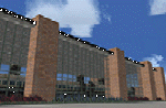
Lucknow,also Famous as 'City of Nawabs' and is capital of Uttar Pradesh,also called a political Sate of India. The Airport is 230 Nm SE of new Delhi.From previous experience I've learned a great deal of file size management to yield maximum frame rate.Now this Airport has a new Apron , which is actually not new, but lets call it new .i.e. 4-6 years old along with Taxiway Delta and echo.I just Found that theirs are no resources available in our virtual aviation community that has information in any form for this Airport scenery, afcads/afxs This ironically 'new' apron and taxiway is why,this airport has been developed.The airport has ADVANCED hanger....and many other things that will make you fly for at least one time in/out of this Place. The airport name is 'Chaudhary Charan Singh Airport" and has all basic navigational tools with CAT II ILS .how about some pics ? ..........will work in FSX.
| Filename: | Lucknow_Airport_India__VILK_.zip |
| License: | Freeware |
| Added: | 16th August 2010, 20:49:50 |
| Downloads: | 1,551 |
| Author: | Ashish Singh |
| Size: | 23.85 MB |


© 2001-2026 AVSIM Online
All Rights Reserved
Privacy Policy |