
Where Flight Simulation Enthusiasts Gather from Around the World!
AVSIM Library - Search Results

| Category: Flight Simulator 2004 - Scenery | |
| SKMD Medellin/Enrique Olaya Herrera, Colombia |

|
File Description:
Googly scenery for Medellin/Enrique Olaya Herrera (ICAO: SKMD, IATA: EOH). This
centrally located airport, named after the 1930 president of Colombia, was once
the only airport for the city of Medellin but most international flights are now
concentrated on the new international airport inconveniently situated 24 miles
away. Nevertheless the airport is very busy with domestic, charter and private
traffic and is regularly served by scheduled services of Aerolínea de Antioquia,
AIRES, Easyfly and SATENA. There are many charter operators based or serving
serving this airport, including Aexpa, Heliandes, Sarpa, Helicol and TAC; these
are mostly smaller aircraft or helicopter operations.
Remarkably for such an important airport, Microsoft have only provided a runway
at this airport in Flight Simulator 2004 and this scenery seeks to redress the
situation so that you and your "AI" traffic can use the airport realistically.
The scenery does not purport to be ultra-accurate. Based on high quality
satellite imagery from Google Earth, the layout is proportionally correct but the
added airport features, such as buildings, are built from default Microsoft objects
and add-on libraries so will not look exactly like the real thing.
You are not obliged to download and install any additional scenery libraries,
but to enjoy this scenery in its entirety, you may wish to. It will work fine,
with or without.
| Filename: | SKMD_MedellinEnrique_Olaya_Herrera_Colombia.zip |
| License: | Freeware |
| Added: | 6th December 2008, 10:22:40 |
| Downloads: | 2,568 |
| Author: | John Hinson |
| Size: | 388 KB |
| Category: Flight Simulator 2004 - Scenery | |
| FTTN Am-Timan, Chad |
|
File Description:
Googly scenery for Am-Timan (ICAO: FTTN, ICAO: ANC), also known as Am
Timan, Am Timane, Am Timmane, Umm Timman - take your pick! It is a small
airport serving a small city of the same name in South-Eastern Chad,
almost exactly centred in the continent of Africa.
The airport was upgraded in 1971 by the French Foreign Legion to allow
military transport craft to land, but it still retains a sand/dirt
strip. The airport is served today by a couple of flights a week using
Fokker Fellowship jets of Toumai Air Tchad.
The entire area is very dry and sandy but for some reason it is depicted
in Flight Simulator as green and lush. Microsoft have only provided a runway
at this airport and this scenery seeks to redress the situation so that you
and your "AI" traffic can use the airport realistically.
The scenery does not purport to be ultra-accurate. Based on high quality
satellite imagery from Google Earth, the layout is proportionally correct but the
added airport features, such as buildings, are built from default Microsoft objects
and add-on libraries so will not look exactly like the real thing.
You are not obliged to download and install any additional scenery libraries,
but to enjoy this scenery in its entirety, you may wish to. It will work fine,
with or without.
| Filename: | FTTN_AmTiman_Chad.zip |
| License: | Freeware |
| Added: | 24th December 2008, 13:31:36 |
| Downloads: | 883 |
| Author: | John Hinson |
| Size: | 83.66 KB |
| Category: Flight Simulator 2004 - Scenery | |
| MRAO Turtuguero, Costa Rica |
|
Images related to this file:
File Description:
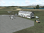
Googly scenery for MRAO Turtuguero, Costa Rica - another one that Microsoft
forgot in FS2004. It is a small domestic airport located on a long spit of
land that almost seems like an island. Turtuguero is just a village but the
airport also serves the lush Tortuguero National Park (rain falls all the
year round here) which draws thousands of visitors each year. The airport
is served daily by DHC-6 Twin Otters of Nature Air.
These scenery files create the airport and add taxiways, aprons, buildings and other airport features, so that you and your "AI" traffic can land, taxi, park and take
off in a realistic manner.The scenery does not purport to be ultra-accurate. Based on less-than-perfect satellite imagery from Google Earth, the layout is as good as I can get it, but some imagination has been used as I cannot tell what buildings exist. The
buildings and other features I have provided are built from default Microsoft
objects and add-on libraries so will not look exactly like the real thing.
You are not obliged to download and install any additional scenery libraries,
but to enjoy this scenery in its entirety, you may wish to. It will work fine,
with or without. [File re-uploaded at request of AVSIM]
| Filename: | MRAO_Turtuguero_Costa_Rica.zip |
| License: | Freeware |
| Added: | 28th May 2010, 20:40:00 |
| Downloads: | 1,174 |
| Author: | John Hinson |
| Size: | 65.12 KB |
| Category: Flight Simulator 2004 - Scenery | |
| HLLQ El Beida/Labraq |
|
Images related to this file:
File Description:
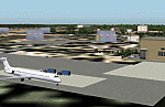
Googly scenery for HLLQ El Beida/Labraq - a joint civilian and military airport
near the north coast of Libya that is poorly provided for in Flight Simulator
2004. These scenery files add taxiways, aprons, buildings and other airport
features, so that you and your "AI" traffic can land, taxi, park and take off
in a realistic manner.
The city of Al Beida, or Al Bayda' or El Beda or Al Baidhah (depending on who
you are) has achieved its own airport status by using the end of a dead runway
at Labraq Air Base. In turn the airbase has contracted to use the opposite end
of the runway as its base of activity. The city is served by jets of Libyan
Airways and turboprop craft of Air One Nine and Ghadames Air Transport.
The scenery does not purport to be ultra-accurate. Based on high-detail satellite
imagery from Google Earth, the layout is proportionally correct but the added
airport features, such as buildings, are built from default Microsoft objects
and add-on libraries so will not look like the real thing.
You are not obliged to download and install any additional scenery libraries,
but to enjoy this scenery in its entirety, you may wish to. It will work fine,
with or without. [File re-uploaded at request of AVSIM]
| Filename: | HLLQ_El_BeidaLabraq.zip |
| License: | Freeware |
| Added: | 28th May 2010, 20:42:26 |
| Downloads: | 1,288 |
| Author: | John Hinson |
| Size: | 73.79 KB |
| Category: Flight Simulator 2004 - Scenery | |
| Ford India Project Compilation |
|
Images related to this file:
File Description:

This zip contains the entire Ford India Project from the inception seed airfield of Pondicherry (Part1) through to the completion of Part4. A total of 24 historically rendered (1930's) airfields. This is the first 4 parts all rolled into one for a project that is planned to be 7 parts - to see detailed descriptions and images visit http://www.ford-tri-motor.net/ford-india-project.htm
Contained in the pack is the historically rendered SCENERY Only for the following airfields:PONDICHERRY, COLOMBO, HYDERABAD, BOMBAY, AHMEDABAD, KARACHI, INDORE, MADRAS (Principle), MADRAS (Alternative), CALCUTTA, ALLAHABAD, CHITTAGONG, NAGPUR, DELHI, JODHPUR, CAWNPORE, BANGKOK, BASSEIN, AKYAH, RANGOON, KUALA LUMPUR (Principle), KUALA LUMPUR (Alternative), PENANG and SINGAPORE.
There is also a comprehensive aircraft AI Pack available on the Ford-Tri-Motor.net site that has a collection of historical aircraft using the above airfields for circuits and some transit between some of the airfields. Visit http://www.ford-tri-motor.net/ford-india-project.htm to get them for Free.
For simmers that have parts of the Project this zip will ensure that they have the complete current components of the project, for new patrons this will install all of the project to date. It will be a couple of months before the remaining Parts,5,6 and 7 are completed.
Project Manager - Edward C. Moore
Project Developer- Garry J. Smith
| Filename: | Ford_India_Project_Compilation.zip |
| License: | Freeware, limited distribution |
| Added: | 16th August 2013, 20:32:47 |
| Downloads: | 298 |
| Author: | Edward Moore & Garry Smith |
| Size: | 9.79 MB |
| Category: Flight Simulator 2004 - Scenery | |
| Ontario Small Fields in Canada: #05 Pelee Island (CYPT) |
|
Images related to this file:
File Description:
This is the fifth in a series of small airfields in southern Ontario Canada, Pelee Island CYPT, an airfield on the island in Lake Erie and the southernmost airfield in Canada. The airfield has an asphalt runway of 3,300 feet, aligned 09/27 in FS9 while today in real life it is 10/28 due to the wandering magnetic pole. There is also a second runway, 36/18 and around 1,500 feet of gravel. There is a small terminal building which now has blue cladding; here it is still in the dirty yellow of the original colour scheme.
This version is based upon what appears to be a "lost" 2005 scenery of Pelee Island. When I started to make Pelee Island I discovered that in fact I already had a version installed; my memory can be excused, as I installed it in 2005. I modified the scenery to include parking, taxiways that connected, revised runway markings, new windsocks, new signage, larger apron, parked cars and planes, revised landclass, AI, etc. My intention was to instruct you to download and install the original and then incorporate my changes. Problem: it does not appear to exist for download; perhaps it was washed away when the Avsim site crashed. I have included it in this post. If anyone knows who made it please let me know.
| Filename: | Ontario_Small_Fields_in_Canada_05_Pelee_Island_CYP.zip |
| License: | Freeware, limited distribution |
| Added: | 5th August 2015, 18:52:25 |
| Downloads: | 171 |
| Author: | Roger Wensley |
| Size: | 4.39 MB |
| Category: Flight Simulator 2004 - Scenery | |
| VAOZ Nashik/Ozar, India |
|
File Description:
Googly scenery for Ozar, a small domestic airport located in Nashik (or
Nasik), 111 miles from Mumbai (Bombay). Nashik is a fast-expanding city in
the Maharashtra state in the Western Ghats located on the western edge of the Deccan
peninsula and is known as the Wine Capital of India or Grape City.
Owing to its close proximity to Mumbai, the airport has not proved popular as
the journey by taxi, bus or rail is not much greater after taking into account
check-in times etc. Air Deccan recently withdrew all flights from Ozar and as
far as I can establish the only airline now serving Ozar is Jagson Airlines,
using Dornier 228 turboprops. There is also a military presence at the east
end of the airport.
Flight Simulator 2004 has only provided a runway at this airport and this scenery
seeks to redress the situation so that you and your "AI" traffic can use the
airport.
The scenery does not purport to be ultra-accurate. Based on high quality
satellite imagery from Google Earth, the layout is proportionally correct but the
added airport features, such as buildings, are built from default Microsoft objects
and add-on libraries so will not look exactly like the real thing.
You are not obliged to download and install any additional scenery libraries,
but to enjoy this scenery in its entirety, you may wish to. It will work fine,
with or without.
| Filename: | VAOZ_NashikOzar_India.zip |
| License: | Freeware |
| Added: | 22nd April 2008, 07:55:32 |
| Downloads: | 737 |
| Author: | John Hinson |
| Size: | 118.11 KB |
| Category: Flight Simulator 2004 - Scenery | |
| HCMM - Mogadishu International Airport, Mogadishu/Petrella, Somalia |
|
Images related to this file:
File Description:
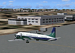
Googly scenery for HCMM Mogadishu/Petrella, the capital airport of Somalia.
Astonishingly, in Flight Simulator 2004 this international airport is depicted as little
more than a runway! Whilst in the real world the airport can hardly be
described as busy, it is served by the country's sole airline - Jubba
Airways, with their wonderful Ilyushin IL-18, and many African and Eastern
European operators call by with cargo flights. In fact, the vast proportion of
the aircraft seen here are Russian-built.
These scenery files add aprons, taxiways, buildings and other airport features to Flight Simulator's limited representation and allow "AI" traffic to land, taxi, park and take off in a realistic manner. But do watch out for cars on the runway and taxiways as they
appear to be regularly used as a by-pass to the perils of driving through the city!
The scenery does not purport to be ultra-accurate. Based on high-detail satellite
imagery from Google Earth, the layout is proportionally correct but the added
airport features, such as buildings, are built from default Microsoft objects
and add-on libraries so will not look exactly like the real thing.
You are not obliged to download and install any additional scenery libraries,
but to enjoy this scenery in its entirety, you may wish to. It will work fine,
with or without. [File re-uploaded at request of AVSIM]
| Filename: | HCMM__Mogadishu_International_Airport_MogadishuPet.zip |
| License: | Freeware |
| Added: | 28th May 2010, 20:46:31 |
| Downloads: | 2,791 |
| Author: | John Hinson |
| Size: | 61.51 KB |
| Category: Flight Simulator 2004 - Scenery | |
| Ulukhaktok (Holman) CYHI in the Northwest Territories, Canada |
|
Images related to this file:
File Description:
Ulukhaktok (Holman) is an airfield on the west side of Victoria Island, off the northern coast of Canada. It is 320 miles west of Cambridge Bay (and you should download and install the recent post of CYCB by Sid and Pete, as I use it for the AI included in this post) and around 400 miles east of Inuvik (my post of a few months ago). It has been officially called Ulukhaktok since 2006, and before that it's name was Holman.
The village of Ulukhaktok has been placed around the bay and is approximately the right shape; it houses some 460 people who used to rely solely on hunting and fishing. The village is close to 71 degrees north, and there are only four months of the year when the average high is above zero centigrade. The photograph with snow (and of course a frozen sea) is typical; for the frozen sea download my Frozen Rivers & Lakes post which will provide this. The buildings on the field have been modelled specifically for this scenery, and as in real life there is only JetA available. The AI visiting aircraft are an Aklak Air DC3 (based in Inuvik and operated by Kenn Borek Air) and a Canadian North Dash 8-100. Note that the runways are signed as "true" headings instead of magnetic; in the Canadian Northern Domestic Airspace all headings are given as true. Unfortunately FS9 doesn't accommodate this in ATC.
| Filename: | Ulukhaktok_Holman_CYHI_in_the_Northwest_Territorie.zip |
| License: | Freeware, limited distribution |
| Added: | 24th May 2011, 20:05:47 |
| Downloads: | 454 |
| Author: | Roger Wensley |
| Size: | 2.3 MB |
| Category: Flight Simulator 2004 - Scenery | |
| Sioux Lookout CYXL in northern Ontario, Canada, updated |
|
Images related to this file:
File Description:
This greatly modifies my previous post of Sioux Lookout; it is stand-alone and does not require you to have the 2009 version. The AI provided with the post complements what was included with Dryden (March 2013). Sioux Lookout is in northern Ontario, 40 miles east of Dryden, and 145 miles northwest of Thunder Bay. The town is on the northeastern shore of a lake that I don't know the name of (I've been there, but has anyone COUNTED how many lakes Canada has?). It has a population of around 5,000. The main businesses are lumber, tourism, and health care. The airport is immediately adjacent to the northeastern corner of the town, and has 5,300' of asphalt which is aligned 16-34. There are two taxiways which curve and climb up to the apron which is 20 or 30 feet higher. When you taxi on them the knowledge that in reality you would be climbing makes sense of the curved routing. The apron is large and a mixture of asphalt and gravel. I did not make the terminal building and I have no photo or even a recollection of what it looks like, so you should first install Northwest Ontario Airports by Eric O'Link as he has a terminal building for CYXL that might be how it looks; some of his airfields collide with other and newer versions and I have kept only his CYXL and CYPL bgl's.
| Filename: | Sioux_Lookout_CYXL_in_northern_Ontario_Canada_upda.zip |
| License: | Freeware, limited distribution |
| Added: | 19th March 2013, 19:23:24 |
| Downloads: | 405 |
| Author: | Roger Wensley |
| Size: | 5.08 MB |


© 2001-2026 AVSIM Online
All Rights Reserved
Privacy Policy |