
Where Flight Simulation Enthusiasts Gather from Around the World!
AVSIM Library - Search Results

| Category: Flight Simulator 2004 - Scenery | |
| CEN5 - Cold Lake Regional & revised CYOD - Cold Lake, Alberta, Canada |

|
Images related to this file:
File Description:
CYOD was made by John Stinstrom and you should download and install it first; there is also a "fix" for the apron lights textures. I am posting a modified AFCAD for CYOD with John's knowledge; this changes gates and atc identifications for the gates, so that with my version of the CYOD AI there are pairs of F18s taking off every 20 minutes or so. This means that the nearby Cold Lake Regional CEN5 works within the busy environment of flights to and from the nearby base. There is also a Hawker Hunter that drops in, and transport planes. The planes are listed so that you will know which are required to be downloaded. CEN5 may have "Regional" attached to its name, but there are now no scheduled flights and it is a peaceful and relaxed little airfield. There is fuel, and a little clubhouse building, and some hangars. There is ai for it here, using original FS9 planes so no downloads are required. Right hand circuits for runway 25 to stay as far away as possible from CYOD, and it is the CYOD tower that controls all flights in the area.
| Filename: | CEN5__Cold_Lake_Regional___revised_CYOD__Cold_Lake.zip |
| License: | Freeware, limited distribution |
| Added: | 11th May 2014, 13:41:51 |
| Downloads: | 490 |
| Author: | Roger Wensley |
| Size: | 12.25 MB |
| Category: Flight Simulator 2004 - Scenery | |
| Sproat Lake CAA9 V2 on Vancouver Island in British Columbia, Canada |
|
Images related to this file:
File Description:
This presumes you have already installed Sproat Lake CAA9; it is not a stand-alone scenery. In the original post I omitted the traffic bgl. This is now included, as are the two AI Beavers that FSAddon gave permission for inclusion and use as AI with Sproat Lake. So if you already have installed the pay scenery they came with they will show up anyway, but if you don't then install these two and they will; just drop the Sproat Lake AI Beavers folder into your aircraft folder, and the traffic bgl into the FS9'Scenery/World/Scenery folder as usual. I have now also included a Grumman Goose amphibian as this was the plane that the Fire Boss would be operating in while fire fighting. The textures are what were available and that I could (limited skills here) revise to at least have a Canadian registration. If I find a more accurate version I will include it at a later date. Drop the bgl's and textures into the already installed Sproat Lake scenery and texture folders and say yes to overwrite or replace.
| Filename: | Sproat_Lake_CAA9_V2_on_Vancouver_Island_in_British.zip |
| License: | Freeware, limited distribution |
| Added: | 11th December 2016, 06:45:32 |
| Downloads: | 223 |
| Author: | Roger Wensley |
| Size: | 3.89 MB |
| Category: Flight Simulator 2004 - Scenery | |
| Galena PAGA Runway and Taxiway Lighting in Alaska |
|
Images related to this file:
File Description:
Galena is in Alaska, and this posting adds proper runway lighting to the gravel runway that is used in the winter by light planes on skis, and because of that is not cleared of snow; unfortunately a gravel surface that gets snow covered in winter cannot be replicated in FS9. There are also taxiway lights visible during the day and at night there will be lit taxiway lights. I did not attempt to replicate the complicated main runway lighting which is well covered anyway by FS9. First of all, download and install the Library Objects once and for all from either the Allakaket Lights or Anaktuvuk Lights postings earlier this week. Then put these new bgl's into the existing scenery folder of your previous Galena PAGA installation and say yes to replace the existing bgl's that have the same names. Add the texture folder contents to the existing texture folder as they are required for the red warning lights at the ends of the gravel runway. There will be further retro upgrades to other recent scenery that was posted with temporary lighting. Say thank you to Greg Putz for making the lighting.
| Filename: | Galena_PAGA_Runway_and_Taxiway_Lighting_in_Alaska.zip |
| License: | Freeware, limited distribution |
| Added: | 27th November 2019, 19:14:31 |
| Downloads: | 155 |
| Author: | Roger Wensley |
| Size: | 1011.22 KB |
| Category: Flight Simulator 2004 - Scenery | |
| KCMI Update for KCMI Willard airport in Champaign, IL |
|
File Description:
I have made a few changes to parking lot lights and some movement of objects.
This update should have the previous version of kcmi_willard.zip installed already to work..
At request of different people. I have made three different levels of display for KCMI Willard Airport located in Champaign, IL.
To add the new scenery file to your KCMI just install and override the original Scenery folder in the KCMI Folder.
Then to select the level of display I have numerous settings that can be changed.
To change the level of vehicles seen chose one of the following.
KCMI_Vehicles_low.xxx
KCMI_Vehicles_med.xxx
KCMI_Vehicles_high.bgl
The default is the KCMI_Vehicles_high.bgl setting.
If you computer can not handle this high setting, just change KCMI_Vehicles_high.bgl to KCMI_Vehicles_high.xxx
Then change either KCMI_Vehicles_low.xxx or KCMI_Vehicles_med.xxx
By just changing the xxx to bgl
At the low setting, only a few vehicles will be seen.
___________________________________
Also you can change the following bgl files to see how they look also.
KCMI_Power Poles.bgl to KCMI_Power Poles.xxx will eliminate the power lines.
static-planes.bgl to static-planes.xxx will eliminate the two large planes at the corners of the runway.
KCMI_Maintenance.bgl to KCMI_Maintenance.xxx will eliminate related maintenance equipment of the two large planes.
____________________
Then restart your FS9 and it will apply the changes...
| Filename: | KCMI_Update_for_KCMI_Willard_airport_in_Champaign_.zip |
| License: | Freeware |
| Added: | 6th February 2006, 01:45:47 |
| Downloads: | 1,053 |
| Author: | Lawrence F Dorries |
| Size: | 69 KB |
| Category: Flight Simulator 2004 - Scenery | |
| WIKD/WIOD Tanjung Pandan/Buluh Tumbang/H.A.S. Hanandjoeddin, Indonesia |
|
File Description:
Googly scenery for WIKD/WIOD Tanjung Pandan/Buluh Tumbang/H.A.S. Hanandjoeddin,
Indonesia, based on Google Earth satellite data. It is a small domestic airport
serving the island of Belitung, located about 17 miles from the main town of the
island - Tandjungpandan. The island produces mainly tin and pepper but there are
some beaches that are generating tourist traffic too.
Flight Simulator 2004 has made no provision for any traffic at this airport and
this scenery seeks to redress the situation. The airport sees daily scheduled
traffic operated by Batavia Air and Sriwijaya Air.
The scenery does not purport to be ultra-accurate. Based on poor quality
satellite imagery from Google Earth, the layout is proportionally correct but the
added airport features, such as buildings, are built from default Microsoft objects
and add-on libraries so will not look exactly like the real thing.
You are not obliged to download and install any additional scenery libraries,
but to enjoy this scenery in its entirety, you may wish to. It will work fine,
with or without.
The ICAO code for this airport has recently changed from WIKD to WIOD. The included
files allow you to either retain the old code or optionally change the airport to
use the new one.
| Filename: | WIKDWIOD_Tanjung_PandanBuluh_TumbangHAS_Hanandjoed.zip |
| License: | Freeware |
| Added: | 22nd February 2008, 09:19:27 |
| Downloads: | 1,774 |
| Author: | John Hinson |
| Size: | 64.96 KB |
| Category: Flight Simulator 2004 - Scenery | |
| VGCB Cox's Bazar, Bangladesh |
|
File Description:
Googly scenery for VGCB Cox's Bazar, Bangladesh, a small domestic airport
serving the fishing town of the same name in the Bay of Bengal, to the
south of Chittagong. It boasts extensive sandy beaches which has allowed
tourism development. The unusual name comes from Captain Hiram Cox of the
British East India Company who was appointed Superintendent of the outpost
in the late 1700s. The airport, which was originally a Pakistan Air Force
base, sees domestic flights (mostly to/from Dhaka) operated by Hawker
Siddeley 748s, de Havilland Dash 8s and Fokker Fellowship aircraft of Biman
Bangladesh Airlines, GMG Airlines, United Airways and Zoom Airlines.
Flight Simulator 2004 has made no provision for traffic with only a runway
provided and this scenery seeks to redress the situation.
The scenery does not purport to be ultra-accurate. Based on high quality
satellite imagery from Google Earth, the layout is proportionally correct but the
added airport features, such as buildings, are built from default Microsoft objects
and add-on libraries so will not look exactly like the real thing.
You are not obliged to download and install any additional scenery libraries,
but to enjoy this scenery in its entirety, you may wish to. It will work fine,
with or without.
| Filename: | VGCB_Coxs_Bazar_Bangladesh.zip |
| License: | Freeware |
| Added: | 14th April 2008, 21:13:08 |
| Downloads: | 1,354 |
| Author: | John Hinson |
| Size: | 67.71 KB |
| Category: Flight Simulator 2004 - Scenery | |
| VGEG Chittagong/Shah Amanat International, Bangladesh |
|
Images related to this file:
File Description:
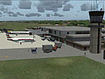
Googly scenery for VGEG Chittagong/Shah Amanat International (known as M A
Hannan until 2005) - an important airport in Bangladesh that is poorly provided
for in Flight Simulator 2004. These scenery files add taxiways, aprons,
buildings and other airport features, including the military area at the north
end and the general aviation ramps, so that you and your "AI" traffic can land,
taxi, park and take off in a realistic manner.
The city of Chittagong and its port are served regularly by jets ranging in size
from the Fokker 28 to the Douglas DC10 from operators like Air Arabia, Air Asia,
Biman Bangladesh Airlines, Oman Air, Thai Airways International, and turboprops of
GMG Airlines, United Airways and Zoom Airways.
The scenery does not purport to be ultra-accurate. Based on high-detail satellite
imagery from Google Earth, the layout is proportionally correct but the added
airport features, such as buildings, are built from default Microsoft objects
and add-on libraries so will not look like the real thing.
You are not obliged to download and install any additional scenery libraries,
but to enjoy this scenery in its entirety, you may wish to. It will work fine,
with or without.
[File re-uploaded at request of AVSIM]
| Filename: | VGEG_ChittagongShah_Amanat_International_Banglades.zip |
| License: | Freeware |
| Added: | 14th May 2010, 05:10:02 |
| Downloads: | 3,084 |
| Author: | John Hinson |
| Size: | 71.7 KB |
| Category: Flight Simulator 2004 - Scenery | |
| HCMI Berbera, Somalia |
|
Images related to this file:
File Description:
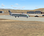
Googly scenery for HCMI Berbera, Somalia - an airport largely overlooked in
Flight Simulator 2004 with just a runway and tower provided at what is actually
the country's largest airport. At one time it had two active runways and a
strong military presence but today activity is limited to occasional
civilian flights. These scenery files add taxiways, aprons, buildings and
other airport features (and remove the non-existent tower that Microsoft
put there) so that you and your "AI" traffic can land, taxi, park and take
off in a realistic manner. This desert-surrounded airport is served three times per week by Douglas DC-9 jets of Kenyan airline African Express Airways.
The scenery does not purport to be ultra-accurate. Based on high-detail satellite
imagery from Google Earth, the layout is proportionally correct but the added
airport features, such as buildings, are built from default Microsoft objects
and add-on libraries so will not look like the real thing.
You are not obliged to download and install any additional scenery libraries,
but to enjoy this scenery in its entirety, you may wish to. It will work fine,
with or without. [File re-uploaded at request of AVSIM]
| Filename: | HCMI_Berbera_Somalia.zip |
| License: | Freeware |
| Added: | 29th May 2010, 09:26:33 |
| Downloads: | 1,317 |
| Author: | John Hinson |
| Size: | 62.07 KB |
| Category: Flight Simulator 2004 - Scenery | |
| Cape Verde Islands Domestic Airports |
|
Images related to this file:
File Description:
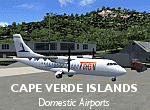
Googlyafcads and simple scenery for five airports in the Cape Verde Islands, all
of which are served by regular domestic flights of TACV - Transportes Aereos de
Cabo Verde. Each of these has been "overlooked" by Microsoft in Flight Simulator
2004 and are provided with nothing other than a runway. These scenery files add
aprons, taxiways, buildings and other airport features to Flight Simulator's bland
representation and allow you and "AI" traffic to land, taxi, park and take off
in a realistic manner.
The airports represented are: GVBA Rabil, GVMA Maio, GVSF Sao Filipe, GVSN Preguica and GVSV Sao Pedro.
The scenery does not purport to be ultra-accurate. Based on high-detail satellite
imagery from Google Earth (except Sao Filipe), the layout is proportianally correct
but the added airport features, such as buildings, are built from default Microsoft
objects and add-on libraries so will not look like the real thing. Sao Filipe is
largely imaginary owing to poor quality of the satellite image, but has been created
to be similar to other airports of like size.
You are not obliged to download and install any additional scenery libraries,
but to enjoy this scenery in its entirety, you may wish to. It will work fine,
with or without.
[File re-uploaded at request of AVSIM]
| Filename: | Cape_Verde_Islands_Domestic_Airports.zip |
| License: | Freeware |
| Added: | 15th June 2010, 01:00:46 |
| Downloads: | 7,004 |
| Author: | John Hinson |
| Size: | 84.1 KB |
| Category: Flight Simulator 2004 - Scenery | |
| LFBT Tarbes/Lourdes-Pyrenees, France |
|
Images related to this file:
File Description:
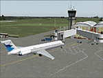
Googly scenery for LFBT Tarbes - a normally quiet airport that just sees a few
domestic flights a day but bursts into life for those of the the Catholic faith to
participate in the pilgrimage to Lourdes. At these times it is served by a
regular stream of charter flights and the airport can handle aircraft as large
as the Boeing 747. The only scheduled flights are between here and Paris, normally operated by Canadair CRJ700 craft worked by Brittany Air International on behalf of Air France, but a huge range of charter operators - mostly from Italy, Ireland, Belgium, the
United Kingdom and Germany - may be seen here at times and although seasonal this
traffic represents 80% of the airport's entire annual activity.
The scenery does not purport to be ultra-accurate. Based on less-than-perfect
satellite imagery from Google Earth, the layout is proportionally correct but the
added airport features, such as buildings, are built from default Microsoft objects
and add-on libraries so will not look exactly like the real thing. You are not obliged to download and install any additional scenery libraries, but to enjoy this scenery in its entirety, you may wish to. It will work fine, with or without.
[File re-uploaded at the request of AVSIM]
| Filename: | LFBT_TarbesLourdesPyrenees_France.zip |
| License: | Freeware |
| Added: | 4th May 2010, 15:02:30 |
| Downloads: | 7,819 |
| Author: | John Hinson |
| Size: | 73 KB |


© 2001-2026 AVSIM Online
All Rights Reserved
Privacy Policy |