
Where Flight Simulation Enthusiasts Gather from Around the World!
AVSIM Library - Search Results

| Category: Flight Simulator 2004 - Scenery | |
| HEMM Mersa Matruh, Egypt |

|
File Description:
Googly scenery for HEMM Mersa Matruh - a large Air Base near the north coast of
Egypt. Marsa Matruh, as the town should be spelt, is a seaport 150 miles west of
Alexandria but its main function today is that of a holiday resort for the
residents of Cairo. It does not have an airport of its own, but uses a small
corner of the Air Base for civilian flights. Microsoft Flight Simulator has
made no provision for any traffic at this airport and this scenery seeks to
redress the situation.
Scheduled flights are operated by Egyptair Express using Embraer 170 jets,
but other airlines call here from time to time, such as Air Sinai and Midwest
Airlines.
The scenery does not purport to be ultra-accurate. Based on high quality
satellite imagery from Google Earth, the layout is proportionally correct but the
added airport features, such as buildings, are built from default Microsoft objects
and add-on libraries so will not look exactly like the real thing.
You are not obliged to download and install any additional scenery libraries,
but to enjoy this scenery in its entirety, you may wish to. It will work fine,
with or without.
| Filename: | HEMM_Mersa_Matruh_Egypt.zip |
| License: | Freeware |
| Added: | 18th February 2008, 17:32:10 |
| Downloads: | 1,993 |
| Author: | John Hinson |
| Size: | 114.6 KB |
| Category: Flight Simulator 2004 - Scenery | |
| LELC Murcia/San Javier, Spain |
|
File Description:
Googly scenery for LELC San Javier, Spain, a medium-sized airport on the Costa
Cálida 17 miles south of Murcia. The airport sees daily scheduled traffic
operated by Canadair Regional Jets and Dash 8 turboprops of Air Nostrum but a
large proportion of the airport's traffic is derived from tourist charter
traffic from operators such as Air Berlin, Easyjet, LTU International and
Ryanair and the airport can accept aircraft as large as the Boeing 767. The
north end of the airport is home to the Spanish Air Force Academy.
Flight Simulator 2004 has made little provision for traffic with facilities only
for general aviation aircraft and this scenery seeks to redress the situation.
The scenery does not purport to be ultra-accurate. Based on high quality
satellite imagery from Google Earth, the layout is proportionally correct but the
added airport features, such as buildings, are built from default Microsoft objects
and add-on libraries so will not look exactly like the real thing.
You are not obliged to download and install any additional scenery libraries,
but to enjoy this scenery in its entirety, you may wish to. It will work fine,
with or without.
| Filename: | LELC_MurciaSan_Javier_Spain.zip |
| License: | Freeware |
| Added: | 6th April 2008, 20:35:29 |
| Downloads: | 3,171 |
| Author: | John hinson |
| Size: | 20.51 KB |
| Category: Flight Simulator 2004 - Scenery | |
| Houn, Libyan (HLON/HUQ) |
|
File Description:
Googly scenery for HLON Hon, Libya, a small domestic airport serving the oasis town (which is correctly spelt Houn) about 250 miles south-east of Tripoli. It is the capital of the Al Jufrah region. Although the airport holds ICAO and IATA status, as far as I can establish there are
currently no scheduled services to this airport, so present-day traffic is limited to the occasional charter, cargo or private flight. Flight Simulator 2004 has made no provision for traffic with only a runway provided and this scenery seeks to redress the situation so that you and your "AI" traffic can use the airport. The scenery does not purport to be ultra-accurate. Based on high quality satellite imagery from Google Earth, the layout is proportionally correct but the
added airport features, such as buildings, are built from default Microsoft objects
and add-on libraries so will not look exactly like the real thing. You are not obliged to download and install any additional scenery libraries, but to enjoy this scenery in its entirety, you may wish to. It will work fine, with or without.
| Filename: | Houn_Libyan_HLONHUQ.zip |
| License: | Freeware |
| Added: | 18th April 2008, 09:51:02 |
| Downloads: | 842 |
| Author: | John Hinson |
| Size: | 65.71 KB |
| Category: Flight Simulator 2004 - Scenery | |
| HTMS Moshi |
|
File Description:
Googly scenery for Moshi (ICAO: HTMS), a small airport serving the town of the same name
located in the lower slopes of Africa's highest mountain - Mount Kilamanjaro.
The town boasts good quality education and medical facilities, and industry
includes production of fizzy drinks, beer, flour, animal feed and furniture,
but surprisingly little tourism activity has been developed here so much of
the traffic at this airport is unscheduled and charter work using smaller
aircraft.
Microsoft have only provided wrongly-positioned runways at this airport in
Flight Simulator 2004 and this scenery seeks to redress the situation
so that you and your "AI" traffic can use the airport.
The scenery does not purport to be ultra-accurate. Based on high quality
satellite imagery from Google Earth, the layout is proportionally correct but the
added airport features, such as buildings, are built from default Microsoft objects
and add-on libraries so will not look exactly like the real thing.
You are not obliged to download and install any additional scenery libraries,
but to enjoy this scenery in its entirety, you may wish to. It will work fine,
with or without.
| Filename: | HTMS_Moshi.zip |
| License: | Freeware |
| Added: | 12th October 2008, 10:22:59 |
| Downloads: | 1,079 |
| Author: | John Hinson |
| Size: | 61.84 KB |
| Category: Flight Simulator 2004 - Scenery | |
| MYER Rock Sound International, Eleuthera Island, Bahamas |
|
File Description:
Googly scenery for Rock Sound International (ICAO: MYER), a grand-sounding but
quiet airport located on Eleuthera Island, Bahamas. Eleuthera is a long
and thin island east of Nassau and has three commercial airports, the busiest
being Governor's Harbour. Rock Sound is at the southern end and is served twice
daily by Dash 8 turboprops of Bahamasair, along with occasional flights by
operators such as Southern Air Charter. The airport has seen busier days and
was once even served from Europe by Alitalia.
Microsoft have only provided general aviation facilities at this airport in
Flight Simulator 2004 and this scenery seeks to redress the situation
so that you and your "AI" traffic can use the airport realistically.
The scenery does not purport to be ultra-accurate. Based on high quality
satellite imagery from Google Earth, the layout is proportionally correct but the
added airport features, such as buildings, are built from default Microsoft objects
and add-on libraries so will not look exactly like the real thing.
You are not obliged to download and install any additional scenery libraries,
but to enjoy this scenery in its entirety, you may wish to. It will work fine,
with or without.
| Filename: | MYER_Rock_Sound_International_Eleuthera_Island_Bah.zip |
| License: | Freeware |
| Added: | 13th October 2008, 11:01:56 |
| Downloads: | 1,468 |
| Author: | John Hinson |
| Size: | 61.42 KB |
| Category: Flight Simulator 2004 - Scenery | |
| DTTG Gabes, Tunisia |
|
File Description:
Googly scenery for Gabes (ICAO: DTTG), a somewhat nondescript airport
shoe-horned into one of Tunisia's largest industrial cities. Famed for
its beaches, the city hosts cement, chemical and brick factories and an
oil refinery, resulting in poor levels of air pollution. The airport is
a joint military and civilian operation although military traffic appears
to be mostly helicopter activity and the civilian traffic consists of an
ATR of Sevenair calling in once in a blue moon.
Microsoft have only provided a runway at this airport in Flight Simulator
2004 and this scenery seeks to redress the situation so that you and your
"AI" traffic can use the airport realistically.
The scenery does not purport to be ultra-accurate. Based on high quality
satellite imagery from Google Earth, the layout is proportionally correct but the
added airport features, such as buildings, are built from default Microsoft objects
and add-on libraries so will not look exactly like the real thing.
You are not obliged to download and install any additional scenery libraries,
but to enjoy this scenery in its entirety, you may wish to. It will work fine,
with or without.
| Filename: | DTTG_Gabes_Tunisia.zip |
| License: | Freeware |
| Added: | 14th October 2008, 13:18:33 |
| Downloads: | 757 |
| Author: | John Hinson |
| Size: | 83.15 KB |
| Category: Flight Simulator 2004 - Scenery | |
| FNGI N'giva/Ondjiva Pereira, Angola |
|
File Description:
Googly scenery for N'giva - Ondjiva Pereira (ICAO: FNGI, IATA: NGV), an airport
serving Ondjiva, one of Angola's larger cities. Until relatively recently it
possessed little more than a dirt runway but recent expansion has seen the
commissioning of a longer asphalt runway and a terminal area. Today, the airport
sees passenger and cargo flights from airlines such as Air Gemini, Angola
Airlines, Savanair and Sonair utilising a variety of aircraft from the little
Let 410 turboprop through to Boeing 737 jets.
Microsoft have only provided the dirt runway at this airport in Flight Simulator
2004 and this scenery seeks to redress the situation so that you and your
"AI" traffic can use the airport realistically.
The scenery does not purport to be ultra-accurate. Based on high quality
satellite imagery from Google Earth, the layout is proportionally correct but the
added airport features, such as buildings, are built from default Microsoft objects
and add-on libraries so will not look exactly like the real thing.
You are not obliged to download and install any additional scenery libraries,
but to enjoy this scenery in its entirety, you may wish to. It will work fine,
with or without.
| Filename: | FNGI_NgivaOndjiva_Pereira_Angola.zip |
| License: | Freeware |
| Added: | 15th October 2008, 12:40:17 |
| Downloads: | 1,610 |
| Author: | John Hinson |
| Size: | 73.94 KB |
| Category: Flight Simulator 2004 - Scenery | |
| KGFL - Glens Falls, Floyd Bennett Memorial (v2.2) |
|
Images related to this file:
File Description:

KGFL - Glens Falls, Floyd Bennett Memorial v2.2, located in the foothills of the Adirondack Mountains in upstate NY USA, this facility is owned by Warren County and run by RichAir. Although it has a 5000 ft main rwy, KGFL is a Non-controlled airfield catering to small engine a/c up to a few private jet daily traffic serving 'The Northcountry' New York. KGFL recently received several upgrades including 4 new GA hangars large enough to accommodate the needs of business jets.
All Objects fully designed and completely redone in GMAX using high resolution custom photo-real 32bit textures. Optional DXT textures included. Also includes new AFCAD file, more accurate airport grounds perimeter, satellite photo-real grounds, custom taxiways, taxi-signs and taxi lights, area roads, animated hangar doors, and near area landclass. No AI traffic tracks included with this release, but afcad designed to support several AI. Rwy12 objects required for a few static a/c and parking lot cars. v2.2 Includes mipmapped textures, reduced trees for better performance, and increased, more accurate taxiway light density. This v2.2 package is a full-install.
| Filename: | KGFL__Glens_Falls_Floyd_Bennett_Memorial_v22.zip |
| License: | Freeware, limited distribution |
| Added: | 5th February 2010, 16:52:44 |
| Downloads: | 2,350 |
| Author: | Ed 'Geneer' Cox |
| Size: | 74.81 MB |
| Category: Flight Simulator 2004 - Scenery | |
| VABP Bhopal/Bairagarh, India |
|
Images related to this file:
File Description:
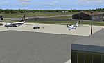
Googly scenery for VABP Bhopal/Bairagarh, India - an enhancement to the
airport provided in Flight Simulator 2004 which is incorrect in many respects.
These scenery files enlarge the apron to a realistic size to accept scheduled
traffic, remove spurious taxiways (they were actually perimeter tracks!), and
add buildings and other airport features so that you and your "AI" traffic
can land, taxi, park and take off in a realistic manner.
This small domestic airport is served by Boeing and Airbus jets of Indian
Airlines and Jet Airways together with local flights operated by ATRs of Air
Deccan.
The scenery does not purport to be ultra-accurate. Based on high-detail satellite
imagery from Google Earth, the layout is proportionally correct but the added
airport features, such as buildings, are built from default Microsoft objects
and add-on libraries so will not look like the real thing.
You are not obliged to download and install any additional scenery libraries,
but to enjoy this scenery in its entirety, you may wish to. It will work fine,
with or without.
[File re-uploaded at request of AVSIM]
| Filename: | VABP_BhopalBairagarh_India.zip |
| License: | Freeware |
| Added: | 7th May 2010, 22:34:06 |
| Downloads: | 1,625 |
| Author: | John Hinson |
| Size: | 64.37 KB |
| Category: Flight Simulator 2004 - Scenery | |
| VAKE Kandla/Gandhidham, India |
|
Images related to this file:
File Description:
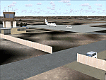
Googly scenery for VAKE Kandla/Gandhidham - a small domestic airport
in the state of Gujurat, India, for which little other than a runway is
provided in Flight Simulator 2004. These scenery files add taxiways, aprons,
buildings and other airport features, so that you and your "AI" traffic can
land, taxi, park and take off in a realistic manner.
Gandhidham is a small city about 5 miles from the seaport of Kandla, in the
Gulf of Kutch, and was developed in 1950 after the separation of Pakistan and
India left the key port of Karachi in Pakistan. The airport is served by daily
flights using turboprop aircraft of Air Deccan.
The scenery does not purport to be ultra-accurate. Based on high-detail satellite
imagery from Google Earth, the layout is proportionally correct but the added
airport features, such as buildings, are built from default Microsoft objects
and add-on libraries so will not look exactly like the real thing.
You are not obliged to download and install any additional scenery libraries,
but to enjoy this scenery in its entirety, you may wish to. It will work fine,
with or without.
[File re-uploaded at request of AVSIM]
| Filename: | VAKE_KandlaGandhidham_India.zip |
| License: | Freeware |
| Added: | 14th May 2010, 05:11:31 |
| Downloads: | 848 |
| Author: | John Hinson |
| Size: | 67.36 KB |


© 2001-2026 AVSIM Online
All Rights Reserved
Privacy Policy |