
Where Flight Simulation Enthusiasts Gather from Around the World!
AVSIM Library - Search Results

| Category: Flight Simulator 2004 - Scenery | |
| Kingstown, St. Vincent and the Grenadines - Argyle Int'l new airport TVSA |

|
File Description:
Kingstown had replaced old airport of E T Joshua (TVSV) including scenery package with closed marked runway. Argyle International opened recently this year with a few airlines serve. It will expand some airlines coming up soon.
| Filename: | Kingstown_St_Vincent_and_the_Grenadines__Argyle_In.zip |
| License: | Freeware |
| Added: | 1st August 2017, 18:39:53 |
| Downloads: | 766 |
| Author: | Stuart John Gilbert II |
| Size: | 2.25 MB |
| Category: Flight Simulator 2004 - Scenery | |
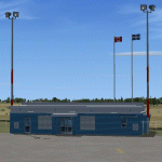
| St Lawrence Island AK: Gambell PAGM, Savoonga PASA, and Northeast Cape |
|
Images related to this file:
File Description:
St Lawrence Island is in Alaska, but "in" is slightly misleading as it is in fact in the Barents Sea and 120 miles from the Alaska mainland, and only 40 miles offshore of Russia. The island is around 100 miles long, with two villages and at the eastern end an old air force radar base that was cleared away some 25 years ago. Gambell is one of the two villages and is at the far western end of the island, with a population of around 700 living mainly from the sea. This northern airfield is unusual in that it has an asphalt runway and apron, the lit runway being aligned 16-34 and just over 4,500 feet long. The reason for the asphalt becomes apparent if you try walking in the vicinity, as underfoot there are rounded pebbles down to varying depths, and they are quite small and eventually slippery enough to trip you up. To base a flexible gravel runway on top of this would have been difficult, and when it was originally built it was for an air force base (closed long ago). The village is also fairly unique among northern settlements in that it has wind turbines and also solar panels. The second village is Savoonga and is around 40 miles east of Gambell with a similar population. The runway here is lit gravel aligned 5-23 and 4,900 feet long. This village also has wind turbines and solar panels. There are no vehicles (cars, pickups, trucks etc) on the island, mainly because there is nowhere far to go to and in the case of Gambell because roads as such would be difficult to create. ATV's are the standard way to go, along with small boats for fishing and whaling. At the eastern and of the island the remaining traces of the air force radar base are just the gravel runway and aprons, included with the Savoonga scenery. The AI included here is for daily flights from Nome by ERA and Bering Air, along with some GA. Also included here is the EZ library that includes the wind turbines, to save you looking for it. Installing this will also mean that a wind farm in my Cyprus scenery wii now be visible to the north of Larnaca, and there are other libraries in the series that include useful objects. The Lens_EZ_Animated library could go into your static objects folders, which is where I have it; up to you.
| Filename: | St_Lawrence_Island_AK_Gambell_PAGM_Savoonga_PASA_a.zip |
| License: | Freeware, limited distribution |
| Added: | 29th February 2020, 00:09:36 |
| Downloads: | 221 |
| Author: | Roger Wensley |
| Size: | 11.59 MB |
| Category: Flight Simulator 2004 - Scenery | |
| Natashquan CYNA , Quebec, Canada |
|
Images related to this file:
File Description:
This scenery represents as much as possible the airport of Natashquan (CYNA). However, certain frontages of the buildings can farier, not having had the authorization to take photographs on the ground. This scene was built with FSDS and it is compatible for FS-X and FS-2004. Natashquan is located at Quebec, Canada on banks of the St-Laurent river. It is a small village of the Cote-Nord.
| Filename: | Natashquan_CYNA__Quebec_Canada.zip |
| License: | Freeware |
| Added: | 30th December 2009, 21:33:27 |
| Downloads: | 1,137 |
| Author: | Regis Dassylva |
| Size: | 7.6 MB |
| Category: Flight Simulator 2004 - Scenery | |
| Belg 7000 |
|
File Description:
Scenery "Belg7000 V2.0" (Belgium 2003) - For FS2004 only
Airport : EBSG-StGhislain - EBCV-Chièvres - EBTY-Maubray
The first part of Belgium scenery where you can fly in "VFR" over 1350 Square area.
scenery : Tournai-> StGhislain-> Mons-> Chièvres-> Ath-> Leuze.
Ebsg-Stghislain-> Condé/Escaut-> St Amand les Eaux (France) -> Ebty-Maubray.
Quiévrain-> Roisin-> Givry (view map).
Very very nice to fly at low altitude (1000-3000 ft) with an little aircraft.
| Filename: | Belg_7000.zip |
| License: | Freeware |
| Added: | 1st December 2003, 16:02:30 |
| Downloads: | 7,392 |
| Author: | Freddy Bridoux |
| Size: | 8.31 MB |
| Category: Flight Simulator 2004 - Scenery | |
| Napa/Sonoma Wine Country Landclass |
|
Images related to this file:
File Description:
This landclass file covers the Napa/Sonoma wine country. The landclass file was made with my free landclass tool, Landclass Assistant, and is compatible with Flight Simulator 2002, Flight Simulator 2004 and Flight Simulator X. The update adds several small towns (Yountville, St. Helena, Calistoga, Sonoma, Glen Ellen) and was matched up against satellite data as well as my own memory of the area (having lived 20+ years in the heart of wine country).
| Filename: | NapaSonoma_Wine_Country_Landclass.zip |
| License: | Freeware |
| Added: | 19th January 2011, 23:10:05 |
| Downloads: | 531 |
| Author: | John Cillis |
| Size: | 215.83 KB |
| Category: Flight Simulator 2004 - Scenery | |
| Miramichi Airport CYCH Demo for FS2004 |
|
File Description:
Miramichi Airport is CanUk's first shareware scenery. CanUk is requesting support to cover costs associated with travel to airports. All who donate will receive both CYCH and CCS3 (St. Stephen Airport - New Brunswick's border airport with Maine, USA). The sceneries feature custom ground textures, photoreal building textures, automated hangars and fence gates, landclass, static vehicles, many many trees and off-airport buildings.
Please support CanUk by visiting our website at www.cysjhangar.ca/canuk.
| Filename: | Miramichi_Airport_CYCH_Demo_for_FS2004.zip |
| License: | Shareware, limited functionality |
| Added: | 5th January 2006, 14:25:48 |
| Downloads: | 1,938 |
| Author: | Adam Bentley-CanUk Scenery |
| Size: | 9.54 MB |
| Category: Flight Simulator 2004 - Scenery | |
| Vance W. Amory International Airport, St Kitss and Nevis (TKPN), Version 1.0 |
|
Images related to this file:
File Description:
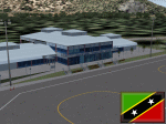
This zip-file contains a detailed yet very frame-rate friendly scenery for the Vance W. Amory International Airport, Newcastle, St. Kitts and Nevis. Version 1.0. Added as much photo-real details as possible. Limited night texture at this time. Included the "Hurricane Hill" so the approach of runway 10 becomes a bit challenging like in real-world. Charts included.
For the trees to show up around the airfield you need to have installed: Gerrish Gray's trees_v3.zip.
| Filename: | Vance_W_Amory_International_Airport_St_Kitss_and_N.zip |
| License: | Freeware, limited distribution |
| Added: | 22nd March 2010, 16:53:20 |
| Downloads: | 2,545 |
| Author: | Marcel Ritzema |
| Size: | 2.77 MB |
| Category: Flight Simulator 2004 - Scenery | |
| Ogdensburg International KOGS New York state close to the St. Lawrence River |
|
File Description:
Ogdensburg is called "International" but there is in fact very little activity, in spite of Big Sky Airways now operating flights between Ogdensburg and Boston. The airfield and the town of the same name are close to the St. Lawrence and the border with Ontario in Canada, and would be very convenient for a cross border hop except for the stepped up security that now applies to cross-border flights. So it is now even emptier than before, in spite of the excellent condition of the 5,200' runway.
| Filename: | Ogdensburg_International__KOGS_New_York_state_clos.zip |
| License: | Freeware |
| Added: | 2nd August 2007, 03:16:36 |
| Downloads: | 843 |
| Author: | Roger Wensley and Jim Turner |
| Size: | 1.13 MB |
| Category: Flight Simulator 2004 - Scenery | |
| St.Siméon Airfield, Québec Short Hops |
|
File Description:
Saint-Siméon, part of Québec Short Hops sits on the banks of the St. Lawrence River, downstream from Québec City. The village is situated directly across the St.Lawrence River from Rivière-du-Loup. It has the docking facilities for the ferry that goes to Rivière-du-Loup. To help navigation, I have added a beam on top of the ferry dock. My rendition of the village is fictitious. The grass strip is on top of the cliff.
| Filename: | StSimon_Airfield_Qubec_Short_Hops.zip |
| License: | Freeware |
| Added: | 10th June 2004, 14:10:46 |
| Downloads: | 1,429 |
| Author: | Leon Louis |
| Size: | 4.1 MB |
| Category: Flight Simulator 2004 - Scenery | |
| Queensland3 Soaring Scenery |
|
File Description:
FS2004 Queensland3 Soaring Scenery
These files adds some missed thermals to default Microsoft Scenery ,over below Regions,Queensland,Australia:
1.Copperbella Town.
2.St. Helens Town
3.Cains Town
4.Kingaroy Town
5.Bunya Mts.
6.Rainbow Beach
7.Waipoint MI
8.Waipoint ME
9.Waipoint NI
10.Waipoint NM
11.Waipoint NE
12.Waipoint EP
13.Eungella Re-worked 2
14.Eungella Reworked 3.
It is freeware.
Goods flights and better landings
By Francisco Vargas.
E-mail:[email protected]
| Filename: | Queensland3_Soaring_Scenery.zip |
| License: | Freeware |
| Added: | 16th November 2005, 16:16:14 |
| Downloads: | 308 |
| Author: | Francisco Augusto Vargas Carneiro |
| Size: | 133.17 KB |
© 2001-2026 AVSIM Online
All Rights Reserved
Privacy Policy |