
Where Flight Simulation Enthusiasts Gather from Around the World!
AVSIM Library - Search Results

| Category: Flight Simulator 2004 - Scenery | |
| Boischâtel Airstrip and Scenery, === Québec Short Hops |

|
File Description:
Boischâtel is a (fictitious) grass strip by the St. Lawrence River a few miles downstream from Québec City facing beautiful Île d'Orléans. It also has a dock for seaplanes. Taking off at night you will see the magnificient Château Frontenac and animated fireworks with detonations. Heading due East, you should see Ste Anne Basilica. Those other sceneries are the creations of André Côté and Michel Baron. Details to get the files in the download. This scenery, though not tested, should work in FS2002 also.
| Filename: | Boischtel_Airstrip_and_Scenery__Qubec_Short_Hops.zip |
| License: | Freeware |
| Added: | 6th January 2004, 20:29:32 |
| Downloads: | 2,519 |
| Author: | Léon Louis |
| Size: | 4.14 MB |
| Category: Flight Simulator 2004 - Scenery | |
| Hewanorra TLPL on Saint Lucia in the eastern Caribbean |
|
Images related to this file:
File Description:
St Lucia island is to the north of the Grenadines, between Martinique and Saint Vincent. St Lucia is nearly 30 miles long and has a population of 175,000, with two airports. Hewanorra International is at the southern end of the island, the end furthest from the capital, Castries. The reason for this is that at the southern end it was possible to build a runway almost 9,000 feet long, while the airport in the north (Vigie) could not be extended further to accomodate the largest jets. The airport was originally a USAAF base, converted to commercial use.
All buildings are made with photographic textures and include the new terminal and a new control tower. The apron has been extended so that 747's etc can be accommodated, and there are regular international flights by Virgin, BA, Air Canada, Air France, etc and local connecting flights by LIAT; the AI includes both major international airlines and LIAT. The towns around the airport (Vieux Fort etc) are included here: the scenery is based on the "Lesser Antilles Mesh" which is required and can be downloaded for free.
| Filename: | Hewanorra_TLPL_on_Saint_Lucia_in_the_eastern_Carib.zip |
| License: | Freeware, limited distribution |
| Added: | 11th June 2013, 16:23:49 |
| Downloads: | 831 |
| Author: | Roger Wensley |
| Size: | 4.25 MB |
| Category: Flight Simulator 2004 - Scenery | |
| Pete & Sid's Scenery UT Updates |
|
File Description:
Re-upload. These are Ultimate Terrain scenery fixes for six airports in the Pete & Sid's Scenery collection. These are all airports that had problems with misplaced lakes or rivers. PSS Volume 1: Bettles, Ft. Yukon, Northway. PSS Volume 2: Galena-Pitka, Kotzebue-Wien Memorial, St. Mary's. These fixes were made using Sbuilder. I've also included a modifed texture file to fix one that has been reported by some people to cause the scenery to go blurry. If you don't have Pete & Sid's Scenery but are using my new or old hanger scenery objects to make your own scenery, you should install this texture fix.
| Filename: | Pete__Sids_Scenery_UT_Updates.zip |
| License: | Freeware |
| Added: | 8th December 2011, 09:02:17 |
| Downloads: | 445 |
| Author: | Sidney Schwartz |
| Size: | 849.04 KB |
| Category: Flight Simulator 2004 - Scenery | |
| Bethel: Yukon Area |
|
Images related to this file:
File Description:
This presumes you have already installed Bethel PABE, Bethel Local Airfields, and Bethel St Mary's. In the Yukon River area of Alaska to the north of Bethel and to the south around the equally wide (but shorter) Kuskowim River there are small villages, served by flights from both Bethel PABE and St Mary's PASM. These villages are dependent upon fishing for survival, and in this flat and very wet terrain are equally dependent upon the gravel runways that link them to the outside world. There are no surfaced roads, and the rivers and their tributaries wind into the distance and are impractical delivery routes except from nearby places. In an area 300 miles by 200 miles most places cannot be described as "nearby". This post is of the small villages, including those previously posted; I had missed on picking up some terrain conflicts between nighttime grass and town textures. They are corrected here and included along with new airfields. Bethel and St Mary's are also reposted to include the further enlargement of parking for the increased number of small AI aircraft. These smaller airfields vary in quality; some have runway signage but most do not, and while some have two or even three hangars/garages/terminal buildings on the apron there are others who have none at all. The 39 small airfields included here are as listed:
Akiak AKI, Akiakchak Z13, Alakanuk AUK, Anvik PANV, Atmautluak 4A2, Cape Romanzof PACZ, Chefornak PACK, Chevak VAK, Eek EEK, Emmonak PAEM, Goodnews GNU, Grayling KGX, Holy Cross HCA, Hooper Bay PAHP, Kako 9AK2, Kalskag KLG, Kasigluk Z09, Kipnuk PAKI, Kongiganak PADY, Kotlik KOT, Kwethluk KWT, Kwigillingok A85, Marshall MLL, Mountain Village MOU, Napakiak WNA, Napaskiak PKA, Newtok PAEW, Nightmute IGT, Nunapichuk 16A, Pilot Station 0AK, Quinhagak PAQH, Russian Mission RSH, Scammon Bay SCM, Shageluk SHX, Sheldon Point SXP, Toksook Bay OOK, Tuluksak TLT, Tuntutuliak A61, Tununak 4KA.
I am currently going through the airfields again to check if further modifications are required, and I am also adding a few new ones. As I am going to be updating my computer I am posting now, complete or not, and I will post an update later of further additions.
| Filename: | Bethel_Yukon_Area.zip |
| License: | Freeware, limited distribution |
| Added: | 3rd May 2019, 17:20:53 |
| Downloads: | 169 |
| Author: | Roger Wensley |
| Size: | 6.3 MB |
| Category: Flight Simulator 2004 - Scenery | |
| Maurice Bishop TGPY on Grenada in the Caribbean |
|
Images related to this file:
File Description:
Grenada island is 17 miles south of the southernmost island of the Grenadines, Carriacou; there are some smaller islands between the two. Grenada is 18 miles long and around 8 miles wide, has an estimated population of 110,000, and produces a very large part of the world's annual nutmeg harvest. The capital, St Georges, is by far the largest town and is at the southern end of the island, with the airport close by.
The airport is now called Maurice Bishop, but for some years was called Point Salines. The runway is just over 9,000 feet long and oriented 10/28. Point Salines replaced Pearl Airport, which is on the east coast 12 miles northeast of St Georges and was difficult to expand as the runway had mountains at one end and the sea at the other. Pearl is now closed; it is included here but only as a visual landmark with "closed" markings. There are regular international flights from North America and Europe, some of which are seasonal only (Air Canada for instance) and local connecting flights by LIAT and SVG. I retained the default control tower as it is some distance away. In real life it is also some distance away and on a hill northwest of the terminal. Which is why I did not take photos from which I would have made the real one. The hill does not feature in FS9.
| Filename: | Maurice_Bishop_TGPY_on_Grenada_in_the_Caribbean.zip |
| License: | Freeware, limited distribution |
| Added: | 11th June 2013, 23:28:17 |
| Downloads: | 824 |
| Author: | Roger Wensley |
| Size: | 7.38 MB |
| Category: Flight Simulator 2004 - Scenery | |
| Lauriston TGPZ on Carriacou Island in the Caribbean |
|
Images related to this file:
File Description:
Canrriacou Island, though part of the Grenadines geographically, is south of the island chain known politically as St Vincent and the Grenadines, and with Petite Martinique is a dependency of Grenada. Carriacou is around 7 miles long and 2 miles wide, with a resident population of perhaps 5,000. Lauriston airport is at the southwest end of the island, on the north coast, and the runway is around 2,600 feet and aligned 09/27. There are connecting flights both north and south to the other islands by SVG and LIAT. The terminal is stucco and pastel colours and not exactly new. The airport apron is tight. This is the last of my Caribbean series made for default FS9.
| Filename: | Lauriston_TGPZ_on_Carriacou_Island_in_the_Caribbea.zip |
| License: | Freeware, limited distribution |
| Added: | 6th July 2013, 22:23:03 |
| Downloads: | 643 |
| Author: | Roger Wensley |
| Size: | 2.47 MB |
| Category: Flight Simulator 2004 - Scenery | |
| Scott AFB/MidAmerica Airport (KBLV) |
|
Images related to this file:
File Description:
FS2004 Scenery - Scott Air Force Base (IATA: BLV, ICAO: KBLV, FAA LID: BLV) is a base of the United States Air Force in St. Clair County, Illinois, near Belleville. The base is named after Corporal Frank S. Scott, the first enlisted person to be killed in an aviation crash. The base is operated by the 375th Air Mobility Wing (375 AMW) and is also home to the Air Force Reserve Command's 932d Airlift Wing (932 AW) and the Illinois Air National Guard's 126th Air Refueling Wing (126 ARW), the latter two units being operationally gained by the US Air Force's Air Mobility Command (AMC). Created with Instant Scenery 2 by John B. Loney, Jr.
| Filename: | Scott_AFBMidAmerica_Airport_KBLV.zip |
| License: | Freeware, limited distribution |
| Added: | 29th April 2012, 05:39:14 |
| Downloads: | 636 |
| Author: | John B. Loney, Jr. |
| Size: | 2.06 MB |
| Category: Flight Simulator 2004 - Scenery | |
| Mormon Range, Enterprise, Beryl (UT82), Utah, Photo-Scenery |
|
Images related to this file:
File Description:
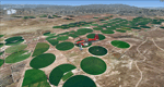
Mormon Range, Enterprise, Beryl (UT82), Utah, Photo-Scenery (FS9 & FSX)
This scenery covers the area of just north of St. George (KSGU) north along the Mormon Range and Enterprise to Beryl (UT82). It completes the southwestern corner of Utah and paves our way into Nevada. High resolution versions of this scenery for FS9 and FSX (much sharper, but larger and multiple downloads)are available at www.blueskyscenery.com/CNY_South2West6.html . The screenies are taken from the high-res versions, so expect this version to be slightly more blurry.
Thanks to Joop Mak for providing a custom AFCADs that correct airport layouts so that they align with the photo-textures! They are available at www.blueskyscenery.com/AFCADs.html . YourDonation@Work: Dedicated to Jean Pierre, Konrad and Juan.
| Filename: | Mormon_Range_Enterprise_Beryl_UT82_Utah_PhotoScene.zip |
| License: | Freeware, limited distribution |
| Added: | 27th March 2010, 11:38:48 |
| Downloads: | 1,365 |
| Author: | Gottfried Razek, blueskyscenery.com |
| Size: | 97.45 MB |
| Category: Flight Simulator 2004 - Scenery | |
| Southwestern Ontario Part 1 - Version 1.0 |
|
File Description:
I decided to make Southern Ontario much more interesting for flight simulator general aviation pilots. I have released several packages already but this is by far the most complex. London International Airport will be very lively with this addon. During testing I was cleared number 5 for landing on one occasion! I made the AI plans to account for your traffic amount setting so on a lower system you will have less planes so you’re performance doesn’t die on you.
This package is fully compatible with all of my other releases and all of the Project AI official releases. It only uses default MS aircraft so no additional downloads are required.
Overall
• 7 Improved airports – London, Woodstock, Tillsonburg, Straffordville, Stratford Municipal, Strathroy and St. Thomas.
• 43 flight plans
• 64 new parking spaces
• 3 new gates
| Filename: | Southwestern_Ontario_Part_1__Version_10.zip |
| License: | Freeware, limited distribution |
| Added: | 14th November 2003, 03:58:59 |
| Downloads: | 1,659 |
| Author: | David Voogd |
| Size: | 780.81 KB |
| Category: Flight Simulator 2004 - Scenery | |
| The Grenadines Islands Airports V1.1 for use with Antilles 2004 |
|
Images related to this file:
File Description:
This is a self-contained version V1.1 of the airports in the Grenadines chain of islands that I have already posted, modified for use with the Antilles 2004 scenery. I originally made them for stock FS9. The list is Hewanora, Saint Vincent, Bequia, Mustique, Canouan, Union Island, Carriacou, and Maurice Bishop International at the southern end of Grenada. The notes for V1.1 contain some information that should have been included in the first posting. The replacement scenery bgl's include some fixes to Antilles 2004 sea levels where the sea was climbing a hill, additional town landclass for the area close to the airport in Grenada as St Georges now stretches out along the coast, and some revisions to my airports where I found that installing on a second computer gave a slightly different and unsatisfactory result, in particular TVSB on Bequia.
| Filename: | The_Grenadines_Islands_Airports_V11_for_use_with_A.zip |
| License: | Freeware, limited distribution |
| Added: | 7th July 2013, 05:28:12 |
| Downloads: | 571 |
| Author: | Roger Wensley |
| Size: | 17.05 MB |
© 2001-2026 AVSIM Online
All Rights Reserved
Privacy Policy |