
Where Flight Simulation Enthusiasts Gather from Around the World!
AVSIM Library - Search Results

| Category: Flight Simulator 2004 - Scenery | |
| OSM World: South America |

|
Images related to this file:
File Description:
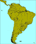
OSM World is a community project! If you wish to help, check the documentation and contact the author!
Welcome to OSM Wold: South America! This is a vector data scenery package covering the South American area. Coastlines, Rivers, lakes, roads, railways, and power lines with detail never before seen! All in an autogen-compatible density! You can see roundabouts, train terminals, harbor areas in a resolution of a point every 10 meters. At this same resolution a vectorial city class places residential (in small and big building variations, depending on surface area) and industrial areas exactly where they are supposed to be. This gives the city areas a resolution far superior to the capacity of FS-2004 default landclass bitmaps, limited to approximately 1 Km x 1 Km squares. OSM World: South America will even give you small roads leading to small towns (even a few houses across)! From big highway intersections, including ramps, to the tiniest rural pathways covering the entire South american area! Wherever in South America you fly, there is something to see!
You can enjoy this scenery near coastlines too! harbor areas and extremely detailed coastal topology (try the southern Chile). This scenery makes sure that the ocean is always flat, you can forget about the climbing water often found around photo-sceneries! This scenery is best paired with a good set of terrain meshes (like the freeware global SRTM mesh by Stephen Rothlisberger , available here: http://simviation.com/1/fs2004terrainmesh).
| Filename: | OSM_World_South_America.zip |
| License: | Freeware |
| Added: | 5th August 2015, 02:31:08 |
| Downloads: | 3,107 |
| Author: | Mario Noriega, Luis Miguel Hernandez |
| Size: | 64.37 MB |
| Category: Flight Simulator 2004 - Scenery | |
| Butuan Bancasi Airport, Butuan, Philippines |
|
File Description:
This is a totally new Butuan Scenery Addon for Flight Simulator 2004. This features Multi-Level of Detail (MLOD) which makes a scenery framerate-friendly. At a distance, the objects are on its LOW POLYGON STATE. And while you get closer and closer, the objects become more and more complex, making you landing sequence unaffected by heavy framerate hit due to the High number of Polygons of the Library Objects.
Butuan Bancasi Airport Scenery (RPME) features photorealistic textures. This includes the Main Terminal Building, the Philippine Airlines Cargo warehouse, the Old Butuan Airport Cargo Warehouse, the Air Transportation Office Building, the Old Private Hangar, and the Control Tower. This scenery has full night lighting textures and has night lighting beams that illuminate the ramp from the main terminal building. Other library objects included are: Cebu Pacific baggage carts, Cebu Pacific and Philippine Airlines stairs, Airport and Ramp personnel, cars, trucks, buses, jeeps, cows and horses. But these objects do not interfere with the framerate so much because this is defined in the MLOD feature.This scenery has not been tested with FS2002 but is more likely to work without problem in that version.
Currently, Philippine Airlines serves this destination daily from Manila arriving at 12:15 p.m. and departing for Manila at 01:15 p.m. Cebu Pacific also serves this destination daily from Manila arriving at 10:25 a.m. and departing for Manila at 11:15 a.m. and thrice weekly (Mon-Wed-Sat) from Mactan, Cebu arriving at 11:50 a.m. and departing for Mactan at 12:30 p.m.
| Filename: | Butuan_Bancasi_Airport_Butuan_Philippines.zip |
| License: | Freeware |
| Added: | 24th June 2004, 05:40:52 |
| Downloads: | 6,876 |
| Author: | Ver Walter Gulfan, Philippine Flightsimmers Group |
| Size: | 8.85 MB |
| Category: Flight Simulator 2004 - Scenery | |
| Masbate Airport, Masbate, Philippines |
|
File Description:
This is a totally new Masbate Scenery Addon for Flight Simulator 2004. This features Multi-Level of Detail (MLOD) which makes a scenery framerate-friendly. At a distance, the objects are on its LOW POLYGON STATE. And while you get closer and closer, the objects become more and more complex, making you landing sequence unaffected by heavy framerate hit due to the High number of Polygons of the Library Objects.
In this scenery, you will see a total transformation from the default Masbate City area in FS2004 to a new realistic and alive Masbate City as seen in the included screenshots.
Masbate Airport Scenery (RPVJ) features photorealistic textures. This includes the Main Terminal Building, the Rancho Cuervo Verde Hangar, the Masbate Airport cargo warehouse, the Administration Building, the Crash and Fire Rescue Station, and the Control Tower. This scenery has full night lighting textures and has night lighting beams that illuminate the ramp from the firestation building. Other library objects included are: Animated Baggage Carts, Airport and Ramp personnel, ferry boats, ships, yachts, sailboats, cargo vessels, lighthouse, jeeps, cows and horses. But these objects do not interfere with the framerate so much because this is defined in the MLOD feature.This scenery has not been tested with FS2002 but is more likely to work without problem in that version except that AFCAD for FS2002 should be separately designed.
Currently, Asian Spirit serves this destination daily from Manila arriving at 7:15 a.m. and departing for Manila at 7:35 a.m.
| Filename: | Masbate_Airport_Masbate_Philippines.zip |
| License: | Freeware |
| Added: | 29th June 2004, 02:55:36 |
| Downloads: | 4,249 |
| Author: | Ver Walter Gulfan, Philippine Flightsimmers Group |
| Size: | 4.09 MB |
| Category: Flight Simulator 2004 - Scenery | |
| VVCR Cam Ranh Airport |
|
Images related to this file:
File Description:

Cam Ranh is currently a fast-growing beauty spot and tourist area on the Vietnamese coast. In May 2004, Cam Ranh airport (VVCR) opened to commercial traffic, initially only serving domestic traffic but international flights will commence in 2005. The airport was once a massive US Air Force base, but was later used as a base for Russion spy plane activities.
This scenery adds this "missing" airport to Flight Simulator, but much is based around satellite views of the airport when the US were spying on the Russian base and other historical information and it may not accurately reflect the airport as it is today. Furthermore, my capabilities at scenery design are limited and restricted to scenery objects available through the Rwy12 scenery creation programme.
You do NOT need to download and install the full 45 MB Rwy 12 Object Placer programme, which is for the designers and not the end user.
Some of the scenery objects will appear without any extra downloads, but to get the greatest benefit from this scenery, you may optionally download following files, which should be installed according to the instructions within this download and not as described in their own download archive:
Level 2 objects
rwy12-lvl2.zip (Israel Roth and Seev Kahn/John Hinson),
Level 3 objects
jw_rwy12.zip (Shehryar Ansari),
tl_rwy12.zip (Todd Lucas) ,
ford_transit_collection.zip (S Legg),
hgrrwy12.zip (ESDG), and
ga-hangers_lib_for_rwy12.zip (S Legg)
Also included with this scenery are two EditVoicepack files which may be imported to that programme so that the controllers will be heard referring to "Cam Ranh".
[File re-uploaded at request of AVSIM] See also file vvcru11.zip.
| Filename: | VVCR_Cam_Ranh_Airport.zip |
| License: | Freeware |
| Added: | 15th May 2010, 01:13:46 |
| Downloads: | 4,177 |
| Author: | John Hinson |
| Size: | 21.36 KB |
| Category: Flight Simulator 2004 - Scenery | |
| Airstrips of North-West Europe |
|
Images related to this file:
File Description:
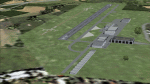
The sales blurb for FS2004 announced the inclusion of over 23,000 airfields ... unfortunately a significant number of those consisted of little or nothing more than a runway on a flatten with a rectangular background polygon.
To enable the addition of an amount of lightweight GA AI traffic, without overloading those airfields that were designed with parking spaces and taxi-ways, (and are probably already busy), I herewith include over 140 small sceneries, of mostly default airfields, from NW France, up the English Channel and the North Sea coast through Belgium, the Netherlands and NW Germany to Denmark, all with added taxiways and parking spots, aprons, generic buildings and background polygons as appropriate, to enable AI traffic to be generated without interrupting things at the more major airports.
A few of the French airfields are "new", not included originally with FS2004, and a couple have been updated to suit more recent developments :- for example, LFES "Scaer Guiscriff" is now LFES "Bretagne Atlantique", LFOR "Chartres Champhol" is now LFOR "Chartres Metropole", EHSE "Seppe" is now EHSE "Breda International" and EKVH "Vesthimmerlands" was previously EKVH "Aars".
There's no photo-realism here, just a selection of basic 'generic' buildings, more or less accurately sized and placed to reflect the airfield layout as seen on on-line satellite imagery and aerial photography. These buildings have minimal effect on frame-rates, so are ideal for this kind of job.
The airfields are aligned as well as possible with the roads etc. in UT Europe and the Genesis Europe mesh, but should mostly be fine in a default installation or other configuration.
Please read the rest of this "waffle" in the included text file ... it might save some confusion ;)
Enjoy :)
| Filename: | Airstrips_of_NorthWest_Europe.zip |
| License: | Freeware |
| Added: | 14th June 2024, 13:44:58 |
| Downloads: | 286 |
| Author: | Chris Eve |
| Size: | 9.95 MB |
| Category: Flight Simulator 2004 - Scenery | |
| Dervio scenery - Como lake Italy |
|
Images related to this file:
File Description:
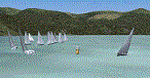
Scenery homage to a beautifull little town in north of Como lake of Italy; builded-up mainly with some existing objects and some buildings sintax made. It DOES NOT INCLUDE any airport, but represents only some pictures of Dervio town, reachable from Como Idroscalo floating airport or Samolaco or Sondrio Caiolo airports (closest ones); this is one of the moorings of Navigazione del Lago di Como. Informations: Dervio is one of the beautiful towns on north east area of Como lake, on a handland created by Varrone river. North and closed to the town, you can find Corenno Plinio old castle and in the opposite side of the lake the S. Bernardo church; you can also have some fireworks, obviously suggested with the night. Contents:
Mooring pier at snack bar, with awning and tables; Ferryboat in the lake with some sailbots in race between two buoys; Walk alongside the shore of the lake, with benches and some fisher piers; Main church with related church house and footbal soil; Several buildings, parking area, factories, bar and restaurant with tables chairs and gazebos, gas station and cars; Rail station with a small train and road gates; Sailbots on ground inside Centro Vela Dervio area and slipway with dinghy; Little marina with boats; Public park with entering gate, covered stand and tables; Residence La Boldona bloks with buildings, swimmin pool and tennis facilities, fenced; Campsite with campers, roulottes and tents; Corenno Plinio castle with tower and S. Bernardo little church; Spread of trees in all the scenery; (night scenery)two floating platforms wiht fireworks; six wood bonfires on shore of lake and on the mountains; One big ship with some other sailboats and speedboats
| Filename: | Dervio_scenery__Como_lake_Italy.zip |
| License: | Freeware |
| Added: | 22nd February 2011, 22:59:46 |
| Downloads: | 951 |
| Author: | Aldo Della Vedova |
| Size: | 12.71 MB |
| Category: Flight Simulator 2004 - Scenery | |
| Brevoort CWOB and BAF-3 radar plus Cartwright LAB-6 radar Canada |
|
Images related to this file:
File Description:
Brevoort airstrip and the BAF-3 radar it serves is on Brevoort Island, off one of the southeastern tips of Baffin Island and 140 miles east of Iqaluit. This scenery includes the BAF-3 buildings on the hilltop and those on the airstrip below, plus the roads connecting them and down to the beach landing area on the rocky coast. This scenery is made for the FSGenesis 76m terrain mesh for northern Canada, and there will be a repost of all my northern Canada airfields to suit this; I cannot think now why I never installed this mesh before. The AI reflects the use of civil airlines for resupply and transportation of personnel. Given the terrain the wind should be from the north so that ai lands using the 02 runway. Landing from the north will involve a terrain clash while take off towards the north will not as the climb out clears the hilltop. The video shows the 600 foot cliff at the runway threshold and an Air Tindi plane on the apron. Cartwright CYCA is on the Labrador coast and has been posted by Flight Ontario as part of their Goose Bay and Labrador Regional Airports sceneries. The nearby LAB-6 radar site is included here, connected to CYCA by an extended road. The site uses the same buildings as Brevoort and Saglek (posted recently) and although I have included them here as separate sceneries the contents can be placed in the same folders as Saglek with a saving in duplicated textures. The textures here are more accurate than Saglek so say yes to over-write; a downloader with personal experience of Brevoort noted that in reality they are lighter.
| Filename: | Brevoort_CWOB_and_BAF3_radar_plus_Cartwright_LAB6_.zip |
| License: | Freeware, limited distribution |
| Added: | 20th August 2017, 15:46:36 |
| Downloads: | 177 |
| Author: | Roger Wensley |
| Size: | 4.37 MB |
| Category: Flight Simulator 2004 - Scenery | |
| WASF Fak-Fak |
|
Images related to this file:
File Description:
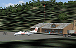
Googly scenery for WASF Fak-Fak, in Irian Jaya (Western New Gunea),
Indonesia - a small domestic airport that Microsoft managed to omit from Flight
Simulator 2004. These scenery files add the runway, apron, taxiways, buildings
and other airport features so that you and your "AI" traffic can land, taxi,
park and take off in a realistic manner.
Little information is available on the services operated - flight plans are
available for Lion Airlines showing two flights per week operated on their behalf
by Wings Abadi Dash 8 aircraft. But it is known that Merpati Nusentara also serve
the airport with Twin Otters. If you are using the Lion Airlines flight plans
for Winter 2006, you must change the airport's co-ordinates as detailed in the readme.txt file
because the co-ordinates given there will cause the aircraft to aim for a point
on the wrong side of the equator in the middle of the sea!
There is no lighting at this airport, and few navigational aids. However, I have
added a missing NDB nearby (FA, 380.0).
The scenery does not purport to be ultra-accurate. The quality of the satellite
imagery at Google Earth is poor, but a number of photographs and other information
has enabled this airport to be depicted reasonably accurately. However the added
airport features, such as buildings, are built from default Microsoft objects
and add-on libraries so will not look exactly like the real thing.
You are not obliged to download and install any additional scenery libraries,
but to enjoy this scenery in its entirety, you may wish to. It will work fine,
with or without.
An editvoicepack file has been included for the airport to help you embarrass
yourself in front of others when flying.
[File re-uploaded at request of AVSIM]
| Filename: | WASF_FakFak.zip |
| License: | Freeware |
| Added: | 7th May 2010, 22:30:22 |
| Downloads: | 1,904 |
| Author: | John Hinson |
| Size: | 72.51 KB |
| Category: Flight Simulator 2004 - Scenery | |
| MNPC Puerto Cabezas, Nicaragua |
|
Images related to this file:
File Description:
Googly scenery for MNPC Puerto Cabezas - a small international
airport in Nicaragua for which no facilities are provided in Microsoft Flight
Simulator 2004. These scenery files create the airport and add taxiways, aprons,
buildings and other airport features, so that you and your "AI" traffic can land,
taxi, park and take off in a realistic manner.
The airport, with its new Rigoberto Cabezas terminal opened in 2000, serves the
city of Puerto Cabezas and is surrounded by beautiful beaches and lush scenery.
Unfortunately, the country of Nicaragua has been embroiled in civil unrest almost
continuously since it became an independent republic in 1838, most of which is funded and fuelled by other countries seeking to interfere with Nicaragua's politics. For this reason, the country has no national airline or international flights of its own - the major powers refuse to accept its currency - and commercial traffic is confined to local flights operated by small craft from adjoining countries like those of Atlantic Airlines de Honduras and TACA Regional.
Fortunately, in Flight Simulator you do not need to worry about world politics
and you will be assured of a "virtual" welcome when you call in here. Please
say a small prayer for world peace when you do.
The scenery does not purport to be ultra-accurate. Based on high-detail satellite
imagery from Google Earth, the layout is proportionally correct but the added
airport features, such as buildings, are built from default Microsoft objects
and add-on libraries so will not look exactly like the real thing.
You are not obliged to download and install any additional scenery libraries,
but to enjoy this scenery in its entirety, you may wish to. It will work fine,
with or without. [File re-uploaded at request of AVSIM]
| Filename: | MNPC_Puerto_Cabezas_Nicaragua.zip |
| License: | Freeware |
| Added: | 28th May 2010, 20:36:10 |
| Downloads: | 1,150 |
| Author: | John Hinson |
| Size: | 67.63 KB |
| Category: Flight Simulator 2004 - Scenery | |
| PAKN - King Salmon - Alaska, US V1 |
|
Images related to this file:
File Description:
This is the final version, complete in itself and incorporating the two modifications posted separately. King Salmon is a town with a population of just under 400, on the north bank of the Naknek River and 15 miles from the sea. The airport is adjacent to the town and was originally an airforce base; the military hangars on the airport are still usable. The airport, with its long runway (11-29 and 8,500 feet with an ILS, and a second runway 18-36 and 4,000 feet) is a transportation hub for the area in general and in particular for the salmon industry. Along the Naknek River there are numerous canneries and there are also fishing lodges on the river and nearby lakes; to speed up transportation to the lodges there are float bases on the river to the south of the airport. King Salmon has three tiers of scheduled flights: Alaska Air direct from Anchorage in a 737 (passengers and cargo), PenAir (Saab turboprop) as part of their flights up and down the peninsula, and Grant Air serving nearby small towns. There are also PenAir flights, both scheduled and unscheduled, in smaller aircraft (Piper Navajo for instance) to smaller airports for the fishing season, plus cargo flights in larger aircraft by the lowest bidder (Everts and Northern). To complete the mix the AI includes a pair of F15s. The runways cross (see the airport diagram) so read the notes re long taxi routes. There is AI for PAKN, plus revised AI made for Dutch Harbor which includes flights by PenAir to King Salmon, plus revised parking for Dutch Harbor with new replacement bgls to cater for more flights. There is also AI for the float bases on the river; I have made two runways separated into two float bases for river AI, called King Salmon Floats and King Salmon River; more AI for these will be added when other scenery along the river is made. Just land according to the wind and taxi to whatever dock takes your fancy.
| Filename: | PAKN__King_Salmon__Alaska_US_V1.zip |
| License: | Freeware, limited distribution |
| Added: | 11th April 2015, 06:20:40 |
| Downloads: | 506 |
| Author: | Roger Wensley |
| Size: | 23.67 MB |


© 2001-2026 AVSIM Online
All Rights Reserved
Privacy Policy |