
Where Flight Simulation Enthusiasts Gather from Around the World!
AVSIM Library - Search Results

| Category: Flight Simulator 2004 - Scenery | |
| EBAW2004 Deurne, Antwerpen (Belgium) |

|
File Description:
The airport:
FS2002/2004. Is situated on the western edge of the city of Antwerp and is the home base of VLM Airlines (Vlaamse Luchtvaart Maatschappij). On one side, the airport is enclosed by a residential area, on the other side by an old fort (which is a protected area) an a major district road. All these factors make that the runway is pretty short and a challenge to land on with a larger jet, like a 737 for example. Extra info about this airport can be found on the net : http://www.antwerpairport.be/
Members of FSCB (Flight Simulator Club Belgium), together with the airport authorities made it possible for me to have a guided tour on the airport so I got the opportunity to make pictures of each and every building. This together with other information that people sent to me, I had all the ingredients to make a scenery to what it has become : an exact replica of the real Antwerp airport.
| Filename: | EBAW2004_Deurne_Antwerpen_Belgium.zip |
| License: | Freeware, limited distribution |
| Added: | 27th December 2003, 19:52:39 |
| Downloads: | 7,999 |
| Author: | Robert Buysen |
| Size: | 8.39 MB |
| Category: Flight Simulator 2004 - Scenery | |
| SWUY Coari/Urucu, Brazil |
|
File Description:
Googly scenery for SWUY Coari/Urucu, Brazil, a small domestic airport
located near Brazil's largest inshore gas source and serving the city
of Coari (some distance away), one of the largest cities in the Amazonas
state. The airport is served about four times daily by ATR aircraft of
Total Linhas Aereas on domestic flights, plus general aviation traffic.
Flight Simulator 2004 has made no provision for traffic with only a runway
provided and this scenery seeks to redress the situation.
The scenery does not purport to be ultra-accurate. Based on high quality
satellite imagery from Google Earth, the layout is proportionally correct but the
added airport features, such as buildings, are built from default Microsoft objects
and add-on libraries so will not look exactly like the real thing.
You are not obliged to download and install any additional scenery libraries,
but to enjoy this scenery in its entirety, you may wish to. It will work fine,
with or without.
| Filename: | SWUY_CoariUrucu_Brazil.zip |
| License: | Freeware |
| Added: | 16th April 2008, 19:26:04 |
| Downloads: | 1,208 |
| Author: | John Hinson |
| Size: | 61.58 KB |
| Category: Flight Simulator 2004 - Scenery | |
| LTBM Isparta, Turkey |
|
Images related to this file:
File Description:
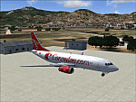
Googly scenery for LTBM Isparta, Turkey - a small airport for which nothing more than a runway has been provided in Flight Simulator 2004. These scenery files add the apron, taxiways, buildings and other airport features so that you and your "AI" traffic can land, taxi, park and take off in a realistic manner.
The airport appears to used mainly for occasional tourism flights, particularly traffic to and from Iran.
The scenery does not purport to be ultra-accurate. Based on high-detail satellite imagery from Google Earth, the layout is proportionally correct but the added airport features, such as buildings, are built from default Microsoft objects and add-on libraries so will not look like the real thing.
You are not obliged to download and install any additional scenery libraries, but to enjoy this scenery in its entirety, you may wish to. It will work fine, with or without.
[File re-uploaded at request of AVSIM]
| Filename: | LTBM_Isparta_Turkey.zip |
| License: | Freeware |
| Added: | 26th June 2010, 13:53:59 |
| Downloads: | 1,559 |
| Author: | John Hinson |
| Size: | 88.64 KB |
| Category: Flight Simulator 2004 - Scenery | |
| Branson Airport KBBG--New Airport, Scenery, and Flight Plans |
|
Images related to this file:
File Description:

This project adds a new Branson Airport KBBG (Missouri) to FS 2004, which opened in May 2009, and is a privately developed commercial airport. The construction of the airport, which involved the flattening of several Ozark Mountains, is claimed to be the largest earthmoving project in Missouri history. As a result, the airport actually sits on a manmade plateau, surrounded by rolling hills. The airport uses the ICAO identifier BBG, however, the airlines use the IATA code BKG. The airport is served by AirTran, Frontier, and ExpressJet (Branson AirExpress), and is located in hilly terrain. Aircraft equipped with a terrain avoidance warning system may experience system activation on final approach. AFCAD created using Airport Design Editor 9 v1.47.07, and the hilltops were cleared and flattened and roads were added using SBuilder 2.05 revision 06. The terminal and hangar were added and modified from within Airport Design Editor 9. This airport is based on my more detailed FSX version, Branson_Airport_Project.zip.
| Filename: | Branson_Airport_KBBGNew_Airport_Scenery_and_Flight.zip |
| License: | Freeware |
| Added: | 16th August 2010, 20:50:16 |
| Downloads: | 1,734 |
| Author: | Carlyle Sharpe |
| Size: | 3.23 MB |
| Category: Flight Simulator 2004 - Scenery | |
| VEAT Argatala, India |
|
Images related to this file:
File Description:
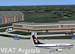
Googly scenery for VEAT Argatala, India - one of the airports that Microsoft seem to have, um, "forgotten" in FS2004. In the real world it is regularly served by Boeings and Airbii of Alliance Air, Indian Airlines, Jet Airways and Kingfisher Airlines (and smaller aircraft), using the 6000 foot runway with little room for manoevre. These scenery files add aprons, taxiways, buildings and other airport features to Flight Simulator's bland representation and allow you, and "AI" traffic, to land, taxi, park and take off realistically. The scenery does not purport to be ultra-accurate. Based on high-detail satellite imagery from Google Earth, the layout is proportianally correct but the added airport features, such as buildings, are built from default Microsoft objects and add-on libraries so will not look like the real thing. You are not obliged to download and install any additional scenery libraries, but to enjoy this scenery in its entirety, you may wish to. It will work fine, with or without. Details of optional additional scenery library downloads are provided within.
[File re-uploaded at request of AVSIM]
| Filename: | VEAT_Argatala_India.zip |
| License: | Freeware |
| Added: | 14th May 2010, 04:49:05 |
| Downloads: | 1,658 |
| Author: | John Hinson |
| Size: | 65.16 KB |
| Category: Flight Simulator 2004 - Scenery | |
| Thames Estuary Airport - Version 2 |
|
Images related to this file:
File Description: This is the long awaited update to our original Thames Estuary scenery.
Version 1 is still available, but this is also 'stand alone' (version 1 not
needed)
Works with both FS9 and FSX. Seperate FSX version to follow.

Thames estuary airport is a possible new feature to the compilation of UK
airports. Using the concept images on the net, we have made the airport for FS9.
Please note that this is a very large airport and may not be suitable for slower
computers.
There have been plans since 1943 to build a new airport for London at various
locations around the Thames Estuary. The proposal was revived in 2008 by the
Mayor of London, Boris Johnson, and has acquired the nickname "Boris Island".
| Filename: | Thames_Estuary_Airport__Version_2.zip |
| License: | Freeware |
| Added: | 28th August 2013, 01:14:08 |
| Downloads: | 1,161 |
| Author: | Mark Piccolo - Soarfly Concepts |
| Size: | 903.4 KB |
| Category: Flight Simulator 2004 - Scenery | |
| Kona at Keahole International Airport PHKO |
|
File Description:
This is a completely new Kona, which is now more correctly laid out and very detailed. This is one of the most unique and beautiful airports in the world. It resembles a Hawaiian Village and Botanic garden combined, and is completey open air. The airport is built on old lava flows, and the terminal area is full of lava rock walls, which was probably mined while constructing the taxiways, tarmacs, and terminal itself. This scenery redoes the entire airport, and includes details like baggage carrousels, benches at the gate areas, check-in counters, parking lot shelters, and some purple baggage carts to go with the Island atmosphere. Since this airport has no jetways, I have created some new lower impact air stairs, and have positioned them around the two main gate areas. There is also a large air stair at each gate area to accommodate heavy jetliners. The unique ramp lights found at this airport are also included as well as some interesting night lit ramp textures. It has not been tested in FS2002.
| Filename: | Kona_at_Keahole_International_Airport______PHKO.zip |
| License: | Freeware |
| Added: | 16th January 2004, 14:14:35 |
| Downloads: | 6,781 |
| Author: | Bill Melichar |
| Size: | 5.52 MB |
| Category: Flight Simulator 2004 - Scenery | |
| Sioux Lookout CYXL in northwest Ontario Canada |
|
File Description:
Sioux Lookout is a small town of some 5,000 folks in northwest Ontario, towards the Manitoba border, and a regional centre for surrounding villages. The airfield is some two miles east of the town. It originally had two runways but the smaller was abandoned recently as part of a planned long term improvement of the field, leaving just 34/16 with its 5,300 feeet of asphalt. Both Wasaya and Bearskin fly to Sioux Lookout; on the field there are two maintenance companies, Eagle and Allen, and hangers for the Ministry of Health, Bearskin Airlines, Wasaya, and the Nishnawbe Aski Police Service (NAPS). I think there is now another company too, but I have no information on them so I pretended this was two years ago. As well as the airfield scenery there is also a landclass file an "AFCAD" file for your AI aircraft. You should also download and install Northwest Ontario Airports by Eric O'Link, and preferably also have Ultimate Terrain; I have not tested this without UT and there is a small lake nearby.
| Filename: | Sioux_Lookout_CYXL_in_northwest_Ontario_Canada.zip |
| License: | Freeware |
| Added: | 26th November 2008, 13:08:04 |
| Downloads: | 853 |
| Author: | Roger Wensley |
| Size: | 2.66 MB |
| Category: Flight Simulator 2004 - Scenery | |
| 13 Northern Ontario Airfields in Canada |
|
Images related to this file:
File Description:
These are 13 airfields in northwest Ontario, Canada. They were previously posted individually, but not on Avsim. There is a screenshot of Google Earth showing their names and locations. There are also updates to two previously posted airports, Red Lake CYRL and Sioux Lookout CYXL, and AI with the supply flights that are vital for these isolated outposts. Pickle Lake is a northern airfield that is connected to the rest of Canada by an all-weather road, and a large number of the supply flights originate from there. In fact these flights are the primary reason for the small towns existence. This will be followed by a posting of a similar number of northern Manitoba airfields. You may wonder about the numbers of fuel tanks at these airfields. These are not for the airfield use, they are for the settlement to be able to generate electricity and also to provide heating in the winter. If you find an error email me please, and note that my email address has been changed to rogwens at Gmail dot com.
| Filename: | 13_Northern_Ontario_Airfields_in_Canada.zip |
| License: | Freeware, limited distribution |
| Added: | 6th April 2021, 18:03:40 |
| Downloads: | 161 |
| Author: | Roger Wensley |
| Size: | 43.84 MB |
| Category: Flight Simulator 2004 - Scenery | |
| Tel Aviv Lod Airport Scenery 1961 |
|
File Description:
Lod Airport, now called Ben Gurion International Airport started out in 1936 as Lydda Airport, an airstrip of four concrete runways on the outskirts of the Arab town of Lydda. By the mid-1960s, 14 international airlines were landing at Lod Airport.
I have backdated Lod airport back to 1961, when it was much smaller than today. Lod was and is Tel Aviv's major airport, used for all airline flights in 1961, and most international flights today. I have used GMAX to create the terminal and many of the hangars and other buildings at the airport, and have also used many library objects to increase the detail around the airport. Landclass files are included to reduce the city area back to their sizes in the 1960's. I have also backdated 4 other airports: Eilath (LLET), Sde Dov (LLSD), Mahanaim (LLIB), and Beer Sheeba (Teyman LLBS). These use library objects to increase the airport detail as well. These cities constituted the entire route network of Arkia, the local airline of Israel, in 1961.
| Filename: | Tel_Aviv_Lod_Airport_Scenery_1961.zip |
| License: | Freeware, limited distribution |
| Added: | 30th October 2008, 20:30:22 |
| Downloads: | 2,857 |
| Author: | Mike Stevens |
| Size: | 699.82 KB |


© 2001-2026 AVSIM Online
All Rights Reserved
Privacy Policy |