
Where Flight Simulation Enthusiasts Gather from Around the World!
AVSIM Library - Search Results

| Category: Flight Simulator 2004 - Scenery | |
| Denali Park Research Base |

|
Images related to this file:
File Description:
A fictitious research base located 16 nautical miles west of Denali airport (AK06). It is owned and operated by NWS and used by several agencies including park service, various concessionaires, Fish and Game, Law enforcement and Medical/search and rescue agencies.
It has a runway only marked by barrels emitting heavy smoke along with crew barracks, main base building w/comm center, covered parking for snowcats and cargo/supplies. there are other buildings and a very large communications tower on the south side of the runway which parallels the river. It has an NDB of 351.2 (ADF).
Get hired to bring in cargo from Denali and other nearby airports. Made with Instant Scenery and various object libraries.
Best approach is from the north and the smoking barrels only mark a short section of the available landing area. Read the txt file for more info and have a great fly to the research base. By savageagle.
| Filename: | Denali_Park_Research_Base.zip |
| License: | Freeware |
| Added: | 1st February 2010, 09:35:25 |
| Downloads: | 279 |
| Author: | Tim Durham |
| Size: | 3.46 MB |
| Category: Flight Simulator 2004 - Scenery | |
| Skysoft Simulation - ZUJZ_2011 |
|
Images related to this file:
File Description:
Jiuzhai Huanglong Airport (ICAO: ZUJZ, IATA: JZH) situated at the famous tourist
spot Jiuzhaigou in Sichuan Province, China, where is the home of pandas. With an
elevation of 3448m, it is one of the highest airports in China as well as in the world.
While enjoying the breathtaking landscape around you, you should always be cautious
about the severe turbulence and intense crosswind whenever departure or arriving the
airport. The airport was constructed in the year 2003 with a runway length 3400 meters
(11 056 ft.) and width 60 meters (147 ft.).
In the year 2007, the airport has been expanded. The runway was extended by 200
meters (650 ft.) and 7 parking gates were added. Now the airport is capable for
medium jets to takeoff and landing. Certification needed in both airplanes as well as the
crews before executing takeoff or landing on the airport. It is expected that in the year
2015, the average number of flights everyday could increased to about 100.
| Filename: | Skysoft_Simulation__ZUJZ_2011.zip |
| License: | Freeware, limited distribution |
| Added: | 1st April 2011, 15:36:44 |
| Downloads: | 2,909 |
| Author: | Skysoft Simulation DevelopTeam |
| Size: | 24.48 MB |
| Category: Flight Simulator 2004 - Scenery | |
| KSGU-Saint George, Utah |
|
File Description:
The 6600' long St. George airport in southwestern Utah sits high on a mesa! You grasp your armrest hoping that you will become airborne before you fall off the cliff...Or just after landing you are nervously waiting for the pilot to apply the brakes as the end of the runway rushes up to meet you before you fall into nothingness! Such is the fate that awaits the pilot or passenger that ventures to the Saint George, Utah airport.
Actually, it is a very safe and delightful airport to base your flights from. Visit Southern Utah and see the many sights that await the adventurous soul. Take a trip from KSGU to Moab-KCNY or KVEL and marvel at the diversity of the landscape. ( I upgraded those 2 airports also.)
While designed for use with Ultimate Terrain, this enhancement should work with the default FS2004 setting. Please unzip to a temporary folder and follow the simple installation instructions.
| Filename: | KSGUSaint_George_Utah.zip |
| License: | Freeware |
| Added: | 23rd August 2008, 09:49:58 |
| Downloads: | 1,412 |
| Author: | Alan C. Heiner |
| Size: | 664.81 KB |
| Category: Flight Simulator 2004 - Scenery | |
| North Haledon |
|
File Description:
North Haledon is a small town in Northern New Jersey, USA. This is Chopper Friendly scenery, folks. It wasn't designed to be flown over at 10,000 feet - although, if you like to fly heavy iron into the major New York/New Jersey airports, you'll notice that it replaces the terrain elevation of Northern New Jersey with all the hills and valleys that the default scenery left out. No, this is interactive scenery. Built to be explored low and slow. Want to perfect your landing skills in a huge playground of rooftops, irregular terrain, and tight spaces? This is the place. You won't find any unlandable surfaces or false crashes here - just hundreds of places to touch down ranging from beginner, through expert, to downright sick! There's a police station with landable helipad, four schools, ballfields, an optional forest fire (with a scenic lake nearby for refilling), too many highly detailed houses and buildings to count, and much more.
| Filename: | North_Haledon.zip |
| License: | Freeware, limited distribution |
| Added: | 25th April 2006, 02:48:26 |
| Downloads: | 1,925 |
| Author: | Mick Posch |
| Size: | 13.14 MB |
| Category: Flight Simulator 2004 - Scenery | |
| High Prairie CZHP in Alberta, Canada |
|
Images related to this file:
File Description:
High Prairie is at 1,974 feet asl, 15 miles west of Lesser Slave Lake, 70 miles southeast of Peace River CYPE, and 90 miles east of Grande Prairie CYQU (both already posted). The town has a population of around 2,600 and is based on agriculture, forestry, and oil and gas. The initial impetus behind its growth was the routing of the railroad in 1914. The airport is around 2 miles south of the town, and is fairly basic. There is a single runway just under 4,000 feet of asphalt aligned 07-25. There is a daily flight and around 2010 this was by Central Mountain Air. I believe that there is now a newer terminal building, but a lack of information leaves the older one in place here. There are runway and taxiway lights, unlike some of my recent posts. I made this to fill in the gap between Edmonton and the airports to the northwest such as Grande Prairie.
| Filename: | High_Prairie_CZHP_in_Alberta_Canada.zip |
| License: | Freeware, limited distribution |
| Added: | 9th December 2018, 17:21:09 |
| Downloads: | 123 |
| Author: | Roger Wensley |
| Size: | 3.16 MB |
| Category: Flight Simulator 2004 - Scenery | |
| WRRB Bima/Mohammad Salahuddin, Indonesia |
|
Images related to this file:
File Description:
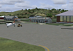
Googly scenery for WRRB Bima/Mohammad Salahuddin, Indonesia. In Flight Simulator
2004 little is provided other than a runway at this small domestic airport,
although in the real world it sees regular local flights from airlines
such as Merpati Nusentara and Pelita Air Service. These scenery files add aprons,
taxiways, buildings and other airport features to Flight Simulator's limited
representation and allow "AI" traffic to land, taxi, park and take off in a
realistic manner.
The scenery does not purport to be ultra-accurate. Based on high-detail satellite
imagery from Google Earth, the layout is proportionally correct but the added
airport features, such as buildings, are built from default Microsoft objects
and add-on libraries so will not look exactly like the real thing.
You are not obliged to download and install any additional scenery libraries,
but to enjoy this scenery in its entirety, you may wish to. It will work fine,
with or without.
[File re-uploaded at request of AVSIM]
| Filename: | WRRB_BimaMohammad_Salahuddin_Indonesia.zip |
| License: | Freeware |
| Added: | 15th June 2010, 01:03:28 |
| Downloads: | 1,931 |
| Author: | John Hinson |
| Size: | 65.89 KB |
| Category: Flight Simulator 2004 - Scenery | |
| OPGD Gwadar International, Pakistan |
|
Images related to this file:
File Description:
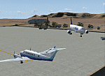
Googly scenery for OPGD Gwadar International, Pakistan. In Flight Simulator
2004 only general aviation parking is provided at this so-called international airport but in the real world it is served two or three times a day by Airbii of Airblue and ATRs of Pakistan International Airways. These scenery files improve or add
aprons, taxiways, buildings and other airport features to Flight Simulator's limited
representation and allow "AI" traffic to land, taxi, park and take off in a realistic
manner.
The scenery does not purport to be ultra-accurate. Based on high-detail satellite
imagery from Google Earth, the layout is proportionally correct but the added
airport features, such as buildings, are built from default Microsoft objects
and add-on libraries so will not look like the real thing.
You are not obliged to download and install any additional scenery libraries,
but to enjoy this scenery in its entirety, you may wish to. It will work fine,
with or without.
[File re-uploaded at request of AVSIM]
| Filename: | OPGD_Gwadar_International_Pakistan.zip |
| License: | Freeware |
| Added: | 15th May 2010, 23:51:51 |
| Downloads: | 170 |
| Author: | John Hinson |
| Size: | 58.09 KB |
| Category: Flight Simulator 2004 - Scenery | |
| OPGD Gwadar International, Pakistan |
|
Images related to this file:
File Description:
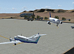
Googly scenery for OPGD Gwadar International, Pakistan. In Flight Simulator
2004 only general aviation parking is provided at this so-called international airport but in the real world it is served two or three times a day by Airbii of Airblue and ATRs of Pakistan International Airways. These scenery files improve or add
aprons, taxiways, buildings and other airport features to Flight Simulator's limited
representation and allow "AI" traffic to land, taxi, park and take off in a realistic
manner.
The scenery does not purport to be ultra-accurate. Based on high-detail satellite
imagery from Google Earth, the layout is proportionally correct but the added
airport features, such as buildings, are built from default Microsoft objects
and add-on libraries so will not look like the real thing.
You are not obliged to download and install any additional scenery libraries,
but to enjoy this scenery in its entirety, you may wish to. It will work fine,
with or without.
[File re-uploaded at request of AVSIM]
| Filename: | OPGD_Gwadar_International_Pakistan.zip |
| License: | Freeware |
| Added: | 23rd May 2010, 01:26:15 |
| Downloads: | 1,065 |
| Author: | John Hinson |
| Size: | 58.09 KB |
| Category: Flight Simulator 2004 - Scenery | |
| Warnervale, NSW, Australia |
|
File Description:
This version is a major update of this fine little airport
with the permission of Greg Archer, the original author.
Upgrades include the Terminal building, Booking office,
some hangars, lights and trees all featuring photo real textures.
An AFCAD file and AI traffic are now included.
Warnervale NSW, is a small airfield not included in FS2002 or 2004.
It is however a busy little field run by the Central Coast Aero Club
and incorporates the Drop Zone Skydiving Centre, as well as
Joy Flights over the Beautiful Central Coast of NSW.
The field is very close to Aeropelican Airport home of
Aeropelican Airways which has regular services to
Sydney Kingsford Smith International using Twin Otters.
in fact you can see Aeropelican Airstrip 8NM to the
north once you take off from Warnervale.
You can download Aeropelican from this site (aero2004.zip).
Both airfields complement each other, just follow the sail boats north.
Textures required. Airport 2.6, VOD, Nova and Nova Gold.
| Filename: | Warnervale_NSW_Australia.zip |
| License: | Freeware |
| Added: | 4th June 2004, 14:04:15 |
| Downloads: | 1,771 |
| Author: | Clive Marriott |
| Size: | 1.9 MB |
| Category: Flight Simulator 2004 - Scenery | |
| NTGK Kaukura, French Polynesia |
|
File Description:
Googly scenery for NTGK Kaukura, a small airport on Motu Panao island of Kaukura
atoll, part of the Tuamotu group in French Polynesia. The airport, opened in 1994,
is served just a couple of times per week by ATR turboprop aircraft of Air Tahiti.
Flight Simulator 2004 has only provided a runway at this airport and this scenery
seeks to redress the situation so that you and your "AI" traffic can use the
airport.
The scenery does not purport to be ultra-accurate. Based on high quality
satellite imagery from Google Earth, the layout is proportionally correct but the
added airport features, such as buildings, are built from default Microsoft objects
and add-on libraries so will not look exactly like the real thing.
You are not obliged to download and install any additional scenery libraries,
but to enjoy this scenery in its entirety, you may wish to. It will work fine,
with or without.
| Filename: | NTGK_Kaukura_French_Polynesia.zip |
| License: | Freeware |
| Added: | 19th April 2008, 20:34:24 |
| Downloads: | 1,573 |
| Author: | John Hinson |
| Size: | 70.52 KB |


© 2001-2026 AVSIM Online
All Rights Reserved
Privacy Policy |