
Where Flight Simulation Enthusiasts Gather from Around the World!
AVSIM Library - Search Results

| Category: Flight Simulator 2004 - Scenery | |
| "Himalayan Peaks" LOD10 Mesh, Volume 6 - Jammu and Kashmir |

|
Images related to this file:
File Description:
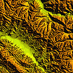
Highly detailed terrain mesh of the Jammu and Kashmir areas, N31-36 E76-78. The files in this package are based on Shuttle Radar (SRTM) Version 2 data but with many of the void areas, especially the most significant sections, filled with elevation data generated from topographic maps by Jonathan de Ferranti. While Jonathan's work is unrelated to flight simulation he kindly gave me permission to compile his data for use in FS. The result is a wonderful improvement in detail and accuracy over any existing mesh file, freeware or commercial, based on SRTM or DTED data alone.
Due to the large area of the Himalayas I've compiled the source data as two separate series: the "Himalayan Peaks" series covers prominent mountains and ranges in higher detail and locally overrides any existing LOD9 terrain mesh. In addition, a LOD9 "base mesh" series covering the entire Himalayas will be available for those who do not yet have an add-on terrain mesh of these beautiful mountains.
| Filename: | Himalayan_Peaks_LOD10_Mesh_Volume_6__Jammu_and_Kas.zip |
| License: | Freeware, limited distribution |
| Added: | 29th May 2010, 08:55:43 |
| Downloads: | 9,666 |
| Author: | Holger Sandmann, Jonathan de Ferranti |
| Size: | 52.19 MB |
| Category: Flight Simulator 2004 - Scenery | |
| "Himalayan Peaks" LOD10 Mesh, Volume 7 - K2 and Karakoram |
|
Images related to this file:
File Description:

Highly detailed terrain mesh of the Karakoram area, N35-37 E73-77. The files in this package are based on Shuttle Radar (SRTM) Version 2 data but with many of the void areas, especially the most significant sections, filled with elevation data generated from topographic maps by Jonathan de Ferranti. While Jonathan's work is unrelated to flight simulation he kindly gave me permission to compile his data for use in FS. The result is a wonderful improvement in detail and accuracy over any existing mesh file, freeware or commercial, based on SRTM or DTED data alone.
Due to the large area of the Himalayas I've compiled the source data as two separate series: the "Himalayan Peaks" series covers prominent mountains and ranges in higher detail and locally overrides any existing LOD9 terrain mesh. In addition, a LOD9 "base mesh" series covering the entire Himalayas will be available for those who do not yet have an add-on terrain mesh of these beautiful mountains.
| Filename: | Himalayan_Peaks_LOD10_Mesh_Volume_7__K2_and_Karako.zip |
| License: | Freeware, limited distribution |
| Added: | 30th May 2010, 09:56:27 |
| Downloads: | 9,480 |
| Author: | Holger Sandmann, Jonathan de Ferranti |
| Size: | 38.58 MB |
| Category: Flight Simulator 2004 - Scenery | |
| Himalayan Peaks LOD10 Mesh, Volume 1 - Mt. Everest and Kula Kangri |
|
File Description:
Highly detailed terrain mesh of the Mt. Everest and Kula Kangri areas, N26°-29° E85°-92°. The files in this package are based on Shuttle Radar (SRTM) Version 2 data but with many of the void areas, especially the most significant sections, filled with elevation data generated from topographic maps by Jonathan de Ferranti. While Jonathan's work is unrelated to flight simulation he kindly gave me permission to compile his data for use in FS. The result is a wonderful improvement in detail and accuracy over any existing mesh file, freeware or commercial, based on SRTM or DTED data alone. Due to the large area of the Himalayas I've compiled the source data as two separate series: the "Himalayan Peaks" series covers prominent mountains and ranges in higher detail and locally overrides any existing LOD9 terrain mesh. In addition, a LOD9 "base mesh" series covering the entire Himalayas will be available for those who do not yet have an add-on terrain mesh of these beautiful mountains.
| Filename: | Himalayan_Peaks_LOD10_Mesh_Volume_1__Mt_Everest_an.zip |
| License: | Freeware, limited distribution |
| Added: | 9th February 2006, 22:13:00 |
| Downloads: | 37,047 |
| Author: | Holger Sandmann and Jonathan de Ferranti |
| Size: | 52.01 MB |
| Category: Flight Simulator 2004 - Scenery | |
| PASD - Sand Point - Aleutians Alaska USA |
|
Images related to this file:
File Description:
Sand Point is in the eastern third of the Aleutian chain of islands in Alaska, around 85 miles east of Cold Bay on Popof Island. The town has a population of around 1,000 and it's economy is solidly based on fishing. There is, in the town, a fish processing plant owned by Trident (their largest plant is in Akutan, east of Dutch Harbor) and the area close to the airport is used for crab pot storage etc. The single runway is aligned 13-31 (with right hand circuits on 13) and 6,000 feet long. There are scheduled flights by Grant Aviation to neighbouring local airfields and flights to and from Anchorage by Peninsula Air (included in the AI posted with Adak). The Coastguard also make occasional visits.
| Filename: | PASD__Sand_Point__Aleutians_Alaska_USA.zip |
| License: | Freeware, limited distribution |
| Added: | 22nd January 2015, 23:59:35 |
| Downloads: | 366 |
| Author: | Roger Wensley |
| Size: | 6.38 MB |
| Category: Flight Simulator 2004 - Scenery | |
| Time Zone Scenery ver. 1.0 (April 2022) |
|
Images related to this file:
File Description:
Time Zone Scenery is meant to completely replace the default time zone definitions as well as those coming from Dennis Thomson TZ3-TZ4.
Product characteristics:
-Each single squared mile of the earth surface is covered
-All standard time zones are correctly defined
-All non-standard time zones included: those with fraction-of-an-hour difference w.r.t UTC (eg. Iran, Afghanistan, India, Nepal, Myanmar, portions of Australia...)
-All Islands in the Pacific Ocean properly covered, including those in the +13, +14 hours regions or the few cases with fractional hours offset.
-Regions following DST are thoroughly modelled (requires FS Real Time)
-The scenery is updated to the world status as of April 2022
-The scenery is intended for FS9, but should also work on FSX and P3D
| Filename: | Time_Zone_Scenery_ver_10_April_2022.zip |
| License: | Freeware, limited distribution |
| Added: | 12th April 2022, 04:09:21 |
| Downloads: | 211 |
| Author: | Antonio Arreghini |
| Size: | 1.39 MB |
| Category: Flight Simulator 2004 - Scenery | |
| Port of Spain waterfront in Trinidad |
|
File Description:
Port of Spain is the capital of Trinidad and Tobago and happens to be where I am right now. As the flying down here is completely different to Canada (the only direction to go is north up the chain of islands, unless you want to be a suspected drug smuggler) and there aren't a whole bunch of airfields to model I turned my attention to the waterfront as a place where a floatplane would tie up. The result is here, and makes the harbour and some of the city more realistic. I had to use Lago for some of the buildings in the city itself but if you've never been to Trinidad then it won't make any diference to you if they're missing.
| Filename: | Port_of_Spain_waterfront_in_Trinidad.zip |
| License: | Freeware |
| Added: | 20th October 2007, 17:05:30 |
| Downloads: | 2,199 |
| Author: | Roger Wensley and Jim Turner |
| Size: | 1.29 MB |
| Category: Flight Simulator 2004 - Scenery | |
| DBWsim San Rafael 2005 |
|
File Description:
DBWsim proudly reopens Hamilton AFB in the northern San Francisco Bay Area. Included as well is scenery for the small local airfield of San Rafael. Both airports have been comprehensively redeveloped and the scenery features an improved local landclass.
VERSION 1.1
Major Content inclusion error fixed, the primary scenery for Hamilton AFB is now included in the pack.
| Filename: | DBWsim_San_Rafael_2005.zip |
| License: | Freeware |
| Added: | 28th September 2005, 13:02:06 |
| Downloads: | 3,167 |
| Author: | Derek and Brendan Webb |
| Size: | 1.59 MB |
| Category: Flight Simulator 2004 - Scenery | |
| Netherlands 2000 v2.9 SP1 |
|
Images related to this file:
File Description:

Re-upload. This is Service Pack 1 for NL2000 version 2.9. The Netherlands 2000 V2.9 Scenery is the award winning free scenery package covering the Netherlands. It solves some issues and contains improvements in the installer and featurepanel, to better integrate with other add-ons. You need nl2kv29a.zip in addition to this file. By The Netherlands 2000 Design Team.
| Filename: | Netherlands_2000_v29_SP1.zip |
| License: | Freeware, limited distribution |
| Added: | 22nd May 2010, 04:41:31 |
| Downloads: | 20,987 |
| Author: | The Netherlands 2000 Design Team |
| Size: | 36.41 MB |
| Category: Flight Simulator 2004 - Scenery | |
| Himalayas LOD9 Base Mesh, Volume 3 - Southwestern Ranges |
|
Images related to this file:
File Description:
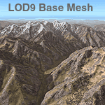
Detailed terrain mesh of the Southwestern Himalayan Ranges, N28-37 E78-82. The files in this package are based on Shuttle Radar (SRTM) Version 2 data but with many of the void areas, especially the most significant sections, filled with elevation data generated from topographic maps by Jonathan de Ferranti. While Jonathan's work is unrelated to flight simulation he kindly gave me permission to compile his data for use in FS. The result is a wonderful improvement in detail and accuracy over any existing mesh file, freeware or commercial, based on SRTM or DTED data alone.
Due to the large area of the Himalayas I've compiled the source data as two separate series: the "Himalayan Peaks" series covers prominent mountains and ranges in higher detail and locally overrides any existing LOD9 terrain mesh. In addition, the LOD9 "base mesh" series, with LOD8 and LOD7 "buffer" mesh files, covering the entire Himalayas, is meant for those who do not yet have an add-on terrain mesh of these beautiful mountains.
| Filename: | Himalayas_LOD9_Base_Mesh_Volume_3__Southwestern_Ra.zip |
| License: | Freeware, limited distribution |
| Added: | 30th May 2010, 10:00:26 |
| Downloads: | 155,808 |
| Author: | Holger Sandmann, Jonathan de Ferranti |
| Size: | 62.16 MB |
| Category: Flight Simulator 2004 - Scenery | |
| Sioux Lookout CYXL in northwest Ontario Canada |
|
File Description:
Sioux Lookout is a small town of some 5,000 folks in northwest Ontario, towards the Manitoba border, and a regional centre for surrounding villages. The airfield is some two miles east of the town. It originally had two runways but the smaller was abandoned recently as part of a planned long term improvement of the field, leaving just 34/16 with its 5,300 feeet of asphalt. Both Wasaya and Bearskin fly to Sioux Lookout; on the field there are two maintenance companies, Eagle and Allen, and hangers for the Ministry of Health, Bearskin Airlines, Wasaya, and the Nishnawbe Aski Police Service (NAPS). I think there is now another company too, but I have no information on them so I pretended this was two years ago. As well as the airfield scenery there is also a landclass file an "AFCAD" file for your AI aircraft. You should also download and install Northwest Ontario Airports by Eric O'Link, and preferably also have Ultimate Terrain; I have not tested this without UT and there is a small lake nearby.
| Filename: | Sioux_Lookout_CYXL_in_northwest_Ontario_Canada.zip |
| License: | Freeware |
| Added: | 26th November 2008, 13:08:04 |
| Downloads: | 853 |
| Author: | Roger Wensley |
| Size: | 2.66 MB |


© 2001-2026 AVSIM Online
All Rights Reserved
Privacy Policy |