
Where Flight Simulation Enthusiasts Gather from Around the World!
AVSIM Library - Search Results

| Category: Flight Simulator 2004 - Scenery | |
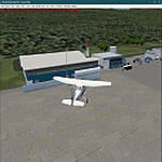
| Lauriston TGPZ on Carriacou Island in the Caribbean |

|
Images related to this file:
File Description:
Canrriacou Island, though part of the Grenadines geographically, is south of the island chain known politically as St Vincent and the Grenadines, and with Petite Martinique is a dependency of Grenada. Carriacou is around 7 miles long and 2 miles wide, with a resident population of perhaps 5,000. Lauriston airport is at the southwest end of the island, on the north coast, and the runway is around 2,600 feet and aligned 09/27. There are connecting flights both north and south to the other islands by SVG and LIAT. The terminal is stucco and pastel colours and not exactly new. The airport apron is tight. This is the last of my Caribbean series made for default FS9.
| Filename: | Lauriston_TGPZ_on_Carriacou_Island_in_the_Caribbea.zip |
| License: | Freeware, limited distribution |
| Added: | 6th July 2013, 22:23:03 |
| Downloads: | 643 |
| Author: | Roger Wensley |
| Size: | 2.47 MB |
| Category: Flight Simulator 2004 - Scenery | |
| Greece SRTM Mesh Part 1 |
|
File Description:
This terrain mesh scenery covers Greece, including all Aegean sea islands, plus most parts of Albania and Macedonia up to 41°50'N. Some parts of Bulgaria and Turkey are also included in northern and eastern boundaries of the mesh. The greek island of Crete isn't part of this mesh because SRTM data isn't yet released for the whole island.
Based on SRTM Data (3 arcsec, 90m), generated with Matthew Styles's program "SRTM To BGL v1.04", sampled to LOD9 resolution (76m). While only tested with Fs2004, this mesh should also run with FS2002.
This part contains northern parts of the mesh: Greece-N.bgl, Greece-NE1.bgl and Greece-NE2.bgl. See Greece_Mesh_Part1-1.jpg for exact bgl coverage.
| Filename: | Greece_SRTM_Mesh_Part_1.zip |
| License: | Freeware |
| Added: | 10th November 2003, 02:08:20 |
| Downloads: | 10,987 |
| Author: | Yohann Baptiste |
| Size: | 17.75 MB |
| Category: Flight Simulator 2004 - Scenery | |
| Greece SRTM Mesh Part 2 |
|
File Description:
This terrain mesh scenery covers Greece, including all Aegean sea islands, plus most parts of Albania and Macedonia up to 41°50'N. Some parts of Bulgaria and Turkey are also included in northern and eastern boundaries of the mesh. The greek island of Crete isn't part of this mesh because SRTM data isn't yet released for the whole island.
Based on SRTM Data (3 arcsec, 90m), generated with Matthew Styles's program "SRTM To BGL v1.04", sampled to LOD9 resolution (76m). While only tested with Fs2004, this mesh should also run with FS2002.
This part contains all bgl files except Greece-N.bgl, Greece-NE1.bgl and Greece-NE2.bgl. See Greece_Mesh_Part2-1.jpg for details.
| Filename: | Greece_SRTM_Mesh_Part_2.zip |
| License: | Freeware |
| Added: | 10th November 2003, 02:09:45 |
| Downloads: | 10,927 |
| Author: | Yohann Baptiste |
| Size: | 18.54 MB |
| Category: Flight Simulator 2004 - Scenery | |
| Moorea Airport, French Polynesia, NTTM |
|
File Description:
This version completely redoes the previous with a more accurate representation of the entire airport. It contains four distinct areas including the main terminal, a fictional sea plane pier and shelter, rudimentary hangars, and some Polynesian huts along with a pier and sail boats in the bay just down from the airport. This Island is the closest to Tahiti, and you can even see the Tahiti airport from it. The other outer Society Islands will be coming soon. It is suggested that you also download the file Fpsimesh.zip, which has been made for FS2004, and provides a very nice alternative to the boring terrain which FS has put in this most beautiful area of the world.
| Filename: | Moorea_Airport_French_Polynesia_NTTM.zip |
| License: | Freeware |
| Added: | 11th April 2004, 06:41:34 |
| Downloads: | 12,492 |
| Author: | Bill Melichar |
| Size: | 3.08 MB |
| Category: Flight Simulator 2004 - Scenery | |
| Guangdong Pearl River Delta Landclass - China |
|
File Description:
These are landclass files of the Pearl River Delta area, located in the south of China's Guangdong province.
This area is one of the biggest metropolitan areas (or megacity) in the world today, and as it was poorly represented in FS2004, I decided to 'map' it using EZ-landclass and images from Google Maps.
The area that was mapped stretches as far north as the New Bayiun Airport, all the way to the islands south of Hong Kong, and to the mountain ranges east and west of the Delta; with big cities included being: Guangzhou, Foshan, Dongguan, Jiangmen, Huizhou, Shenzen, Zhongshan, Zuhai, Macau & Hong Kong.
Only tested in FS9 but should work in FSX as well.
| Filename: | Guangdong_Pearl_River_Delta_Landclass__China.zip |
| License: | Freeware |
| Added: | 17th April 2016, 19:11:40 |
| Downloads: | 489 |
| Author: | Leonardo Santos |
| Size: | 6.92 KB |
| Category: Flight Simulator 2004 - Scenery | |
| Comoros Airpot package |
|
Images related to this file:
File Description:
This package contains the 3 airports of the Republic of Comoros. The major airport is FMCH-Prince Said Ibrahim International Airport which is in the Island of Grand Comores. Comoros consists of 3 major Islands, each of them has an airport. The other airports on this package are FMCV - Ouani Airport (Anjouan Airport) on the Island of Anjouan. The third is FMCI - Mwali Airport (Moheli Airport) on the Island of Moheli. As with my other sceneries, needs RWY12 object library installed to see airport objects, you will find RWY12 objects in the avsim/ flightsim library. Scenery was built using sketchup, ADE, Sbuilder, Instant scenery and contains tropical trees macros by Bill Melichar.
| Filename: | Comoros_Airpot_package.zip |
| License: | Freeware |
| Added: | 9th April 2021, 18:56:36 |
| Downloads: | 333 |
| Author: | EMMANUEL MWANDOSYA |
| Size: | 16.61 MB |
| Category: Flight Simulator 2004 - Scenery | |
| "Himalayan Peaks" LOD10 Mesh, Volume 4 - Annapurna |
|
Images related to this file:
File Description:

Highly detailed terrain mesh of the Annapurna area, N28-30 E83-85. The files in this package are based on Shuttle Radar (SRTM) Version 2 data but with many of the void areas, especially the most significant sections, filled with elevation data generated from topographic maps by Jonathan de Ferranti. While Jonathan's work is unrelated to flight simulation he kindly gave me permission to compile his data for use in FS. The result is a wonderful improvement in detail and accuracy over any existing mesh file, freeware or commercial, based on SRTM or DTED data alone.
Due to the large area of the Himalayas I've compiled the source data as two separate series: the "Himalayan Peaks" series covers prominent mountains and ranges in higher detail and locally overrides any existing LOD9 terrain mesh. In addition, a LOD9 "base mesh" series covering the entire Himalayas will be available for those who do not yet have an add-on terrain mesh of these beautiful mountains.
| Filename: | Himalayan_Peaks_LOD10_Mesh_Volume_4__Annapurna.zip |
| License: | Freeware, limited distribution |
| Added: | 29th May 2010, 08:59:29 |
| Downloads: | 10,462 |
| Author: | Holger Sandmann, Jonathan de Ferranti |
| Size: | 15.07 MB |
| Category: Flight Simulator 2004 - Scenery | |
| Rome Fiumicino Area 2013 |
|
Images related to this file:
File Description:

Dear Friends simmer, as always taking advantage of the beautiful objects bgl Gianluca Giovannini, I tried to improve with a symmetric pairing of autogen trees / towns / industrial buildings and grass in 3-D, the urban area near the Intercontinental Airport in Rome Fiumicino in the amazing scenery by the ISD project. "With the current integration I have created the town of Fiumicino located on the south west of the airport.The scenery is based videos of real landing and satellite photos availables on the web.
The purpose of visualization tasks is an overall improvement of the work of Leonardo da Vinci airport . The scenery is designed only for ISD project (even better with UTE by Flight one software), but i dont exclude that (which you should remove the file from the folder scenery the bgl Groups houses) or the more recent Payware published by Aerosoft. Most information inside the read me file. Best regards from Italy, Fafo !
| Filename: | Rome_Fiumicino_Area_2013.zip |
| License: | Freeware |
| Added: | 24th February 2013, 01:02:07 |
| Downloads: | 3,484 |
| Author: | Fabio Ferrari "fafo air" |
| Size: | 4.28 MB |
| Category: Flight Simulator 2004 - Scenery | |
| "Himalayan Peaks" LOD10 Mesh, Volume 3 - Namcha Barwa |
|
File Description:
Highly detailed terrain mesh of the Namcha Barwa area, N29°-31° E94°-96°. The files in this package are based on Shuttle Radar (SRTM) Version 2 data but with many of the void areas, especially the most significant sections, filled with elevation data generated from topographic maps by Jonathan de Ferranti. While Jonathan's work is unrelated to flight simulation he kindly gave me permission to compile his data for use in FS. The result is a wonderful improvement in detail and accuracy over any existing mesh file, freeware or commercial, based on SRTM or DTED data alone. Due to the large area of the Himalayas I've compiled the source data as two separate series: the "Himalayan Peaks" series covers prominent mountains and ranges in higher detail and locally overrides any existing LOD9 terrain mesh. In addition, a LOD9 "base mesh" series covering the entire Himalayas will be available for those who do not yet have an add-on terrain mesh of these beautiful mountains.
| Filename: | Himalayan_Peaks_LOD10_Mesh_Volume_3__Namcha_Barwa.zip |
| License: | Freeware, limited distribution |
| Added: | 18th February 2006, 23:15:17 |
| Downloads: | 12,188 |
| Author: | Holger Sandmann and Jonathan de Ferranti |
| Size: | 15.09 MB |
| Category: Flight Simulator 2004 - Scenery | |
| "Himalayan Peaks" LOD10 Mesh, Volume 5 - Garhwal |
|
File Description:
Highly detailed terrain mesh of the Garhwal area, N30°-32° E78°-81°. The files in this package are based on Shuttle Radar (SRTM) Version 2 data but with many of the void areas, especially the most significant sections, filled with elevation data generated from topographic maps by Jonathan de Ferranti. While Jonathan's work is unrelated to flight simulation he kindly gave me permission to compile his data for use in FS. The result is a wonderful improvement in detail and accuracy over any existing mesh file, freeware or commercial, based on SRTM or DTED data alone. Due to the large area of the Himalayas I've compiled the source data as two separate series: the "Himalayan Peaks" series covers prominent mountains and ranges in higher detail and locally overrides any existing LOD9 terrain mesh. In addition, a LOD9 "base mesh" series covering the entire Himalayas will be available for those who do not yet have an add-on terrain mesh of these beautiful mountains.
| Filename: | Himalayan_Peaks_LOD10_Mesh_Volume_5__Garhwal.zip |
| License: | Freeware, limited distribution |
| Added: | 18th February 2006, 23:16:47 |
| Downloads: | 10,134 |
| Author: | Holger Sandmann and Jonathan de Ferranti |
| Size: | 27.72 MB |


© 2001-2026 AVSIM Online
All Rights Reserved
Privacy Policy |