
Where Flight Simulation Enthusiasts Gather from Around the World!
AVSIM Library - Search Results

| Category: Flight Simulator 2004 - Scenery | |
| Emsdale CNA4 & Emsdale South fields in Ontario, Canada |

|
Images related to this file:
File Description:
Emsdale is on Hwy 11 about midway between North Bay and Lake Simcoe. A mile north of the town is Emsdale airfield CNA4, with two grass runways that are 12/30 2,500 feet long, and 17/35 2,000 feet long. There is only one hangar, no fuel, and in general there does not appear to be a lot of action. "Grass" may be a generous description of the runway surface, particularly for 12/30.
The second field is two miles southwest of Emsdale and privately owned. It has 2,700 feet or so of asphalt runway and a parallel grass runway (which is short at under 800 feet, plus a hangar at the north end!). There are six buildings, between hangars and office or club house and that about sums up all I know about it. If anyone knows more about this field please let me know.
| Filename: | Emsdale_CNA4__Emsdale_South_fields_in_Ontario_Cana.zip |
| License: | Freeware |
| Added: | 3rd February 2010, 15:35:35 |
| Downloads: | 390 |
| Author: | Roger Wensley |
| Size: | 1.91 MB |
| Category: Flight Simulator 2004 - Scenery | |
| Salluit CYZG in Hudson Strait, Quebec, Canada |
|
Images related to this file:
File Description:
Salluit is a village of 1,250 or so inhabitants at N 62 W 75 40 on the shore of Sugluk Inlet, which is off Hudson Strait. It's name means "Skinny Ones" in Inuit, and refers to a time when there was not enough to eat, which is a rather scary reminder of just how fragile Inuit survival used to be. The village does not feature in FS9 but is included in this scenery with approximately the right shape and with the roads that lead to the airfield and what I presume are quarries for building materials and roads. The airfield runway is 3,510 feet of gravel 100 feet wide and is some 740 feet higher than the village on the shoreline. I added the roads, the quarries, a new airfield background, plus of course there is the scenery file and the AFCAD and AI.
| Filename: | Salluit_CYZG_in_Hudson_Strait_Quebec_Canada.zip |
| License: | Freeware, limited distribution |
| Added: | 2nd November 2010, 01:18:55 |
| Downloads: | 372 |
| Author: | Roger Wensley |
| Size: | 1.96 MB |
| Category: Flight Simulator 2004 - Scenery | |
| Guaymaral Airport SKGY 2011 |
|
File Description:
Guaymaral Airport (IATA: GAA, ICAO: SKGY) is an airport located in Bogota, Colombia, in the area from which its name was taken, which is located to the north-west of the city, and limits with the towns of Cota and Chia. The airport handles primarily general aviation traffic, type A and B, only VFR. It's the base for private and commercial pilot training schools like Aeroandes and Aeroclub de Colombia.
This file has the right coordinates, with the apron and characteristics of the airport. The runways were reoriented to the correct direction, runway were resized the gates placed on correct location, Colombia National Police was
assigned a correct apron. All the airport charts required to navigate in and out of this airport which are courtesy of: Areonatica Civil de Colombia can be found at www.aerocivil.gov.co/ under Informacion Aeronautica click AIP; on AIP
click Aerodromos then click at SKGY.
| Filename: | Guaymaral_Airport__SKGY_2011.zip |
| License: | Freeware |
| Added: | 6th November 2011, 21:14:52 |
| Downloads: | 563 |
| Author: | Anwar Gonzalez |
| Size: | 12.07 KB |
| Category: Flight Simulator 2004 - Scenery | |
| Tsuniah Lake Lodge CAF4 in British Columbia Canada |
|
Images related to this file:
File Description:
Tsuniah Lake Lodge is an airstrip that serves the Lodge of the same name at the western end of the lake. Tsuniah Lake is close to the eastern side of Chilko Lake, some 7 miles south of the northern end of Chilko Lake and the recent post of Tsylos Lodge. Tsuniah Lodge is at the eastern and lake end of the grass runway, which is 4,000 feet of grass aligned 04-22 and in good condition at 4,026 feet ASL. No lights. The lodge is extensive with numerous separate cabins and I would expect the prices to be up there with the cost of the chartered planes that delivered guests. There is a second airstrip included here, around 3 miles north of the northern end of Chilko Lake and which used to serve the Wilderness Ranch before it was closed. The runway closed I mean. It is still visible but now not used at all although the ranch still functions. I have posted this as Tsuniah Lake Lodge CAF4, but I suggest that you add this to your "BC airfields" folder as previously suggested. Up to you. If you find a defect, email me.
| Filename: | Tsuniah_Lake_Lodge_CAF4_in_British_Columbia_Canada.zip |
| License: | Freeware, limited distribution |
| Added: | 23rd November 2020, 20:03:34 |
| Downloads: | 86 |
| Author: | Roger Wensley |
| Size: | 10.29 MB |
| Category: Flight Simulator 2004 - Scenery | |
| Deline CYWJ - Northwest Territories, Canada |
|
Images related to this file:
File Description:
This is the third in a series of airfields that follow in a southward direction that early access route to the Canadian northern shore, the Mackenzie River. Deline is south of Tuktuk, Inuvik, Fort McPherson, and Fort Good Hope, all already posted. Deline is at 704 feet asl and around 50 miles east of the the Mackenzie, where the Great Bear River flows out of the western end of Great Bear Lake on its way to the Mackenzie. This lake is huge. The town of Deline has a population of around 500, and the first trading post (of the North West Company) was established there as early as 1799. The Hudson Bay Company opened an outpost in 1825 to support the Franklin Arctic Exploration expedition, and it was then called Fort Franklin. The name was changed to Deline in 1993. The airport is just over a mile north of the town, and has almost 4,000 feet of gravel runway. There is no fuel available. The original airfield is still visible just to the north of the town, from before it was rebuilt on higher ground (better drainage) and away from the houses. AI will follow with later posts.
| Filename: | Deline_CYWJ__Northwest_Territories_Canada.zip |
| License: | Freeware, limited distribution |
| Added: | 5th July 2014, 14:47:36 |
| Downloads: | 240 |
| Author: | Roger Wensley |
| Size: | 2.54 MB |
| Category: Flight Simulator 2004 - Scenery | |
| Akulivik CYKO in northern Quebec Canada |
|
Images related to this file:
File Description:
This is another of the many airfields that are all around the coast of Hudson Bay, this one being on the eastern, Quebec side. Akulivik is around 110 miles south of Ivujivik, which is on the northeastern corner of the Bay, and some 60 miles north of Puvirnituq. The population is 630 or so and the village grew from a move back to the area by one family in 1973, followed by others in the following years; the closure of the Hudson Bay trading post post in 1952 had pushed all residents to move south to Puvirnituq. The village is unusual in that it has a built harbour instead of the usual beached storage of boats. The village is built on the central prong of a three pronged spear of headlands (from which the village name is derived) while the airfield is a mile or so further inland. I have no information regarding what I think may be a new terminal building, so this includes only the old original one. The runway is just under 3,500 feet of gravel aligned 09-27, and the ai includes the scheduled flight by an Air Inuit Dash 8-300, plus GA.
| Filename: | Akulivik_CYKO_in_northern_Quebec_Canada.zip |
| License: | Freeware, limited distribution |
| Added: | 9th September 2018, 03:43:25 |
| Downloads: | 162 |
| Author: | Roger Wensley |
| Size: | 4.69 MB |
| Category: Flight Simulator 2004 - Scenery | |
| OTBD - Doha International Airport |
|
Images related to this file:
File Description:
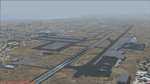
This is a very simple rendition of Doha airport as of Januray 2011 with default and library objects.
All taxiways, aprons, parkings are perfectly accurate according to airport charts and personal experience.
Buildings and airport objects are placed according to real life but are not themselves a real depiction. I have used default objects as well as library objects found on the Internet.
If anyone downloading this airport has knowledge on how to create custom buildings and objects to improve the scenery, please let me know, I'll be happy to share photos of the real thing for you.
| Filename: | OTBD__Doha_International_Airport.zip |
| License: | Freeware, limited distribution |
| Added: | 16th January 2011, 02:17:02 |
| Downloads: | 2,467 |
| Author: | Frederic Revol |
| Size: | 5.57 MB |
| Category: Flight Simulator 2004 - Scenery | |
| Camarillo Airport KCMA |
|
File Description:
FS2004 Scenery - Camarillo Airport (ICAO: KCMA, FAA LID: CMA) is a public airport located three miles (5 km) west of the central business district (CBD) of Camarillo, in Ventura County, California, USA. It is roughly equidistant from Los Angeles, CA and Santa Barbara, CA although it is inland. The airport has one runway and exclusively serves privately-operated general aviation and executive aircraft with no scheduled commercial service. The paved runway extends for 6010 feet. The facility is at an elevation of 75 feet. Created with EZ Scenery. EZ Scenery libraries required. Please read the readme file. By John B. Loney, Jr.
| Filename: | Camarillo_Airport_KCMA.zip |
| License: | Freeware, limited distribution |
| Added: | 15th May 2007, 00:11:49 |
| Downloads: | 2,417 |
| Author: | John B. Loney, Jr. |
| Size: | 5.1 MB |
| Category: Flight Simulator 2004 - Scenery | |
| Offutt Air Force Base, Omaha, Nebraska (KOFF) |
|
File Description:
FS2004 Scenery - Offutt Air Force Base (Offutt AFB, KOFF) is a U.S. Air Force installation near Omaha in Sarpy County, Nebraska. It is the headquarters of the U.S. Strategic Command, the Air Force Weather Agency, and the 55th Wing. Its legacy includes the construction of the first two bombers to drop atomic bombs and nearly 30 years as the aerial command center for the U.S. in case of nuclear war during the Cold War. The population was 8,901 at the 2000 census. Created with Instant Scenery. Many aircraft included with permission. By John B. Loney, Jr.
| Filename: | Offutt_Air_Force_Base_Omaha_Nebraska_KOFF.zip |
| License: | Freeware, limited distribution |
| Added: | 27th May 2008, 04:39:17 |
| Downloads: | 1,937 |
| Author: | John B. Loney, Jr. |
| Size: | 10.28 MB |
| Category: Flight Simulator 2004 - Scenery | |
| St Lawrence Island AK: Gambell PAGM, Savoonga PASA, and Northeast Cape |
|
Images related to this file:
File Description:
St Lawrence Island is in Alaska, but "in" is slightly misleading as it is in fact in the Barents Sea and 120 miles from the Alaska mainland, and only 40 miles offshore of Russia. The island is around 100 miles long, with two villages and at the eastern end an old air force radar base that was cleared away some 25 years ago. Gambell is one of the two villages and is at the far western end of the island, with a population of around 700 living mainly from the sea. This northern airfield is unusual in that it has an asphalt runway and apron, the lit runway being aligned 16-34 and just over 4,500 feet long. The reason for the asphalt becomes apparent if you try walking in the vicinity, as underfoot there are rounded pebbles down to varying depths, and they are quite small and eventually slippery enough to trip you up. To base a flexible gravel runway on top of this would have been difficult, and when it was originally built it was for an air force base (closed long ago). The village is also fairly unique among northern settlements in that it has wind turbines and also solar panels. The second village is Savoonga and is around 40 miles east of Gambell with a similar population. The runway here is lit gravel aligned 5-23 and 4,900 feet long. This village also has wind turbines and solar panels. There are no vehicles (cars, pickups, trucks etc) on the island, mainly because there is nowhere far to go to and in the case of Gambell because roads as such would be difficult to create. ATV's are the standard way to go, along with small boats for fishing and whaling. At the eastern and of the island the remaining traces of the air force radar base are just the gravel runway and aprons, included with the Savoonga scenery. The AI included here is for daily flights from Nome by ERA and Bering Air, along with some GA. Also included here is the EZ library that includes the wind turbines, to save you looking for it. Installing this will also mean that a wind farm in my Cyprus scenery wii now be visible to the north of Larnaca, and there are other libraries in the series that include useful objects. The Lens_EZ_Animated library could go into your static objects folders, which is where I have it; up to you.
| Filename: | St_Lawrence_Island_AK_Gambell_PAGM_Savoonga_PASA_a.zip |
| License: | Freeware, limited distribution |
| Added: | 29th February 2020, 00:09:36 |
| Downloads: | 221 |
| Author: | Roger Wensley |
| Size: | 11.59 MB |
© 2001-2026 AVSIM Online
All Rights Reserved
Privacy Policy |