
Where Flight Simulation Enthusiasts Gather from Around the World!
AVSIM Library - Search Results

| Category: Flight Simulator 2004 - Scenery | |
| USS Langley relocation to Italy |

|
File Description:
These files relocate the USS Langley of the MAAM Avenger package into the waters on either side of Italy. CVL30 is located in the Adriatic Sea near the city of Ancona (LIPY). CVL31 is located in the Tyrrhenian/Mediterranean Sea near Rome. You can install one or both Italy locations of the USS Langley. Your choice.
| Filename: | USS_Langley_relocation_to_Italy.zip |
| License: | Freeware, limited distribution |
| Added: | 2nd July 2008, 23:33:01 |
| Downloads: | 1,345 |
| Author: | Claudio Carra and Brent Hricziscse |
| Size: | 1.42 MB |
| Category: Flight Simulator 2004 - Scenery | |
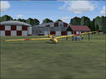
| Burg Military Airfield |
|
Images related to this file:
File Description:
Burg military airfield, Paratrooper-training base-40. The airfield Cottbus is the one field of a row of military airfield sceneries. In the scenery are included the airfield and the technical supplies.
The airfield was put into operation in 1982 in duty of the NVA. Here were trained paratroopers of the NVA and other airborne-units.
| Filename: | Burg_Military_Airfield.zip |
| License: | Freeware |
| Added: | 4th May 2012, 15:51:13 |
| Downloads: | 478 |
| Author: | Volker Loew, Frithjof Koch |
| Size: | 1.38 MB |
| Category: Flight Simulator 2004 - Scenery | |
| SBPM - Palmas-Brigadeiro Lysias Rodrigues Airport - Palmas, Brazil |
|
File Description:
Palmas-Brigadeiro Lysias Rodrigues Airport (IATA: PMW, ICAO: SBPJ;FS9 ICAO: SBPM) is the airport serving Palmas, Brazil. The airport is named after Brigadier Lysias Augusto Rodrigues (1896-1957), one of the founding figures of the Brazilian Air Force and crucial to the integration of Tocantins to Brazil via the passenger air services of the Brazilian Air Force.
| Filename: | SBPM__PalmasBrigadeiro_Lysias_Rodrigues_Airport__P.zip |
| License: | Freeware, limited distribution |
| Added: | 20th April 2016, 14:17:28 |
| Downloads: | 428 |
| Author: | Billy Guo |
| Size: | 507.95 KB |
| Category: Flight Simulator 2004 - Scenery | |
| Necochea Airport - Argentina |
|
Images related to this file:
File Description:
Being the aerodrome of one of the most important cities of the Atlantic Coast in Buenos Aires province, Necochea airport is an entrance door to agro-related businesses and Quequen harbor. This scenery includes the representation of the air terminal, the two grass runways (missing in the default airport) and the hangars and flying club facilities.
| Filename: | Necochea_Airport__Argentina.zip |
| License: | Freeware |
| Added: | 12th February 2010, 11:01:14 |
| Downloads: | 890 |
| Author: | Ramon Sola |
| Size: | 3.46 MB |
| Category: Flight Simulator 2004 - Scenery | |
| Kuujjuarapik CYGW in northern Quebec, Canada |
|
Images related to this file:
File Description:
Kuujjuarapik is in northern Quebec at the southern end of Hudson Bay, 90 miles east of James Bay and on the north shore of the Great Whale River; Kuujjuarapik means Small Great River in Inuktitut. Once again the Hudson Bay trading post that opened (in 1820) was the catalyst for the establishment of first a seasonal encampment and then the beginnings of a town in the late 1930's.
The two adjacent villages that now form the town have a total population (mainly Cree and Inuit) of around 1,500. When the Quebec hydo-electric project was under construction in the early 1980's a large portion of the Inuit population voted to move to a new settlement called Umiujaq (my post) 100 miles to the north.
The airport is to the west of the town, between the town and the sea. The gravel and sand runway (which I have made as gravel as there is no convincing way to mix the two) is 5,500 feet long, 150 feet wide, and aligned 17/35, which is approximately parallel to the coast. There is fuel available, both 100LL and JetA, delivered by truck. The AI included here is for Air Inuit and Wasaya, with Air Inuit making three flights per day plus a fourth flight by the Air Inuit Twotter C-GNDO that is based at the airport, and private flights by various aircraft. Yes, there really is a golf course to the south of the airport, and the last thing to note is that Kuujjuarapik has a mandatory radio frequency and that taking into consideration the scheduled flights I have included the tower radio frequency that makes this a controlled airport in FS9.
| Filename: | Kuujjuarapik_CYGW_in_northern_Quebec_Canada.zip |
| License: | Freeware, limited distribution |
| Added: | 16th February 2013, 00:33:20 |
| Downloads: | 305 |
| Author: | Roger Wensley |
| Size: | 2.8 MB |
| Category: Flight Simulator 2004 - Scenery | |
| Nanisivik CYSR and Arctic Bay CJX7 in Nunavut, Canada |
|
Images related to this file:
File Description:
Nanisivik is an airfield in the north of Baffin Island, 470 miles north of the Arctic circle. It was built to service a zinc and lead mine that was opened in 1976 as Canada's first Arctic mine, now closed and dismantled. The deep water Strathcona Sound has been ear-marked by the Canadian government for development as a naval base, so I have left the large ore storage shed and the jetty in place. The airfield is at 2,106 feet on the top of the Borden Peninsula hills with a lighted 6,400 feet of 150 feet wide gravel runway runway aligned 11/29. There is a terminal and other maintenance buildings, and First Air have a building there from when the mine generated a lot of traffic and jets were used. Arctic Bay is a village 11 miles west of Nanisivik airfield with a population of around 690 which also uses the Nanisivik airfield. There is another gravel strip much closer to the village that is called Arctic Bay CJX7, but this is smaller with only 1,500' of 50' wide gravel and has no facilities of any sort. The village is partly dependent on visiting sports hunters and other limited tourist visits. At almost 73 degrees north the average year will have only four or even three months where the average high is above freezing. The buildings on the field have been modelled specifically for this scenery, and as in real life there is only JetA available. The AI visiting aircraft are a Kenn Borek Twin Otter and a First Air 42-300. As Nanisivik is in the "Northern Domestic Airspace" the runway is signed in "true" bearings and not magnetic as magnetic compasses become unreliable close to the magnetic pole.
| Filename: | Nanisivik_CYSR_and_Arctic_Bay_CJX7_in_Nunavut_Cana.zip |
| License: | Freeware, limited distribution |
| Added: | 28th May 2011, 19:59:18 |
| Downloads: | 494 |
| Author: | Roger Wensley |
| Size: | 2.64 MB |
| Category: Flight Simulator 2004 - Scenery | |
| Columbus Stainless Steel Factory and Airfield, Middelburg, South Africa |
|
Images related to this file:
File Description:
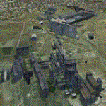
A custom made Columbus Stainless-steel Factory and its airfield, Middelburg Mall and Afgri Silo's in the town of Middelburg. The airfield is not in use anymore in real life, but this package will bring it back to life in the simulator. The Columbus stainless-steel factory is the biggest stainless-steel factory on the African continent and is situated south of the town of Middelburg, right off the N4 highway. Co-incedentally, it is also adjacent to the site of the original Middelburg airfield (included in this package) and east of the suburb of Aerorand (named as such because of the location of the original airfield right next to it) which is also where the newly built Middelburg Mall is located.
This is a nice addition to my Middelburg (FAMB) scenery (worx50.zip).
| Filename: | Columbus_Stainless_Steel_Factory_and_Airfield_Midd.zip |
| License: | Freeware, limited distribution |
| Added: | 16th February 2021, 20:01:38 |
| Downloads: | 178 |
| Author: | Kobus van Wyk & Morne van Wyk |
| Size: | 14.12 MB |
| Category: Flight Simulator 2004 - Scenery | |
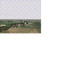
| Montana Unleashed! - Part One |
|
Images related to this file:
File Description:
Montana Unleashed! Part 1 is the first in a two part series of a collection of airports in Montana. The majority of airports covered in Part 1 are located in the western half of the state. THIS IS A RE-UPLOAD OF A PREVIOUS UPLOADED SCENERY THAT WAS LOST DURING THE AVSIM HACK! NOTHING HAS CHANGED!
Montana Unleashed! is a collection of 14 highly detailed airports, created using Abacus' EZ-Scenery, scattered about the state of Montana and one in Washington. Do a ZipDive and check out some of the screenshots! The state of Montana, from what I've seen, seems to have been very neglected by scenery makers over the years which is surprising considering the beautiful and varied landscapes the state has to offer. There's some very cool approaches at many of these airports. The size of the airports vary from large all the way down to small county airports meaning you can fly just about any kind and size of aircraft with these sceneries. Fly your Delta 737 from Salt Lake to Bozeman. Fly your shiny new Skywest EMB-120 from Missoula to Billings. Or fly your Piper Cub from Havre City to Choteau and on to Dillon. It's all here!
| Filename: | Montana_Unleashed__Part_One.zip |
| License: | Freeware, limited distribution |
| Added: | 18th April 2010, 09:48:54 |
| Downloads: | 7,072 |
| Author: | Lauren Robison |
| Size: | 3.81 MB |
| Category: Flight Simulator 2004 - Scenery | |
| SBSG - New Airport Gov Aluizio Alves Int'l - Natal, Brazil |
|
File Description:
Natal, Brazil - SBSG - has a new airport moved out of old Natal airport (SBNT). I created scenery with new update Google Earth image. Please check with my readme.txt for additional information with flightplans and add new airport.
| Filename: | SBSG__New_Airport_Gov_Aluizio_Alves_Intl__Natal_Br.zip |
| License: | Freeware |
| Added: | 14th October 2015, 15:43:45 |
| Downloads: | 3,104 |
| Author: | Stuart John Gilbert II |
| Size: | 2.43 MB |
| Category: Flight Simulator 2004 - Scenery | |
| CD GlattonFS9 |
|
Images related to this file:
File Description:
The airfield was opened in 1943 and was first used by the United States Army Air Force Eighth Air Force 457th Bombardment Group (Heavy), arriving from Wendover AAF, Utah on 21 January 1944. The 457th was assigned to the 94th Combat Bombardment Wing of the 1st Bombardment Division. Its tail code was Triangle-U.
The Group flew its last combat mission on 20 April 1945. The unit had carried out 237 missions. Total number of sorties was 7.086 with nearly 17.000 tons of bombs and 142 tons of leaflets being dropped.
The 457th was inactivated on 18 August 1945.
Included in the download is an AI traffic BGL file that makes this base come to life. To get this file working, you must download and install the 457th bomb group repaints for the Wings of Power B-17G by Chuck Lawsen.
Enjoy!
Cees Donker
| Filename: | CD_GlattonFS9.zip |
| License: | Freeware |
| Added: | 10th May 2010, 05:27:16 |
| Downloads: | 593 |
| Author: | Cees Donker |
| Size: | 1.09 MB |
© 2001-2026 AVSIM Online
All Rights Reserved
Privacy Policy |