
Where Flight Simulation Enthusiasts Gather from Around the World!
AVSIM Library - Search Results

| Category: Flight Simulator 2004 - Scenery | |
| Soekarno-Hatta Intl Airport, Jakarta Update |

|
File Description:
Update for SOEKARNO-HATTA Scenery for Microsoft FS2004. With AES support.
- this scenery update is FREEWARE
- Buddy is not responsible, in any way, for any problems and
damages occurring from the use or misuse of this scenery (please backup first ur old scenery)
- add palm trees and triangle near gate
- banana trees around airport near fence
- remove default building on gate D (fixed)
| Filename: | SoekarnoHatta_Intl_Airport_Jakarta_Update.zip |
| License: | Freeware, limited distribution |
| Added: | 20th March 2008, 12:45:35 |
| Downloads: | 12,409 |
| Author: | Budi Santoso |
| Size: | 227.55 KB |
| Category: Flight Simulator 2004 - Scenery | |
| FS2004 Terra Emergence Project v1.0 |
|
Images related to this file:
File Description:
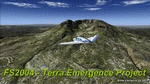
This is a new set of ground textures for FS2004. In this version, 100% forests, 80% interzones and 90% desert have been reworked. These textures are inspired by my work from FSX. Forests, rocks, mountains and intermediates zones for all the world and all seasons. See FS2004 Avsim forum for more info. See also my website https://sites.google.com/site/aimecreations/freeware-fs2004/fs2004ter
| Filename: | FS2004_Terra_Emergence_Project_v10.zip |
| License: | Freeware |
| Added: | 5th October 2013, 18:22:33 |
| Downloads: | 10,227 |
| Author: | Aime Leclercq |
| Size: | 39.48 MB |
| Category: Flight Simulator 2004 - Scenery | |
| Tsuniah Lake Lodge CAF4 in British Columbia Canada |
|
Images related to this file:
File Description:
Tsuniah Lake Lodge is an airstrip that serves the Lodge of the same name at the western end of the lake. Tsuniah Lake is close to the eastern side of Chilko Lake, some 7 miles south of the northern end of Chilko Lake and the recent post of Tsylos Lodge. Tsuniah Lodge is at the eastern and lake end of the grass runway, which is 4,000 feet of grass aligned 04-22 and in good condition at 4,026 feet ASL. No lights. The lodge is extensive with numerous separate cabins and I would expect the prices to be up there with the cost of the chartered planes that delivered guests. There is a second airstrip included here, around 3 miles north of the northern end of Chilko Lake and which used to serve the Wilderness Ranch before it was closed. The runway closed I mean. It is still visible but now not used at all although the ranch still functions. I have posted this as Tsuniah Lake Lodge CAF4, but I suggest that you add this to your "BC airfields" folder as previously suggested. Up to you. If you find a defect, email me.
| Filename: | Tsuniah_Lake_Lodge_CAF4_in_British_Columbia_Canada.zip |
| License: | Freeware, limited distribution |
| Added: | 23rd November 2020, 20:03:34 |
| Downloads: | 86 |
| Author: | Roger Wensley |
| Size: | 10.29 MB |
| Category: Flight Simulator 2004 - Scenery | |
| Deline CYWJ - Northwest Territories, Canada |
|
Images related to this file:
File Description:
This is the third in a series of airfields that follow in a southward direction that early access route to the Canadian northern shore, the Mackenzie River. Deline is south of Tuktuk, Inuvik, Fort McPherson, and Fort Good Hope, all already posted. Deline is at 704 feet asl and around 50 miles east of the the Mackenzie, where the Great Bear River flows out of the western end of Great Bear Lake on its way to the Mackenzie. This lake is huge. The town of Deline has a population of around 500, and the first trading post (of the North West Company) was established there as early as 1799. The Hudson Bay Company opened an outpost in 1825 to support the Franklin Arctic Exploration expedition, and it was then called Fort Franklin. The name was changed to Deline in 1993. The airport is just over a mile north of the town, and has almost 4,000 feet of gravel runway. There is no fuel available. The original airfield is still visible just to the north of the town, from before it was rebuilt on higher ground (better drainage) and away from the houses. AI will follow with later posts.
| Filename: | Deline_CYWJ__Northwest_Territories_Canada.zip |
| License: | Freeware, limited distribution |
| Added: | 5th July 2014, 14:47:36 |
| Downloads: | 240 |
| Author: | Roger Wensley |
| Size: | 2.54 MB |
| Category: Flight Simulator 2004 - Scenery | |
| Akulivik CYKO in northern Quebec Canada |
|
Images related to this file:
File Description:
This is another of the many airfields that are all around the coast of Hudson Bay, this one being on the eastern, Quebec side. Akulivik is around 110 miles south of Ivujivik, which is on the northeastern corner of the Bay, and some 60 miles north of Puvirnituq. The population is 630 or so and the village grew from a move back to the area by one family in 1973, followed by others in the following years; the closure of the Hudson Bay trading post post in 1952 had pushed all residents to move south to Puvirnituq. The village is unusual in that it has a built harbour instead of the usual beached storage of boats. The village is built on the central prong of a three pronged spear of headlands (from which the village name is derived) while the airfield is a mile or so further inland. I have no information regarding what I think may be a new terminal building, so this includes only the old original one. The runway is just under 3,500 feet of gravel aligned 09-27, and the ai includes the scheduled flight by an Air Inuit Dash 8-300, plus GA.
| Filename: | Akulivik_CYKO_in_northern_Quebec_Canada.zip |
| License: | Freeware, limited distribution |
| Added: | 9th September 2018, 03:43:25 |
| Downloads: | 162 |
| Author: | Roger Wensley |
| Size: | 4.69 MB |
| Category: Flight Simulator 2004 - Scenery | |
| Ford-Timor (Jump Ramp Heaven) |
|
Images related to this file:
File Description:
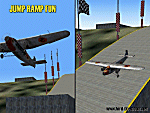
6 different layers in one pack. This scenery pack is a fun experiment in Jump Ramp development - to get aircraft to launch into the air.
Many different angles and many different challenges for your fun flying pleasure.
Contains lots of small and large Jump Ramps, a couple of Ski Ramps and a Grass up/down Hill Runway.
Also contains an Aircraft Carrier with two jump ramps and an Airship with a runway and jump ramp on top.
All set up on 6 different height levels - absolute fun flying and some great challenges for takeoff and landings.
BONUS AIRFIELDS
For those that already have Ford-Blackhawk, Ford-Brazil and Ford-Switzerland installed - a collection of files are included in the Ford-Timor project that will add ramps and jumps to these packages.
Slideshow to show you what is included:
http://www.ford-tri-motor.net/Slideshows/JUMP_RAMP_HEAVEN.html
| Filename: | FordTimor_Jump_Ramp_Heaven.zip |
| License: | Freeware, limited distribution |
| Added: | 16th July 2016, 14:34:48 |
| Downloads: | 80 |
| Author: | Garry J. Smith - Ford Project Team |
| Size: | 3.91 MB |
| Category: Flight Simulator 2004 - Scenery | |
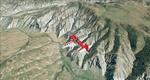
| Clinton Point CWCP, Horton River CWHR & Keats Point CWKP; DEW sites in Northwest Territories, Canada |
|
Images related to this file:
File Description:
These are three DEW line sites in northern mainland Canada, to the east of Tuktoyaktuk.
Clinton Point is almost 300 miles east of Tuktoyaktuk and on the Northwest Territories and Nunavut border. It is the site of a closed DEW station (closed in 1993) and all the buildings have been removed, unlike many other sites where buildings are still almost complete. The roads and the gravel runway down by the beach are still there.
Horton River is 150 miles east of Tuktoyaktuk, up on higher land above the cliffs at around 500 feet ASL. The NWS (North Warning System) replaced the I site which was there previously and which ceased operations in 1963. The NWS is serviced by helicopter from a barge 400 yards away on the beach.
Keats Point is 270 miles east of Tuktoyaktuk, 7 miles from the coast but significantly close to a lake, which was probably used for float plane delivery in the summer (or ski plane delivery in the winter) of NWS station elements during construction.
| Filename: | Clinton_Point_CWCP_Horton_River_CWHR__Keats_Point_.zip |
| License: | Freeware, limited distribution |
| Added: | 17th July 2012, 18:57:08 |
| Downloads: | 279 |
| Author: | Roger Wensley |
| Size: | 2.07 MB |
| Category: Flight Simulator 2004 - Scenery | |
| Eagle County (KEGE), Glenwood Springs (KGWS), Colorado, Photo-Scenery (FS9 & FSX) |
|
Images related to this file:
File Description:
To explore this region depart from Eagle County Regional Airport (KEGE) which is a popular regional airport used in winter to transport skiers to nearby Vail. Northwest of the airport you can see the pit gypsum mine of American Gypsum which produces a variety of wallboard products. When you fly to the west and along the Eagle River, you soon pass its confluence with the Colorado River. Further west you can fly along Glennwood Canyon and finally reach Glennwood Springs where the Colorado meets the Roaring Fork River. Here you can turn south and fly direct Glenwood Springs Airport (KGWS) which lies south of the city. This scenery brings you another 3.500 sq km of beautiful Colorado in 4.7m/pix quality.
High resolution versions of this scenery for FS9 and FSX (much sharper, but larger and multiple downloads) are available at www.blueskyscenery.com/GNB_SouthWest2.html . The screenies are taken from the high-res versions, so expect this version to be slightly more blurry. YourDonation@Work: Dedicated to Alain and James.
| Filename: | Eagle_County_KEGE_Glenwood_Springs_KGWS_Colorado_P.zip |
| License: | Freeware, limited distribution |
| Added: | 30th January 2010, 17:01:49 |
| Downloads: | 2,706 |
| Author: | Gottfried Razek - blueskyscenery.com |
| Size: | 93.8 MB |
| Category: Flight Simulator 2004 - Scenery | |
| Tel Aviv Lod Airport Scenery 1961 |
|
File Description:
Lod Airport, now called Ben Gurion International Airport started out in 1936 as Lydda Airport, an airstrip of four concrete runways on the outskirts of the Arab town of Lydda. By the mid-1960s, 14 international airlines were landing at Lod Airport.
I have backdated Lod airport back to 1961, when it was much smaller than today. Lod was and is Tel Aviv's major airport, used for all airline flights in 1961, and most international flights today. I have used GMAX to create the terminal and many of the hangars and other buildings at the airport, and have also used many library objects to increase the detail around the airport. Landclass files are included to reduce the city area back to their sizes in the 1960's. I have also backdated 4 other airports: Eilath (LLET), Sde Dov (LLSD), Mahanaim (LLIB), and Beer Sheeba (Teyman LLBS). These use library objects to increase the airport detail as well. These cities constituted the entire route network of Arkia, the local airline of Israel, in 1961.
| Filename: | Tel_Aviv_Lod_Airport_Scenery_1961.zip |
| License: | Freeware, limited distribution |
| Added: | 30th October 2008, 20:30:22 |
| Downloads: | 2,845 |
| Author: | Mike Stevens |
| Size: | 699.82 KB |
| Category: Flight Simulator 2004 - Scenery | |
| CYQR Regina (Regina International Airport and Roland Groome Field) Version 2 |
|
Images related to this file:
File Description:

Regina International Airport can trace its history back to 1919, when Regina airport became the first registered air harbour in Canada. This virtual model of CYQR represents the airport as it was in spring of 2007. CYQR airport is the gateway to southern Saskatchewan, Canada and is situationed in Regina, which is the provincial capital. The airport is served by Air Canada, Air Canada JAZZ, Westjet, West Wind, Express Air, Northwest Airlines and United Airlines. The airport is named for Roland Groome, who was the first registered pilot in Canada.
This scenery is a re-upload of version 2 of the scenery, which was lost in the AVSIM hack. Nothing has changed.
This scenery was constructed using GMAX and includes nearly every airport and commercial building on the airport property. Beyond the airport itself this scenery also includes, as an option, the major landmark buildings in the city of Regina proper and those on the runway approaches. Regina City buildings are meant to enhance the realism of virtual flying in the Regina area.
| Filename: | CYQR_Regina_Regina_International_Airport_and_Rolan.zip |
| License: | Freeware |
| Added: | 7th May 2010, 12:49:25 |
| Downloads: | 6,907 |
| Author: | Gregory Putz |
| Size: | 10.99 MB |
© 2001-2026 AVSIM Online
All Rights Reserved
Privacy Policy |