
Where Flight Simulation Enthusiasts Gather from Around the World!
AVSIM Library - Search Results

| Category: Flight Simulator 2004 - Scenery | |
| Southern California Oilrigs v2.0 |

|
File Description:
This is a revised version of my previous rendition of the Oil Rigs off the Southern California Coastline. This file acurately represents the positions of ALL of the Oilrigs extending from Lompoc to Newport Beach, California. Also included are 4 lighthouses not placed in the FS2004 Default Scenery located from Morro Bay - Point Conception, California. * * REQUIRES RWY 12 * * This add-on was created with Runway 12 add-on, so you must have this add-on installed, or at least the scenery BGL and Texture files installed in your Addon Scenery\Static Objects Library folder for the scenery to work. In addition, the scenery was created while using Ultimate Terrain USA, so default FS2004 Scenery users may have some scenery items in slightly different places.
| Filename: | Southern_California_Oilrigs_v20.zip |
| License: | Freeware |
| Added: | 24th September 2005, 18:43:11 |
| Downloads: | 1,326 |
| Author: | Brian C. Selb |
| Size: | 63.56 KB |
| Category: Flight Simulator 2004 - Scenery | |
| Cavanaugh Bay 66S Idaho Airport |
|
File Description:
Priest Lake in Idaho is described by their Chamber of Commerce as "...a magnificent 23,000 acre azure lake nestled beneath the majestic Selkirk Mountains — without question, one of the most beautiful wilderness areas you’ll ever see." Cavanaugh Bay is a grass strip right on the lake, with lodges (there's one right next to the end of the runway), campgrounds and boat/plane docks nearby. I think I was able to make a fair approximation of the real thing, based on Google Earth. If you're flying something that floats, choosing RWY S or RWY E from the FS9 airport menu will park you conveniently at a floatplane dock. This scenery was designed for use with Ultimate Terrain USA and has not been tested with the default FS9 scenery.
| Filename: | Cavanaugh_Bay_66S_Idaho_Airport.zip |
| License: | Freeware |
| Added: | 14th July 2008, 13:38:40 |
| Downloads: | 608 |
| Author: | Sidney Schwartz |
| Size: | 654.43 KB |
| Category: Flight Simulator 2004 - Scenery | |
| Blanding (KBDG), Utah, Photo-Scenery |
|
Images related to this file:
File Description:
Blanding (KBDG), Utah, Photo-Scenery (FS9 & FSX)
This scenery covers the area around Blanding, Utah (KBDG), extending from just south of Monticello to Bluff (66V) and the northern part of the Comb Ridge. It extends my Canyonlands sceneries to the south and brings you another 3.500 sq km of wonderful southern Utah in 4.7m/pix quality. To explore the scenery depart from Blanding (KBDG). High resolution versions of this scenery for FS9 and FSX (much sharper, but larger and multiple downloads) are available at
www.blueskyscenery.com/CNY_South2.html. The screenies are taken from the high-res versions, so expect this version to be slightly more blurry. YourDonation@Work: Dedicated to Joseph, Rainer and Cesare.
| Filename: | Blanding_KBDG_Utah_PhotoScenery.zip |
| License: | Freeware, limited distribution |
| Added: | 4th January 2010, 19:09:22 |
| Downloads: | 1,628 |
| Author: | Gottfried Razek, blueskyscenery.com |
| Size: | 95.8 MB |
| Category: Flight Simulator 2004 - Scenery | |
| Minden-Tahoe Airport (KMEV) |
|
File Description:
The Minden-Tahoe Airport(KMEV) is a 990-acre general aviation non-towered airport. Built in 1942 as a military training base, Douglas County acquired the Airport and has operated it as a municipal airport governed by Douglas County Board of County Commissioners. The Airport serves a broad base of aviation uses from corporate to recreational flying. It is home to approximately 250 aircraft with 80,000 annual operation. It is also home to the Minden Tanker Base and the Sierra Front Dispatch Agency with primary mission of dispatching tankers to fires in the Sierra Nevada region. Scenery created with FSDS3, Rwy12, EZ Scenery, AFCAD2 and Traffic Tools2.x. Your choice of Towered or non-towered AFCAD file. See readme for details.
| Filename: | MindenTahoe_Airport_KMEV.zip |
| License: | Freeware |
| Added: | 2nd February 2006, 03:15:10 |
| Downloads: | 1,016 |
| Author: | John B. Loney, Jr. |
| Size: | 619.94 KB |
| Category: Flight Simulator 2004 - Scenery | |
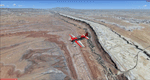
| Nanisivik CYSR and Arctic Bay CJX7 in Nunavut, Canada |
|
Images related to this file:
File Description:
Nanisivik is an airfield in the north of Baffin Island, 470 miles north of the Arctic circle. It was built to service a zinc and lead mine that was opened in 1976 as Canada's first Arctic mine, now closed and dismantled. The deep water Strathcona Sound has been ear-marked by the Canadian government for development as a naval base, so I have left the large ore storage shed and the jetty in place. The airfield is at 2,106 feet on the top of the Borden Peninsula hills with a lighted 6,400 feet of 150 feet wide gravel runway runway aligned 11/29. There is a terminal and other maintenance buildings, and First Air have a building there from when the mine generated a lot of traffic and jets were used. Arctic Bay is a village 11 miles west of Nanisivik airfield with a population of around 690 which also uses the Nanisivik airfield. There is another gravel strip much closer to the village that is called Arctic Bay CJX7, but this is smaller with only 1,500' of 50' wide gravel and has no facilities of any sort. The village is partly dependent on visiting sports hunters and other limited tourist visits. At almost 73 degrees north the average year will have only four or even three months where the average high is above freezing. The buildings on the field have been modelled specifically for this scenery, and as in real life there is only JetA available. The AI visiting aircraft are a Kenn Borek Twin Otter and a First Air 42-300. As Nanisivik is in the "Northern Domestic Airspace" the runway is signed in "true" bearings and not magnetic as magnetic compasses become unreliable close to the magnetic pole.
| Filename: | Nanisivik_CYSR_and_Arctic_Bay_CJX7_in_Nunavut_Cana.zip |
| License: | Freeware, limited distribution |
| Added: | 28th May 2011, 19:59:18 |
| Downloads: | 494 |
| Author: | Roger Wensley |
| Size: | 2.64 MB |
| Category: Flight Simulator 2004 - Scenery | |
| Kuujjuarapik CYGW in northern Quebec, Canada |
|
Images related to this file:
File Description:
Kuujjuarapik is in northern Quebec at the southern end of Hudson Bay, 90 miles east of James Bay and on the north shore of the Great Whale River; Kuujjuarapik means Small Great River in Inuktitut. Once again the Hudson Bay trading post that opened (in 1820) was the catalyst for the establishment of first a seasonal encampment and then the beginnings of a town in the late 1930's.
The two adjacent villages that now form the town have a total population (mainly Cree and Inuit) of around 1,500. When the Quebec hydo-electric project was under construction in the early 1980's a large portion of the Inuit population voted to move to a new settlement called Umiujaq (my post) 100 miles to the north.
The airport is to the west of the town, between the town and the sea. The gravel and sand runway (which I have made as gravel as there is no convincing way to mix the two) is 5,500 feet long, 150 feet wide, and aligned 17/35, which is approximately parallel to the coast. There is fuel available, both 100LL and JetA, delivered by truck. The AI included here is for Air Inuit and Wasaya, with Air Inuit making three flights per day plus a fourth flight by the Air Inuit Twotter C-GNDO that is based at the airport, and private flights by various aircraft. Yes, there really is a golf course to the south of the airport, and the last thing to note is that Kuujjuarapik has a mandatory radio frequency and that taking into consideration the scheduled flights I have included the tower radio frequency that makes this a controlled airport in FS9.
| Filename: | Kuujjuarapik_CYGW_in_northern_Quebec_Canada.zip |
| License: | Freeware, limited distribution |
| Added: | 16th February 2013, 00:33:20 |
| Downloads: | 305 |
| Author: | Roger Wensley |
| Size: | 2.8 MB |
| Category: Flight Simulator 2004 - Scenery | |
| SBSG - New Airport Gov Aluizio Alves Int'l - Natal, Brazil |
|
File Description:
Natal, Brazil - SBSG - has a new airport moved out of old Natal airport (SBNT). I created scenery with new update Google Earth image. Please check with my readme.txt for additional information with flightplans and add new airport.
| Filename: | SBSG__New_Airport_Gov_Aluizio_Alves_Intl__Natal_Br.zip |
| License: | Freeware |
| Added: | 14th October 2015, 15:43:45 |
| Downloads: | 3,104 |
| Author: | Stuart John Gilbert II |
| Size: | 2.43 MB |
| Category: Flight Simulator 2004 - Scenery | |
| California Thermals |
|
File Description:
A set of thermals that include the complete Territory of California.
You can fly in a glider the complete area.
| Filename: | California_Thermals.zip |
| License: | Freeware |
| Added: | 30th August 2005, 00:31:54 |
| Downloads: | 868 |
| Author: | Alejandro Villa |
| Size: | 1.96 MB |
| Category: Flight Simulator 2004 - Scenery | |
| RAF Aldergrove V1.0 |
|
File Description:
RAF Aldegrove, Belfast International Airport, Comprises of basic outlay of the Army Air Corp hangers and JHC (Joint Helicopter Command).
| Filename: | RAF_Aldergrove_V10.zip |
| License: | Freeware, limited distribution |
| Added: | 13th January 2006, 04:36:46 |
| Downloads: | 7,317 |
| Author: | Gary Gray |
| Size: | 984.95 KB |
| Category: Flight Simulator 2004 - Scenery | |
| Euroairport Basel Mulhouse Freiburg |
|
File Description:
The Euroairport Basel Mulhouse Freiburg LFSB, Pre-Release
Created 18.04.2004, Tested with Win XP on F2004.
This is a Pre-Release of the EAP LFSB because of many requests.
Still a lot of work has to be done!
| Filename: | Euroairport_Basel_Mulhouse_Freiburg.zip |
| License: | Freeware |
| Added: | 19th April 2004, 04:02:59 |
| Downloads: | 8,721 |
| Author: | Joerg Unglaub |
| Size: | 11.85 MB |
© 2001-2026 AVSIM Online
All Rights Reserved
Privacy Policy |