
Where Flight Simulation Enthusiasts Gather from Around the World!
AVSIM Library - Search Results

| Category: Flight Simulator 2004 - Scenery | |
| New Alternate Roads for FlightOne "USRoads" |

|
File Description:
USA Roads" is a software add-on for MS Flight Simulator 2004 (FS9) marketed by Flight One Software, Inc. and Scenery Solutions. It replaces the default roads and highways which are sparse and only approximate in location, with correctly placed roads, down to the street level.
It has been said by some that "US Roads" look unrealistic, like looking at a Road-Map, because the roads are too bright and clean. In real life the roads are darker and partially concealed by vegetation. I have spent hours looking at aerial photos on the net, and was surprised at how "US Roads" looks very realistic, especially when comparing FS "top-down" views with map-type color photos. The light color roads are very prominent in the pictures, as are the clean lines. In my new "Alternate US Roads", I have modified the various roads using different methods, including actual road photographs, changes in road color and brightness, and the use of irregular transparency to soften the lines and give the illusion of vegetation partially obscuring the roadse. Most textures use images adapted from "US Roads" by kind permission of the author. Extract to a temporary file, and follow the ReadMe!
| Filename: | New_Alternate_Roads_for_FlightOne_USRoads.zip |
| License: | Freeware |
| Added: | 14th July 2004, 10:50:27 |
| Downloads: | 4,263 |
| Author: | Frank Bergson |
| Size: | 1.69 MB |
| Category: Flight Simulator 2004 - Scenery | |
| Kogd-Ogden,Utah |
|
Images related to this file:
File Description:
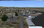
KOGD-Ogden,Ut
Take your sailboat to the Great Salt Lake inland sea or hike the many mountains and enjoy the vistas offered atop the lofty peaks. Visit the quiet mountain valley town of Eden to the east of KOGD with its annual balloon festival and summer fun on Pineview dam or spend the day shopping the shops of Brigham City to the north or Salt Lake City to the south. Fly over the Great Salt Lake to the west.
See the Ogden airport come alive with this must have add-on. With the help of Google Earth and FS Earth I have recreated the Ogden airport, with its new taxiway A (from a site visit), and the surrounding cities and towns to look as real as possible.
Made with Ultimate Terrain, but the airport should be ok with default FS9. (No guarantee though ;-)
The scenery enhancements were made with Ultimate Terrain in place. I modified the landclass to look more like the real thing. The airport is very close to a exact replica of KOGD! The crane by the tower was there when I took the pictures so I included it.
| Filename: | KogdOgdenUtah.zip |
| License: | Freeware |
| Added: | 20th January 2009, 13:42:09 |
| Downloads: | 1,344 |
| Author: | Alan C. Heiner |
| Size: | 15.59 MB |
| Category: Flight Simulator 2004 - Scenery | |
| Kogd-Ogden,Utah |
|
Images related to this file:
File Description:
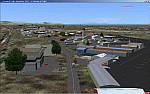
KOGD-Ogden,Ut Take your sailboat to the Great Salt Lake inland sea or hike the many mountains and enjoy the vistas offered atop the lofty peaks. Visit the quiet mountain valley town of Eden to the east of KOGD with its annual balloon festival and summer fun on Pineview dam or spend the day shopping the shops of Brigham City to the north or Salt Lake City to the south. Fly over the Great Salt Lake to the west. See the Ogden airport come alive with this must have add-on. With the help of Google Earth and FS Earth I have recreated the Ogden airport, with its new taxiway A (from a site visit), and the surrounding cities and towns to look as real as possible. Made with Ultimate Terrain, but the airport should be ok with default FS9. (No guarantee though ;-) The scenery enhancements were made with Ultimate Terrain in place. I modified the landclass to look more like the real thing. The airport is very close to a exact replica of KOGD! The crane by the tower was there when I took the pictures so I included it.
| Filename: | KogdOgdenUtah.zip |
| License: | Freeware |
| Added: | 15th December 2009, 00:45:07 |
| Downloads: | 725 |
| Author: | Alan C. Heiner |
| Size: | 15.59 MB |
| Category: Flight Simulator 2004 - Scenery | |
| ISD Milan (Bergamo) Orio al Serio - Update 2013 |
|
Images related to this file:
File Description:

Cari Amici Simmer Dear friends and lovers of the eternal FS2004, thanks to the work carried out by the Bgl Mr. Gianluca Giovannini, the tower by luca Manineti, airport objects of Mr. Andrei Visan, the upgrades from the ISD project, and the new frequency vor Fabio Iaria and the grass in 3d by MrKobbe Farwick. I tried an update of the Milan-Bergamo "Orio al Serio", the undisputed leader of the panorama Low fare in Italy. The scenery is not a new job, but an adaptation and updating of files scanrio isd 2002. In the new work will, therefore, the new tower of the city near the airport, the outline of trees along the surface of the airport, new airport objects, 3D grass, industrial buildings on the highway, night lights and a new reconstruction of the new terminal. I also realizizzato an urban area to recreate the city of Bergamo Orio al Serio and Bergmao and Alta. Compatible with AES latest version.
not assume responsibility for any errors that may occur, for information [email protected] "Fafo's air production."
A greeting and good flights - Fabio Ferrari, Castione della Presolana (BG) Italy.
Long life fs 2004! And Best regards from Italy
| Filename: | ISD_Milan_Bergamo_Orio_al_Serio__Update_2013.zip |
| License: | Freeware, limited distribution |
| Added: | 24th January 2013, 03:06:34 |
| Downloads: | 4,960 |
| Author: | Fabio Ferrari, Gianluca Giovannini, Luca Mainenti |
| Size: | 103.44 MB |
| Category: Flight Simulator 2004 - Scenery | |
| Kenmore Village Field CF08 near Ottawa in Ontario, Canada |
|
Images related to this file:
File Description:
Kenmore Village Field is in Ontario, at the northwest corner of the village of Kenmore. Kenmore is around 13 miles southeast of Ottawa airport and 3 miles east of Bank Farm Field. The village doesn't appear in FS as it is too small, but I have recreated it based on the roads that show in Ultimate Terrain. There is a grass runway 09/27 (actually 086/266) that is 3,100 feet long, and the grass is good, and with lights. The field is owned by a gentleman in his mid 70's who sold his plane five years ago and less than two years later discovered that he really didn't want to give up flying; he then went out and bought another slightly older and cheaper version of the one he sold. The house is in a direct line with the runway approach from the east; try to miss it. There is a large hangar and workshop behind the house and to the north of the runway center line, and a second older hangar on the same side a bit further along, both modeled specifically for this.
| Filename: | Kenmore_Village_Field_CF08_near_Ottawa_in_Ontario_.zip |
| License: | Freeware, limited distribution |
| Added: | 9th February 2010, 13:39:57 |
| Downloads: | 396 |
| Author: | Roger Wensley |
| Size: | 10.69 MB |
| Category: Flight Simulator 2004 - Scenery | |
| Alps LOD10 Topo Mesh - Austria and Italy |
|
Images related to this file:
File Description:
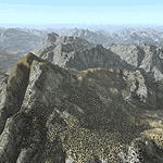
Yet another terrain mesh package of the European Alps? Well, this one is different in that it is NOT primarily based on the Shuttle Radar (SRTM) data with their incomplete coverage of prominent peaks and ridges. Instead, most of the source data for this project were developed over many months by Jonathan de Ferranti using detailed topographic maps. While Jonathan's work is unrelated to flight simulation he kindly gave me permission to compile his data for use in FS. The result is a wonderful improvement in detail and accuracy over any existing SRTM- or DTED-based mesh file, freeware or commercial (a link to an extensive set of screenshot comparisons is included in the read-me file).
I've compiled the source data at LOD10 (38-m) grid resolution because the coverage area is smaller than most existing mesh files. Thus, anyone can use these files without having to first uninstall their current mesh set. Also included are LOD9 and LO8 buffer mesh files. Note: if you own Austria Professional 2004 with its 1:50,000 scale terrain mesh then you don't need this package!
| Filename: | Alps_LOD10_Topo_Mesh__Austria_and_Italy.zip |
| License: | Freeware, limited distribution |
| Added: | 30th May 2010, 09:46:58 |
| Downloads: | 62,963 |
| Author: | Holger Sandmann, Jonathan de Ferranti |
| Size: | 73.32 MB |
| Category: Flight Simulator 2004 - Scenery | |
| Alps LOD10 Topo Mesh - Switzerland and France |
|
Images related to this file:
File Description:
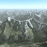
Yet another terrain mesh package of the European Alps? Well, this one is different in that it is NOT primarily based on the Shuttle Radar (SRTM) data with their incomplete coverage of prominent peaks and ridges. Instead, most of the source data for this project were developed over many months by Jonathan de Ferranti using detailed topographic maps. While Jonathan's work is unrelated to flight simulation he kindly gave me permission to compile his data for use in FS. The result is a wonderful improvement in detail and accuracy over any existing SRTM- or DTED-based mesh file, freeware or commercial (a link to an extensive set of screenshot comparisons is included in the read-me file).
I've compiled the source data at LOD10 (38-m) grid resolution because the coverage area is smaller than most existing mesh files. Thus, anyone can use these files without having to first uninstall their current mesh set. Also included are LOD9 and LO8 buffer mesh files. Note: if you own Switzerland Professional with its high-resolution terrain mesh then you don't need this package, at least not the Switzerland files!
| Filename: | Alps_LOD10_Topo_Mesh__Switzerland_and_France.zip |
| License: | Freeware, limited distribution |
| Added: | 30th May 2010, 09:51:03 |
| Downloads: | 59,007 |
| Author: | Holger Sandmann, Jonathan de Ferranti |
| Size: | 50.03 MB |
| Category: Flight Simulator 2004 - Scenery | |
| Dease Lake CYDL 2010 v1.1 |
|
Images related to this file:
File Description:
Version 1.1 adds the three hazard beacons that define the boundaries of the night circuit, as depicted in the included chart. Many thanks to Lane Street for creating the beacons and giving us permission to include them in the scenery. This scenery is complete and does not require the previous verion. Dease Lake CYDL airport is located about 2 miles south of Dease Lake in stunningly beautiful northwest British Columbia. (The lake directly to the east of the airport is Allan Lake.) Scheduled passenger service to Smithers and Bob Quinn Lake is provided by Northern Thunderbird Air (http://ntair.ca/). CYDL also serves as a base for Pacific Western Helicopters (http://www.pwh.ca/). This version moves the airport slightly to its correct location. All aprons & taxiways have been redone and all default buildings replaced. The little terminal building is photo real. The missing town of Dease Lake and the missing lake south of Allan lake have been added. This scenery was designed for use with Ultimate Terrain and was not tested in the default scenery. It may or may not work in FSX. Previous version had 307 downloads.
| Filename: | Dease_Lake_CYDL_2010_v11.zip |
| License: | Freeware |
| Added: | 6th November 2010, 22:30:24 |
| Downloads: | 793 |
| Author: | Sidney Schwartz & Peter Ham |
| Size: | 1.8 MB |
| Category: Flight Simulator 2004 - Scenery | |
| Tampa General Aviation Airports |
|
File Description:
Tampa General Aviation Airports for FS9
Tampa has three General Aviation Airports: Tampa Executive Airport, Peter O. Knight Airport and Plant City Municipal Airport. They are operated by the Hillsborough Aviation Authority, in addition to Tampa International Airport.
All three airports are represented in this package. The airports were made using Aircraft Design Editor. This program was produced by Scruffyduck Software. I also wish to thank John B. Loney who has kindly consented to allow me to use the buildings and textures from his original release of Peter O. Knight Airport in 2005. This is the first version of KPCM designed over and above the original FS9 stock airport.
Here is a list of the scenery objects used in Tampa Executive and Plant City Muni:
DB Parkinglots
ez-extra-objects
ga hangars ss vol vol 2 v1
ga hangars ss v3
large hangars ss v2
loney's buildings
loney's hangars and buildings
loney's hangars and buildings2
warehouse airport vehicles
You must have these objects installed in a folder in your FS9 Addon Scenery folder
You may download these from AVSIM and Flightsim.com
John Loney's Objects may be downloaded from www.lfssd.net
| Filename: | Tampa_General_Aviation_Airports.zip |
| License: | Freeware, limited distribution |
| Added: | 11th August 2013, 22:56:15 |
| Downloads: | 370 |
| Author: | Michael Verlin /John B. Loney |
| Size: | 1021.15 KB |
| Category: Flight Simulator 2004 - Scenery | |
| Legnano scenery - Italy |
|
Images related to this file:
File Description:
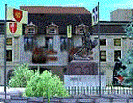
Homage to my town, scenery built mainly with existing objects, buildings by sintax and few experiments by GMax. It DOES NOT include any airport, but represents some pictures of Legnano town
Informations: Legnano is a town in north of Italy (approx 25 kmt NW Milan, ref coordinates N45 35.98 E8 54.59), reachable from Casorezzo ultralight airport (closest one) or all the near others of Milan area.
Here was done in 1176 the historical fight of the Alliance Lombarda's city-states against Federico Barbarossa German imperator. Legnano is also well known for his metallurgical and textile industries story.
Contents: rev.1 : down town square with municipal Palazzo Malinverni and S. Magno basilica, skyscraper, one of Olona river's bridges, G. Mari football stadium, Alberto da Giussano circus with related monument, encircled by the eight quarter's flags, F. Tosi and Manifattura industrial buildings, Rail station, external parking and glass building
rev.2 : Courthouse building with Teresa's face bronze statue and some more buidings, Palio hystorical figurants inside the stadium, Carroccio and Alberto da Giussano rider, Small goods train on railroad; S. Magno belltower reviewed, red sky-lights on top of skyscraper and chimney, Chimney smoke
| Filename: | Legnano_scenery__Italy.zip |
| License: | Freeware |
| Added: | 27th March 2011, 02:55:40 |
| Downloads: | 648 |
| Author: | Aldo Della Vedova |
| Size: | 6.83 MB |


© 2001-2026 AVSIM Online
All Rights Reserved
Privacy Policy |