
Where Flight Simulation Enthusiasts Gather from Around the World!
AVSIM Library - Search Results

| Category: Flight Simulator 2004 - Scenery | |
| Minstrel Island CAX7 float base in British Columbia, Canada |

|
Images related to this file:
File Description:
This is the third in a series of new and renovated float bases in BC. Minstrel Island is on the south side of Knight Inlet and 25 miles west of Knight Inlet Lodge (the previous post in this series). There is a resort on the island, though it is hidden from the air by the trees. Fuel and oil are both available at the dock, and there is a 17 feet tidal range, which would be interesting of it could be replicated in FS. The AI is an adaptation of that for CF36 and involves a GA Cessna, and a Seair Beaver flying from Campbell River to Knight Inlet Lodge via Minstrel Island. Again, because of large hills the landing of the AI may or may not take place, depending on wind direction and whether or not they fly into solid rock before landing. Take off and departure will take place. Ultimate Terrain Alaska/Canada would be a definite plus to get the water in the right shape and place. This scenery will not work without it.
| Filename: | Minstrel_Island_CAX7_float_base_in_British_Columbi.zip |
| License: | Freeware, limited distribution |
| Added: | 3rd January 2017, 15:38:57 |
| Downloads: | 228 |
| Author: | Roger Wensley |
| Size: | 3.54 MB |
| Category: Flight Simulator 2004 - Scenery | |
| Hricziscse Ranch, Oregon v2 |
|
File Description:
A small mixup resulted in a couple incorrect files for a short time in previous version. Check inside folder "FS9 Default Mesh" for bgl files "hricz.bgl" and "hricz_A16N.bgl". They should be dated 4/28/2004. If you have the earlier dated version then you will want to download this fixed version. Sorry for the inconvenience.--------------------------
A simulation of the real-world 483 acre Hricziscse Ranch located in Langell Valley, southeast Oregon, 21nm east of KLMT. Of course, I don't really have an airstrip, but it would be neat. Landclass also used to more closely depict the agricultural nature of the valley. Some artistic leeway is used in the depiction of the ranch and its surroundings. It's a lot cleaner (sterile) in FS than real-life. Rwy 29/11_1500' x 50' grass_alt 4211.3'_night lighting (airstrip does not exist in real world). This scenery is a bit of a frame-hog. --This scenery is designed for use with FSGenesis Westcoast mesh. Alternate files provided for FS9 default mesh users. See install readme for options--
| Filename: | Hricziscse_Ranch_Oregon_v2.zip |
| License: | Freeware, limited distribution |
| Added: | 1st May 2004, 01:42:15 |
| Downloads: | 1,116 |
| Author: | Brent Hricziscse |
| Size: | 7.24 MB |
| Category: Flight Simulator 2004 - Scenery | |
| Ocean Stations for Multiplayer Use |
|
File Description:
I've produced this scenery to provide all of the Ocean Stations I know about in the 1950's and 1960's. There is a Coast Guard ship on station (painted in the colors of the USA), an NDB to give you a bearing to the ship, a way to contact the ship using voice (you can get your position relative to the ship this way), and a DME for distances further than the limited 30 NM FS ATC gives you (normal communications would reach about 100 NM). You can also get a weather report, and if you are a seaplane you can be cleared to land. If you are a landplane, I guess this would constitute permission to ditch...
I want to give a big thank you to Mitsuya Hamaguchi (hama) for graciously supplying the ship used in this scenery.
This version uses scenery ships, which will not disappear in multiplayer. There is only a US ship, however. For the AI ship version (with ships of several countries) download OceanStations.zip instead.
| Filename: | Ocean_Stations_for_Multiplayer_Use.zip |
| License: | Freeware, limited distribution |
| Added: | 6th May 2008, 03:51:56 |
| Downloads: | 543 |
| Author: | Tom Gibson |
| Size: | 405.16 KB |
| Category: Flight Simulator 2004 - Scenery | |
| ETUO - RAF Gutersloh AB |
|
Images related to this file:
File Description:
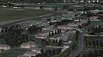
FS 2004 scenery - RAF Gutersloh AB (ICAO: ETUO)
The scenery represents the former airbase of RAF Gutersloh, one of the most populated military bases in West Germany during the Cold War, due to its location near the former East/West border. This scenery reflects the era at the end of the 1980s/beginning of the 90s, when the Harrier GR3 was in operation there, along with Chinook helicopters.
The airfield was built in 1935 and was used by the German Air Force during WW2, flying the Junkers JU-86 and Heinkel H-111. The first British squadrons were stationed there from 1947, with Mosquitos, Vampires and then Canberras.
The first Harrier arrived at Gutersloh in January 1977 and 3 and 4 Squadrons became resident until their farewell in 1993, after the cold war had ended. The airfield is currently used by the British army, but they will leave in 2014 to relinquish the area to the Government of Gutersloh for civil usage.
High detailed scenery by Manfred Schyma and Pete Beeby, supported by the Airfield Construction Group.
| Filename: | ETUO__RAF_Gutersloh_AB.zip |
| License: | Freeware |
| Added: | 10th October 2013, 20:30:01 |
| Downloads: | 1,926 |
| Author: | Manfred Schyma / Pete Beeby |
| Size: | 173.25 MB |
| Category: Flight Simulator 2004 - Scenery | |
| Palermo Punta Raisi Area 2013 |
|
Images related to this file:
File Description:

Dear Friends simmer, using the great objects bgl by mr Gianluca Giovannini, I tried to fill with autogen trees / buildings , the urban area near the international airport of Palermo "Falcone Borsellino". With the current integration of scenery i have created the town of Cinisi, Villagrazia di Carini, Torre Muzza and part of the smalls village near Airport.
Warning Very Important: the scenery "is not complete" and to get the best result YOU MUST INSTALL the following files:
-mesh by Pietro mauri (or SIMILAR mesh OF Sicily) (available HERE);
-install the wonderfull scenery LICJ by Francesco Salsano (available HERE);
-the "Palermo Vfr" by Fulvio Mazzokan (available HERE).
Most information inside the read me file. I hope you like this for your eternal fs 2004 and for your flights in Sicily. Best regards from Italy, Fabio Ferrari Castione della Presolana (bg).
| Filename: | Palermo_Punta_Raisi_Area_2013.zip |
| License: | Freeware, limited distribution |
| Added: | 20th February 2013, 21:57:36 |
| Downloads: | 2,716 |
| Author: | Fabio Ferrari |
| Size: | 4.72 MB |
| Category: Flight Simulator 2004 - Scenery | |
| Cape Dorset CYTE, Baffin Island, Nunavut, Canada |
|
Images related to this file:
File Description:
Cape Dorset is a village of 1,300 or so inhabitants at N 64 13 W 76 31 on Dorset Island, off the southwest corner of Baffin Island. It's Inuit name is Kinngait, which means "High Mountains"; watch out if you fly there in low clouds. The village (again) does not feature in FS9 but is included in this scenery with approximately the right shape, or shapes as there are separate parts. The airfield runway is just under 4,000 feet of gravel 100 feet wide at 158 feet above sea level. There is a double gradient to it, but unfortunately this cannot be replicated in FS.
Cape Dorset had a Hudson Bay Company store as long ago as 1913, and is now known as a centre for Inuit art. I added the roads, a new airfield background, a pond between apron and runway, plus of course there is the scenery file and the AFCAD and AI, which has two planes visiting, a First Air HS748 and a Canadian North Dash 8-100, as per real life.
| Filename: | Cape_Dorset_CYTE_Baffin_Island_Nunavut_Canada.zip |
| License: | Freeware, limited distribution |
| Added: | 9th December 2010, 18:45:06 |
| Downloads: | 1,016 |
| Author: | Roger Wensley |
| Size: | 2.75 MB |
| Category: Flight Simulator 2004 - Scenery | |
| CZFM - Fort McPherson - Northwest Territories, Canada |
|
Images related to this file:
File Description:
This is the first of a series of airfields that follow (approximately) that early access route to the Canadian northern shore, the Mackenzie River. At the far northern end of the river and on the eastern side of the delta there is Tuktoyaktuk, then 80 miles south is Inuvik (both already posted). 70 miles south of Inuvik is Fort McPherson, on the east bank of the Peel River, 20 miles west of the junction with the Mackenzie and on the Dempster Highway. The town has a population of around 830, and (as usual in the north!) was the site of a Hudson Bay trading post, the main post for the Mackenzie delta area for over 50 years. The airport is less than 2 miles to the south of the town, and has 3,500 feet of gravel runway. AI is two ga flights and a Buffalo Airways delivery trip that hops north and south from field to field; this will change with further posts. There is no fuel available.
| Filename: | CZFM__Fort_McPherson__Northwest_Territories_Canada.zip |
| License: | Freeware, limited distribution |
| Added: | 4th July 2014, 05:33:03 |
| Downloads: | 290 |
| Author: | Roger Wensley |
| Size: | 2.3 MB |
| Category: Flight Simulator 2004 - Scenery | |
| TIJ - Tijuana General Abelardo L. Rodriguez Int'l Airport |
|
File Description:
English:
Thank you for downloading Tijuana 2009 scenery by Mach-1 Design Group. The Tijuana international airport is the only airport in Mexico to sit aprroximately 250 feet or 75 meters from the US/Mexico International border. Planes on approach to runway niner actually have to cross into the US before going back into Mexico to land. The airport itself is acutally only 2 miles (4KM) away from downtown Tijuana. This scenery includes accurate and re-done AFCAD along with all parking spots and gates, a newly redone terminal, the Avolar maintenance and base operations hangar. A landclass update for the area is also available, so now you can tell when you cross into Mexico.
Spanish:
Gracias por descargar Tijuana 2009 de Mach-1 Design Group. El aeropuerto internacional de Tijuana es el unico aeropuerto en Mexico que se encuentra a solo 75 metros de la frontera internacional con E.E.U.U. Ademas el aeropuerto se localiza a escazos 4 kilometros del centro de la ciudad. Este escenario incluye todas las salas, una terminal nueva, y el angar de "Avolar".
| Filename: | TIJ__Tijuana_General_Abelardo_L_Rodriguez_Intl_Air.zip |
| License: | Freeware, limited distribution |
| Added: | 29th September 2008, 08:21:03 |
| Downloads: | 3,551 |
| Author: | Mach-1 Design Group |
| Size: | 2.45 MB |
| Category: Flight Simulator 2004 - Scenery | |
| Santorini LGSR Big Scenery 2012 (airport and full island scenery) |
|
Images related to this file:
File Description:
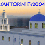
This FS2004 project is about the greek Santorini island (located in the Aegean Sea 200 km southeast from Greece's mainland) and contain two main scenery parts:
1) the "Santorini (Thira) International Airport" (Iata: JTR, Icao: LGSR) where you'll find all buldings (airport and close sourroundings buildings), hundred of custom made detailed objects, static and animated vehicles, animated scenery parts and various effects.
2)the Santorini island scenery where you'll find real hand-made landmarks (churches, factories, windmills,harbors and more), boats/ferries, completely redesigned landclasses with custom (seasonal+night) ground textures, coastlines, roads, main towns with custom greek textures, extreme autogen density and a lot of objects.
Every scenery part (frame-rate friendly thanks to the low poly design) has photoreal textures and everything is placed in the right position (wich was found at spring 2012) and in according to the satellite image.English extendet handbook is included. Watch the screenshot and the demo video on the Albysim youtube chanel and enjoy all scenery features (in this free/demo edition some features are limited).
| Filename: | Santorini_LGSR_Big_Scenery_2012_airport_and_full_i.zip |
| License: | Check within download |
| Added: | 4th November 2012, 13:13:55 |
| Downloads: | 4,721 |
| Author: | Albysim Scenery Design (Alberto Di Bolzano) |
| Size: | 35.43 MB |
| Category: Flight Simulator 2004 - Scenery | |
| Washington AI Floatplanes And Other Goodies |
|
File Description:
Five files to enhance your state of Washington adventures.
1) Adds AI floatplanes to 3 airports in the San Juan Island chain and two airports near Seattle with AI floatplane traffic to and from each airport utilizing Holger Sandmans AI Floatplane kit (ai_float.zip required as well as several floatplanes. See readme for details). Included is FSE scenery for each airport. Airports used are WN19, 83Q, W39, W33, and 21H.
2) Sound files using FSE for Richard Goldsteins Orcas Island scenery.
3) AI traffic of San Juan Airlines summer schedule using Ron Days SJA C208 and C208B textures.
4) Adds general aviation AI to the San Juan Island area at KFHR Friday Harbor, S31 Lopez Island, and 74S Anacortes Island and includes FSE scenery for all three airports.
5) Adds an FSE enhancement to Larry Silsbee's rendition of the Wilson Point Lighthouse by myself and Dexter Thomas. Requires Larrys wa_lighthouse.zip available here. (Its terrific!)
Lagos FSE for 2004 required to view the eye/ear candy but the traffic files all will work fine without it. Enjoy!
| Filename: | Washington_AI_Floatplanes_And_Other_Goodies.zip |
| License: | Check within download |
| Added: | 13th April 2004, 12:38:02 |
| Downloads: | 3,778 |
| Author: | Lauren Robison, Ron Day, Dexter Thomas |
| Size: | 4.83 MB |


© 2001-2026 AVSIM Online
All Rights Reserved
Privacy Policy |